
Introduction
Virginia is a U.S. state covering 110,787 km², with a population of ~8.7 million (12th most populous state). Its capital is Richmond, and the state features a diverse geographic landscape. Five distinct physiographic provinces from west to east: Appalachian Plateau, Ridge-and-Valley (Shenandoah Valley), Blue Ridge Mountains, Piedmont rolling hills, and Atlantic Coastal Plain (Tidewater) with the Chesapeake Bay Notable geographic features include Shenandoah Valley, Blue Ridge Mountains, Chesapeake Bay, Shenandoah National Park, and Natural Bridge. The geography of Virginia has shaped its settlement patterns, economic development, and cultural identity.

Physical Geography
The physical geography of Virginia encompasses diverse landforms and terrain. Five distinct physiographic provinces from west to east: Appalachian Plateau, Ridge-and-Valley (Shenandoah Valley), Blue Ridge Mountains, Piedmont rolling hills, and Atlantic Coastal Plain (Tidewater) with the Chesapeake Bay The state's mountain systems include Mount Rogers (1,746 m, highest in Virginia) with spruce-fir forest and wild ponies in the Grayson Highlands; Whitetop Mountain (1,682 m); Old Rag Mountain (1,037 m, popular granite scramble); Blue Ridge runs 620 km through the state; Massanutten Mountain (50 km long ridge within the Shenandoah Valley). Major waterways include James River (560 km, longest river entirely within Virginia), Potomac River (652 km total, forms northern border), Shenandoah River (240 km, scenic valley river), Rappahannock River, Roanoke River, New River (one of the oldest rivers in the world, flows north through the Appalachians). These physical features create distinct geographic regions within the state, each contributing to Virginia's unique character.
Climate & Weather
Virginia's climate varies across the state. Humid subtropical in the Tidewater and Piedmont, transitioning to humid continental in the mountains; Richmond averages 14°C annually with 1,110 mm precipitation; mountains are cooler and wetter with 1,520 mm; occasional hurricanes affect the coast; Shenandoah Valley can get significant snowfall; Blue Ridge has frequent fog These climate patterns directly influence the state's agriculture, outdoor recreation, and daily life for residents across different regions.
Natural Resources & Environment
Virginia possesses a variety of natural resources and ecosystems. Coal (historically from southwest Virginia), tobacco (declining), agriculture (wine grapes — 5th largest wine-producing state, apples, peanuts, Virginia ham), timber, seafood (Chesapeake Bay blue crabs, oysters), data centers (Loudoun County is the 'Data Center Capital of the World') The state's ecosystems include Chesapeake Bay estuary (largest in the US at 11,601 km²), Blue Ridge cove forests, Shenandoah Valley limestone karst, Great Dismal Swamp (462 km² peat swamp), maritime forests of the Eastern Shore, montane spruce-fir forests on Mount Rogers, Piedmont oak-hickory forests, tidal freshwater marshes These natural assets support the state's economy and provide habitat for diverse plant and animal communities.
Human Geography
Virginia has a population of ~8.7 million (12th most populous state), distributed across urban centers and rural communities. Major cities include Virginia Beach-Norfolk (1.8M metro), Richmond (1.3M metro), Northern Virginia (part of 6.4M DC metro), Roanoke (315K metro), Lynchburg (265K metro). The state capital, Richmond, serves as the center of government. Population distribution reflects the influence of geographic factors on settlement patterns throughout the state's history.
Economy & Industry
Virginia's economy reflects its diverse geographic zones. The Chesapeake Bay and coastal plain support one of the US's most important seafood industries — blue crabs, oysters, and clams from the bay generate hundreds of millions annually. Northern Virginia's position adjacent to Washington DC made it the center of US federal contracting and the world's highest concentration of data centers (Loudoun County), exploiting cheap electricity and fiber infrastructure. The Shenandoah Valley's limestone soils support apple orchards (5th largest US producer), poultry, and wine grapes — Virginia is among the top ten wine-producing states. The Hampton Roads area, with the world's largest naval station, reflects the geographic advantage of the Chesapeake Bay's deep harbor. Coal from the southwestern Appalachian Plateau historically powered the state's industrial economy. Tourism to Shenandoah National Park, colonial sites, and the Blue Ridge Parkway contributes significantly.
Notable Landmarks
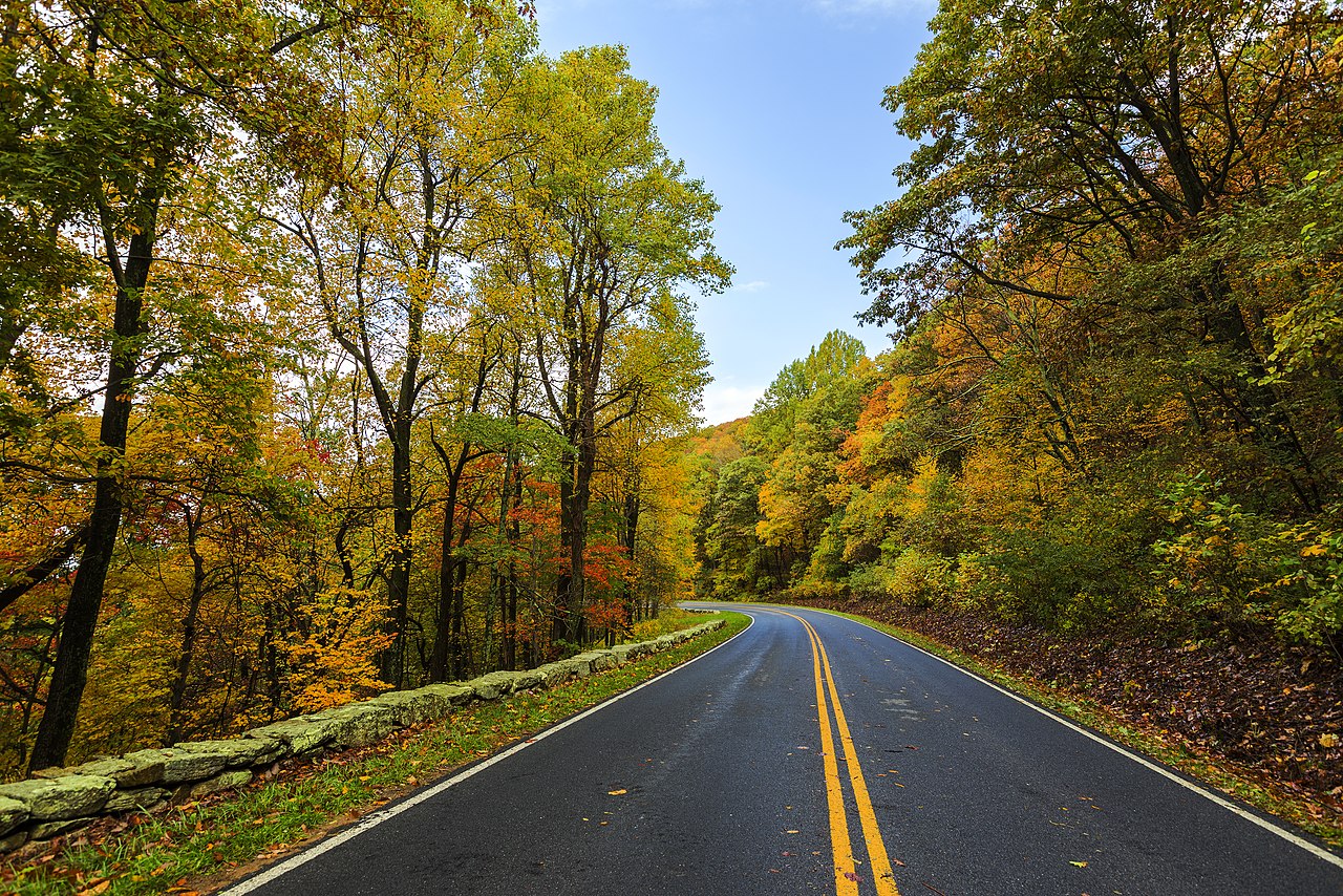
Shenandoah National Park preserves 810 km² of Blue Ridge ridgeline; the 169 km Skyline Drive along the crest offers panoramic views into the Shenandoah Valley to the west and Piedmont to the east. Natural Bridge, a 66 m limestone arch in the Shenandoah Valley, was once owned by Thomas Jefferson. The Great Dismal Swamp, a 462 km² peat swamp straddling the Virginia-North Carolina border, is one of the largest intact wetlands on the East Coast. Assateague Island, a barrier island on Virginia's Eastern Shore, is home to wild ponies and some of the most pristine Atlantic coast beaches in the region. Luray Caverns in the Shenandoah Valley features the world's largest stalacpipe organ, with stalactites tuned to musical pitches. The New River Gorge, now a national park, cuts 305 m through the Appalachian Plateau in West Virginia's neighbor; Virginia's own Breaks Interstate Park protects the deepest gorge east of the Mississippi.
Geography & Culture
Virginia's five geographic provinces — Appalachian Plateau, Ridge-and-Valley, Blue Ridge, Piedmont, and Tidewater — created dramatically different cultural zones that persist today. Tidewater Virginia, accessible by the Chesapeake Bay and its tributaries, became the cradle of English colonization and plantation tobacco culture; eight US presidents were born in this coastal zone. The Piedmont's rolling hills supported smaller farms and gave rise to a more varied agricultural culture. The Shenandoah Valley was settled primarily by Scots-Irish and German immigrants coming south from Pennsylvania through the Great Appalachian Valley, producing a culture quite different from the Tidewater aristocracy. Southwest Virginia's isolated Appalachian hollows developed a distinctive mountain culture with roots in English and Celtic folk traditions that survive in old-time music. Northern Virginia's proximity to Washington DC has transformed it into the most diverse, cosmopolitan part of the state.
Key Geographic Facts
- The Chesapeake Bay, the largest estuary in the US at 11,601 km², is fed by over 150 rivers and streams draining through Virginia
- Mount Rogers at 1,746 m is the highest point in Virginia, topped by a rare southern Appalachian spruce-fir forest
- Virginia has over 4,000 documented caves, concentrated in the limestone karst of the Shenandoah Valley
- The New River in southwestern Virginia is one of the oldest rivers in the world, estimated at 320 million years old — it flows north, against the typical drainage pattern
- Shenandoah National Park preserves 810 km² of Blue Ridge Mountain scenery, with Skyline Drive running 169 km along the crest
Fun Facts
- Natural Bridge, a 66 m limestone arch in the Shenandoah Valley, was once owned by Thomas Jefferson, who called it 'the most sublime of Nature's works'
- Virginia's Eastern Shore is a 113 km peninsula between the Chesapeake Bay and the Atlantic, accessible only by the 28 km Chesapeake Bay Bridge-Tunnel — one of the longest bridge-tunnel complexes in the world
- The Great Dismal Swamp straddles the VA-NC border and contains Lake Drummond, one of only two natural lakes in Virginia
- Wild ponies roam the Grayson Highlands near Mount Rogers at elevations above 1,500 m — managed by letting nature take its course
