

The Allegheny River flows 325 miles from its headwaters in Potter County, Pennsylvania, north into New York state, then south and west through the Allegheny Plateau of western Pennsylvania to Pittsburgh, where it joins the Monongahela River at Point State Park to form the Ohio River. The Allegheny is the Ohio's primary tributary by volume, contributing more water than the Monongahela.
Introduction
The Allegheny valley holds a unique place in American industrial history. It was here, near Titusville, Pennsylvania, that Edwin Drake drilled the first successful commercial oil well in 1859, launching the petroleum industry that would transform the modern world. The river also powered lumber mills, glassworks, and the steel mills that made Pittsburgh the industrial capital of America.
Geography & Dimensions
- Length: 325 miles (523 km)
- Drainage Basin: 11,580 sq miles
- Average Discharge: 19,750 cu ft/s at mouth
- Source: Potter County, Pennsylvania
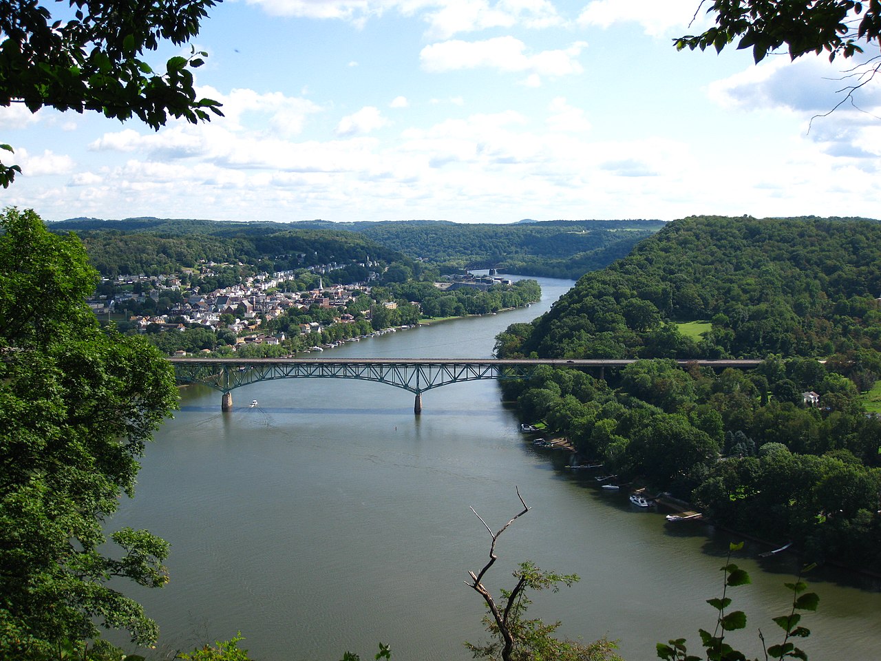
The Allegheny rises in the forested hills of Potter County in north-central Pennsylvania and flows north into New York, passing through Olean and Salamanca before re-entering Pennsylvania near Warren. From there, it flows generally south and southwest through the Allegheny Plateau — a deeply dissected upland of narrow valleys and steep, forested ridges — to Pittsburgh.
The river's course through the Allegheny National Forest is one of the most scenic stretches of river in the eastern United States. Dense hardwood forests of oak, maple, cherry, and hemlock line the valley, and the river is punctuated by rocky riffles and deep pools. The Kinzua Dam, completed in 1965, impounds the Allegheny Reservoir (Kinzua Bay) in the national forest, creating a 12,000-acre lake used for flood control and recreation.
Oil Industry Origins
- Drake Well: First commercial oil well, 1859, Titusville, PA
- Oil Creek: Tributary where the oil industry was born
- John D. Rockefeller: Built Standard Oil empire from Allegheny valley oil
- Boom Towns: Pithole, Oil City, Franklin — explosive growth and bust
On August 27, 1859, Edwin Drake struck oil at 69 feet near Titusville, Pennsylvania, along Oil Creek, a tributary of the Allegheny. The discovery launched the modern petroleum industry and triggered the world's first oil boom. Within months, thousands of prospectors flooded the Allegheny valley, and boom towns sprang up overnight. Pithole, which grew from a farm to a city of 15,000 in eight months, became a ghost town within two years when the wells ran dry.
The Allegheny valley's oil was initially shipped downstream in barrels on flatboats and later through the first long-distance oil pipelines. John D. Rockefeller built his Standard Oil empire by controlling the refining and transportation of Allegheny valley petroleum. Oil City and Franklin, at the confluence of Oil Creek and the Allegheny, became centers of the early oil industry. The Drake Well Museum near Titusville preserves the site where the petroleum age began.
Kinzua Dam & Seneca Nation
- Kinzua Dam: Completed 1965, flood control
- Seneca Displacement: Over 600 Seneca families relocated
- Treaty of 1794: Canandaigua Treaty guaranteed Seneca land "forever"
- Cornplanter Grant: Oldest treaty-granted land in the US, flooded by the dam
The construction of Kinzua Dam in the early 1960s was one of the most controversial dam projects in American history. The dam flooded over 10,000 acres of the Seneca Nation's Allegany Reservation — land guaranteed to the Seneca "forever" by the Treaty of Canandaigua in 1794, signed by George Washington. Over 600 Seneca families were forcibly relocated from their ancestral homes in the fertile river bottom to new housing on higher ground.
The Cornplanter Grant, a tract of land given to the Seneca chief Cornplanter in 1791 and the oldest treaty-granted land in the United States, was submerged beneath the reservoir. President John F. Kennedy signed the appropriation for the dam despite personal misgivings, noting that the government was breaking "the oldest treaty in the nation." The loss of the Kinzua land remains a deep wound for the Seneca Nation and a stark example of the human cost of federal dam-building.
Ecology & Recovery
- Water Quality: Dramatically improved since the 1970s
- Fish Species: Over 90 species including muskellunge, walleye
- Wild & Scenic: 86 miles designated as Wild and Scenic River
- Bald Eagles: Growing population along the river
The Allegheny River has undergone a remarkable ecological recovery. By the mid-20th century, industrial pollution, sewage, and acid mine drainage had severely degraded water quality. The Clean Water Act and billions of dollars in wastewater treatment investment transformed the river. Today, the Allegheny supports over 90 species of fish, including muskellunge, walleye, smallmouth bass, and several species of darters found nowhere else.
In 1992, 86 miles of the Allegheny from Kinzua Dam to East Brady were designated as a National Wild and Scenic River — the only river in Pennsylvania with this distinction. This stretch flows through the Allegheny National Forest and includes some of the cleanest and most biologically diverse river habitat in the Allegheny Plateau. The river supports nationally significant populations of freshwater mussels, including several endangered species.
Challenges & Future
- Acid Mine Drainage: Legacy of coal and oil extraction pollutes tributaries
- Invasive Species: Round goby, rusty crayfish threatening native species
- Natural Gas: Marcellus Shale fracking in the watershed
- Combined Sewer Overflows: Pittsburgh and other cities still discharge raw sewage in storms
Acid mine drainage from abandoned coal mines remains the most persistent water quality problem in the Allegheny watershed. Thousands of discharge points release iron-laden, acidic water that turns streams orange and eliminates aquatic life. While significant progress has been made in treating mine drainage, the scale of the problem dwarfs available resources.
The Marcellus Shale gas boom of the 2000s and 2010s brought thousands of hydraulic fracturing (fracking) operations to the Allegheny watershed, raising concerns about water contamination, habitat fragmentation, and wastewater disposal. Pittsburgh and other cities along the river still have combined sewer systems that discharge raw sewage during storms. Addressing these legacy and emerging challenges while maintaining the river's ecological recovery is the central task for the Allegheny's future.
Key Facts
- The Allegheny River flows 325 miles to Pittsburgh, where it forms the Ohio River.
- Edwin Drake drilled the first commercial oil well near the Allegheny in 1859.
- 86 miles of the Allegheny are designated as a National Wild and Scenic River.
- Kinzua Dam flooded over 10,000 acres of Seneca Nation land despite a 1794 treaty.
- The river supports over 90 fish species after dramatic water quality improvements.
Fun Facts
- The Allegheny is one of the few major rivers in the US that flows north before turning south — it enters New York state before flowing back into Pennsylvania.
- Pithole, the Allegheny valley oil boomtown, went from zero to 15,000 people in 8 months, then back to nearly zero within 2 years.
- Point State Park in Pittsburgh, where the Allegheny and Monongahela meet, was the site of Fort Duquesne, a French fortress that sparked the French and Indian War.
- The word "Allegheny" may come from a Lenape word meaning "fine river" — an apt description of the scenic stretch through the national forest.
Final Thoughts
The Allegheny River is where modern America was born — at the confluence that created Pittsburgh's steel empire and in the valley where the petroleum age began. Its recovery from industrial devastation to Wild and Scenic designation is a testament to the resilience of both rivers and communities, though the scars of dam-building and resource extraction remain.
Test Your Knowledge!
Think you know America's rivers? Try our interactive quiz!
Play Geography Games →