
Minneapolis, the largest city in Minnesota, covers 151 square kilometers of rolling glacial terrain dotted with 13 named lakes and bisected by the Mississippi River. The city's name combines the Dakota Sioux word "mni" (water) with the Greek word "polis" (city), a fitting description for a metropolis defined by its relationship with water. Founded in the 1850s around the Falls of Saint Anthony — the only major waterfall on the entire 3,766-kilometer length of the Mississippi — Minneapolis grew into one of the great milling cities of the 19th century.
Introduction
The Minneapolis-Saint Paul metropolitan area, commonly called the Twin Cities, is home to approximately 3.7 million people. The two cities are separated by the Mississippi River and share a cultural and economic identity while maintaining distinct characters. Minneapolis is known for its progressive politics, arts scene, and outdoor recreation, anchored by a park system that has been consistently rated the best in the nation.
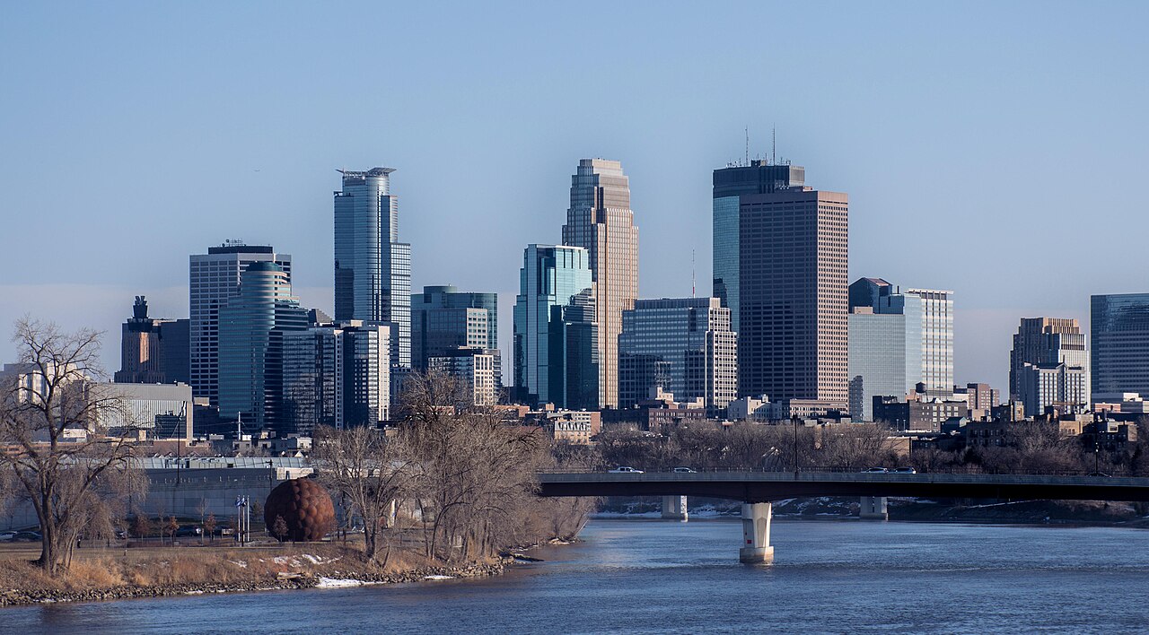
Physical Geography & Terrain
- City Area: 151 km²
- Elevation Range: 209–295 m
- Named Lakes: 13 within city limits
- Founding Year: 1856
- Falls of Saint Anthony: Only major waterfall on the Mississippi
Minneapolis sits on terrain shaped by the Wisconsin glaciation, which retreated from the area roughly 12,000 years ago. The glaciers left behind a landscape of rolling moraines, outwash plains, and countless kettle lakes — depressions formed when buried blocks of ice melted. The city's 13 named lakes, including Lake Calhoun (Bde Maka Ska), Lake Harriet, and Lake of the Isles, are all glacial kettle lakes.
The Mississippi River gorge through Minneapolis is the only true gorge on the river's entire course. The Falls of Saint Anthony, now largely hidden by a concrete apron installed in 1869 to prevent further erosion, originally dropped 16 meters and provided the waterpower that made Minneapolis the flour-milling capital of the world. The river drops approximately 22 meters as it passes through the city, creating significant hydropower potential that fueled industrial growth.
Lakes & Waterways
- Largest Lake: Bde Maka Ska (Lake Calhoun), 1.7 km²
- Chain of Lakes: Connected by channels and bike paths
- Mississippi River: Bisects the city north-south
- Minnehaha Falls: 16 m waterfall in Minnehaha Park
The Chain of Lakes — Bde Maka Ska, Lake Harriet, Lake of the Isles, and Cedar Lake — forms a connected system of water bodies linked by channels and surrounded by a continuous 21-kilometer walking and biking path. These lakes are the centerpiece of the city's outdoor recreation culture, used for swimming, canoeing, sailing, fishing, and ice skating depending on the season.
Minnehaha Falls, a 16-meter waterfall on Minnehaha Creek in southern Minneapolis, flows into the Mississippi River and was made famous by Henry Wadsworth Longfellow's 1855 poem "The Song of Hiawatha." The creek drains Lake Minnetonka, a large suburban lake, through the city to the Mississippi. In winter, the falls freeze into a spectacular ice formation that draws thousands of visitors.
Climate & Weather
- Climate Type: Humid continental (Dfb)
- Average High (July): 29°C
- Average Low (January): −16°C
- Annual Precipitation: 787 mm
- Annual Snowfall: ~130 cm
Minneapolis has one of the most extreme climates of any major US city, with temperature swings of over 60 degrees Celsius between the coldest winter nights and hottest summer days. January average lows of minus 16 degrees Celsius make it the coldest major metro in the contiguous United States. Wind chill values can plunge below minus 40 degrees during Arctic outbreaks. Summers, by contrast, are warm and humid, with July highs averaging 29 degrees Celsius.
The city receives approximately 130 centimeters of snow annually, with persistent snow cover from December through March. Lakes typically freeze by late November and may not fully thaw until April. To cope with the harsh winters, Minneapolis developed an extensive skyway system — 18 kilometers of enclosed, climate-controlled pedestrian bridges connecting 80 downtown blocks, the longest continuous skyway system in the world.
Parks & Urban Geography
- Park Acreage: Over 6,800 acres (27.5 km²)
- Population: ~425,000 (city), ~3.7 million (metro)
- Population Density: 2,900/km²
- Grand Rounds: ~80 km scenic parkway loop
Minneapolis's park system, managed by the Minneapolis Park and Recreation Board, has been ranked the number one park system in the nation multiple times. The Grand Rounds National Scenic Byway is an approximately 80-kilometer loop of connected parkways, trails, and waterways that encircles the city, linking lakes, the Mississippi River gorge, Minnehaha Falls, and neighborhood parks.
The city's neighborhoods are organized around the lakes and the river. Uptown, adjacent to Bde Maka Ska and Lake Harriet, is a walkable commercial and entertainment district. The North Loop (Warehouse District) has transformed from industrial grain storage to trendy loft apartments and restaurants. Northeast Minneapolis, historically home to Eastern European immigrants, is now the city's arts district. The University of Minnesota campus straddles the Mississippi River, one of the largest public universities in the country with over 50,000 students.
Economic Geography
- Metro GDP: $280 billion (2023)
- Fortune 500 Companies: 16 in metro area
- Key Industries: Finance, healthcare, food production, retail, tech
- Major Employers: UnitedHealth, Target, US Bancorp, 3M, General Mills
The Twin Cities metro punches far above its weight economically, hosting 16 Fortune 500 company headquarters — the most per capita of any US metro. Major companies headquartered in the area include UnitedHealth Group, Target, US Bancorp, 3M, General Mills, and Best Buy. This corporate density reflects the region's historic role as a commercial hub for the Upper Midwest's agricultural and natural resource economy.
Minneapolis's milling heritage is still visible in the Mill District along the Mississippi riverfront, where renovated flour mills now house luxury condos, restaurants, and the Mill City Museum. The city's economy has diversified into healthcare technology (Medtronic, UnitedHealth), financial services, and a growing tech startup scene. The medical device industry, centered in the Twin Cities, is one of the largest clusters in the world.
Key Facts
- Minneapolis has 13 named lakes within its 151 km² city limits, all formed by glacial activity.
- The Falls of Saint Anthony is the only major waterfall on the Mississippi River's 3,766 km course.
- January average lows of −16°C make it the coldest major metro in the contiguous US.
- The skyway system connects 80 downtown blocks with 18 km of enclosed pedestrian bridges.
- The Twin Cities metro hosts 16 Fortune 500 headquarters, the most per capita in the US.
Fun Facts
- The Chain of Lakes in Minneapolis has a continuous 21-km trail circling multiple connected lakes.
- Minnehaha Falls freezes into a massive ice formation each winter that visitors can walk behind.
- Minneapolis's park system was designed by Horace Cleveland in 1883, predating most of the city's development.
- The city was once called the "Flour Milling Capital of the World" — at its peak, Minneapolis mills produced enough flour to bake 12 million loaves of bread per day.
Final Thoughts
Minneapolis's geography — glacial lakes, the Mississippi River gorge, and the Falls of Saint Anthony — shaped a city that balances urban vitality with extraordinary natural beauty. Its extreme continental climate forged a resilient culture that embraces both outdoor recreation and innovative engineering solutions like the skyway system. The City of Lakes remains one of America's most livable urban environments, rooted in its distinctive water-rich landscape.
Test Your Knowledge!
Think you know American cities? Try our interactive geography quiz!
Play Geography Games →