
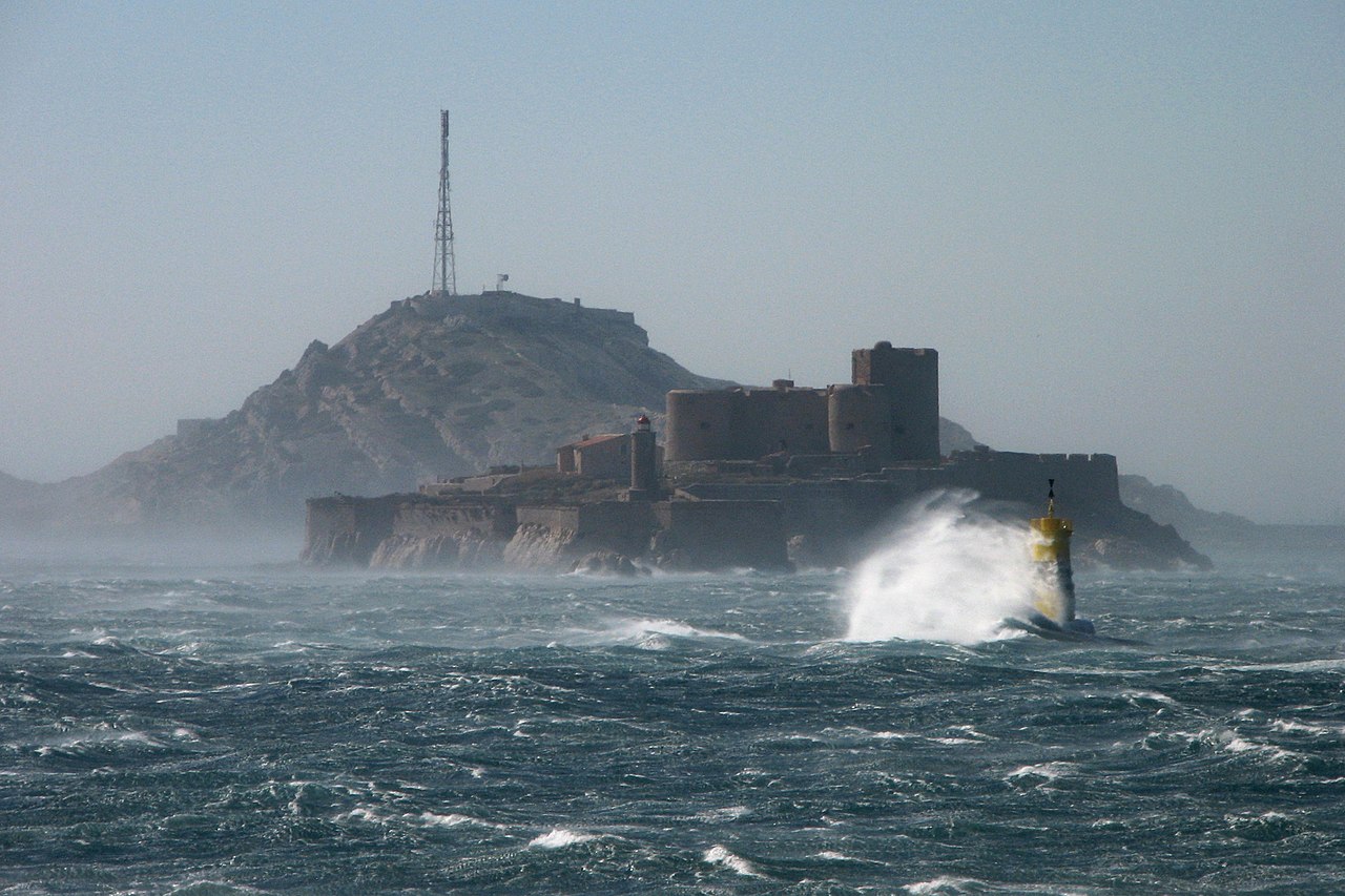
The mistral is a cold, dry, often violent wind that blows from the north or northwest down the Rhone valley and out across Provence into the Gulf of Lion. Its name comes from the Provencal mistrau, meaning masterly, and it is the defining weather feature of southern France. It forms when high pressure sits over the Bay of Biscay or the Massif Central while low pressure lies over the Gulf of Genoa, driving cold continental air southward. That air is then funnelled between two mountain barriers — the Massif Central to the west and the Alps to the east — which narrow toward the south and accelerate the flow, so a moderate regional pressure gradient becomes a wind that routinely exceeds 90 km/h and has gusted well past 300 km/h at the summit of Mont Ventoux. The lower Rhone valley records mistral conditions on roughly 100 to 150 days a year. Unlike the foehn winds, it does not warm on the way down: it arrives cold, and its two most famous effects are bitter windchill and an extraordinary clarity of light.
A Valley Shaped Like a Funnel
The mistral is a textbook case of terrain doing the work. Cold air moving south across France encounters two highland masses running roughly parallel: the Massif Central, rising to over 1,800 m, and the western Alps, rising far higher. Between them the Rhone corridor runs south to the Mediterranean, and it narrows.

Air behaves like any fluid forced through a constriction: to move the same volume through a smaller cross-section, it must speed up. The narrowest section, between Montelimar and the Rhone delta, is where the wind is fastest, and it is no coincidence that the towns with the strongest mistral reputations — Orange, Avignon, Arles, Nimes, Salon-de-Provence — sit along that stretch. The Rhone gave the corridor its shape, and the wind simply uses it.
Beyond the delta the constriction ends and the wind fans out over the Gulf of Lion, where it retains enough strength to be one of the more dangerous coastal wind regimes in the Mediterranean. Marseille sits at the eastern edge of the outflow and gets a strong but slightly deflected version; the coast west toward Montpellier and Narbonne takes it more directly.
Cold, Dry, and Coming From the North
A common misconception is that the mistral belongs to the same family as the foehn or the chinook. It does not, and the difference matters.
A foehn wind crosses a mountain barrier, loses its moisture on the windward side, and warms through compression on the way down, arriving hotter than it started. The mistral goes around the mountains rather than over them, channelled through a gap. It undergoes some compressional warming as it descends toward sea level, but it starts as genuinely cold continental or polar air, and the warming is nowhere near enough to offset that. The result is a wind that can drop the apparent temperature in Provence by 10 to 15 °C and that makes a sunny 12 °C February day in Arles feel closer to freezing.
What it shares with the foehn family is dryness. The air arrives with low humidity and the wind strips moisture from everything it passes over — soil, vegetation, laundry, skin. That combination of cold and dry is why the mistral is regarded locally as unhealthy, and the traditional Provencal saying holds it responsible for a long list of ailments.
One Hundred Days a Year
The mistral blows year-round but is most frequent and most severe in winter and spring, with a secondary maximum around the equinoxes. Local convention holds that a mistral lasts in multiples of three — three, six or nine days — which is folklore rather than meteorology, but it does capture something real about how the driving pressure patterns lock in for several days at a time.
Typical episode speeds run 50 to 90 km/h sustained with gusts to 130. The extremes are considerably higher: the observatory on Mont Ventoux, at 1,910 m and fully exposed, has recorded gusts above 300 km/h, among the highest surface wind speeds measured in Europe. Even at ground level in the valley, gusts above 150 km/h occur most winters.
The wind's persistence produced a genuine industrial consequence: the lower Rhone valley and the Languedoc coast now carry one of the densest concentrations of wind turbines in France, sited precisely on the corridor's reliability.
What It Did to Provencal Architecture
Few winds have left a clearer mark on how a region is built. The vernacular architecture of Provence is legible as a set of responses to a cold wind from a known direction.
- Blank north walls. The traditional Provencal mas is oriented with its long axis east-west and its northern wall built solid, with few or no openings. Doors and windows face south and east, away from the wind.
- Cypress windbreaks. The rows of tall, narrow cypress that read as decorative in photographs are functional: planted in dense lines on the north side of fields and farmhouses, they filter the wind rather than blocking it, which avoids the damaging turbulence a solid barrier creates. Reed hedges serve the same purpose in the Rhone delta.
- Open ironwork bell towers. The campaniles of Provencal churches and town halls are frequently built as open wrought-iron cages rather than solid masonry spires. A solid tower catches the wind; an iron cage lets it pass straight through, and the bell survives the mistral.
- Weighted and shuttered openings. Heavy external shutters, latched rather than hooked, are standard, and roof tiles along the exposed edges are traditionally set in mortar or weighted with stones.
The same logic operates on the Adriatic, where the bora produced a comparable set of adaptations for a wind that is colder still and arrives more suddenly.
The Tramontane, and a Roman Temple to the Wind
The mistral has a near twin. West of the Massif Central, the same southward-moving cold air is funnelled through the gap between that massif and the Pyrenees, down the Aude valley and out onto the Languedoc coast around Narbonne and Perpignan. There it is called the tramontane, from the Latin for across the mountains. The driver is identical and the two often blow on the same day through their separate gaps, which is why a single pressure pattern can leave the whole of southern France windswept at once.
Both winds are old enough to have Roman names. Classical authors writing about Gallia Narbonensis describe a violent northwesterly they called the circius, and Seneca singled it out as the region's characteristic wind, noting that it could flatten buildings while leaving the sky brilliantly clear. Pliny the Elder recorded much the same. There is a persistent tradition, repeated from antiquity onward, that Augustus dedicated a temple to the circius in Narbonne — an unusual honour for a wind, and a reasonable measure of how much it mattered to a province whose grain, wine and shipping all depended on it.
The continuity is the striking part. The wind that Seneca described flattening structures in the first century is the same wind that Van Gogh pegged his easel against in 1888 and that closes the A9 autoroute to high-sided vehicles today, driven by the same two mountain ranges and the same gap between them.
Clear Skies, Painters and Observatories
The mistral's most celebrated effect is optical. By sweeping out humidity, haze and pollution and replacing it with dry continental air, the wind leaves behind visibility and colour saturation that are exceptional for a Mediterranean region. Provence is markedly sunnier than the French average, and the quality of light after a mistral is the reason the region became a centre of European painting.
Van Gogh, working at Arles and Saint-Remy in 1888 and 1889, wrote repeatedly about the wind in his letters — both about the light it produced and about the practical problem of painting outdoors in it, which he solved by driving his easel pegs into the ground. Cezanne worked in the same conditions around Aix. The wind is genuinely part of the visual record of post-impressionism.
The same clarity attracted astronomy: the observatory at Saint-Michel-l'Observatoire in Haute-Provence was sited partly on the strength of the region's transparent skies, and it was there that the first exoplanet orbiting a Sun-like star was detected in 1995.
Sailing, Aviation and the Gulf of Lion
Offshore, the mistral is a hazard of the first order. It arrives at the coast with little warning to a sailor already at sea, it blows offshore so that a vessel losing ground is pushed into open water rather than toward shelter, and it raises a steep, short, breaking sea in the shallow Gulf of Lion that is disproportionately dangerous for small craft. Mediterranean sailing guides treat it as the single most important weather consideration for the French coast.
It also has a large oceanographic role that is easy to miss. Cold dry air blowing hard over the Gulf of Lion cools and evaporates the surface water, making it colder and saltier and therefore denser, until it sinks. This is one of the few places in the Mediterranean where deep water forms, and mistral events are the engine of it — a regional wind operating as a component of basin-scale circulation, in the same way the bora ventilates the Adriatic.