

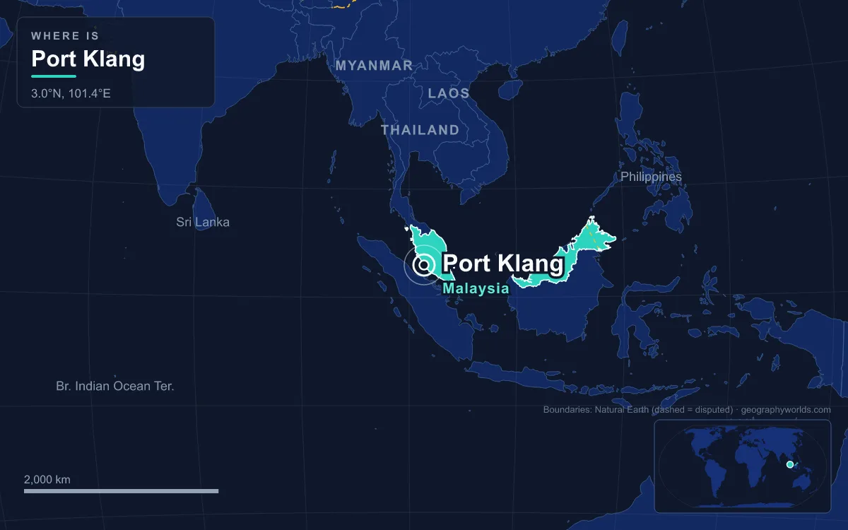
Port Klang is Malaysia’s largest and busiest port, on the Strait of Malacca in Klang District, Selangor, about 6 km southwest of Klang town and 38 km southwest of Kuala Lumpur. It handled about 14.6 million TEU (twenty-foot equivalent units) of containers in 2024, which made it the 10th busiest container port in the world in Lloyd’s List’s One Hundred Container Ports 2025. The port was opened on 15 September 1901 as Port Swettenham, took its present name in July 1972, and today works as two things at once: the sea gate for Kuala Lumpur and the Klang Valley, and a transshipment hub where cargo changes ships beside one of the world’s busiest shipping lanes.
Two ways in: the Pulau Angsa and Pintu Gedong channels
Port Klang is not one quay but a cluster of terminals spread around the mouth of the Klang River and the islands in front of it, and the way ships reach them explains most of how the port works. There are two navigation channels from the strait, and each leads to a different part of the port.
The northern route, the Pulau Angsa Channel, runs 11 nautical miles to Northport with a dredged depth of 11.3 m and a minimum width of 365 m. It connects to a 4.5-nautical-mile fairway in front of Northport, 15 m deep as far as berth 15 and 13 m deep along berths 15 to 21. At the southern end of that fairway a narrower approach, 2.6 nautical miles long, 210 m wide and 7.5 m deep, turns off to the old South Port. With the help of the tide, ships drawing up to 15 m can use the Pulau Angsa Channel.
The southern route, the Pintu Gedong Channel, is short and deep. It runs only 2.3 nautical miles to Westport, is 18 m deep and at least 500 m wide, and the tide adds between 2 m and 5.5 m on top of that, so ships drawing up to 17.5 m can reach the berths. That single difference in water depth is why Westport, rather than Northport, handles the largest container ships that call at Port Klang.
Outer and inner anchorages: where ships wait for a berth at Port Klang
Ships that arrive before a berth is free wait at one of two outer anchorages, one seaward of each channel. The Outer Anchorage South Channel lies in the Pintu Gedong area east and southeast of the South Fairway Buoy and is also used for ship-to-ship transfers, though anchoring within 1 nautical mile of the buoy is banned. On the north side, vessels wait for pilots about half a nautical mile short of the pilot boarding ground, in 15 to 22 m of water. Inside the harbour, four smaller anchorages take coastal ships: the deep-water points North, South and Reserve, and the Northshore Anchorage, with draught limits from 10 m at the North point down to 4 m at Northshore.
Northport, Southpoint and Westport: three ports under one authority
The Port Klang Authority, a statutory body set up on 1 July 1963 as the Port Swettenham Authority, governs the whole harbour, but the terminals are run by separate companies. There are three of them.
Southpoint, the original South Port, has a wharf of eight berths numbered 1 to 7A. Berths 1 and 2 handle liquid cargo and can take ships of up to 40,000 deadweight tonnes, berth 3 handles dry bulk up to 23,000 tonnes, and the remaining berths take breakbulk cargo on ships of 6,000 to 20,000 tonnes. It is the shallowest part of the port and the oldest.
Northport, operated by Northport (Malaysia) Bhd, was formed by merging Kelang Container Terminal and Kelang Port Management. It is a multipurpose port that also runs Southpoint and a logistics arm, Northport Distripark. Its history is the history of Malaysian containerisation: new deep-water berths for containers and conventional cargo were built in the late 1960s and 1970s, and Prime Minister Tun Abdul Razak declared the container terminal open in November 1972. Seven more bulk berths were started in May 1974 and finished in 1983, a liquid bulk terminal at North Port was completed in October 1982, and the container terminal was privatised to Klang Container Terminal Berhad on 17 March 1986.

Westport, run by Westports Malaysia Sdn Bhd (formerly Kelang Multi Terminal), sits on Pulau Indah, an island once called Pulau Lumut whose mangrove swamps were mostly cleared by 1999 for the port and its industrial estates. Because it faces the deep Pintu Gedong Channel it is the container workhorse of the port. The Port Klang Cruise Centre, opened in December 1995, sits next to Westport’s cargo terminals with three berths for cruise liners and visiting naval ships.
Why the port moved to the mouth of the Klang River in 1901
The layout makes more sense once you know why there is a port here at all. In 1880 the capital of Selangor moved from Klang to Kuala Lumpur, and in the years that followed the only ways between the two towns, and for tin ore heading from the mines to Klang’s river port, were horse or buffalo wagons or a boat along the Klang River. Frank Swettenham, appointed British Resident of Selangor in September 1882, pushed for a railway; 19.5 miles of track from Kuala Lumpur to Bukit Kudu opened in September 1886 and reached Klang in 1890. But the river jetty could only take ships drawing less than 3.9 m, so a new port was laid out near the river mouth, where the anchorage was good. Built by the Malayan Railway, it was opened by Swettenham himself as Port Swettenham on 15 September 1901.
The site was mangrove swamp, and within two months malaria forced the port to close. It became the first colonial area to apply Ronald Ross’s 1897 finding that mosquitoes carry the disease: swamps were filled, jungle cleared and standing water drained until the outbreaks stopped. Two new berths followed by 1914, and tonnage peaked before the Second World War at 550,000 tonnes in 1940. After the war the port expanded south to handle palm oil and latex, two increasingly important exports.
Roads, rails and the Port Klang Free Zone
A port is only as useful as its links inland. Port Klang is the western end of Federal Route 2, the Federal Highway to Kuala Lumpur, while the KESAS expressway meets the Pulau Indah Expressway at Pandamaran to reach Westport. Since 2012 the South Klang Valley Expressway has tied Pulau Indah directly to Putrajaya and Kajang. Two road bridges now cross to the island, which before they were built could be reached only by an hour-long ferry. A rail bridge runs beside the Pulau Indah Expressway to a cargo-only KTM station, and passenger trains on the KTM Komuter line run from Port Klang station through Klang, Shah Alam and Kuala Lumpur to Tanjung Malim.
Next to Westport lies the Port Klang Free Zone, a 1,000-acre (4.0 km²) duty-free trade and logistics zone established in 2004. It is also remembered for a financial scandal: planned at RM1.845 billion, it had cost RM4.6 billion by the time it was completed four years later. In July 2010 five people, including a former general manager of the Port Klang Authority, were charged over the project, and later that month former transport minister Ling Liong Sik was charged with cheating over land valuations; he pleaded not guilty. The episode led the transport ministry to adopt a whistleblower policy for Malaysia’s ports.
What 14.6 million TEU means for the Klang Valley and the Strait of Malacca
A 1993 government directive identified Port Klang to be developed as Malaysia’s National Load Centre, the main hub for the country’s seaborne trade, and volumes have grown steadily since. Lloyd’s List and AAPA figures show the port handling about 5.2 million TEU in 2004, 8.9 million in 2010, 13.2 million in 2016 and 14.1 million in 2023, when it ranked 11th in the world, before reaching about 14.6 million in 2024. The climb has not been smooth: throughput fell from about 8.0 million TEU in 2008 to 7.3 million in 2009 during the global financial crisis, and from 13.2 million in 2016 to about 12.0 million in 2017, before recovering to above 13 million from 2019 onwards, through the pandemic years. Total cargo capacity was put at 109.7 million tonnes in 2005, against 550,000 tonnes handled in 1940, and the port has trade links with more than 120 countries and over 500 ports.

The location does the rest. The Strait of Malacca, 900 km long and between 65 and 250 km wide, is the main channel between the Indian and Pacific oceans; more than 94,000 vessels passed through it in 2008, carrying roughly a quarter of the world’s traded goods. Port Klang competes for that traffic with two neighbours near the strait’s southern exit, Singapore and Malaysia’s own Tanjung Pelepas in Johor. Singapore remains far larger, but Port Klang handles more containers than Tanjung Pelepas, and unlike either of them it sits at the doorstep of Malaysia’s capital region, with the Federal Highway running straight from its quays into Kuala Lumpur.
Its role goes beyond boxes. As of July 2020 Port Klang was the leading storage location for aluminium registered on the London Metal Exchange, with 911,000 tonnes of registered stock and a further 434,000 tonnes of so-called shadow stocks held there at the end of May 2020. For the waterway that feeds the port, read our guide to the Strait of Malacca; for the city it serves, see Kuala Lumpur, capital of Malaysia; and for the rival terminal at the other end of the strait, compare Port Klang with the Port of Tanjung Pelepas.