
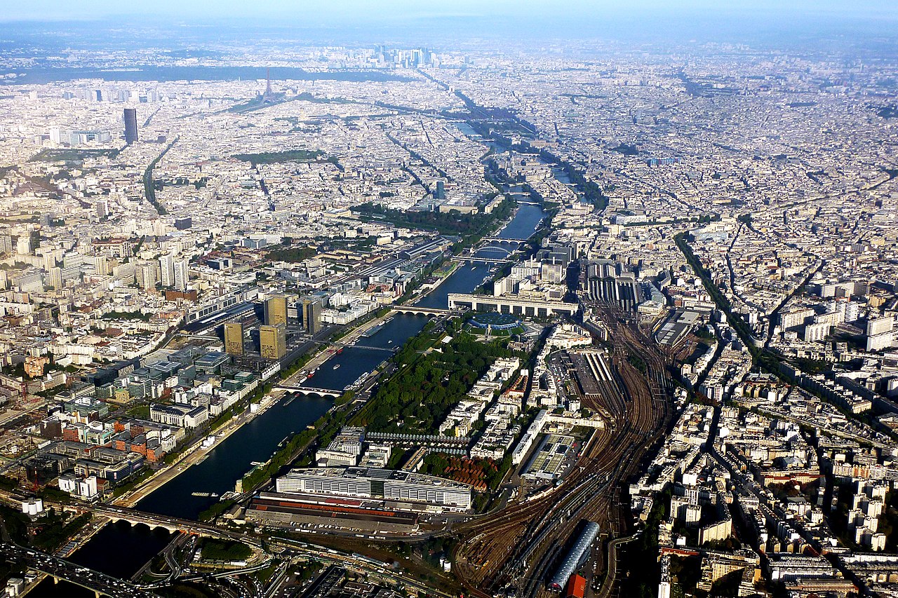
The Seine is a 777 km (483 mi) river in northern France, rising on the Langres Plateau in Burgundy and flowing north-west through Paris to the English Channel between Le Havre and Honfleur. It is France's second-longest river after the Loire, drains a basin of roughly 79,000 km², and its banks through central Paris have been a UNESCO World Heritage Site since 1991.
Key Facts
- Length: 777 km (483 mi)
- Country: France, entirely
- Source: Source-Seine, Langres Plateau, Côte-d'Or, at roughly 446 m elevation
- Mouth: The English Channel, in a long estuary below Rouen
- Drainage basin: approximately 79,000 km²
- Mean discharge: broadly 500 m³/s near the mouth, though it varies widely by season
- Main tributaries: Yonne, Aube, Marne, Oise, Eure, Loing
Course: A River of Enormous Loops
The Seine rises modestly, in a small stone grotto on the Langres Plateau, and gathers its major tributaries before reaching the capital: the Yonne at Montereau, the Marne just upstream of Paris, and the Oise below it.
The Yonne raises a genuine hydrological curiosity. At the confluence it is the larger of the two rivers by discharge, so on the usual convention of following the dominant branch, the river below Montereau arguably ought to be called the Yonne. History and the importance of Paris settled the naming instead.
What defines the Seine's character is its gradient — or lack of one. Crossing the soft sedimentary rock of the Paris Basin with very little fall, the river developed vast meanders. Below Rouen especially, it swings through loops so wide that the navigable distance to the sea is far greater than the straight-line distance. This gentle profile makes the Seine unusually navigable for its size, and the entire lower course is canalised with locks and weirs.
The estuary
The Seine's mouth is a broad tidal estuary. Tides are felt a long way inland — historically as far as Rouen, roughly 120 km from the sea — which is why Rouen functions as a seaport despite being well inside the country. The estuary is spanned near its mouth by the Pont de Normandie, a cable-stayed bridge completed in 1995 that briefly held the record for the longest cable-stayed span in the world.
Paris Was Built Because of This River
The city exists where it does because of a specific feature of the river: a cluster of islands offering a defensible site and an easy crossing point. The Celtic Parisii settled the Île de la Cité, and the Roman town of Lutetia grew on and around it. Every layer of Paris since has organised itself around the water.
The river also gives Paris its basic geography of address. The Rive Droite (Right Bank) to the north and Rive Gauche (Left Bank) to the south are not merely directions but cultural categories — commerce and government historically on the right, university and intellectual life on the left. The arrondissements spiral outward from the islands at the centre. Even the city's coat of arms is a ship, with the motto Fluctuat nec mergitur: "she is tossed by the waves but does not sink."
Thirty-seven bridges cross the Seine within Paris. The oldest still standing is the Pont Neuf, completed in 1607 — its name meaning "new bridge" is one of the city's better jokes. The riverfront sequence from the Louvre past Notre-Dame to the Eiffel Tower is what the UNESCO inscription "Paris, Banks of the Seine" recognises.
Floods: The River's Other Face
The Seine's gentle gradient makes it navigable, but it also means that a large volume of water arriving from the Marne and Yonne has nowhere to go quickly.
The reference event is the Great Flood of January 1910, when the river at Paris rose about 8.6 metres above its normal level. Water did not overtop most quays directly so much as force its way up through sewers, the metro tunnels and the porous ground, inundating large districts for weeks. The statue of a Zouave soldier on the Pont de l'Alma has served as the city's informal flood gauge ever since — Parisians judge severity by how much of him is submerged.
Significant floods recurred in 2016 and 2018, prompting the Louvre and Musée d'Orsay to move artworks out of basement storage. A system of large upstream reservoirs on the Seine, Marne, Aube and Yonne now buffers peak flows, but a repeat of 1910 remains one of the most studied risks to the city.
A River That Was Cleaned Up
By the mid-twentieth century the Seine was severely polluted, with stretches through and below Paris nearly devoid of fish. Public swimming had been banned since 1923.
Decades of investment in wastewater treatment and the interception of storm overflows reversed much of this, and fish species counts recovered substantially. The effort then accelerated dramatically ahead of the 2024 Olympic Games, with a clean-up programme costing on the order of €1.4 billion, including a very large stormwater storage basin near Austerlitz built to stop untreated overflow entering the river during heavy rain.
The results were put to public test. The 2024 Paris Olympics staged its opening ceremony as a flotilla on the Seine — the first summer Games opening held outside a stadium — and used the river for the marathon swimming and triathlon events. Then, on 5 July 2025, Paris opened three supervised public swimming sites on the Seine, at locations in eastern Paris, near Notre-Dame and near the Eiffel Tower, ending the ban that had stood for 102 years. Water quality is monitored daily and sites close after heavy rainfall, so the recovery is real but conditional.
Working River
The Seine is France's busiest inland waterway for freight, and the Paris port authority handles millions of tonnes of cargo annually — largely construction materials, aggregates and containers — making it one of Europe's largest inland port systems.
Its two seaports divide the work. Le Havre, at the mouth, is France's leading container port. Rouen, upstream, is one of Europe's largest grain-export ports, shipping French wheat from the Paris Basin. Together with Paris they are managed as a single corridor, the logic being that a single river connects the capital's consumption to Atlantic shipping. Tourism adds another layer: the bateaux-mouches sightseeing boats have operated since the nineteenth century, and the river's light on water is inseparable from Impressionism — Monet, Renoir and Sisley all painted the Seine repeatedly at Argenteuil and beyond.
Names, Origins and Curiosities
The river's name descends from the Latin Sequana, a Gallo-Roman goddess worshipped at the river's source. A sanctuary dedicated to her stood near the springs on the Langres Plateau, and excavations there recovered large numbers of votive offerings — including anatomical models left by pilgrims seeking cures, which suggests the source was regarded as a healing site long before Paris was a city of any consequence.
A few other details are worth collecting:
- The Source-Seine site is owned by the City of Paris, not by the local commune — the capital bought the land in the nineteenth century and marked it with a grotto and a statue of a nymph.
- The Seine's islands in Paris number just two natural survivors, the Île de la Cité and the Île Saint-Louis; others were joined to the banks or to each other during centuries of engineering.
- The Canal Saint-Martin and the wider Paris canal network were built partly to supply drinking water and partly to bypass the river's slow loops through the city.
- Because the river is fully canalised with locks, the Seine is connected by canal to the Rhine, the Rhône, the Loire and the Scheldt — meaning a barge can in principle travel from Le Havre to the Black Sea.
How the Seine Compares to Other European Rivers
The Seine is modest in scale next to Europe's giants, and the comparison clarifies what it is actually good at.
- Danube — 2,850 km, 10 countries: Nearly four times the Seine's length and international in a way the Seine never is.
- Rhine — about 1,230 km: Europe's premier freight artery, carrying vastly more tonnage, fed by Alpine glaciers rather than a low plateau. Our Danube vs Rhine comparison covers both.
- Loire — 1,006 km: France's longest river, but shallow, sandy and largely unnavigable — the opposite trade-off to the Seine.
- Thames — about 346 km: Less than half the Seine's length, yet the closest functional parallel: a tidal, heavily engineered river running through a dominant capital. See our Thames guide.
The pattern is clear. The Seine wins on none of the raw measures — it is not the longest, largest or busiest. What it has is an exceptional combination of navigability and centrality: a gentle, lock-controlled channel running from an Atlantic container port directly through the middle of a capital city. The Loire is longer but unusable; the Rhine is busier but reaches no comparable city centre. That combination, not size, is why the Seine matters.