
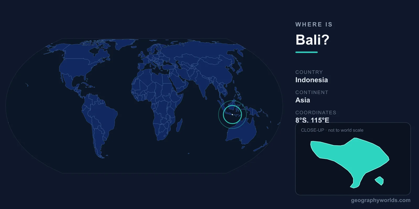
Bali is an island in Southeast Asia, part of the Indonesian archipelago, located at roughly 8.3405°S latitude and 115.0920°E longitude. It sits among the westernmost of Indonesia's Lesser Sunda Islands, wedged between Java to the west and Lombok to the east, just 8 degrees south of the equator. Covering around 5,780 square kilometers, Bali is geographically small yet famous worldwide as a single province of Indonesia with an outsized cultural and natural identity.
Where Exactly Is Bali on the Map?
To find Bali on a globe, look at the chain of islands stretching east from the larger island of Java. Bali is the first major island in that eastward chain, lying in both the Southern and Eastern Hemispheres. Its capital and administrative center is Denpasar, in the south of the island near the main tourist regions of Kuta, Seminyak, and Sanur.
Indonesia is the world's largest archipelago nation, with more than 17,000 islands. Bali is one of its 38 provinces and one of its most recognizable, despite occupying only a tiny fraction of the country's total land area. Sitting near the equator gives Bali a tropical climate with consistent warmth and humidity throughout the year, rather than four distinct seasons.
What Surrounds Bali?
As an island, Bali shares no land borders with any neighbor. Instead it is defined by the seas and straits around it:
- West: Java, Indonesia's most populous island, separated by the narrow Bali Strait — only about 2.4 km wide at its tightest point.
- East: Lombok, separated by the deeper, roughly 35 km wide Lombok Strait.
- North: The Bali Sea, which connects to the broader Java Sea.
- South: The open Indian Ocean, stretching uninterrupted toward Australia and Antarctica.
- Southeast: The small satellite islands of Nusa Penida, Nusa Lembongan, and Nusa Ceningan, popular for diving and day trips.
The Lombok Strait to Bali's east is more than a shipping channel — it marks the Wallace Line, a famous biogeographic boundary identified by naturalist Alfred Russel Wallace. West of this line, the wildlife is distinctly Asian; east of it, species begin to take on Australasian characteristics. This makes Bali the easternmost outpost of typically Asian ecology in the region.
The Island's Physical Geography
Bali's terrain is shaped by volcanoes. A chain of mountains runs roughly east to west across the island, dominated by Mount Agung, an active stratovolcano rising about 3,031 meters and revered as the most sacred mountain in Balinese Hinduism. Nearby, Mount Batur (about 1,717 meters) sits within a dramatic caldera holding a crater lake. These peaks are part of the Pacific Ring of Fire, and Agung's eruptions in 2017–2019 were a reminder of the island's geological energy.
The volcanic spine divides the island. To the south lie fertile lowlands famous for their terraced rice paddies, managed for over a thousand years by the cooperative subak irrigation system, now a UNESCO World Heritage cultural landscape. The north coast drops more steeply to the sea. Because Bali is so compact, you can travel from a misty volcanic crater to lush rice terraces to a beach in a single day.
Bali's Climate by Location
Bali has a tropical monsoon climate with two main seasons rather than the temperate four. The dry season runs roughly April to October, and the wet season November to March. Coastal temperatures hold steady between about 27°C and 30°C year-round, while the mountainous interior is noticeably cooler, sometimes dropping to 15°C or lower at higher elevations.
Rainfall also varies by location: the lowlands receive around 1,500 mm annually, while the central highlands can exceed 3,000 mm. The dry months of June through September are the most popular for visitors, offering sunny skies and lower humidity. Even in the wet season, rain often arrives in short, intense afternoon downpours rather than lasting all day.
How to Reach Bali
Most visitors arrive at Ngurah Rai International Airport (airport code DPS), located near Kuta in the south of the island. It is one of Indonesia's busiest airports, with direct flights from cities across Asia, Australia, the Middle East, and a handful of long-haul routes. A flight from Jakarta on Java takes roughly 1.5 hours. Bali can also be reached overland-and-sea via ferry from Ketapang in East Java — a crossing of the Bali Strait of about 45 minutes — or by fast boat from Lombok and the Gili Islands to the east. If you enjoy testing your map skills, you can practice placing islands like Bali with our geography games.
Frequently Asked Questions
What country is Bali in?
Bali is part of Indonesia, where it forms one of the country's 38 provinces. It lies in Southeast Asia, just east of the much larger island of Java.
Is Bali in Asia or Australia?
Bali is in Asia, as part of Southeast Asian Indonesia. However, it sits close to the Wallace Line in the Lombok Strait, the boundary that separates Asian wildlife from Australasian species, so it lies near the ecological transition toward Australia.
How big is Bali?
Bali covers approximately 5,780 square kilometers and is home to around 4.3 million people. It is small enough to drive across in a few hours, yet packed with volcanoes, beaches, rice terraces, and reefs.
Is Bali near the equator?
Yes. Bali lies about 8 degrees south of the equator, which gives it a warm, humid tropical climate with consistent temperatures and two seasons — wet and dry — rather than four.
