
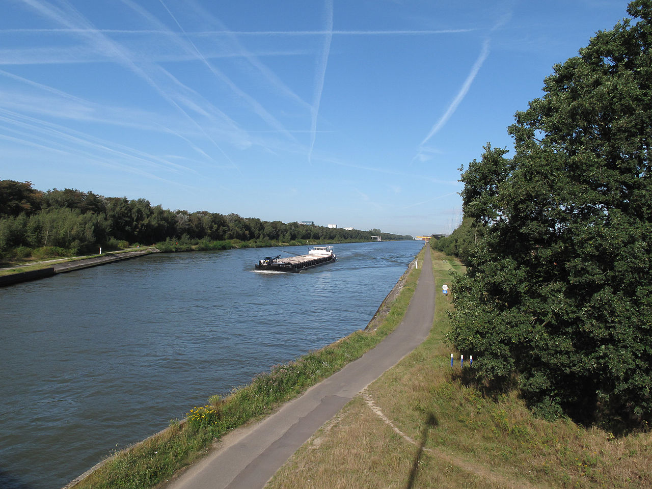
The Albert Canal is a 130-kilometer (81-mile) waterway in northeastern Belgium that connects the port of Antwerp to the city of Liège on the Meuse River. Named after King Albert I and opened in 1939, it is Belgium's busiest commercial waterway, carrying more than 40 million tonnes of freight a year between the country's largest seaport and its eastern industrial heartland.
Few inland waterways in Europe do as much heavy lifting for a national economy as the Albert Canal. It was conceived to solve a simple but stubborn problem: Belgium's biggest port and its biggest industrial region were poorly connected by water. The canal fixed that, and in doing so it reshaped the geography of trade, industry, and even warfare across the Low Countries. This guide covers its route, history, engineering, and the role it plays today.

Where Is the Albert Canal?
The Albert Canal runs across the northern and eastern parts of Belgium, beginning at the port of Antwerp on the River Scheldt in the province of Antwerp and ending at Liège, where it joins the Meuse (Maas) River in the French-speaking region of Wallonia. Between these two endpoints it crosses the Belgian provinces of Antwerp, Limburg, and Liège.
Geographically, the canal links two of Belgium's three regions. Its western and central reaches pass through Flanders, while its eastern terminus sits in Wallonia, making it one of the few major pieces of infrastructure to tie the Dutch-speaking north to the French-speaking south. At Liège the canal connects to the Meuse, and through that river system to the broader European network reaching into the Netherlands and France.
History and Construction
For decades Belgium had needed a direct, deep waterway between its largest port, Antwerp, and the industrial Meuse valley around Liège. The older canal routes were indirect and could only handle small barges, throttling the flow of coal, iron, and steel that powered the Walloon economy. Planning for a modern solution accelerated in the late 1920s.
Construction began in 1930 and continued through the worst years of the Great Depression, employing thousands of workers during a period of mass unemployment. The canal opened in 1939, only months before the outbreak of the Second World War. It was named in honour of King Albert I, the popular "Soldier King" who had led Belgium through the First World War and who died in a climbing accident in 1934, five years before his namesake canal was completed.
From the outset the canal was designed to serve a double purpose. Beyond commerce, it was meant to form a defensive line shielding central Belgium from invasion from the east. The fortress of Eben-Emael, then regarded as the strongest fortification in the world, guarded the point where the canal system met the Meuse. That defensive role collapsed almost immediately: on 10 May 1940, German glider-borne paratroopers landed directly on the fort's roof and neutralised it within hours, opening the way for the wider invasion of Belgium.
The Route from Antwerp to Liège
The canal's western 110 kilometres, from Antwerp toward the Limburg town of Genk, run almost entirely at a single water level with no locks at all. This long lock-free reach crosses the flat Campine (Kempen) region, a landscape of heath, pine forest, and sandy farmland that was historically one of Belgium's poorer and more sparsely developed areas. The arrival of the canal transformed it, drawing factories, logistics parks, and distribution centres to its banks.
Only in its final stretch, as it approaches Liège, does the terrain force the canal to descend. Here it drops roughly 56 metres to the level of the Meuse through a series of locks. This concentration of all the elevation change at the eastern end is the canal's defining engineering trait, and the reason it is so efficient for through traffic.
How the Canal Works
Because the long western section is lock-free, barges can travel most of the canal's length without stopping, avoiding the delays that lockages impose on many other European waterways. The locks that do exist are grouped near Liège, where vessels step down toward the Meuse.
- Length: 130 km (Antwerp to Liège)
- Locks: 6, all concentrated at the Liège end
- Lock-free stretch: roughly 110 km from Antwerp
- Total descent at Liège: about 56 m to the Meuse
- Minimum depth: 3.4 m
- Base width: 24 m
- Maximum vessel: up to 9,000 tonnes (Europa Class Va)
The canal has been progressively modernised to take ever-larger vessels. Recent and ongoing works are raising bridge clearances and deepening the channel so that barges can stack containers four layers high, sharply increasing capacity. These upgrades form part of a wider European Union strategy to move freight off congested roads and onto rivers and canals.
Economic and Strategic Importance
Today the Albert Canal is the commercial backbone of Belgian inland shipping. It is the principal freight artery between the Port of Antwerp, one of Europe's largest seaports, and the industries of eastern Belgium and the wider continent. Typical cargoes include petroleum products, building materials, chemicals, steel, and a fast-growing volume of shipping containers.
The environmental case for the canal is strong. A single fully loaded barge can carry the equivalent of around 200 truckloads, taking those vehicles off the motorways and cutting both carbon emissions and congestion. As climate and transport policy increasingly favours waterborne freight, Belgium, the EU, and private operators continue to invest in the canal's locks, bridges, and depth to push its capacity higher. The corridor along its banks has become one of the most important logistics zones in the country.
Key Facts
- Country: Belgium (provinces of Antwerp, Limburg, and Liège)
- Length: 130 km (81 miles)
- Connects: Port of Antwerp to the Meuse River at Liège
- Opened: 1939, named after King Albert I
- Locks: 6, all at the Liège end; ~110 km lock-free
- Annual freight: more than 40 million tonnes
- Maximum vessel size: up to 9,000 tonnes
Fun Facts
- The German capture of Fort Eben-Emael beside the canal in 1940 was carried out by fewer than 90 paratroopers and remains one of the most audacious special operations in military history.
- King Albert I died in a mountaineering accident in 1934, five years before the canal bearing his name was finished.
- One loaded barge on the Albert Canal can replace roughly 200 truck journeys, making it a model for low-emission freight transport.
Frequently Asked Questions
How long is the Albert Canal?
The Albert Canal is 130 kilometres (about 81 miles) long, running from the port of Antwerp in northern Belgium to the city of Liège in the east, where it joins the Meuse River.
Why does the Albert Canal have so few locks?
Most of the canal crosses the flat Campine region at a single water level, so roughly 110 kilometres of its length need no locks at all. All six of its locks are grouped at the eastern end near Liège, where the canal must descend about 56 metres to reach the Meuse. This makes the long western stretch unusually fast for commercial shipping.
What is the Albert Canal used for today?
It is Belgium's busiest commercial waterway, carrying more than 40 million tonnes of freight a year. Barges move petroleum products, building materials, chemicals, steel, and a rapidly growing number of shipping containers between the Port of Antwerp and the industrial regions of eastern Belgium and beyond.
Why was the Albert Canal built?
It was built to give Belgium a direct, deep-water link between its largest port at Antwerp and its industrial heartland in the Meuse valley around Liège, replacing slow and indirect older routes. It was also intended to serve as a defensive barrier against invasion from the east, a role that ended almost immediately during the German attack of May 1940.
Test Your Knowledge!
Think you know the world's famous canals and waterways? Try our geography quiz games!
Play Geography Games →