
Introduction
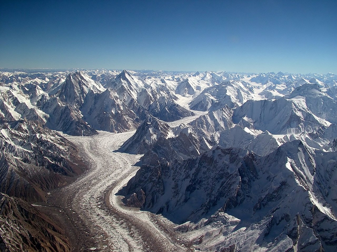
Baltoro Glacier is one of the longest glaciers outside the polar regions, stretching 63 kilometers through the heart of the Karakoram range in the Gilgit-Baltistan region of Pakistan. It flows through the greatest concentration of high peaks on Earth, flanked by four of the world's fourteen 8,000-meter summits: K2, Broad Peak, Gasherbrum I, and Gasherbrum II.
The glacier serves as the highway to K2, the second highest mountain in the world. Every expedition to K2's base camp must traverse the length of Baltoro, walking for days across a chaotic surface of ice, rock, and moraine. It is one of the most dramatic and remote glacier treks on the planet.

Geography & Dimensions
- Length: 63 km
- Width: Up to 3 km
- Area: ~524 km²
- Elevation Range: ~3,400 m (snout) to ~7,600 m (upper basins)
- Location: Gilgit-Baltistan, Pakistan
Baltoro Glacier flows from the high basins beneath the Karakoram's greatest peaks, collecting ice from multiple tributary glaciers. Its main trunk runs roughly east to west through a deep valley flanked by granite spires and ice-capped summits.
The glacier terminates near the village of Paiju at approximately 3,400 meters. The upper reaches include Concordia, a vast glacial junction at 4,600 meters where the Baltoro meets the Godwin-Austen Glacier flowing from K2. Concordia is often called the "Throne Room of the Mountain Gods" for its panorama of soaring peaks.
Formation & Movement
- Tributary Glaciers: Godwin-Austen, Abruzzi, Vigne, and others
- Ice Speed: ~100-200 m per year
- Debris Cover: Heavily debris-covered in lower 20+ km
- Supraglacial Lakes: Numerous ponds on debris-covered surface
Baltoro is fed by dozens of tributary glaciers descending from the surrounding peaks. The enormous altitude range, over 4,000 meters from terminus to accumulation zone, drives intense ice flow. Avalanches from the steep faces of K2, Broad Peak, and the Gasherbrums continuously feed the upper glacier.
The lower 20 or more kilometers of Baltoro are covered by a thick layer of rock debris, giving it the appearance of a rubble-strewn wasteland rather than gleaming ice. This debris cover insulates the underlying ice, slowing melt in some areas while creating a maze of ice towers (penitentes), supraglacial lakes, and unstable terrain that makes trekking challenging.
Climate Impact
- Trend: Complex; some Karakoram glaciers stable or advancing ("Karakoram Anomaly")
- Debris Effect: Thick debris cover insulates ice, complicating melt predictions
- Water Supply: Feeds the Shigar and Indus Rivers
- Significance: Critical water source for millions downstream
Baltoro Glacier exists within the so-called "Karakoram Anomaly," a region where some glaciers have remained stable or even advanced slightly in recent decades, contrary to the global trend of retreat. The reasons are debated but may involve increased snowfall from changing weather patterns.
Regardless of its current stability, Baltoro is critically important as a water source. Its meltwater feeds the Shigar River, which flows into the Indus, the lifeblood of Pakistan's agriculture. Over 200 million people in the Indus basin depend on glacial meltwater, making the future of Karakoram glaciers a matter of enormous consequence.
Surrounding Ecology
- Biome: High-altitude desert and alpine scrub
- Vegetation: Sparse; juniper, willow, wild rose near terminus
- Wildlife: Markhor, ibex, snow leopard (rare), golden eagle, lammergeier
- Protected Status: Central Karakoram National Park (10,000 km²)
The landscape around Baltoro is stark and arid despite the massive amounts of ice. The Karakoram lies in a rain shadow, receiving much of its moisture as winter snowfall at high elevations. Valley floors are barren, with vegetation limited to scattered juniper, willow, and wild rose near water sources.
The broader Central Karakoram National Park, one of the largest national parks in the world, protects the glacier and surrounding peaks. Snow leopards inhabit the higher valleys, though sightings are extremely rare. Markhor and ibex can sometimes be spotted on the rocky slopes above the glacier.
Exploration & Trekking
- Trek Duration: 12-16 days round trip from Askole
- Starting Point: Askole village (3,000 m)
- Key Camps: Paiju, Urdukas, Gore, Concordia, K2 Base Camp
- Season: June to September
- Permit Required: Yes, from Pakistani authorities
The Baltoro trek is one of the world's great mountain journeys. Starting from the remote village of Askole, trekkers walk 6-8 days to reach Concordia, passing through increasingly dramatic mountain scenery. The route crosses the glacier itself for several days, navigating moraine ridges and ice features.
Concordia at 4,600 meters is the climactic destination for most trekkers, offering a 360-degree panorama that includes K2, Broad Peak, Gasherbrum IV's marble-like face, and countless other peaks. Mountaineering expeditions continue from Concordia to K2 Base Camp or the Gasherbrum base camps. The trek requires a government permit, a registered guide, and porters from the Balti communities who have supported expeditions for over a century.
Key Facts
- Baltoro Glacier at 63 km is one of the longest glaciers outside the polar regions.
- Four 8,000-meter peaks flank the glacier: K2, Broad Peak, Gasherbrum I, and Gasherbrum II.
- Concordia, where tributaries meet at 4,600 m, is called the "Throne Room of the Mountain Gods."
- The glacier lies within the "Karakoram Anomaly" where some glaciers are stable or advancing.
- Baltoro's meltwater feeds the Indus River system, supporting over 200 million people.
Fun Facts
- The first European to explore Baltoro was Henry Godwin-Austen in 1861, whose name was later given to the tributary glacier beneath K2.
- Every K2 expedition since the first attempt in 1902 has trekked the full length of Baltoro to reach base camp.
- The granite towers flanking Baltoro, including the Trango Towers and Cathedral Spires, include some of the tallest rock walls on Earth.
- Balti porters can carry loads of 25 kg across the glacier in traditional handmade leather shoes, though modern boots are now more common.
Final Thoughts
Baltoro Glacier is more than a river of ice; it is the gateway to the greatest concentration of high peaks on Earth. Its combination of extreme geography, mountaineering history, and hydrological importance makes it one of the most significant glaciers in the world, a frozen corridor through the roof of the planet.
