
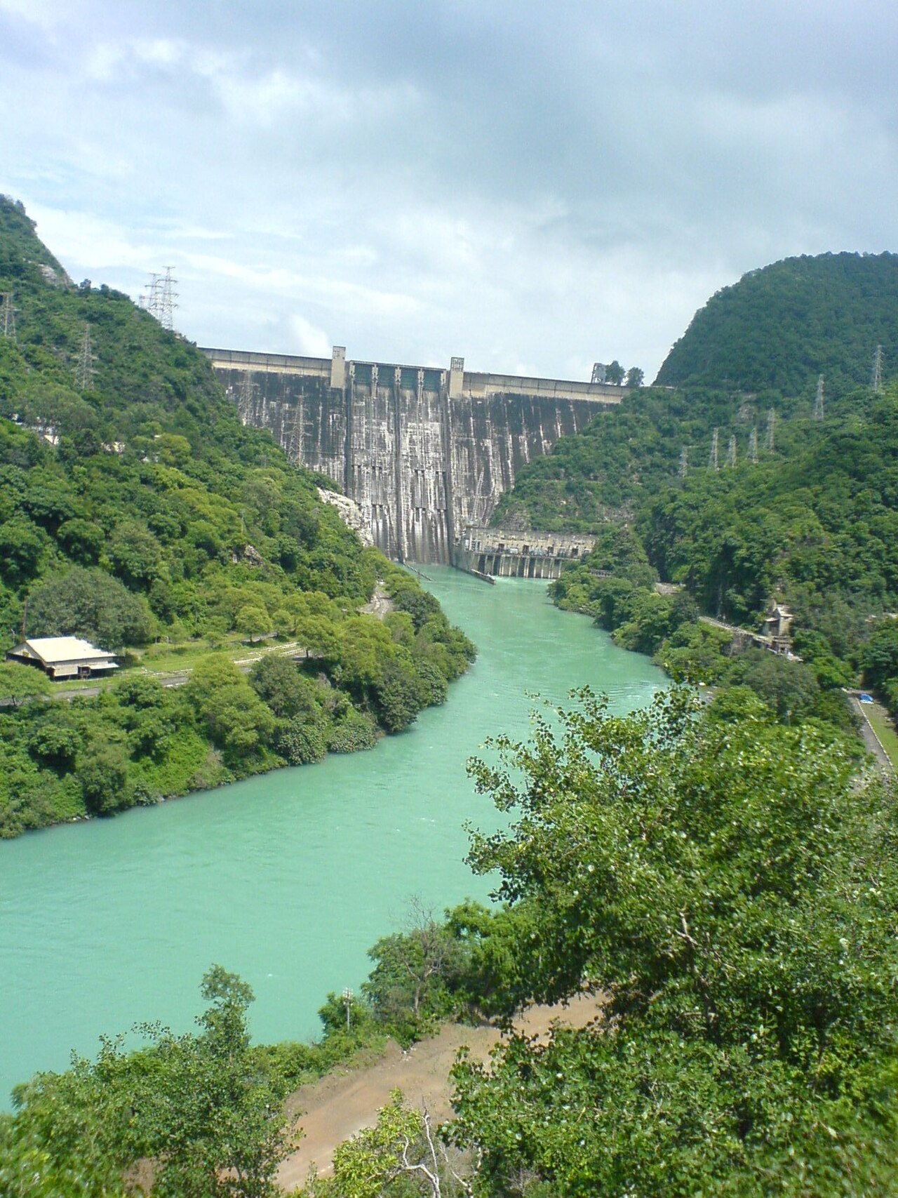
**Bhakra Dam** on the Sutlej River at the border of Himachal Pradesh and Punjab is one of India's most iconic engineering landmarks. Completed in **1963**, it stands **226 meters** tall and was the highest straight gravity dam in the world at the time. India's first Prime Minister, Jawaharlal Nehru, called it a "Temple of Resurgent India," reflecting its symbolic importance to the newly independent nation.
Introduction
The Bhakra-Nangal project transformed the agriculture and economy of northwestern India by providing irrigation water to millions of hectares of farmland in Punjab, Haryana, and Rajasthan. Combined with the Green Revolution's high-yield crop varieties, the dam's irrigation network turned Punjab into India's breadbasket and helped the country achieve food self-sufficiency.
Engineering & Structure
- Type: Concrete straight gravity dam
- Height: 226 meters
- Crest Length: 518 meters
- Reservoir: Gobind Sagar (168 km²)
Bhakra Dam is a concrete straight gravity dam requiring 4.79 million cubic meters of concrete. The dam's foundation sits on competent rock in a narrow gorge of the Sutlej River, providing a stable base for the enormous structure. The spillway can discharge up to 6,475 cubic meters per second through four gates, managing the Sutlej's monsoon floods.
The dam was designed by American engineer Harvey Slocum and built with technical assistance from the United States Bureau of Reclamation. Construction took over a decade, from 1948 to 1963, employing over 20,000 workers at peak periods. The reservoir it creates, Gobind Sagar, has a total storage capacity of 9.34 cubic kilometers, named after the tenth Sikh Guru, Gobind Singh.
Geographic Setting
- River: Sutlej River (Indus tributary)
- Location: Bilaspur, Himachal Pradesh-Punjab border, India
- Coordinates: 31.42°N, 76.43°E
- Reservoir Length: ~88 km
The Sutlej River originates near Lake Rakshastal in Tibet at over 4,500 meters elevation and flows through the Himalayas into the Punjab plains. At the dam site near Bilaspur, the river passes through a narrow gorge in the Shivalik Hills, the southernmost range of the Himalayan system. This gorge provided the ideal constriction point for the dam.
Gobind Sagar reservoir extends 88 kilometers upstream through the lower Himalayan foothills, inundating valleys that were once fertile agricultural land and the old town of Bilaspur. The surrounding hills are covered with subtropical pine forests and scrubland, transitioning to the flat alluvial plains of Punjab just downstream of the dam.
Hydroelectric Power
- Installed Capacity: 1,325 MW (Bhakra complex)
- Main Station: 5 × 10⁸ MW + 5 × 157 MW (Left & Right banks)
- Annual Output: ~5.4 TWh
The Bhakra complex includes two powerhouses — one on each bank of the river — with a combined capacity of 1,325 MW. The Left Bank powerhouse houses five 108 MW units, while the Right Bank houses five 157 MW units. A downstream barrage at Nangal diverts water into canals and includes a small additional power station.
The electricity generated serves Punjab, Haryana, Himachal Pradesh, Rajasthan, and the Delhi region. While the dam's power output is modest by modern standards, it was transformative in the 1960s, providing reliable electricity to a region that had been largely un-electrified and enabling the mechanization of agriculture that accompanied the Green Revolution.
Environmental & Social Impact
- Irrigation Command: ~10.21 million hectares served by canal network
- People Displaced: ~36,000 families
- Agricultural Impact: Catalyzed India's Green Revolution in Punjab
The Bhakra-Nangal canal system is one of the most extensive irrigation networks in the world, delivering water to over 10 million hectares across Punjab, Haryana, and Rajasthan through a network of canals totaling over 4,500 kilometers. This irrigation, combined with the introduction of high-yield wheat and rice varieties in the 1960s, transformed Punjab from a food-deficit region into India's grain surplus state.
The social cost included the displacement of approximately 36,000 families from the reservoir area, including the entire old town of Bilaspur, which was submerged when Gobind Sagar filled in 1963. Many displaced families were resettled in the canal colonies of Punjab and Rajasthan, where they received irrigated farmland — an arrangement that, while disruptive, provided long-term economic benefits to many resettled families.
Key Facts
- Bhakra Dam was the highest straight gravity dam in the world at 226 meters when completed in 1963.
- Its canal network irrigates over 10 million hectares across three Indian states.
- Nehru called it a "Temple of Resurgent India" — a symbol of post-independence development.
- Gobind Sagar reservoir has a capacity of 9.34 km³.
- The Bhakra complex generates approximately 5.4 TWh of electricity annually.
Fun Facts
- The first bucket of concrete for Bhakra Dam was ceremonially poured by Jawaharlal Nehru on November 17, 1955.
- Gobind Sagar is one of India's most popular freshwater fishing destinations, stocked with mahseer and carp.
- The dam's gallery system inside the concrete contains over 10 kilometers of tunnels used for inspection and drainage.
Final Thoughts
Bhakra Dam holds an almost mythological place in India's development narrative, transforming the arid plains of Punjab into one of the world's most productive agricultural regions. Six decades after its completion, it remains a working symbol of how large-scale water infrastructure can reshape entire economies and landscapes.
Test Your Knowledge!
Think you know the world's great dams and reservoirs? Try our geography quiz games!
Play Geography Games →