

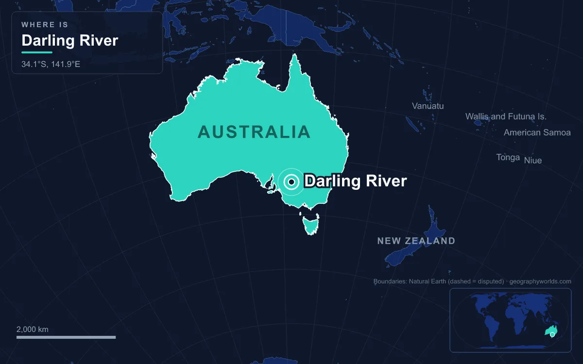
The Darling River, called Baaka or Barka by the Barkindji people, is Australia's third-longest river: it runs 1,472 km across the plains of western New South Wales, from the junction of the Culgoa and Barwon rivers between Brewarrina and Bourke to the Murray River at Wentworth, and with its longest headwater streams in southern Queensland it measures 2,844 km, the longest river system in the country. It drains the inland side of the Great Dividing Range and drains the northern part of the Murray–Darling Basin, which covers 1,061,469 km², about one-seventh of Australia. The river is the product of a very old, very flat landscape: it falls only about 16 mm per kilometre on average, meanders about three times the straight-line distance it covers, and has dried up dozens of times in recorded history. Understanding why begins with rocks almost two billion years old.
Broken Hill's 1,800-Million-Year-Old Crust and the Devonian Darling Basin
Some of the oldest rocks in the Darling's country outcrop around Broken Hill, about 110 km northwest of the Menindee Lakes, which supply the city's water by pipeline. The silver-lead-zinc orebody there, among the largest of its kind in the world, formed about 1,800 million years ago, in the Proterozoic, and its protruding tip gave the city its name.
East of it, a long-lived sag in the continent collected sediment through the Palaeozoic. The Darling Sedimentary Basin, dated from the Late Cambrian or Silurian to the Early Carboniferous, covers more than 100,000 km² of western New South Wales, bounded in the north by a line from Broken Hill through Wilcannia to Cobar and extending south toward the Murray. It is filled mostly with Devonian sedimentary rocks up to 8 km thick, divided into troughs and sub-basins including the Cobar Basin and the Mount Hope, Rast and Melrose troughs. The Lachlan Fold Belt, a 200,000 km² zone of folded and faulted rock formed between about 450 and 340 million years ago, is described as the divide between the Darling Basin and the younger Murray Basin.
Little of this rock is visible from the riverbank today. It is overlain by the younger Eromanga Basin in the north and the Murray Basin in the south, so the Darling crosses its namesake basin on level plains rather than through gorges.
The Eromanga Sea and the Water Under the Upper Darling
The next layer came during the Mesozoic. Through the Triassic, Jurassic and early Cretaceous, erosion of higher ground laid down thick sandstone across what is now inland eastern Australia. Then much of the interior sank below the Eromanga Sea, which covered the sandstone with marine sediment and sealed it. The result is the Great Artesian Basin, the largest and deepest artesian basin in the world at about 1.7 million km², holding an estimated 64,900 km³ of groundwater under most of Queensland and northern New South Wales. In the north, the Eromanga Basin rests directly on top of the older Darling Basin.
The eastern rim of this system was lifted when the Great Dividing Range formed. Rain falling on the inland slopes of that range, such as the Main Range where the Condamine rises about 100 km inland from Point Danger, runs west and south rather than to the Pacific. The same high eastern edge is where most of the Great Artesian Basin's recharge water enters the rock, moving very gradually south and west; the oldest water in its southwestern discharge zones is nearly 2 million years old. The Darling's upper tributaries, the Condamine–Balonne and Culgoa, the Macintyre and Dumaresq, the Gwydir, Namoi, Castlereagh and Macquarie, gather from across this northern country before meeting near Bourke.
Cenozoic Seas and Lake Bungunnia in the Murray Basin
In the south, the Darling Basin is overlain by a younger and shallower depression, the Murray Basin, which the lower Darling crosses on its way to Wentworth. It formed after Australia separated from Antarctica and slowly filled with up to 600 m of Cenozoic sediment. One theory explains the hollow as dynamic topography: a slab of oceanic crust subducted north of Australia in the latest Cretaceous and early Cenozoic is sinking through the mantle beneath the basin, dragging the surface down, and the depression has migrated south over the last 50 million years.
The sea flooded the western Murray Basin several times. Paleocene to Eocene waters left the Warina sand; a Late Oligocene to mid-Miocene rise deposited marl and limestone of the Murray Group; and in the Late Miocene and Pliocene the Murravian Gulf came and went, leaving the Loxton Sands as beaches on the retreating shore. Then, about 2.5 million years ago in the Pleistocene, more than 250 m of uplift in the Grampians region of Victoria blocked the Murray. Behind the barrier grew Lake Bungunnia, which reached about 40,000 km² and laid down the Blanchetown Clay. As rainfall declined, the lake became a chain of salty pans depositing dolomite, the Murray cut a new outlet past Murray Bridge instead of its old exit at Portland, and by about 700,000 years ago the lake was gone. The lower Darling now meets the Murray on the flat floor that this sequence left behind.
Ice-Age Winds, the Ancestral Anabranch and the Menindee Lakes
The last few hundred thousand years shaped the river channel itself. During glacial periods the Murray–Darling plains were arid, while wetter interglacials laid down sand layers that are now aquifers. Wind shaped the plain as well as water: across the lower Darling, winds scoured shallow hollows that now fill as ephemeral lakes.
The clearest evidence of the river moving is the Great Darling Anabranch, an ancestral course of the Darling. It leaves the river south of Menindee and runs about 460 to 488 km south to the Murray west of Wentworth. The main flow now follows the modern bed, and the old course is naturally ephemeral, carrying water only after floods. About twenty ephemeral lakes lie along it, all deflation basins, several larger than 5,000 hectares; together the Anabranch Lakes and their fringing vegetation cover 269,000 hectares.
The Menindee Lakes are a larger set of overflow basins: nine large, shallow lakes beside the river, about 200 km upstream of the Murray junction, once linked to the Darling by short creeks and filled only when the river overflowed. The four main lakes are Wetherell, Pamamaroo, Menindee and Cawndilla.

Because the plain is so flat, tributaries often fail to arrive at all. The Paroo, which descends only 242 m over its 1,210 km course from the gorge country of southwest Queensland, usually ends on the floodplain south of Wanaaring and reaches the Darling only in the wettest years; it is the last free-flowing river in the northern Murray–Darling Basin. The main river is almost as erratic. Between 1885 and 1960 it dried up 45 times, and large floods came in 1974, 1976 and 2022.
What the Landscape Built: Fish Traps, Wool Steamers and the Menindee Scheme
People adapted to this landscape long before it was mapped. Aboriginal peoples have lived along the Barka for tens of thousands of years, and the name Barkindji, or Paakantyi, means "people of the river"; their native title over 128,000 km² of the lower Darling country was recognised in 2015. Upstream at Brewarrina, on the Barwon, the Ngemba Wayilwan built Baiame's Ngunnhu, stone fish traps across the riverbed that drew thousands of people to gatherings; they were added to the New South Wales State Heritage Register in 2000 and the National Heritage List in 2005, and it has been suggested they may be among the oldest human constructions in the world. When Charles Sturt reached the upper river in early 1829, during an intense drought, he named it after Governor Ralph Darling and dismissed the surrounding country as largely uninhabitable.
The flat gradient that starves tributaries made the river navigable in good years. Steamers reached Brewarrina in 1859, and later in the century shallow-draft paddle boats carried wool from Bourke and Wilcannia, then the third-largest inland port in Australia, down to the South Australian railheads at Morgan and Murray Bridge, while Wentworth was the busiest inland port in the country in the late 1880s. The river's habit of drying up could leave boats stranded on the riverbed until the next flow.

In the 20th century engineers tried to fix the variability that geology had built in. A weir was built at Menindee after the 1956 Murray flood, and by 1968 the New South Wales government had turned the Menindee Lakes into a storage scheme supplying Broken Hill, the lower Darling and Murray irrigators. The changes cost the floodplain about 13,800 hectares of lignum and 8,700 hectares of black box, and for four decades the Anabranch was kept as a permanent water supply until a pipeline built in 2007 let it return to its natural wet-and-dry cycle. Upstream, cotton arrived in the late 1970s; Cubbie Station near Dirranbandi, converted to cotton in 1983, is now Australia's largest irrigation property at 93,000 hectares.
The consequences show up whenever water runs short. A cyanobacterial bloom ran the length of the river in 1992. In 2008 the federal government bought Toorale Station for 23 million dollars to return 11 gigalitres of environmental flows to the Darling, and the Murray–Darling Basin Plan was signed on 22 November 2012. Even so, mass fish deaths below Menindee in 2018–2019 killed up to a million fish, and an even larger kill followed in 2023, caused by low oxygen and high temperatures.
The Darling ends where the Murray takes over, and our Murray River guide follows the water from Wentworth to the sea, while the wider system, from the Snowy Mountains to the Coorong, is mapped in our Murray–Darling Basin guide.