
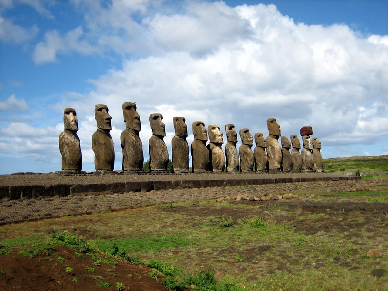
Easter Island (Rapa Nui) is the most geographically isolated inhabited island on Earth — a tiny volcanic triangle of just 163 km² in the southeastern Pacific Ocean, 3,700 km from the coast of Chile and 2,000 km from the nearest inhabited island (Pitcairn).
Introduction
Despite this extreme isolation, Polynesian navigators reached Rapa Nui sometime between 800 and 1200 CE and developed a complex civilization that produced nearly 1,000 monumental stone statues (moai) — some standing over 10 m tall and weighing 82 tons. The island's story is one of remarkable human achievement in the face of severe geographic constraints.
Rapa Nui's history has often been told as a cautionary tale of ecological collapse — a once-forested island stripped bare by statue-building and overpopulation. Recent research has complicated this narrative, suggesting the islanders were more resilient and resourceful than previously believed.

Geography and Geology
- Area: 163 km² — roughly triangular, formed by three extinct volcanoes
- Highest Point: Terevaka (507 m) — the largest of the three volcanic cones
- Climate: Subtropical — 1,100 mm annual rainfall, temperatures 18–28°C, persistent winds
- Isolation: 3,700 km from Chile, 2,000 km from Pitcairn, 4,000 km from Tahiti
Easter Island sits on the Easter Plate, a small tectonic plate at the junction of the Nazca and Pacific plates. The island formed from three shield volcanoes — Terevaka (central, largest), Poike (eastern), and Rano Kau (southwestern) — that erupted between 750,000 and 200,000 years ago. The island has no permanent streams or rivers; freshwater comes from rain-fed crater lakes and coastal seeps.
The island's volcanic soils are relatively fertile but thin, and the lack of coral reefs (due to cold ocean currents) means there is no protected lagoon for fishing. The surrounding ocean drops to depths of 3,000+ m within a few kilometers of shore, limiting near-shore marine resources. These geographic constraints made self-sufficiency challenging for any human population.
The Moai Statues
- Total Count: ~887 moai carved, of which ~400 remain at the quarry (Rano Raraku)
- Average Size: 4 m tall, 12.5 tons — but the largest erected moai (Paro) is 10 m tall, 82 tons
- Largest Unfinished: "El Gigante" — 21 m long, estimated 270 tons, still attached to quarry rock
- Ahu Platforms: ~300 stone platforms (ahu) around the island's coast, averaging 4 m high
The moai were carved at Rano Raraku, a volcanic tuff quarry on the island's eastern slope, and transported to ahu platforms around the coastline — distances of up to 18 km. The method of transport has been debated for decades; recent experiments suggest the statues were "walked" upright using ropes, with teams of people rocking them side to side.
Each moai represented a deified ancestor and was placed on an ahu platform facing inland — watching over the community. Some moai were topped with red scoria "hats" (pukao) weighing up to 12 tons, quarried from Puna Pau crater. The coral-and-obsidian eyes were only inserted during ceremonies, "activating" the statue's spiritual power (mana).
Ecological Transformation
- Original Forest: The island was covered in palm forest (Paschalococos disperta) when Polynesians arrived
- Deforestation: Complete forest loss by ~1600 CE — attributed to land clearing, rat predation on seeds, and statue transport
- Population Peak: Estimated 10,000–15,000 before decline; ~3,000 when Europeans arrived in 1722
When Polynesians first arrived, Rapa Nui was covered in a subtropical forest dominated by a now-extinct species of giant palm. By the time Dutch explorer Jacob Roggeveen arrived on Easter Sunday 1722, the island was almost entirely treeless. The traditional narrative blames deforestation on the demands of moai transport (requiring wooden sledges and rollers) and overpopulation.
However, recent research has added nuance. Pacific rats, brought by the Polynesian settlers, ate palm seeds and prevented forest regeneration — possibly a bigger factor than human clearing. Islanders adapted to deforestation by developing rock-mulch agriculture (lithic mulching), using stone-walled garden enclosures to protect crops from wind and retain soil moisture. This innovation suggests resilience rather than simple collapse.
Contact and Modern Legacy
European contact proved catastrophic. Peruvian slave raids in 1862 kidnapped roughly 1,500 islanders (half the population), including nearly all the ruling class and literate priests. Smallpox brought by returning captives killed most of the survivors. By 1877, only 111 Rapa Nui people remained.
Today, Easter Island is a Chilean special territory and UNESCO World Heritage Site. About 7,750 people live on the island, roughly 60% of Rapa Nui descent. The moai — most toppled during inter-clan conflicts in the 18th–19th centuries — have been partially restored. The island's Rongorongo script, one of very few independent inventions of writing, remains undeciphered, its last readers killed in the slave raids.
Key Facts
- Easter Island is the most isolated inhabited island on Earth — 3,700 km from South America
- Nearly 887 moai statues were carved, the largest erected one standing 10 m tall and weighing 82 tons
- The island is just 163 km² — roughly the size of Washington, D.C.
- The Rapa Nui population dropped from ~10,000–15,000 to 111 by 1877 due to slave raids and disease
- Rongorongo is one of very few independent inventions of writing in human history
Fun Facts
- The moai were likely "walked" to their platforms — experimental archaeology has shown that 18 people can rock a 5-ton replica forward using ropes
- Easter Island's original name in Rapa Nui is "Te Pito o Te Henua" — meaning "The Navel of the World"
- The island's giant palm (Paschalococos disperta) was related to the Chilean wine palm and could grow to 25 m tall
- Every moai on Easter Island faced inland, watching over the island's inhabitants — none look out to sea
Final Thoughts
Easter Island is humanity's most extreme experiment in isolation. Polynesian navigators found a tiny volcanic island in the vast Pacific and built a civilization that produced monumental art — but the island's geographic isolation, limited resources, and small size made that civilization extraordinarily vulnerable to both internal pressures and external contact.
Test Your Knowledge!
Think you know your ancient civilizations? Try our interactive geography quiz!
Play Geography Games →