

The Persian Achaemenid Empire (550–330 BCE) was the largest empire the ancient world had ever seen, stretching from Libya and Egypt in the west to the Indus River in the east — approximately 5.5 million km² at its peak under Darius I.
Introduction
This vast territory encompassed an extraordinary range of geography: the Iranian plateau, Mesopotamian lowlands, Egyptian Nile valley, Central Asian steppes, Anatolian highlands, and the Hindu Kush mountains. The Persians' genius lay in governing this diversity through a decentralized system of satrapies (provinces) connected by the Royal Road postal network.
At its height, the empire held roughly 44% of the world's population — about 35 million of the estimated 80 million people on Earth. No previous empire had attempted to govern on this scale, and the administrative systems the Persians developed influenced every subsequent empire.
The Iranian Plateau
- Elevation: Average 1,000–1,500 m — surrounded by the Zagros, Elburz, and Hindu Kush mountain ranges
- Climate: Arid to semi-arid — annual rainfall below 250 mm across most of the plateau
- Qanat System: Underground irrigation channels, some stretching 70+ km, that tapped mountain aquifers
The Iranian Plateau — the heartland of the Persian Empire — is a high, arid basin ringed by mountains. The Zagros Mountains to the west separate it from Mesopotamia; the Elburz Mountains and Caspian coast lie to the north; the Dasht-e Kavir (Great Salt Desert) and Dasht-e Lut occupy the interior.
The Persians overcame this challenging geography through the qanat system — underground tunnels that transported water from mountain aquifers to settlements and farms over distances of up to 70 km, using gravity alone. Some 40,000 qanats once operated in Iran, and many are still in use today. This irrigation technology enabled agriculture in otherwise uninhabitable regions.
Imperial Capitals
- Persepolis: Ceremonial capital on a massive stone terrace (125,000 m²) in Fars province — built by Darius I c. 515 BCE
- Susa: Administrative capital in Khuzestan lowlands — on the Royal Road, connected to Mesopotamian trade networks
- Pasargadae: First capital, founded by Cyrus the Great — site of his tomb, 1,900 m elevation
- Ecbatana: Summer capital (modern Hamadan) at 1,850 m — retreat from lowland heat
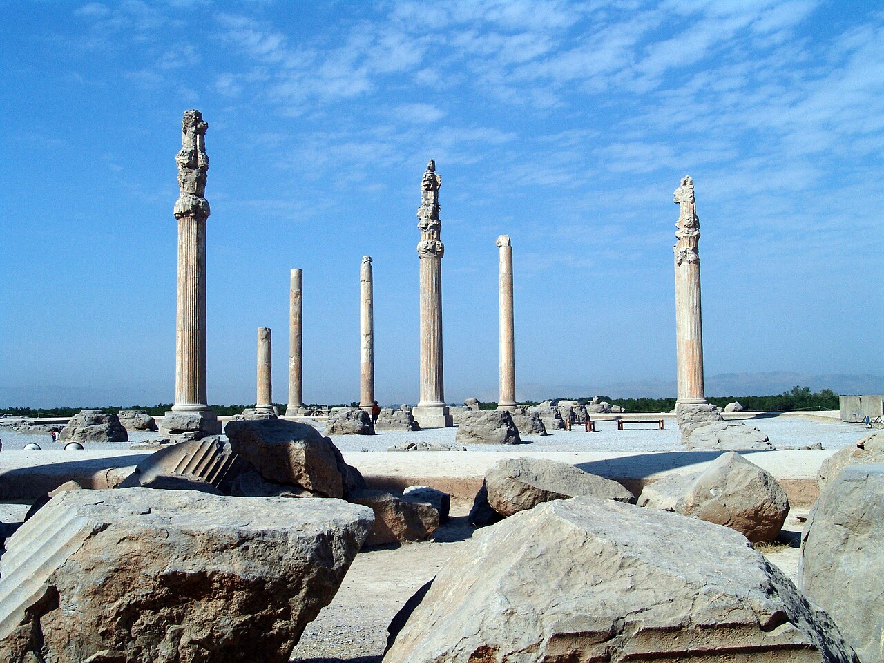
The Persians uniquely maintained multiple capitals for different functions and seasons. Persepolis served as the ceremonial center where subject nations brought tribute during the New Year (Nowruz) festival. Its enormous stone terrace, carved reliefs depicting 23 nations bearing gifts, and massive columned halls (the Apadana could hold 10,000 people) projected imperial power.
Susa, in the hot lowlands near Mesopotamia, was the administrative capital — closer to the empire's western provinces and connected to the Royal Road. Ecbatana (modern Hamadan), at 1,850 m in the Zagros foothills, served as a cool summer retreat. This seasonal rotation of capitals reflected the empire's geographic diversity.
The Royal Road
- Length: 2,699 km from Susa to Sardis (western Turkey)
- Travel Time: 90 days on foot; 7 days by royal courier (using relay stations every 24 km)
- Stations: 111 relay stations with fresh horses, provisions, and lodging
The Royal Road was the ancient world's most sophisticated communication and transportation system. Stretching 2,699 km from Susa to Sardis in Lydia (western Turkey), it crossed the Zagros Mountains, the Tigris and Euphrates rivers, and the Anatolian plateau. Herodotus described its 111 relay stations where royal couriers exchanged fresh horses.
The courier system (angareion) could transmit messages from one end of the empire to the other in just 7 days — a speed not matched until the 19th-century telegraph. The road also facilitated trade, troop movement, and tax collection across the empire's 20+ satrapies.
Geographic Extent and Governance
- Satrapies: 20–30 provinces, each governed by a satrap (governor) with local autonomy
- Diversity: The empire contained deserts, mountain ranges, river valleys, steppes, coastlines, and tropical forests
- Population: ~35 million people — 44% of the world's population at its peak
The Achaemenid Empire's great innovation was governing diverse geographies without imposing uniformity. Each satrapy retained its local language, religion, and customs while paying tribute and providing military forces. Egyptian satrap governed as a pharaoh; Babylonian satrap ruled through Mesopotamian institutions.
This geographic pragmatism was the empire's greatest strength — and ultimately its weakness. When Alexander the Great invaded in 334 BCE, the empire's geographic diversity made coordinated defense difficult. Yet the administrative framework the Persians created — satrapies, postal roads, standardized coinage — was adopted by every subsequent empire from Alexander's Hellenistic kingdoms to the Roman Empire.
Key Facts
- The Achaemenid Empire covered ~5.5 million km² — the largest empire in the ancient world by area
- The Royal Road stretched 2,699 km from Susa to Sardis with 111 relay stations
- Royal couriers could cross the empire in 7 days — a feat not matched until the telegraph
- Persepolis' stone terrace covered 125,000 m² and required 30+ years to build
- The qanat irrigation system included tunnels up to 70 km long
Fun Facts
- The word "paradise" comes from Old Persian "pairidaeza" meaning "walled garden" — the Persians were famous for their gardens
- Cyrus the Great's cylinder (539 BCE) is sometimes called the first declaration of human rights, granting freedom of worship to conquered peoples
- Persepolis was destroyed by Alexander the Great in 330 BCE — scholars still debate whether the burning was deliberate or accidental
- The Persian postal system inspired the motto of the United States Postal Service: "Neither snow nor rain..." — originally said by Herodotus about Persian couriers
Final Thoughts
The Persian Empire demonstrated that geographic diversity could be a strength rather than a weakness — if governed with pragmatism and connected by infrastructure. Their innovations in road building, postal systems, and decentralized governance set the template for every subsequent multicultural empire.
Test Your Knowledge!
Think you know your ancient civilizations? Try our interactive geography quiz!
Play Geography Games →