

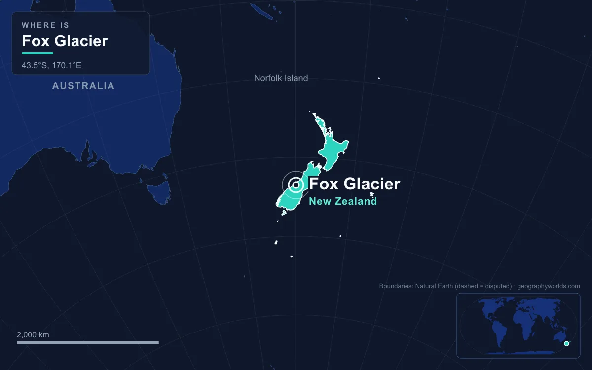
Fox Glacier, officially Fox Glacier / Te Moeka o Tuawe, is a temperate maritime glacier on the West Coast of New Zealand’s South Island, flowing west from the Southern Alps in Westland Tai Poutini National Park. It was 11.7 km (7.3 mi) long in 2022, covers about 32 km² with its tributaries, and is New Zealand’s third-largest glacier. Fed by four alpine glaciers, it drops about 2,600 m from its snowfields to a terminal face as low as 300 m above sea level, close to rainforest and to the village that shares its name. It exists because three things meet here: mountains lifted fast along the Alpine Fault, more than 8 m of precipitation a year blown in from the Tasman Sea, and a steep valley that carries ice down before it can melt. This guide follows that story from the oldest process to the newest, then looks at what it built.
Alpine Fault and Alpine Schist: 12 Million Years of Uplift Behind Fox Glacier
The glacier begins with plate tectonics. The Alpine Fault runs about 600 km (370 mi) along the South Island, just west of the main range, and marks the boundary between the Pacific and Australian plates. For its first stretch of history, between about 25 and 12 million years ago, movement on the fault was purely sideways and most of New Zealand lay under water. Then the plates began to push slightly into each other as well as past each other, and the land on the Pacific side started to rise. Over the last 12 million years the Southern Alps have been lifted about 20 km in total, in a long series of earthquakes.
Very little of that 20 km still stands, because the higher the mountains rose, the more rain and snow they caught and the faster they wore away. Erosion and the weight of the crust have kept the range below about 4,000 m. The fault’s uplift is greatest in its central section near Aoraki / Mount Cook, at 3,724 m (12,218 ft) the highest point in New Zealand, where the plates move against each other at 37 to 40 mm a year, including 6 to 10 mm of upward movement. Uplift has also brought deep rocks to the surface beside the fault, among them the Alpine Schist.
The fault still moves in great earthquakes. The last full rupture, about 1717, was magnitude 8.1 and broke nearly 400 km of the fault’s southern two-thirds. Earlier large ruptures happened around 1400, 1100 and 390 CE. In 2021 scientists put the chance of another major earthquake before 2068 at 75 percent. The result of this ongoing uplift is very high relief: within the Fox catchment, the land climbs from sea level to peaks of about 3,000 m in less than 35 km.
Ice Ages on the Cook River Flats: Moraines, Kettles and Lake Matheson
Once the mountains were high enough, cold periods of the last few million years turned their snow into ice. During the last ice age Fox Glacier was far larger than it is today: its ice pushed beyond the present coastline. As the climate warmed and the glacier retreated, it left many moraines across the coastal lowland around the Cook River / Weheka.
Lake Matheson is the best-known landform from that retreat. About 14,000 years ago, at the end of the last glacial period, Fox Glacier pulled back quickly and left a huge block of ice buried in moraine gravel between two terraces. Insulated by the gravel, the ice melted slowly, and as it did the ground above it collapsed to form the lake bed. This kind of hollow is called a kettle lake. Lake Matheson covers about 30 ha in area with a shoreline of roughly 1.5 km and an average depth of 12 m. It now lies about 12 km from the glacier’s current terminus.

The lake shows how the landscape keeps changing after the ice has gone. No major river flows in or out; small streams that pass through dense native bush feed it, carrying tannins that stain the water dark brown. That colour is what makes its reflections of Aoraki / Mount Cook and Mount Tasman so sharp. The water is acidic, with a pH recorded as low as 5.5, poor in nutrients and sometimes almost without oxygen. Organic matter is slowly building up on the bottom, and over a long enough time the lake will fill in and become a peat bog.
Eight Metres of Rain a Year: How the Tasman Sea Still Shapes Fox Glacier
The névé and the steep valley
The youngest processes are the ones visitors see. The West Coast is New Zealand’s wettest region, and westerly winds off the Tasman Sea rise over the Southern Alps and drop their moisture on the range. The highest parts of the Alps receive more than 10 m of precipitation a year, the coast less than a third of that, and the Fox catchment as a whole more than 8 m. Above the snowline that falls as snow on a large, high accumulation area, which four tributary glaciers carry down into a narrow valley between the Victoria Range to the north and the Fox Range to the south. The catchment covers about 110 km² and runs from the Main Divide to the Tasman Sea.
Because the snowfields are so high and the valley so steep, Fox Glacier reacts quickly to changes in climate. Glaciologists estimate that its terminus responds to a change in its mass balance within 3 to 9 years. Since the 1880s it has retreated more than 3 km overall, but not steadily. It advanced between 1985 and 2009, by about a metre a week on average in 2006, and in January 2009 its face was still advancing and collapsing. Then a retreat set in that has taken it further back than ever recorded. Some time between 2014 and 2017 it passed its previous 1984 low point, and between 2017 and 2022 alone it lost 374 m, reaching its shortest recorded length, 11.7 km.

Rivers, landslides and atmospheric rivers
Meltwater leaves the glacier as the Fox River, a tributary of the Cook River / Weheka, which rises at the La Perouse Glacier and reaches the Tasman Sea. These rivers spread gravel across the broad alluvial floodplain between the mountains and the coast. Heavy rain is now the main force reshaping the valley. Extreme falls on the West Coast often come with atmospheric rivers, long bands of moisture carried from the tropics. In the Fox catchment they can widen or reroute rivers, trigger landslides, debris flows and rockfall, and cause glacier outburst floods, while rain on the lower glacier speeds up melting and ice collapse. Total annual rainfall on the coast has risen over the last century, and rainfall is expected to become more intense and more variable with further warming.
The clearest recent example came on 26 March 2019. Heavy rain destroyed the Waiho Bridge on State Highway 6 at Franz Josef, the next glacier town to the north, and set off a huge landslide in the Fox valley that swept away about 150 m of the northern glacier access road and its car park. This Alpine Gardens landslide holds 50 to 70 million m³ of rock and was still moving 100 to 700 mm a day in October 2020.
What the Ice and Gravel Built: From Weheka to Fox Glacier Village
The flat land the glacier left behind is where people settled. To local Māori the glacier is Te Moeka o Tuawe, “the bed of Tuawe”. In oral tradition, Hine Hukatere persuaded her lover Tuawe to climb with her; an avalanche killed him, and her tears, frozen by Rangi the Sky Father, became the Franz Josef Glacier, while Fox marks where Tuawe lies. Māori travelling this coast to gather pounamu stopped at the lake they call Te Ara Kairaumati, now Lake Matheson, to catch longfin eels and waterbirds. In 1857 local Māori guided Leonard Harper and Edwin Fox to the glaciers; in 1865 the geologist Julius von Haast surveyed them, and in 1872 the lower glacier was renamed after Premier Sir William Fox. The Ngāi Tahu Claims Settlement Act 1998 added the Māori name to the official one.
The village began with gold. Gillespies Beach, 20 km away on the coast, had a gold rush in the 1860s and briefly became the third-largest town on the West Coast. When the gold ran out, Patrick Sullivan and Fred Williams moved inland to farm the Weheka Valley, and by the early 1900s much of the forest on the Cook River flats had been cleared. The Sullivans opened the 40-room Fox Glacier Hostel on 20 December 1928, guiding on the ice began, and Chancellor Hut was built in 1930–31; it is the oldest mountain hut in the Southern Alps still on its original site. The settlement was called Weheka until the 1940s. Westland National Park followed in 1960, and in 1990 it became part of the Te Wāhipounamu World Heritage Site.
The same forces that built the glacier now limit the village. The road to the ice has been closed since the 2019 landslide, so access to the glacier itself is by helicopter, and the village’s population fell by about a third between the 2018 and 2023 censuses.
For the range that feeds the ice, see our guide to the Southern Alps; for the step-by-step process of snow turning to glacier ice, read how glaciers are formed; and for the whole country from Fiordland to the volcanic plateau, our guide to New Zealand’s geography puts Fox Glacier in its place.