

The Gila River is the principal river of southern Arizona, flowing 649 miles from the Mogollon Mountains of western New Mexico westward across Arizona to its historical confluence with the Colorado River near Yuma. For over a thousand years, the Gila sustained the Hohokam civilization, which built one of the most sophisticated irrigation systems in pre-Columbian North America.
Introduction
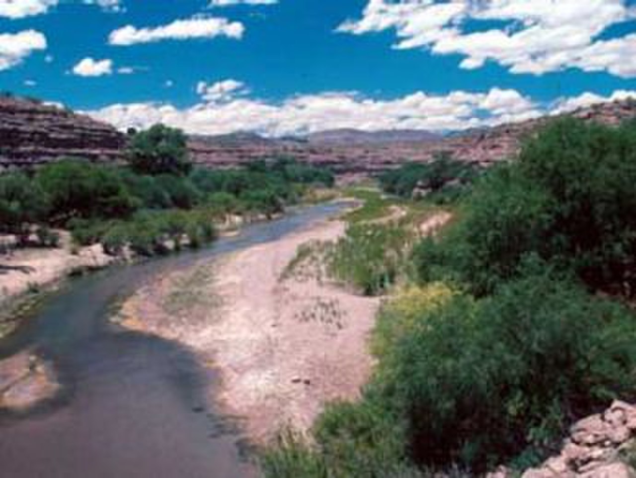
Today, the Gila is one of the most depleted rivers in the United States. Its water is so thoroughly diverted for agriculture and municipal use that the lower river is typically a dry, sandy wash. The contrast between the river's historical abundance and its current state makes the Gila a powerful case study in the consequences of over-development in arid lands.
Geography & Dimensions
- Length: 649 miles (1,044 km)
- Drainage Basin: 58,200 sq miles
- Average Discharge: Historically ~1,800 cu ft/s; now near zero at mouth
- Source: Mogollon Mountains, New Mexico
The Gila rises in the Mogollon Mountains of southwestern New Mexico at approximately 9,000 feet elevation, fed by snowmelt and springs in the Gila National Forest — the first designated wilderness area in the United States (1924). The upper Gila flows through deep canyons and forested mountains before entering the desert basins of southern Arizona.
In Arizona, the Gila flows past Safford, through the San Carlos Apache Reservation, past the Phoenix metropolitan area, and across the Sonoran Desert to Yuma. Major tributaries include the San Francisco, San Pedro, Salt, Santa Cruz, and Hassayampa Rivers. The Salt River, which flows through Phoenix, is the Gila's largest tributary and contributes most of the system's water.
Hohokam Civilization
- Period: AD 450–1450
- Canal System: Over 500 miles of irrigation canals
- Major Sites: Snaketown, Casa Grande
- Population: Estimated 40,000–80,000 in the Salt-Gila basin
The Hohokam people built one of the most remarkable irrigation civilizations in pre-Columbian North America along the Gila and Salt Rivers. Between approximately AD 450 and 1450, they constructed over 500 miles of irrigation canals — some up to 75 feet wide and 50 feet deep — to divert river water to fields of corn, beans, squash, and cotton. At its peak, the Hohokam system supported an estimated 40,000 to 80,000 people.
Casa Grande Ruins National Monument preserves a massive four-story structure built by the Hohokam around AD 1350, one of the largest prehistoric structures in North America. The Hohokam civilization declined around 1450, possibly due to a combination of drought, flooding, salinization of farmland, and social upheaval. Modern Phoenix's canal system follows many of the same routes established by the Hohokam over 1,000 years ago.
Dams & Water Diversion
- Coolidge Dam: Completed 1928, forms San Carlos Lake
- Salt River Project: Major dam system on the Gila's largest tributary
- Roosevelt Dam: Completed 1911, one of the first federal reclamation dams
- Central Arizona Project: Brings Colorado River water to supplement depleted Gila flows
The Gila River system was one of the first targets of federal reclamation efforts. Roosevelt Dam on the Salt River, completed in 1911, was one of the first major dams built under the Reclamation Act of 1902. It provided irrigation water and flood control for the Salt River Valley, enabling the explosive growth of Phoenix. Coolidge Dam on the Gila, completed in 1928, was built to provide water for the San Carlos Apache Reservation and surrounding irrigators.
Today, virtually every drop of the Gila's water is diverted before it reaches Yuma. The Central Arizona Project, a 336-mile canal completed in 1993, brings Colorado River water to Phoenix and Tucson to supplement the depleted Gila system. The Gila River Indian Community, whose reservation lies south of Phoenix, has fought for decades to recover water rights stolen from them in the early 20th century when upstream diversions dried up their farms.
Ecology & Conservation
- Upper Gila Wilderness: First designated wilderness in the US (1924)
- Endangered Species: Gila topminnow, loach minnow, spikedace
- Riparian Habitat: Critical corridor for migratory birds
- Cottonwood-Willow Forests: Among the last remaining in the Southwest
The upper Gila River in New Mexico remains one of the wildest and most ecologically intact river corridors in the Southwest. Aldo Leopold, the father of modern wildlife conservation, championed the protection of the Gila Wilderness in 1924, making it the first designated wilderness area in the US National Forest System. The upper river supports native fish, including the endangered Gila topminnow and loach minnow, that have been eliminated from most of their former range.
The Gila River corridor is a critical migratory pathway for birds moving between Mexico and the northern United States. Cottonwood-willow forests along the river support over 250 bird species, including the endangered southwestern willow flycatcher and the yellow-billed cuckoo. These riparian forests are among the most threatened habitats in the Southwest, lost to dam construction, water diversion, and invasive salt cedar.
Challenges & Water Rights
- Gila River Indian Community: Largest water rights settlement in US history
- Water Rights Settlement: 2004, awarded 653,500 acre-feet annually
- Dry Riverbed: Lower Gila is dry for most of its length
- Climate Change: Reduced snowpack and higher evaporation rates
In 2004, the Gila River Indian Community reached the largest water rights settlement in US history, securing 653,500 acre-feet of water per year — a fraction of what the river historically carried, but enough to begin restoring agriculture on the reservation. The settlement acknowledged that upstream diversions had devastated the community's economy and way of life for over a century.
The lower Gila River, once a flowing stream that Spanish explorers navigated in boats, is now typically a dry, sandy wash. The river's depletion mirrors the broader water crisis of the American Southwest, where population growth, agriculture, and climate change are colliding with finite water supplies. Restoring even modest flows to the lower Gila would require fundamental changes in water allocation that remain politically elusive.
Key Facts
- The Gila River flows 649 miles across New Mexico and Arizona.
- The Hohokam civilization built over 500 miles of irrigation canals along the Gila and Salt Rivers.
- The lower Gila is typically dry — its water is entirely diverted before reaching the Colorado.
- The 2004 Gila River Indian Community water settlement was the largest in US history.
- The Gila Wilderness (1924) was the first designated wilderness area in the United States.
Fun Facts
- Modern Phoenix's canal system follows routes first dug by the Hohokam over 1,000 years ago.
- The Gila monster, one of only two venomous lizards in North America, is named after the river.
- Spanish explorers in the 1600s described the Gila as a broad, flowing river — today it's a dry wash for most of its length.
- Casa Grande Ruins, a Hohokam structure on the Gila, was the first archaeological preserve in the United States, protected in 1892.
Final Thoughts
The Gila River is a cautionary tale of what happens when a desert river is pushed beyond its limits. From the remarkable Hohokam civilization to modern Phoenix's sprawl, the Gila has been both sustained and depleted by human ambition. Its restoration — however partial — would be a landmark in American water policy.
Test Your Knowledge!
Think you know America's rivers? Try our interactive quiz!
Play Geography Games →