
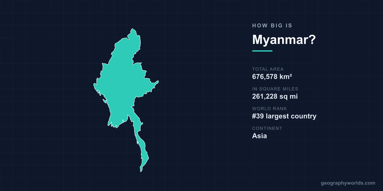
Myanmar covers 676,578 km², or 261,228 square miles, making it the 39th largest country in the world and the largest in mainland Southeast Asia. It is bigger than France, about the size of Texas, and roughly equal to Thailand plus a third again. Its shape — a broad northern block with a long southern tail — gives it a north-to-south extent of about 2,090 kilometres, which is more than the distance from London to Naples.
Bigger Than Every Neighbour Except China and India
Among mainland Southeast Asian states, Myanmar is the largest by a clear margin: Thailand is around 513,000 km², Vietnam around 331,000, Laos around 237,000, Cambodia around 181,000. Only Indonesia, an archipelago, is larger in the region as a whole.
It borders five countries — China, India, Bangladesh, Laos and Thailand — and its two largest neighbours are the two largest countries by population on earth, which tends to make Myanmar look small on a regional map while being substantial in absolute terms.
The Tail
A large part of Myanmar's north-south extent comes from Tanintharyi, the narrow southern strip running down the Malay Peninsula beside Thailand. At its narrowest the country is only a few dozen kilometres wide there, with the Andaman Sea on one side and the Tenasserim hills on the other.
Near Kra in Thailand, just beyond the border, the peninsula narrows to about 44 kilometres — the Kra Isthmus, where a canal linking the Indian Ocean to the Gulf of Thailand has been proposed since the seventeenth century and never built. Myanmar's tail is the reason its coastline runs to roughly 1,930 kilometres, long for a country of its area.
Three Countries in One
Myanmar's area divides into three sharply different environments, and the division explains most of its history.
The centre is the Dry Zone, a rain-shadow region around Mandalay and Bagan receiving under 1,000 millimetres a year, where the Burmese kingdoms were based and where irrigation from the Irrawaddy made dense settlement possible. The south is the Irrawaddy delta, wet, fertile and the country's rice bowl, developed at scale under British rule for export. And the periphery — Kachin, Shan, Chin, Kayah, Kayin and Rakhine — is mountain and plateau, occupied by non-Burman peoples.
The lowland core is a minority of the land area and a majority of the population; the hills are most of the territory. That mismatch is the structure underneath seventy-five years of civil war.
Set Against Its Neighbours
- France (551,695 km²) is about four-fifths of Myanmar's size.
- Texas (695,662 km²) is very slightly larger.
- Ukraine (603,548 km²) is somewhat smaller.
- Thailand (513,120 km²) is about three-quarters the size.
- The United Kingdom (243,610 km²) would fit inside Myanmar nearly three times.
The River Down the Middle
The Irrawaddy runs about 2,170 kilometres from the Kachin mountains to the Andaman Sea, entirely within Myanmar — one of the longest rivers anywhere confined to a single country.
It is navigable for well over a thousand kilometres, and it was the country's principal highway long before roads. The Irrawaddy Flotilla Company, at its peak under British rule, operated one of the largest river fleets in the world. Its delta covers some 35,000 km² and produces the bulk of the country's rice.
The Salween, further east, is longer overall but runs mostly through China before crossing Myanmar in deep gorges. It is one of the last major undammed rivers in Asia, and proposals to change that have been a recurring flashpoint in the ethnic states it passes through.
Hkakabo Razi and the Northern Tip
Myanmar's northern tip reaches into the eastern Himalaya, and Hkakabo Razi, generally given as 5,881 metres, is usually described as the highest peak in Southeast Asia. A 2014 expedition using modern measurement suggested a nearby peak, Gamlang Razi, might be marginally higher, and the question has not been settled definitively.
Either way, this corner of the country holds terrain that has barely been surveyed, including the Hkakabo Razi National Park and the Hukawng Valley, which is among the largest protected areas in the world. It is also where the Ledo Road was cut during the Second World War, at enormous cost, to supply China after the Japanese took the Burma Road.
Water, Forest and What Is Left of It
Around 3.1 per cent of Myanmar's surface is inland water. Forest cover is the more consequential figure: Myanmar holds one of the largest remaining forest areas in mainland Southeast Asia, including roughly half the world's remaining natural teak.
It has also had one of the highest deforestation rates in the region. Logging, much of it illegal and crossing into China through Kachin State, has removed a substantial share of cover since 1990, and jade mining in Hpakant has stripped entire valleys, producing landslides that have killed hundreds of workers at a time.
A Capital Built in Empty Space
One of the more striking uses of Myanmar's land area is Naypyidaw, the capital built from scratch in the early 2000s and formally inaugurated in 2006, replacing Yangon.
It occupies an administrative zone of around 7,000 km² — several times the area of Singapore — in scrubland in the Dry Zone. It was laid out with twenty-lane highways that are famously empty, separate zones for ministries, hotels and the military, and a replica of the Shwedagon pagoda.
The move is usually read as a security decision by the military government: a capital in the interior, far from the coast, from Yangon's population and from any plausible amphibious approach.
Borders Drawn by an Empire in a Hurry
Myanmar's boundaries are British. Three Anglo-Burmese wars between 1824 and 1885 annexed the kingdom in stages, and the frontiers with China, India and Siam were negotiated or imposed over the following decades.
The result cut through peoples along every edge. The Chin and Naga hills are divided with India; Shan territory extends into China, Laos and Thailand; the Rakhine coast faces Bangladesh across the Naf river. Britain administered the lowlands directly and the hill areas through indirect rule, a distinction that survived into independence in 1948 as the promise of federalism in the Panglong Agreement — a promise the post-independence state did not keep.
Territory the Government Does Not Control
An unusual feature of Myanmar's area is how much of it is administered by someone other than the state. Ethnic armed organisations have governed parts of the border regions for decades, running their own taxation, schooling and courts.
The United Wa State Army controls a territory in the Shan hills roughly the size of Belgium, with its own army of tens of thousands, its own currency in circulation and closer links to China than to Naypyidaw. The Kachin Independence Organisation, the Karen National Union and others hold significant areas.
Since the coup of February 2021 and the armed resistance that followed, the share of territory outside central control has grown substantially, with opposition forces and ethnic armies taking towns and border crossings across several states.
Islands, Gas and the Bay of Bengal
Myanmar's 1,930 kilometres of coast face the Bay of Bengal and the Andaman Sea, and its offshore gas fields — Yadana, Yetagun, Shwe — have been the country's largest source of foreign exchange for years, piped to Thailand and China.
The Mergui Archipelago off Tanintharyi comprises some 800 islands, largely undeveloped, and is the home of the Moken, a sea-nomadic people whose range ignores the Thai border entirely.
Cyclone Nargis in 2008 drove a storm surge up the Irrawaddy delta and killed well over 130,000 people, a reminder that the most productive part of the country's land area is also the most exposed.
What the Land Produces
Around 19 per cent of Myanmar is arable, concentrated in the delta and the Dry Zone, and rice occupies the majority of it. Under British rule the delta was cleared and drained on an enormous scale, and by the 1930s Burma was the largest rice exporter in the world, shipping to India and beyond through Rangoon.
That position was lost to war, nationalisation and isolation, and Myanmar now exports a fraction of what Thailand and Vietnam do from smaller areas. The Dry Zone grows sesame, pulses and groundnuts under irrigation from the Irrawaddy and the Chindwin.
The country also holds the great majority of the world's jade, mined at Hpakant in Kachin State, and produces rubies from Mogok that are among the most valuable coloured stones traded anywhere. Both sit in territory contested between the army and ethnic armed organisations, which is why the value of what the land contains has rarely reached the state that claims it.
The Gap Between the Map and the State
676,578 km², 39th in the world, the largest state in mainland Southeast Asia, stretching from Himalayan snow to equatorial islands.
The number understates how varied that territory is and overstates how much of it is governed. Myanmar is a case where the interesting question is not how big the country is but how much of it the state has ever actually held. Myanmar in wider terms is our Myanmar country guide, and the river system along its eastern edge is covered in our Mekong guide.
