

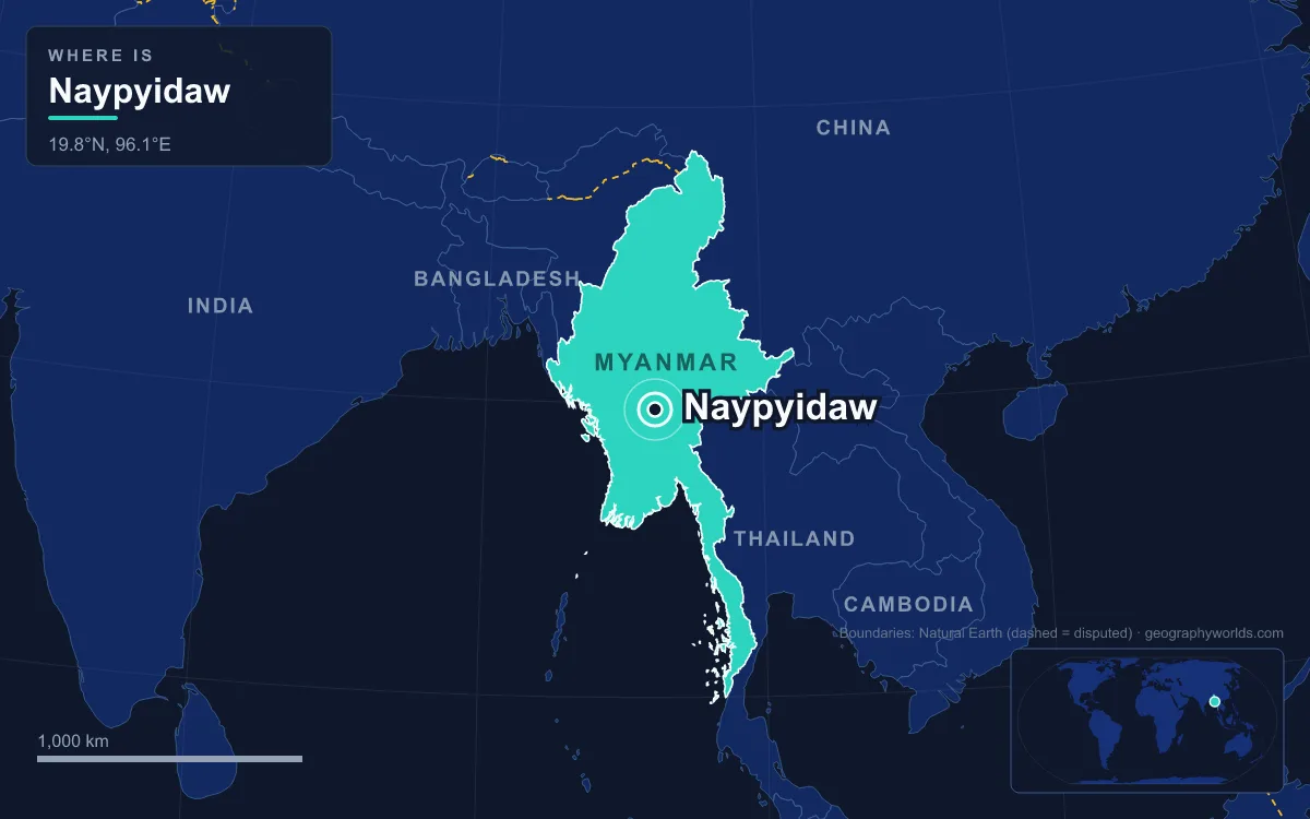
Naypyidaw (officially Nay Pyi Taw) is the capital of Myanmar, a purpose-built city in the centre of the country about 320 kilometres north of Yangon, between the Bago Yoma and Shan Yoma mountain ranges. The government moved there on 6 November 2005 and the name was announced on 27 March 2006. The Naypyidaw Union Territory counted 1,160,242 people in the 2014 census, spread over 7,054 square kilometres. That works out to about 164 people per square kilometre, and the gap between the city's size and its population is what defines it.
7,054 Square Kilometres for About a Million People
Most comparisons of Naypyidaw start with how much land it covers. The Union Territory, separated from the Mandalay Region in 2008, covers 7,054 square kilometres. That is more than eleven times the area of Yangon, which had grown to 598.75 square kilometres by 2008 after a century of expansion from 72.52 square kilometres in 1901. The territory takes in old towns such as Pyinmana, Lewe and Tatkone, which were part of Yamethin District, along with new townships named in Pali: Ottarathiri, Dekkhinathiri, Pobbathiri, Zabuthiri and Zeyathiri. Since 2022 these eight townships have been grouped into four districts.
The population figures depend on where the boundary is drawn. The 2014 census gives 1,160,242 for the whole territory, with 262,253 households, an average household size of 4.1 and a median age of 26.8. Official figures for the city itself give a lower 924,608. Either way, Naypyidaw is usually counted as Myanmar's third-largest city, behind Yangon and Mandalay. The territory is also very uniform in religion: 96.8 percent of residents identified as Buddhist in 2014, compared with 87.9 percent of Myanmar as a whole.
Myanmar's national density is about 76 people per square kilometre, among the lowest in Southeast Asia. Naypyidaw's 164 is only about twice that, even though it is the national capital. Most of its land is farmland, reservoirs and forest, with the Chaungmagyi Dam a few kilometres north of the city, the Ngalaik Dam to the south and the Yezin Dam further to the north-east.
Naypyidaw Against Yangon, the City It Replaced
Yangon was the capital from independence on 4 January 1948 until 2005, and under the British it had been the capital of all of Burma after the Third Anglo-Burmese War of 1885. The 2014 census counted 5.16 million people there, more than four times the whole Naypyidaw territory. Yangon packs about 8,600 people into each square kilometre, roughly fifty times Naypyidaw's density. Yangon has the largest number of colonial-era buildings in Southeast Asia, a downtown on a grid laid out by the army engineer Alexander Fraser, and the country's main international airport. Naypyidaw has almost none of this. Its government quarter was built from 2002 onward, and its airport, which opened in December 2011, now handles only domestic flights.
Several reasons have been given for the move. Officially, Yangon was too congested and had no room for more government offices. Naypyidaw is also more central, and it sits next to Shan, Kayah and Kayin states, where the military wanted a stronger presence. Many observers think the main aim was to build a citadel that could hold out against invasion or a popular uprising, and Yangon had seen large protests in 1974, 1988 and 2007. The historian Michael Aung-Thwin sees the move as a return to the Dry Zone, where Burmese royal capitals were built for about a thousand years. The name supports that reading: Naypyidaw means "abode of the king" and was traditionally added to the names of royal capitals, as in Yadanabon Naypyidaw for Mandalay.
Yangon did not shrink after the move. It is still the country's commercial and cultural centre, and foreign embassies largely stayed there, even though each was offered two hectares of land in Naypyidaw's diplomatic zone. China opened an interim liaison office in 2017, the first foreign office allowed to open in the new capital. In February 2018 the State Counsellor, Aung San Suu Kyi, urged foreign governments to move their embassies there.
A 20-Lane Boulevard and a 323-Kilometre Highway
Traffic is where the gap between size and population shows most. The city has a 20-lane boulevard that is largely empty, like most of its roads. Other roads are four lanes wide, and the roundabouts are multilevel and planted with flowers. The four-lane highway to Yangon is 323.2 kilometres long and forms part of the 563-kilometre Yangon–Naypyidaw–Mandalay Expressway. Most trucks heading north from Yangon are not allowed to use it. The Asian Development Bank estimated that letting more trucks onto the road would save over US$100 million a year.

Other transport projects were built on a similar scale. Naypyidaw Central railway station opened on 5 July 2009, before its overpass, locomotive shed, car park and platform were finished. The station area measures 2,700 by 1,200 metres. The airport, about 16 kilometres south-east of the city between Ela and Lewe, has a 3.6-kilometre runway and a 69-metre control tower, and was designed for up to 65,000 flights a year. Airlines from Thailand and China once flew there, but today it serves only domestic routes. In 2011 Russian media reported plans for a 50-kilometre metro line under the city. The Rail Transportation Ministry cancelled it because of low demand and limited budgets. Inside the city, public transport between neighbourhoods is limited. Ministries run shuttle buses for their own staff, and the only taxi company is run by the military. Motorbikes are banned from some roads, including sections of Taw Win Yadana Road, after hundreds of traffic deaths in 2009.
Uppatasanti Pagoda: 30 Centimetres Short of Shwedagon
The city's main religious monument was deliberately modelled on Yangon's. Uppatasanti Pagoda was begun with a stake-driving ceremony on 12 November 2006 under the direction of Than Shwe, head of the State Peace and Development Council. It was consecrated in March 2009. It is given as 99 metres tall and was built as a near replica of the Shwedagon Pagoda, deliberately 30 centimetres shorter. Its large base looks like a natural hill but is entirely man-made. The name means roughly "protection against calamity" and comes from an early 16th-century sutta meant to be recited in times of crisis, especially foreign invasion. The festival for the consecration turned deadly when 20 people were killed in a ferris wheel accident on 4 March 2009.

Shwedagon stands on the 51-metre Singuttara Hill and has been Myanmar's most sacred pagoda for centuries. Yangon's zoning rules protect its view by limiting building heights to 75 percent of the pagoda's height above sea level. Uppatasanti has no such history, but it does hold a Buddha tooth relic. Seven captive white elephants are kept in its grounds, where they have been documented shackled for 22 hours a day.
Rank, Roof Colour and Zone: How Naypyidaw Sorts Its Residents
Where Yangon grew in layers over centuries, Naypyidaw was divided into zones from the start. The residential zone has about 1,200 four-storey apartment blocks. Flats are assigned by rank and marital status, and roof colours show which ministry the residents work for: blue for Health, green for Agriculture. Senior officials live in about 50 mansions, and in 2019 several were reported empty and overgrown. The ministry zone contains identical ministry buildings, a 31-building parliamentary complex and a 100-room Presidential Palace. The palace, parliament and city hall combine Stalinist architecture with Burmese-style roofs. Senior military officers live eleven kilometres from ordinary civil servants, in a restricted complex said to include tunnels and bunkers.
Leisure facilities are also large relative to the population. The zoo opened in 2008 with 420 species and a climate-controlled penguin house, using animals moved from the old zoo in Yangon. A safari park opened on 12 February 2011, and the National Herbal Park covers 81 hectares. For the 2013 Southeast Asian Games, 348 hotels and 442 inns were built to house athletes and spectators. The city also hosted the 24th and 25th ASEAN Summits and the Ninth East Asia Summit. The whole project is estimated to have cost about US$4 billion, with construction reported to have involved corruption and nepotism.
After the 28 March 2025 Earthquake
The earthquake of 28 March 2025 damaged about 80 percent of Naypyidaw's government buildings, and the city had the second-highest death toll of any area in Myanmar. Damaged buildings included the Presidential Palace and the Pyidaungsu Hluttaw, the national legislature. Apartment blocks collapsed in Zabuthiri Township and the Bawgatheikdi wards. By April 2025, 75 relief camps were sheltering 2,900 families and another 23,800 families had been relocated. A Ministry of Construction survey found that a third of staff housing in nine wards was uninhabitable or destroyed. Min Aung Hlaing, who took power in the 2021 coup, ordered the city's layout to be redrawn. Several bodies, including the Central Bank and the ministries of foreign affairs, commerce, and immigration and population, planned to move back to Yangon.
Twenty years after the move, Yangon is still larger and busier, and some government offices were heading back there after the earthquake. Naypyidaw belongs to a small group of capitals built from scratch, which our guide to planned cities around the world covers. Brasília is the closest comparison: another capital moved inland to a new site, whose planners likewise hoped the country would grow around it. Myanmar's position between China, India, Thailand, Laos and Bangladesh, explained in our guide to the countries that border Myanmar, helps explain why the generals thought a central location mattered.
Quick Facts About Naypyidaw
- Country: Myanmar
- Continent: Asia (Southeast Asia)
- Country population: approximately 55.2 million
- Capital city status: Naypyidaw is the capital of Myanmar, the seat of national government, and the location of foreign embassies, parliament, and the head of state's official residence.
Frequently Asked Questions
What is the capital of Myanmar?
The capital of Myanmar is Naypyidaw. Naypyidaw is the seat of national government, hosts most foreign embassies and consulates, and is typically where the head of state and parliament are located.
What continent is Naypyidaw in?
Naypyidaw, the capital of Myanmar, is located in Asia, in the Southeast Asia region. As Myanmar's capital, Naypyidaw serves as the country's primary connection to the broader Asian political, economic, and cultural sphere.
Why is Naypyidaw the capital of Myanmar?
Naypyidaw was chosen as the capital of Myanmar for reasons that typically combine geography, history, and politics. Capital city selections often reflect a desire for centrality (being accessible from across the country), historical importance (being a longstanding seat of government or culture), or neutrality (being acceptable to multiple regions or ethnic groups within the country). The specific reasons for Naypyidaw's designation are detailed in the city's history above.
What is Naypyidaw known for?
As the capital of Myanmar, Naypyidaw is best known for housing the country's central government institutions — parliament, presidential or royal residences, supreme court, and key ministries. It is also typically a major cultural and economic center within Myanmar, hosting national museums, embassies, and signature monuments. The introduction and history sections above provide detailed coverage of the city's specific notable institutions and landmarks.
Related Pages
- Myanmar Country Guide — full geography, climate, economy, and culture overview
- Flag of Myanmar — meaning, history, and design of Myanmar's national flag