

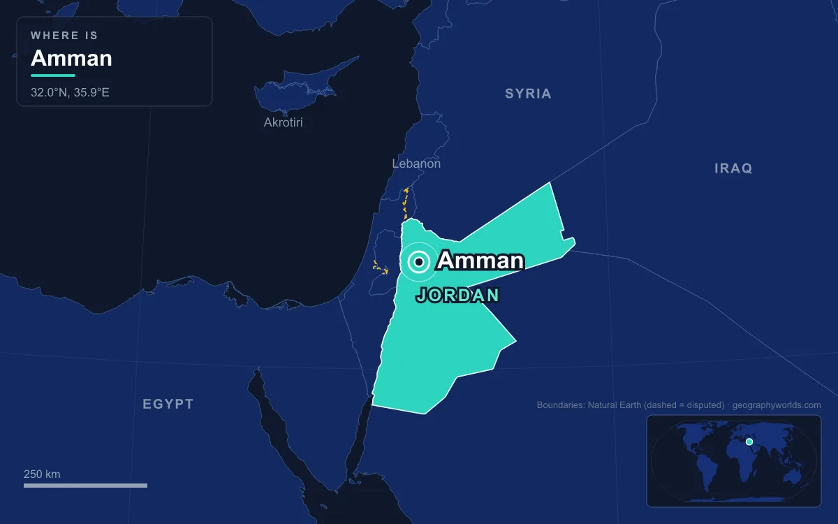
Amman became the capital of Jordan in 1921. That year Emir Abdullah I made what was then a railway town of Circassian settlers the seat of his new Emirate of Transjordan, choosing it over the larger trading town of al-Salt. Today it is Jordan’s capital and largest city, spread over the hills of the East Bank plateau in the north-west of the country, between 700 and 1,100 metres above sea level. The Greater Amman Municipality had about 4.9 million residents in 2024, and in 2015 the city held about 42 percent of all Jordanians. That makes Amman a clear primate city in a country of about 11.5 million.
Why Emir Abdullah Chose Amman Over al-Salt in 1921
When the Ottoman Empire collapsed in 1918, the lands east of the Jordan River had no obvious centre. Ottoman Transjordan was never a single province. It was divided into the districts of Ajlun, al-Balqa, al-Karak and Ma’an. From the 18th century until the first years of the emirate, the most developed town and commercial centre in the region was al-Salt, in the Balqa highlands north-west of Amman. Salt was where the British High Commissioner for Palestine, Herbert Samuel, met local leaders in 1920, and it was first considered as the capital of the new state.
Abdullah, son of the Sharif Hussein of Mecca and brother of the deposed King Faisal of Syria, marched into Ma’an in the far south on 21 November 1920 with about 300 men. He moved on to Amman on 2 March 1921. Later that month, at a conference with the British, it was agreed that he would govern Transjordan under the British Mandate. His first government was formed on 11 April 1921, and he set it up in Amman, not Salt. Several things favoured Amman. It sat on the Hejaz Railway, which had run through central Transjordan since 1903 and linked it to Damascus. It lay near the British military base and small air force at Marka, which Abdullah relied on against raids by Ikhwan tribesmen from Najd between 1922 and 1924.
At first the court was modest. Abdullah lived in an Ottoman-style house near the Roman theatre and received delegations on a hilltop at Marka. In 1924, after Britain had recognised an autonomous government east of the Jordan, he chose a rise overlooking downtown for Raghadan Palace, the first building the Hashemites put up in the country.

A Railway Stop Revived by Circassian Settlers, 1878–1914
The Amman Abdullah found was only about forty years old as a town. For roughly four centuries the site had been largely abandoned. Seasonal farmers and Bedouin tribes used its fields, pastures and water, and for most of the Ottoman period, which began in 1516, al-Salt was the region’s real centre. Resettlement started in 1878, when several hundred Muslim Circassians, driven out of the North Caucasus by the Russian Empire, were sent by the Ottoman authorities to farm the valley of the Amman stream. The first group, from the Shapsug tribe, built their houses near the ruined Roman theatre and reused its stones. Kabardian and Abzakh families followed between 1880 and 1892.
By 1908 the town had about 800 houses in three quarters named after those groups, along with mosques, markets, mills, a textile factory, a post and telegraph office and a government building. It already belonged to the kaza of al-Salt. The railway made the difference. Arab merchants from Damascus, Nablus and Jerusalem moved to Amman in the 1900s and 1910s, and in 1909 the town got its first municipal council, with the Circassian Ismael Babouk as mayor. The two battles of Amman in 1918 were fought over this stretch of the railway, and the British victory in the second one opened the way to Damascus. About 40,000 Circassians live in and around Amman today.
Rabbath Ammon and Philadelphia: A Capital Twice Before
Abdullah’s choice brought back an old role. From around the 13th century BC the city was Rabat Amman, capital of the Iron Age Ammonite kingdom. Rabat means roughly “capital” or “king’s quarters”, and the modern name comes from the Ammonites themselves. Their city stood on the King’s Highway, the trade route linking Egypt with Mesopotamia, Syria and Anatolia. Settlement here is much older than that. The Neolithic site of ’Ain Ghazal, on the city’s edge, dates to the 8th millennium BC and is known for some of the oldest statues of the human form ever found.
Ptolemy II Philadelphus, who ruled Egypt from 283 to 246 BC, renamed the town Philadelphia after himself. It later joined the Decapolis, a league of Greek cities that also included Gerasa, now Jerash, about 48 kilometres to the north. After Rome annexed the Nabataean kingdom in AD 106, Philadelphia became a stop on the Via Traiana Nova, the road Trajan built around 111 from Aqaba to Bosra. The theatre in the photo above dates from this period. It seats about 6,000 people and was built in honour of Emperor Antoninus Pius (138–161).

After the Rashidun conquest in the 630s the city took back the name Amman. The Umayyads built a palace on Citadel Hill, but an earthquake in 749 badly damaged the town. The Abbasid-era geographer al-Yaqubi still called it the capital of the Balqa in the late 9th century, and in 985 al-Muqaddasi described it as the capital of the Balqa, a town on the desert fringe of Syria ringed by villages and cornfields and known for its lambs, grain and honey. It had one more spell as a seat of government in 1356, when the Mamluks moved the administration of the Balqa there from Hisban. By the 15th century Hisban was again the main town of the Balqa, and Amman’s long abandonment began.
From 1946 Independence to a City of Millions
Britain recognised Abdullah’s government as an independent administration on 15 May 1923, and the city grew as the emirate took shape around it. Newcomers came from al-Salt, many of them families who had originally come from Nablus, and from Damascus, al-Karak and Madaba. The Treaty of London, signed on 22 March 1946, recognised Transjordan’s independence. On 25 May 1946 parliament proclaimed the Hashemite Kingdom of Transjordan with Abdullah as king, and independence took full effect on 17 June 1946, when the treaty ratifications were exchanged in Amman. That makes Amman the only capital the kingdom has had. The country took the name Hashemite Kingdom of Jordan in 1949, and in 1950 it annexed the West Bank, which it had held since the 1948 war.
Being the capital of a small state that took in people from almost every conflict around it has shaped Amman more than anything else. About 10,000 Palestinians from Safed, Haifa and Acre came for work before 1948. The war that year brought refugees from Jaffa, Ramla and Lydda, and the population rose to about 110,000. Another wave from the West Bank arrived during the 1967 war, and by 1970, the year the army and the PLO fought in the streets during Black September, the city had an estimated 550,000 people. About 200,000 Palestinians expelled from Kuwait came after the 1991 Gulf War, Iraqis arrived after 1991 and 2003, and Syrians after the war began in 2011.
The growth has left a city of newcomers. Because Amman has no long-rooted native population, it had no dialect of its own until recently. A new one blending Jordanian and Palestinian speech is forming, and the children of migrants have started calling themselves “Ammani”. Several large Palestinian refugee camps sit close to the centre. The city also spread well beyond its first seven hills. It now covers 19 hills and 22 administrative areas over about 1,680 square kilometres, and its districts are named for their jabal (hill) or wadi (valley), such as Jabal al-Luweibdeh and Wadi Abdoun.
Running a Capital of 4.9 Million on Scarce Water
As the capital, Amman is governed differently from other Jordanian towns. A 41-member council is elected for four-year terms, but the king appoints the mayor. The royal court sits in the Al-Maquar compound around Raghadan Palace. Since 10 June 2003 the 126.8-metre Raghadan Flagpole has flown a 60-by-30-metre flag there, visible from up to 20 kilometres away. When it went up it was the tallest free-standing flagpole in the world.
The city’s biggest problem comes from its site. Amman stands on an upland crossed by three main wadis, and one of its few remaining springs feeds the Zarqa River. Rainfall averages about 385 millimetres a year, but the western districts get over 500 and the eastern ones less than 250. Jordan’s water was already scarce, and rapid growth in the 2010s strained it further. The main response has been the Disi Water Conveyance, completed in July 2013 at a cost of US$1.1 billion. It pumps about 100 million cubic metres a year of fossil groundwater from beneath the southern desert up to the capital.
The economy has also moved north and west. The Abdali district, valued at more than US$5 billion, created a new business centre with towers, a mall and a boulevard. It hosts about 500 companies and had provided 15,000 jobs by 2023. East Amman keeps most of the historic sites, from the Citadel to the souks of downtown, known as al-Balad. Municipal rules cap homes at four storeys above street level, and most buildings are faced in white or beige limestone or sandstone, which is why the city looks pale from the hills. For the wider picture, see how Amman’s growth fits the population of Jordan, or how refugee flows followed the lines drawn around Jordan’s neighbouring countries.
Quick Facts About Amman
- Country: Jordan
- Continent: Asia (Middle East)
- Country population: approximately 11.6 million
- Capital city status: Amman is the capital of Jordan, the seat of national government, and the location of foreign embassies, parliament, and the head of state's official residence.
Frequently Asked Questions
What is the capital of Jordan?
The capital of Jordan is Amman. Amman is the seat of national government, hosts most foreign embassies and consulates, and is typically where the head of state and parliament are located.
What continent is Amman in?
Amman, the capital of Jordan, is located in Asia, in the Middle East region. As Jordan's capital, Amman serves as the country's primary connection to the broader Asian political, economic, and cultural sphere.
Why is Amman the capital of Jordan?
Amman was chosen as the capital of Jordan for reasons that typically combine geography, history, and politics. Capital city selections often reflect a desire for centrality (being accessible from across the country), historical importance (being a longstanding seat of government or culture), or neutrality (being acceptable to multiple regions or ethnic groups within the country). The specific reasons for Amman's designation are detailed in the city's history above.
What is Amman known for?
As the capital of Jordan, Amman is best known for housing the country's central government institutions — parliament, presidential or royal residences, supreme court, and key ministries. It is also typically a major cultural and economic center within Jordan, hosting national museums, embassies, and signature monuments. The introduction and history sections above provide detailed coverage of the city's specific notable institutions and landmarks.
Related Pages
- Jordan Country Guide — full geography, climate, economy, and culture overview
- Flag of Jordan — meaning, history, and design of Jordan's national flag