

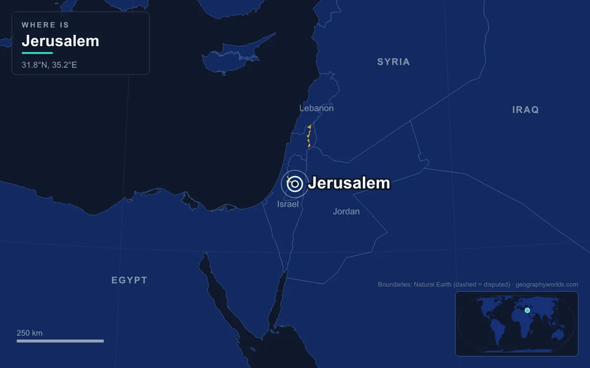
Israel names Jerusalem as its capital, and every branch of the Israeli state sits there: the Knesset, the Supreme Court, the residences of the president and prime minister, and all ministries except Defence and Agriculture. The designation is disputed. Palestinians claim East Jerusalem as the capital of a State of Palestine, and most countries recognise neither claim, so only a handful of embassies, including the United States embassy, moved there in 2018, sit inside the city limits, while most others remain in the Tel Aviv area. Jerusalem lies on a plateau in the Judaean Mountains, about 60 kilometres east of the Mediterranean and 35 kilometres west of the Dead Sea, and had 1,050,153 residents in 2024. At its centre is a walled Old City of just 0.9 square kilometres that is holy to Judaism, Christianity and Islam. This walk crosses it from the western gate of the walls to the national cemetery on its western edge.
Jaffa Gate and Suleiman’s 4,018-Metre Wall
The walk begins at Jaffa Gate, called Bab al-Khalil, the Hebron Gate, in Arabic. The gate tower dates from 1538. Beside it is a wide gap in the masonry that the Ottoman authorities cut in 1898 so that the German emperor Wilhelm II could ride into the city in state.
The wall itself was rebuilt between 1537 and 1541 on the orders of Sultan Suleiman the Magnificent, and it still defines the Old City. It runs for 4,018 metres, averages 12 metres in height and 2.5 metres in thickness, and carries 34 watchtowers. Seven main gates are open to traffic. Until the middle of the 19th century almost the entire city lived inside this circuit; from the 1860s new neighbourhoods such as Mishkenot Sha’ananim began to spread across the hills outside. The walled Old City was added to UNESCO’s World Heritage List in 1981 and is on the List of World Heritage in Danger.
St James Monastery and the Descent to the Western Wall Plaza
Turning south from Jaffa Gate leads into the Armenian Quarter, the smallest and quietest of the four. It covers 0.126 square kilometres, about 14 per cent of the Old City, and had 2,424 residents in 2007. Armenian monks are recorded in Jerusalem as early as the 4th century, after the Christian holy places in the city were uncovered, which makes this the oldest living Armenian community outside the Armenian homeland. The quarter grew around the St James Monastery, seat of the Armenian Patriarchate.
Across Habad Street lies the Jewish Quarter, and from there stairs drop to the Western Wall Plaza. The wall that Jews pray at is a 57-metre exposed section of a retaining wall built by Herod the Great to enlarge the Temple Mount; in full, that western retaining wall runs for 488 metres, most of it hidden behind later buildings in the Muslim Quarter. The open space in front of it is modern. Between 1948 and 1967, when Jordan held the Old City, Jews could not pray at the site; Israel took control on 10 June 1967, and three days later the Moroccan Quarter that stood here was bulldozed to create the plaza.
The Dome of the Rock on the Haram al-Sharif
Above the Western Wall rises the platform that Jews call the Temple Mount and Muslims the Haram al-Sharif or Al-Aqsa compound. It is the holiest site in Judaism, where the First and Second Temples stood until the Babylonian destruction of 586 BCE and the Roman destruction of 70 CE. For Muslims it is the third-holiest site in Islam, the destination of Muhammad’s Night Journey from Mecca. Since 1967 Israel has held security control, while administration of the compound has remained with the Jordanian-run Islamic waqf.
The gold dome visible across the whole city belongs to the Dome of the Rock, built on the orders of the Umayyad caliph Abd al-Malik and completed in 691 or 692. It is the oldest surviving work of Islamic architecture. Its octagonal walls surround a dome roughly 20 metres across, set over the Foundation Stone. The gold-plated roof was added in 1959 to 1964 and renewed in the 1990s. At the southern end of the platform stands the Qibli Mosque, commonly called Al-Aqsa, whose rebuilding Abd al-Malik began and his son al-Walid I, caliph from 705 to 715, completed.
The Holy Sepulchre and Out Through Damascus Gate
Heading north-west through the Muslim and Christian Quarters brings you to the Church of the Holy Sepulchre. The emperor Constantine ordered a church on the site around 326, and it was consecrated on 13 September 335; Christians hold that it contains both Golgotha, where Jesus was crucified, and his tomb. No single church owns it. The Roman Catholic, Greek Orthodox, Armenian Apostolic, Coptic, Syriac and Ethiopian Orthodox churches share it under the Status Quo, an arrangement that grew from an Ottoman decree after disputes in 1757 and was fixed by a further decree in 1853, under which even small changes require the agreement of all parties.
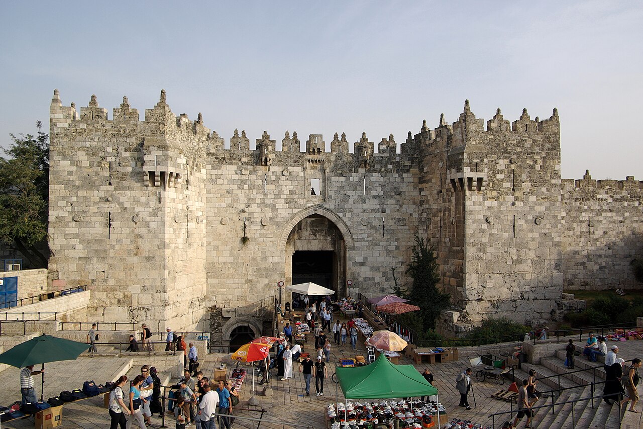
The northern exit is Damascus Gate, known in Arabic as Bab al-Amud, the Gate of the Column, and in Hebrew as Sha’ar Shkhem, the Nablus Gate. The present gate was built in 1537, but excavations between 1979 and 1984 exposed an older gate beneath it from the time of the emperor Hadrian, who visited in 129 or 130 CE. Its lintel is inscribed with the Roman name the city bore after 130 CE: Aelia Capitolina.
Sheikh Jarrah and the 1949 Armistice Line
North of Damascus Gate the road climbs about two kilometres to Sheikh Jarrah, a mainly Palestinian neighbourhood on the way to Mount Scopus. It is named after the 13th-century tomb of Hussam al-Din al-Jarrahi, physician to Saladin, and was founded as a modern district in 1865, becoming home to leading Muslim families such as the al-Husseinis. Orient House, built by the al-Husseini family in 1897, served as the headquarters of the Palestine Liberation Organization in the 1980s and 1990s until Israel closed it in 2001.
This stretch shows how the city was cut in two. The 1947 United Nations Partition Plan proposed Jerusalem as an internationally administered corpus separatum. Instead, the 1949 armistice left West Jerusalem under Israel and East Jerusalem, including the Old City, under Jordan. Route 60 now runs close to that old line. After the 1967 war Israel extended its law to East Jerusalem and wider surrounding land, and in 1980 the Jerusalem Law declared the city its complete and united capital. UN Security Council Resolution 478 of 20 August 1980 called the law null and void. Most governments regard East Jerusalem as occupied territory, and Israel has built 12 settlements there, home to about 220,000 Israelis in 2019, which the international community regards as illegal and Israel disputes.
Jaffa Road, Safra Square and Mahane Yehuda
Back at Jaffa Gate, Jaffa Road heads west into the modern city. It was paved in 1861 as the highway to the port of Jaffa, and the first neighbourhoods outside the walls, among them the Russian Compound, Nahalat Shiva and Mahane Yehuda, grew along it. Much of it is now a pedestrian street served by the Jerusalem Light Rail, which opened in August 2011 and runs 23 stops from Pisgat Ze’ev in the north, past the Old City, to Mount Herzl.
The first stop is Safra Square, where the city hall moved in 1993 into a complex that joined new office blocks to ten restored historic buildings. A 31-member council governs the city. Then comes Mahane Yehuda Market, bounded by Jaffa Road and Agrippas Street, where more than 250 vendors sell fruit and vegetables, spices, fish, cheese and baked goods until a bugle on Friday afternoon closes the market for the Sabbath. At the road’s western end sit the Central Bus Station, the busiest in Israel, and the Yitzhak Navon railway station, 80 metres underground, the terminus of the fast line to Tel Aviv completed in 2019.
Givat Ram: The Knesset, the Supreme Court and the Shrine of the Book
A short ride south-west brings you to Givat Ram, the hill that holds the institutions behind Israel’s claim. On 5 December 1949 David Ben-Gurion proclaimed Jerusalem the country’s capital, and after a Knesset vote on 24 January 1950 the government moved from Tel Aviv (Israel then held only the western half). The Knesset, Israel’s 120-member parliament, first met in temporary quarters and moved in 1966 into its present building on a hilltop that was called Sheikh Badr before 1948. James de Rothschild paid for it through a bequest in his will, and the land was leased from the Greek Orthodox Patriarchate.

About half a kilometre away is the Supreme Court, designed by Ram Karmi and Ada Karmi-Melamede and opened in 1992 as a gift of Dorothy de Rothschild; its 15 judges sit until the age of 70. On the next rise is the Israel Museum, founded in 1965, whose Shrine of the Book holds the Dead Sea Scrolls found in the caves at Qumran. The United States opened its embassy in the city on 14 May 2018, five months after President Donald Trump recognised Jerusalem as Israel’s capital. All 14 other members of the UN Security Council backed a resolution condemning that decision, which the United States vetoed. Its structure is explained in our guide to the government of Israel.
Mount Herzl and Yad Vashem on the Western Edge
The light rail ends at Mount Herzl, beside the Jerusalem Forest. The hill is Israel’s national cemetery, named after Theodor Herzl, founder of political Zionism, whose remains were brought from Vienna and reburied here on 17 August 1949. The western spur, the Mount of Remembrance, 804 metres above sea level, holds Yad Vashem, the national Holocaust memorial set up by a Knesset law of 19 August 1953 and opened to the public in 1957. With about one million visitors a year it is the second most-visited site in Israel after the Western Wall.
The city’s population has risen steadily, and its mix has shifted: in 2020, 59.9 per cent of residents were Jewish, 37.2 per cent Muslim and 1.7 per cent Christian. The Old City where the walk began stays the heart of the argument over whose capital Jerusalem is, and its monuments are covered in more depth in our guide to the Old City of Jerusalem as a World Heritage Site, while the faiths that share it are the subject of our piece on religion in Israel.
How those numbers rank depends on the boundary question again. Counted with East Jerusalem, as the Israel Central Bureau of Statistics counts it, Jerusalem is the most populous city Israel administers, roughly twice the size of Tel Aviv at 494,900; counted without East Jerusalem, Tel Aviv comes first. The wider picture is set out in our overview of the population of Israel.
Quick Facts About Jerusalem
- Country: Israel
- Continent: Asia (Middle East)
- Country population: approximately 9.6 million
- Capital city status: Jerusalem is the capital of Israel, the seat of national government, and the location of foreign embassies, parliament, and the head of state's official residence.
Frequently Asked Questions
What is the capital of Israel?
The capital of Israel is Jerusalem. Jerusalem is the seat of national government, hosts most foreign embassies and consulates, and is typically where the head of state and parliament are located.
What continent is Jerusalem in?
Jerusalem, the capital of Israel, is located in Asia, in the Middle East region. As Israel's capital, Jerusalem serves as the country's primary connection to the broader Asian political, economic, and cultural sphere.
Why is Jerusalem the capital of Israel?
Jerusalem was chosen as the capital of Israel for reasons that typically combine geography, history, and politics. Capital city selections often reflect a desire for centrality (being accessible from across the country), historical importance (being a longstanding seat of government or culture), or neutrality (being acceptable to multiple regions or ethnic groups within the country). The specific reasons for Jerusalem's designation are detailed in the city's history above.
What is Jerusalem known for?
As the capital of Israel, Jerusalem is best known for housing the country's central government institutions — parliament, presidential or royal residences, supreme court, and key ministries. It is also typically a major cultural and economic center within Israel, hosting national museums, embassies, and signature monuments. The introduction and history sections above provide detailed coverage of the city's specific notable institutions and landmarks.
Related Pages
- Israel Country Guide — full geography, climate, economy, and culture overview
- Flag of Israel — meaning, history, and design of Israel's national flag