

Asmara is the capital and largest city of Eritrea. It sits on the Eritrean Highlands in the country's Central Region, 2,325 metres above sea level, which makes it the second-highest capital in Africa and the sixth-highest in the world. Its population is usually estimated at roughly one million (about 1,073,000 in a 2023 estimate), though Eritrea has never held a national census, so every figure is an approximation. What sets Asmara apart is its architecture. Most of its centre was built by Italian colonists between 1935 and 1941, and in 2017 UNESCO listed the whole city as a World Heritage Site, the first modernist city to be inscribed in its entirety.
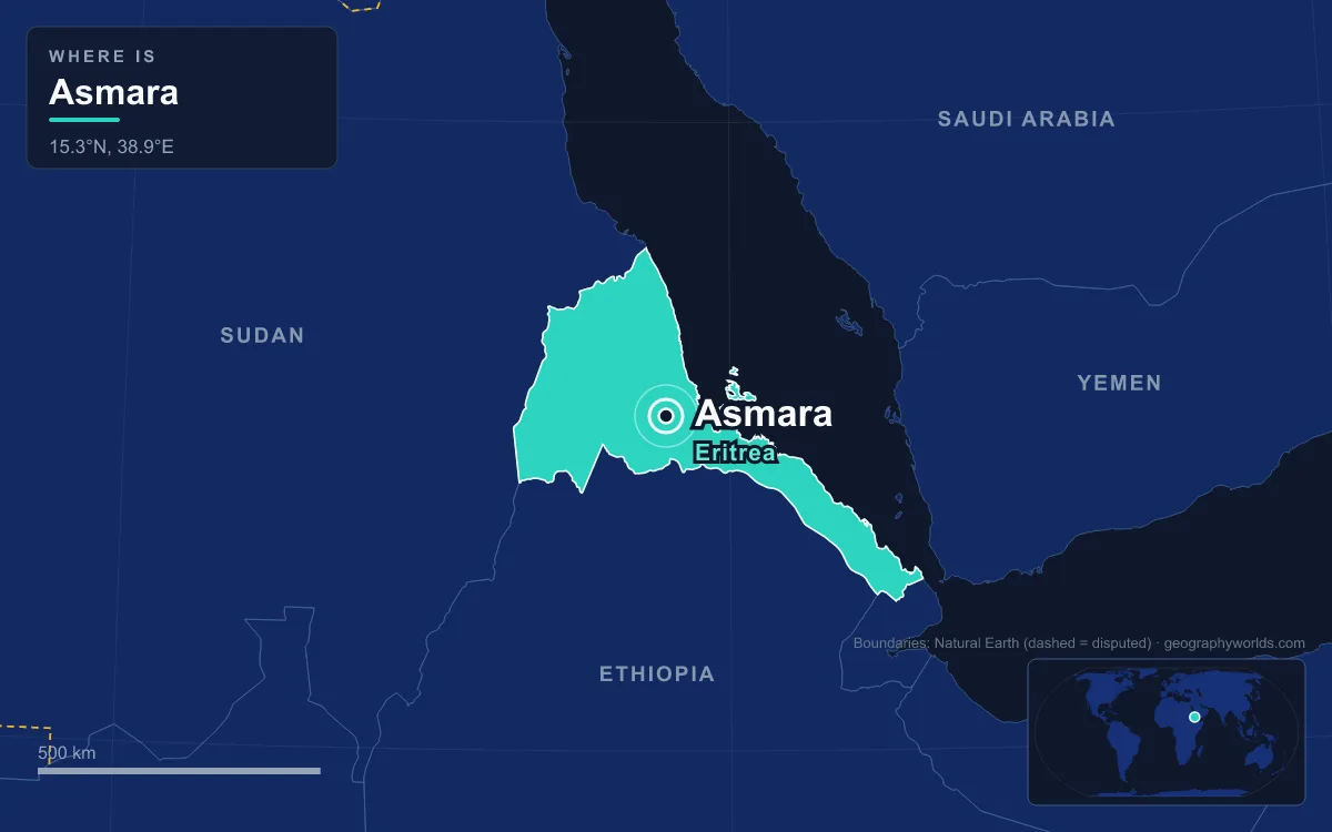
Asmara is easiest to understand through comparison: with the capital just above it in altitude, the port below it, the city it was in 1939, and the country around it now. The numbers below all come from the same few sources, and where they disagree, that is noted.
2,325 Metres Against Addis Ababa's 2,355
Only one African capital sits higher than Asmara, and it belongs to Ethiopia, the country from which Eritrea won its independence after a thirty-year war. Addis Ababa, at 2,355 metres, is the highest capital in Africa and the fourth-highest in the world, just 30 metres above Asmara. Both cities stand on the same great block of highland. The Eritrean Highlands are the northern extension of the Ethiopian Highlands, and Asmara lies at the tip of an escarpment that marks both the northwestern edge of the Eritrean plateau and the Great Rift Valley in neighbouring Ethiopia.
The height changes everything about the city. To the east, the plateau drops toward hot salt pans and the Red Sea coast. To the west, semi-arid hills run toward the Sudanese border through the Gash-Barka Region. The altitude also made Asmara useful to foreign powers. From 1943 to 1977 the US Army ran Kagnew Station, a radio listening post, on the edge of the city. Its high elevation close to the equator suited the antenna farms. By 1970 there were 3,200 Americans on the base, and it worked as a city within a city, with its own water system, recreation facilities and housing. For the full ranking, see our list of the highest capital cities in the world.
A Mean of 15.6 °C Up Top, 40.8 °C Highs at Massawa
Altitude gives Asmara a climate unlike the rest of the Horn's coast. It is classed as cool semi-arid, and its average temperature over the year is 15.6 °C. Daytime highs stay between about 21 and 25 °C in every month, and January nights average 4.3 °C. The coldest temperature on record is −4.5 °C, although frost is extremely rare. Massawa, the Red Sea port about 118 kilometres away by rail, is one of the hottest coastal places in the world, with an average temperature of nearly 30 °C.
Rain in Asmara comes in a short burst. The city averages about 518 millimetres a year, and roughly 60 percent of it falls in July and August. December to February together average only 9.1 millimetres. Occasional showers fall from April to June, and the long dry season lasts from September to about April. Because the rainfall varies so much, droughts have returned in every decade since the 1960s, and deforestation, desertification, soil erosion and overgrazing are the surrounding plateau's main environmental problems.
118 Kilometres of Track, 2,394 Metres of Climb
The contrast between the plateau and the port also shaped Eritrea's colonial history. Italy took the coast first and ruled from Massawa until Governor Ferdinando Martini moved the seat of the colony to Asmara in 1897. To connect the two, Italian engineers built the Eritrean Railway between 1887 and 1932, using a narrow 950-millimetre gauge. On the way up from sea level the line needed 65 bridges, among them a fourteen-arch viaduct over the Obel River, and 39 tunnels, the longest of them 320 metres. It reaches its highest point, 2,394 metres, just east of Asmara, and some gradients are steeper than 3 percent.

The line was later extended north to Keren, Agordat and Bishia. War damage and neglect then closed it section by section, and the last closure came in 1978. After independence a rebuilding effort began. The first rebuilt section reopened in 2003, and by 2009 the full 118 kilometres from Massawa to Asmara was open again. It is one of the few working railways that still use 1930s Italian Littorina railcars and Mallet steam locomotives.
98,000 People in 1939, 53,000 of Them Italian
Asmara was a small village in the 19th century. Local tradition says it grew from four highland clans, Gheza Gurtom, Gheza Shelele, Gheza Serenser and Gheza Asmae, whose women persuaded them to unite for protection. That is the origin of the name Arbate Asmera, Tigrinya for "the four made them unite". The settlement first appears in writing in a Latin itinerary from the reign of Emperor Dawit I (1382–1411).
Italian occupation in 1889 transformed it. By the 1939 census Asmara had 98,000 inhabitants, and 53,000 of them were Italians. Only about 75,000 Italians lived in the whole of Eritrea, so the capital held about seven in ten of them. In Libya, by comparison, a larger settler population was spread across the colony. The settlers came with industry. By 1939 there were about 2,198 factories across Eritrea, and in Asmara the Melotti brewery opened that year. As Asmara Brewery it still employs about 600 people and makes Asmara beer. After the Second World War most Italians left. Asmara today is about ten times larger than it was in 1939, and more than 400 buildings of Italian origin and shop signs such as Bar Vittoria and Pasticceria Moderna are the most visible traces of that community.
Six Years of Building: Asmara Against Mussolini's Rome
Most of central Asmara went up between 1935 and 1941, so Italy built almost an entire city centre in six years. Mussolini poured money into the colony as a base for a new empire in Africa. Architects used the place, in one description, to try out radical new designs, and the city is said to have had more traffic lights than Rome while it was being built. The result mixes Art Deco, Futurism, Cubism, Rationalism and neo-Romanesque in walking distance of one another.

Two buildings show the style best. The Fiat Tagliero service station, completed in 1938 to a design by the engineer Giuseppe Pettazzi, is shaped like an aircraft, with cantilevered concrete wings about 15 metres long on either side of a central tower. Officials wanted pillars under the wings. According to the story, Pettazzi settled the argument with a pistol, and the wings have stayed up without support ever since, even through British bombing in the Second World War. The Cinema Impero, opened in 1937 and designed by Mario Messina, is named after Mussolini's proclamation of empire. It still keeps most of its original seats and equipment, and 45 round lights frame its façade. UNESCO inscribed the city in July 2017 at the 41st session of the World Heritage Committee. Our guide to Art Deco cities around the world sets Asmara alongside other cities known for the style.
Capital, Provincial City, Capital Again: 1952 to 1993
For forty years Asmara was not a national capital at all. In 1952 a United Nations decision federated Eritrea with Ethiopia, and for the length of the federation the capital was Addis Ababa, more than 1,000 kilometres to the south. In 1962 Emperor Haile Selassie dissolved the Eritrean parliament and annexed the territory as a province. The Eritrean War of Independence, which had started in 1961, lasted thirty years. The highlands, including Asmara, came through largely undamaged, which is why the modernist centre survived. The Eritrean People's Liberation Front took the country in 1991, a UN-supervised referendum confirmed independence in 1993, and Asmara became a capital again. On 28 May 1993 Eritrea joined the United Nations as its 182nd member.
One Million People in a Country That Has Never Been Counted
The biggest uncertainty in any comparison is Eritrea itself. Estimates of the national population range from about 3.5 million to 6.4 million, because the last census, taken by Ethiopia in 1984, counted 2,621,566 people in the territory. On the lower estimates, Asmara holds more than a quarter of all Eritreans. The other main urban centres are the port of Assab in the south-east, Massawa to the east, Keren to the north and Mendefera in the south.
The capital also differs from the country in faith. The Central Region is about 89 percent Christian, mostly Eritrean Orthodox, and 5 percent Muslim, while the national split is disputed: the Pew Research Center's 2020 estimate put Eritrea at 62.9 percent Christian and 36.6 percent Muslim. Asmara is the see of the Eritrean Orthodox Tewahedo Church, whose archbishop was raised to the rank of patriarch in 1998, and home to the Enda Mariam Cathedral, alongside the Catholic Church of Our Lady of the Rosary, the Kidane Mehret Cathedral and the Al Khulafa Al Rashiudin Mosque. It has also lost one of its institutions. The University of Asmara, founded in 1958, was shut in 2006 after a new institute opened at Mai Nefhi. For the rest of the country, from the Dahlak islands to the western lowlands, read our country guide to Eritrea.
Quick Facts About Asmara
- Country: Eritrea
- Continent: Africa (East Africa)
- Country population: approximately 3.7 million
- Capital city status: Asmara is the capital of Eritrea, the seat of national government, and the location of foreign embassies, parliament, and the head of state's official residence.
Frequently Asked Questions
What is the capital of Eritrea?
The capital of Eritrea is Asmara. Asmara is the seat of national government, hosts most foreign embassies and consulates, and is typically where the head of state and parliament are located.
What continent is Asmara in?
Asmara, the capital of Eritrea, is located in Africa, in the East Africa region. As Eritrea's capital, Asmara serves as the country's primary connection to the broader African political, economic, and cultural sphere.
Why is Asmara the capital of Eritrea?
Asmara was chosen as the capital of Eritrea for reasons that typically combine geography, history, and politics. Capital city selections often reflect a desire for centrality (being accessible from across the country), historical importance (being a longstanding seat of government or culture), or neutrality (being acceptable to multiple regions or ethnic groups within the country). The specific reasons for Asmara's designation are detailed in the city's history above.
What is Asmara known for?
As the capital of Eritrea, Asmara is best known for housing the country's central government institutions — parliament, presidential or royal residences, supreme court, and key ministries. It is also typically a major cultural and economic center within Eritrea, hosting national museums, embassies, and signature monuments. The introduction and history sections above provide detailed coverage of the city's specific notable institutions and landmarks.
Related Pages
- Eritrea Country Guide — full geography, climate, economy, and culture overview
- Flag of Eritrea — meaning, history, and design of Eritrea's national flag