

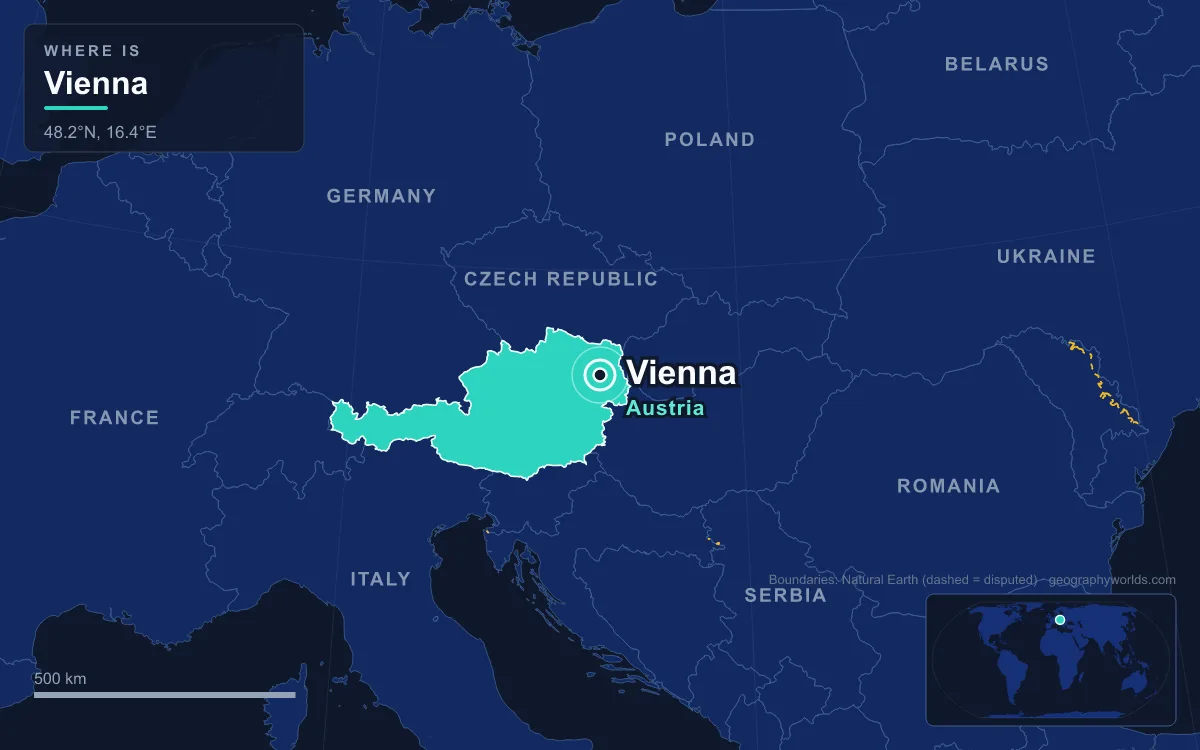
Vienna, the capital of Austria, stands where the last wooded ridge of the Alps runs down to the Danube and the land opens east onto the plains of the Pannonian Basin. With 2,028,499 inhabitants in 2025, and nearly 2.9 million in its metropolitan area, it is by far the largest city in the country and the most populous city on the Danube. It is also one of Austria's nine federal states, completely surrounded by Lower Austria, and lies only about 50 kilometres from Bratislava and the Slovak border. Almost everything about Vienna, from its Roman origins to its ring road and its artificial island, follows from that meeting of mountain, river and plain.
The Vienna Gate: Leopoldsberg, the Danube and the Basin
At the northern edge of today's city the Danube passes through a narrow water gap, the Vienna Gate, beneath the Leopoldsberg, the north-easternmost summit of the Vienna Woods, which geographers treat as the eastern end of the Alpine chain. Below that point the river enters the Vienna Basin, a spindle-shaped lowland about 200 kilometres long and 50 kilometres wide, sunk between the Alps and the Carpathians. The river leaves the basin again at the Devín Gate, east of Hainburg, and flows on towards Bratislava and Hungary.
A town on the first ground downstream of the Vienna Gate sat on the river route, and the basin was also the obvious road into Central Europe from the south-east, which is why fortresses were built at Wiener Neustadt and Hainburg on its rim from the late 12th century, and why Hungarian armies in 1485 and Ottoman armies in 1529 and 1683 marched across it to Vienna's walls.
The same meeting of landscapes gives the city a split personality in its terrain and weather. Its elevation ranges from 151 metres by the Danube to 542 metres in the western hills, and its 414.78 square kilometres make it Austria's largest city by area. The wooded west is the wettest part, with 700 to 800 millimetres of rain a year, while the flat plains east of the river get only 500 to 550 millimetres. The urban core has a humid subtropical climate, while the higher north-western edges stay oceanic.
Vindobona's Terrace and the Street Plan It Left Behind
The Romans saw the site's value first. Around 1 AD the kingdom of Noricum was absorbed into the empire, and the Danube became its frontier. Around the year 100 the army built a legionary fortress beside the Danube, on the ground now covered by Vienna's first district. They called it Vindobona, from a Celtic name meaning either "white place" or "place of Vindos". The camp covered about 20 hectares and held some 6,000 soldiers, with a civilian town growing beside it and a Germanic market settlement facing it across the Danube from the 2nd century. Vindobona was one link in a chain of Danube forts with Carnuntum, the provincial centre downstream, Brigetio and Aquincum. The historian Aurelius Victor says Emperor Marcus Aurelius died here on 17 March 180 while campaigning against Germanic tribes, though Tertullian places his death at Sirmium.
The river shaped the camp even after it was built. A major Danube flood in the 3rd century seems to have eroded part of the fortress, which is why its northern boundary along today's Salzgries runs at an odd angle. The camp's outline is still readable in the street plan of the first district: the Graben, whose name means "ditch" and is thought to recall the fortress's defensive trench, together with Naglergasse, Tiefer Graben, Salzgries, Rabensteig and Rotenturmstraße. After the Huns invaded Pannonia in the 430s, the population fled and the site was largely abandoned for centuries.

The city's modern name also comes from the site, though not from the Romans. Wien derives from the river Wien, the small stream that comes down from the Vienna Woods and now joins the Danube Canal, much as Steyr, Enns and Krems are named after the rivers at whose mouths they stand. It first appears in the Salzburg Annals, which record a battle at a place called Wenia in 881.
Kahlenberg and the Wienerwald: The Hills That Framed 1683
West and north of the city rise the Vienna Woods, a range of forested hills about 45 kilometres long and 20 to 30 kilometres wide, reaching 893 metres at the Schöpfl. Geologically they are the hinge between the Eastern Alps and the Carpathians: sandstone in the north, limestone in the south, with a fault line, the so-called thermal line, marking their eastern edge against the basin. The hills reach right into the city's 19th district, where the Kahlenberg, 484 metres high, looks down over the whole of Vienna and the Danube valley.
Those slopes decided the city's most famous battle. In the summer of 1683 an Ottoman army under Grand Vizier Kara Mustafa Pasha besieged Vienna for two months. On 12 September a relief army of imperial and Polish–Lithuanian troops under King John III Sobieski of Poland came down from the Kahlenberg heights and broke the siege. The Ottomans had already failed once before, in 1529.

The woods have also given Vienna its green edge. In 1561 Emperor Ferdinand I fenced off the Lainzer Tiergarten as a private hunting ground; today it is a wildlife preserve of 24.5 square kilometres, about 80 percent of it woodland, home to wild boar, red and fallow deer and mouflon. At the opposite, eastern end of the city, the Lobau floodplain forest is part of the Danube-Auen National Park, where beavers and white-tailed eagles live inside the boundaries of a capital of two million.
From Glacis to Ringstrasse: Filling the Gap in 1857
Between Roman times and the 19th century, Vienna grew into a capital without leaving its terrace. The Babenberg dukes made it their seat in 1155, the town received city rights in 1221, and from the 16th century the Habsburgs made it the seat of the Holy Roman Emperors, a role it kept until 1806. With the creation of the Austrian Empire in 1804, it became that empire's capital and later the capital of Austria-Hungary.
All that time the inner city stayed inside its walls, first built in the 13th century, reputedly with the ransom paid to free King Richard the Lionheart of England, who had been captured near Vienna on his way home from the Third Crusade. After the siege of 1529 the fortifications were strengthened, and around them lay the glacis, an open strip about 500 metres wide where building and planting were forbidden so that defenders had a clear field of fire. The suburbs grew beyond it, separated from the old town by a belt of empty land.
In 1850 those suburbs, now districts 2 to 9, were incorporated into the city, and the walls became an obstacle to traffic. In 1857 Emperor Franz Joseph I issued the decree "Es ist Mein Wille", ordering the city walls and moats demolished. The result is the Ringstrasse, a 5.3-kilometre ring road that follows the line of the vanished walls and is lined with the Parliament, the City Hall, the State Opera, museums and parks. It forms part of the Historic Centre of Vienna, a UNESCO World Heritage Site since 2001. On its eastern side the river Wien, much of it now channelled underground in the city, runs through the Stadtpark before flowing into the Danube Canal.
The new space fed a boom. By 1910 Vienna had more than two million inhabitants and was the third-largest city in Europe after London and Paris, drawing migrants from across the empire; at the start of the 20th century it had the second-largest Czech population of any city after Prague. After the First World War many Czechs and Hungarians left, and the population stagnated or fell for most of the century before growing again from about 2000.
Straightening the Danube, 1870–1988, and the City Across It
For most of its history Vienna kept its distance from the main Danube, and with reason. Until 1870 the river ran through the area in a tangle of shifting side arms that flooded often. The first great regulation cut a new, straight main channel from 1870. The arm nearest the old town was kept as the Danube Canal, and another former arm north of the river was cut off to become an oxbow lake, the Alte Donau, or Old Danube.
That was not enough to make the river safe, so a second regulation began in the 1970s. Between 1972 and 1988 engineers dug the New Danube, a relief channel about 21 kilometres long that takes excess water in floods, and piled the excavated material into the Donauinsel, the Danube Island: a strip of land 21.1 kilometres long between the two channels, planted with about 1.8 million trees and shrubs. In calm years it is a park that hosts the Donauinselfest, a free open-air music festival with around 3 million visitors over three days; in the European floods of 2024 it did its real job, and Vienna came through largely unaffected.
With the river tamed, the city finally moved across it. North of the main channel, the Vienna International Centre was built between 1973 and 1979 to house United Nations agencies; about 5,000 people work there today, and the city also hosts OPEC and the Organization for Security and Co-operation in Europe. The Danube that once limited the city now runs through the middle of it. To follow the river from its source in Germany's Black Forest to the Black Sea, see our complete guide to the Danube; for the mountains whose last ridge ends at the Leopoldsberg, read our guide to the Alps; and for the eight countries that surround this landlocked state, see the countries that border Austria.
Quick Facts About Vienna
- Country: Austria
- Continent: Europe (Western Europe)
- Country population: approximately 9.1 million
- Capital city status: Vienna is the capital of Austria, the seat of national government, and the location of foreign embassies, parliament, and the head of state's official residence.
Frequently Asked Questions
What is the capital of Austria?
The capital of Austria is Vienna. Vienna is the seat of national government, hosts most foreign embassies and consulates, and is typically where the head of state and parliament are located.
What continent is Vienna in?
Vienna, the capital of Austria, is located in Europe, in the Western Europe region. As Austria's capital, Vienna serves as the country's primary connection to the broader Europen political, economic, and cultural sphere.
Why is Vienna the capital of Austria?
Vienna was chosen as the capital of Austria for reasons that typically combine geography, history, and politics. Capital city selections often reflect a desire for centrality (being accessible from across the country), historical importance (being a longstanding seat of government or culture), or neutrality (being acceptable to multiple regions or ethnic groups within the country). The specific reasons for Vienna's designation are detailed in the city's history above.
What is Vienna known for?
As the capital of Austria, Vienna is best known for housing the country's central government institutions — parliament, presidential or royal residences, supreme court, and key ministries. It is also typically a major cultural and economic center within Austria, hosting national museums, embassies, and signature monuments. The introduction and history sections above provide detailed coverage of the city's specific notable institutions and landmarks.
Related Pages
- Austria Country Guide — full geography, climate, economy, and culture overview
- Flag of Austria — meaning, history, and design of Austria's national flag