

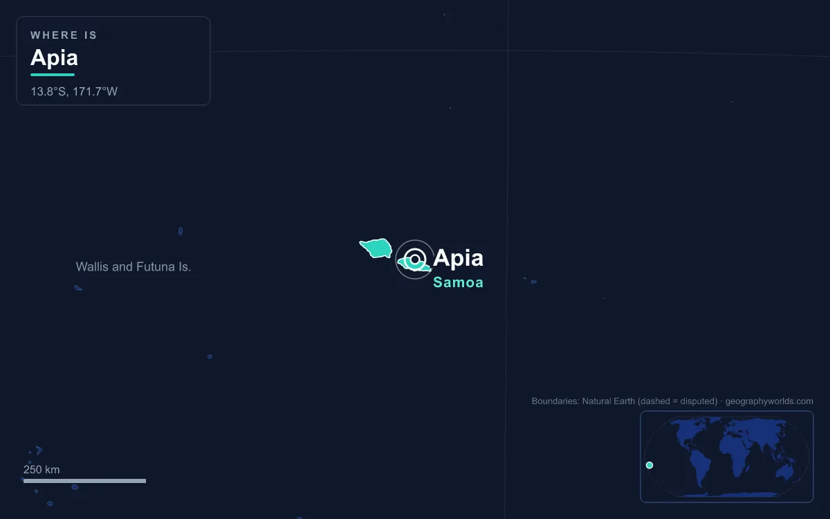
Apia is the capital and largest city of Samoa, spread along a natural harbour at the mouth of the Vaisigano River on the central north coast of Upolu, the country’s second-largest island. The Apia Urban Area counted 35,974 people at the 2021 census, a little over one in six of Samoa’s 205,557 residents. Its defining feature is that, legally, it is hardly a city at all: Apia has no municipal council, and the capital is a chain of roughly 45 traditional and freehold villages that grew together around one harbour, stretching from Letogo in the east to the industrial suburb of Vaitele in the west. The clearest way to understand the place is by measuring it against things: the rest of Samoa, the bigger but emptier island of Savai’i, its American-ruled neighbour Pago Pago, its own wet and dry seasons, and the calendar it abandoned in 2011.
35,974 of 205,557: Apia’s Share of Samoa
By Pacific standards Apia is a mid-sized capital, and by world standards a small town. Its 35,974 residents make up about 17.5 per cent of the national population, a lower share than in many island states where the capital swallows half the country. The reason is Samoan settlement itself. Most Samoans still live in villages organised under matai (chiefs) and fa’a Samoa, the customary way of life, and village land and titles give families a strong reason to stay rooted outside the capital even when they work in it.
Upolu is where the weight of the country sits. The island is 75 kilometres long, covers 1,125 square kilometres and holds about 145,000 people, which is nearly three-quarters of all Samoans. Apia therefore dominates Upolu economically without dominating it numerically: the capital holds the harbour, the ministries, the banks and the country’s only university, the National University of Samoa, while most Upolu families live along the coastal road outside it.
The growth over two centuries is still striking. Apia began as a single village whose population around 1800 was recorded as 304. The modern town was founded in the 1850s and grew into a colonial trading post, and Apia became the official capital in 1959, three years before Western Samoa became independent on 1 January 1962. The original Apia village still exists inside the capital that took its name, with its own matai and its own fa’alupega, the formal greetings recited at gatherings.
Apia’s 45 Villages and No City Council
Compare Apia with almost any other capital and the missing piece is a mayor. There is no city administration. Apia proper is a small village between the mouths of the Vaisigano River to the east and the Mulivai River to the west, framed by the traditional villages of Matautu and Vaiala. Together with freehold settlements that have no traditional village council, some 45 villages make up what Samoans call downtown Apia, each with its own leadership and customs.
That arrangement explains a good deal of the city’s friction. Growth from village to colonial trading post to national business centre happened without a single planning authority, and the result has been flooding in the wet season across a low valley floor, pollution along the shoreline at Sogi, a village built on swampland, and no unified approach to sewage disposal. Parliament passed the Planning and Urban Management Act in 2004 to create the Planning and Urban Management Authority, a national body meant to manage Apia’s growth where no local council existed to do it.
The government quarter itself sits at the western end of town on Mulinu’u, a narrow peninsula that has been the seat of colonial and then national government since the 1870s. It holds the Parliament House, the Maota Fono, the Land and Titles Court and the old German observatory, now the meteorology office. Its resident population at the 2016 census was just 27. In the commercial centre a clock tower, erected as a war memorial, serves as the city’s central reference point.

The skyline is modest but growing. Reclaimed land jutting into the harbour carries the multi-storey government offices named after Fiame Mata’afa Faumuina Mulinu’u II, Samoa’s first prime minister, and the Central Bank of Samoa. Newer additions include the ACC building of 2001, the Samoatel telecommunications building of 2004, deliberately placed inland at Maluafou to protect it from cyclones, the Tui Atua Tupua Tamasese building of 2012 at Sogi, and the SNPF Molesi shopping mall, opened in 2013. The new produce market, the maketi fou, was likewise moved inland to Fugalei for cyclone protection.
Upolu Against Savai’i: 1,125 km² Versus 1,694 km²
Samoa’s land area is 2,842 square kilometres, and the two main islands account for 99 per cent of it. Savai’i is the bigger of the two by a wide margin, at 1,694 square kilometres, and it reaches the country’s highest point, Mount Silisili, at 1,858 metres. Yet at the 2016 census it held only 43,958 people, about 24 per cent of the national total. Upolu, a third smaller, has more than three times as many.
The contrast is sharpest when the two islands’ towns are set side by side. Savai’i has one township, Salelologa, at its eastern end, essentially a single shopping street, a market beside the wharf and the island’s only ferry terminal. Apia, across the 13-kilometre Apolima Strait and a drive along Upolu, has the parliament, the international shipping port and the national university. Savai’i remains the more volcanically active of the two, with eruptions at Mount Matavanu between 1905 and 1911, and its Central Savai’i Rainforest covers about 727 square kilometres, the largest continuous rainforest in Polynesia. Upolu has no historically recorded eruptions at all.
History reversed the islands’ political weight in one respect. The Mau, the non-violent independence movement that shaped Apia’s streets in the 1920s, had its beginnings on Savai’i as the Mau a Pule. It reached the capital with force on 28 December 1929, Black Saturday, when New Zealand police fired on a peaceful Mau procession in Apia and killed the paramount chief Tupua Tamasese Lealofi III.
482.8 mm in January, 112.3 mm in August: Apia’s Wet and Dry Halves
Apia has a tropical rainforest climate in which temperature barely moves and rainfall swings wildly. The 1991–2020 averages from the World Meteorological Organization give a mean temperature of 27.8°C in April, the warmest month, and 26.6°C in July and August, the coolest, a spread of just over one degree. Rainfall is a different story. January averages 482.8 millimetres, more than four times August’s 112.3 millimetres, and the year totals roughly 3,090 millimetres.
The calendar of rain shapes the calendar of visitors. The peak tourist season runs from June to September, the drier Samoan winter, with a second peak over December and January when Samoans living in New Zealand and Australia fly home for Christmas, straight into the wettest weeks of the year. About 200,000 tourists visited Samoa in 2024, and tourism made up around 20 per cent of GDP that year, down from 24.5 per cent in 2019. The wet season is also cyclone season, which is why so much of Apia’s newer infrastructure has been built away from the waterfront.
Apia Harbour: Seven Warships in 1889, Container Ships Today
The harbour is Apia’s reason for existing, and also its greatest weakness. It is exposed to the north, with no enclosing reef or high ground to shelter ships. On 15 March 1889, at the height of the rivalry between Germany, the United States and Britain over Samoa, seven warships of the three powers stayed at anchor as a cyclone approached, each captain unwilling to be the first to leave. Only the British cruiser HMS Calliope steamed out to the open sea, making less than a knot against the wind. The German ships Adler and Eber and the American Trenton and Vandalia were wrecked, along with six merchant vessels, and the death toll reached roughly 200 sailors or more, depending on the source.

The disaster ended the naval standoff, and after the Tripartite Convention of 1899 Germany took the western islands and ruled them as German Samoa from 1900, with Apia as capital, until New Zealand troops occupied the town without bloodshed in August 1914. Today Apia Harbour is by far Samoa’s largest and busiest port, handling containers, LPG and fuel, and ferries sail from it to Tokelau and American Samoa. International flights, by contrast, avoid the capital: Faleolo International Airport lies about 40 kilometres west, roughly a 40-minute drive.
Apia and Pago Pago: Two Capitals, One Archipelago
The nearest foreign capital is Pago Pago, seat of the United States territory of American Samoa on Tutuila, which lies 64 kilometres east of Samoa at the closest point. The two towns share a language and a culture but little else. Pago Pago is a string of six villages around one of the deepest natural harbours in the South Pacific, and its economy rests on tuna canning; the village that gives the capital its name had about 3,000 residents in 2020. Apia is larger, sits on an open harbour and lives on government, services, remittances and tourism.
The deepest contrast is temporal. Until the end of 2011 the two Samoas shared a clock, set in 1892 to match American traders in California. At the end of December 2011 Samoa moved from UTC−11 to UTC+13, skipping Friday 30 December altogether and redrawing the International Date Line to its east. Before the change Apia was 21 hours behind Sydney; afterwards it was three hours ahead, and a day ahead of Pago Pago, a short flight away. The reasoning and the mechanics are set out in our explainer on Samoa’s 2011 time zone change.
Put together, the numbers describe a capital that is small, dispersed and unusually rooted in custom: 35,974 people in 45 villages, one exposed harbour, a wet season that brings four times the rain of the dry, and a clock that now sits among the first on Earth to see each new day. For the wider country beyond the harbour, including Savai’i’s volcanoes and the villages of the south coast, see our Samoa country guide, or check the seasons in more detail in the best time to visit Samoa.
Quick Facts About Apia
- Country: Samoa
- Continent: Oceania
- Country population: approximately 221 thousand
- Capital city status: Apia is the capital of Samoa, the seat of national government, and the location of foreign embassies, parliament, and the head of state's official residence.
Frequently Asked Questions
What is the capital of Samoa?
The capital of Samoa is Apia. Apia is the seat of national government, hosts most foreign embassies and consulates, and is typically where the head of state and parliament are located.
What continent is Apia in?
Apia, the capital of Samoa, is located in Oceania. As Samoa's capital, Apia serves as the country's primary connection to the broader Oceanian political, economic, and cultural sphere.
Why is Apia the capital of Samoa?
Apia was chosen as the capital of Samoa for reasons that typically combine geography, history, and politics. Capital city selections often reflect a desire for centrality (being accessible from across the country), historical importance (being a longstanding seat of government or culture), or neutrality (being acceptable to multiple regions or ethnic groups within the country). The specific reasons for Apia's designation are detailed in the city's history above.
What is Apia known for?
As the capital of Samoa, Apia is best known for housing the country's central government institutions — parliament, presidential or royal residences, supreme court, and key ministries. It is also typically a major cultural and economic center within Samoa, hosting national museums, embassies, and signature monuments. The introduction and history sections above provide detailed coverage of the city's specific notable institutions and landmarks.
Related Pages
- Samoa Country Guide — full geography, climate, economy, and culture overview
- Flag of Samoa — meaning, history, and design of Samoa's national flag