

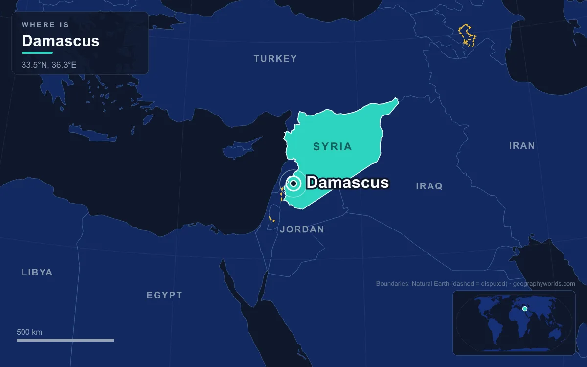
Damascus is the capital and largest city of Syria, set on a plateau about 680 metres above sea level at the foot of the Anti-Lebanon Mountains in the south-west of the country, some 80 km inland from the Mediterranean. The 2004 census counted 1,552,161 people in the city proper, and the wider metropolitan area is estimated at around 5 million. First settled in the 3rd millennium BC and capital of the Umayyad Caliphate from 661 to 750, it is often described as the oldest capital city in the world, and its walled Old City has been a UNESCO World Heritage Site since 1979. Seven places inside, above and beside that city explain how it has held on to power for so long.
Mount Qasioun and the Barada Valley Below
Start on the mountain, because it shows why Damascus is where it is. Mount Qasioun rises to 1,151 metres directly above the north of the city, bare, rocky and dry; its name may come from a Syriac word for “hard and dry”. From its slopes the whole plan of the city is visible: the Barada River emerging from its gorge in the west, the walled Old City on the river’s south bank, and the green belt of the Ghouta, the irrigated farmland that once surrounded Damascus like an oasis.
The geography is a paradox. The Anti-Lebanon range, with peaks above 3,000 metres, blocks rain from the Mediterranean, so Damascus has a cool arid climate with only about 130 mm of rain a year, falling between October and May. What made settlement possible was the Barada, fed by snowmelt from those same mountains, and the Fijeh spring up the valley, which long supplied the city’s drinking water. Damascus also sat where the north–south route from Egypt to Asia Minor crossed the desert road from Lebanon to the Euphrates. Today the Barada is nearly dry as it passes the Old City, drained by housing and industry.
The mountain has its own history. Medieval writers placed a Cave of Blood on its slopes, where tradition says Cain killed Abel and where rulers climbed to pray for rain. In the 19th century new districts spread up its flanks, al-Akrad (“the Kurds”) and al-Muhajirin (“the migrants”), named for the soldiers and refugees who settled there. During the civil war the Syrian army dug tunnels into Qasioun and used it for artillery positions, and public access was restricted until the fall of the Assad government in December 2024.
The Umayyad Mosque, Built 706 to 715
The single building that best explains Damascus is the Great Mosque, better known as the Umayyad Mosque. Its site has been a place of worship since the Iron Age. The Arameans built a temple to their rain god Hadad here in the Iron Age; the Romans turned it into one of the largest temples in Syria, dedicated to Jupiter, and the mosque’s outer walls are the inner walls of that temple. Under the Byzantine emperor Theodosius I (r. 379–395) it became a cathedral dedicated to John the Baptist.
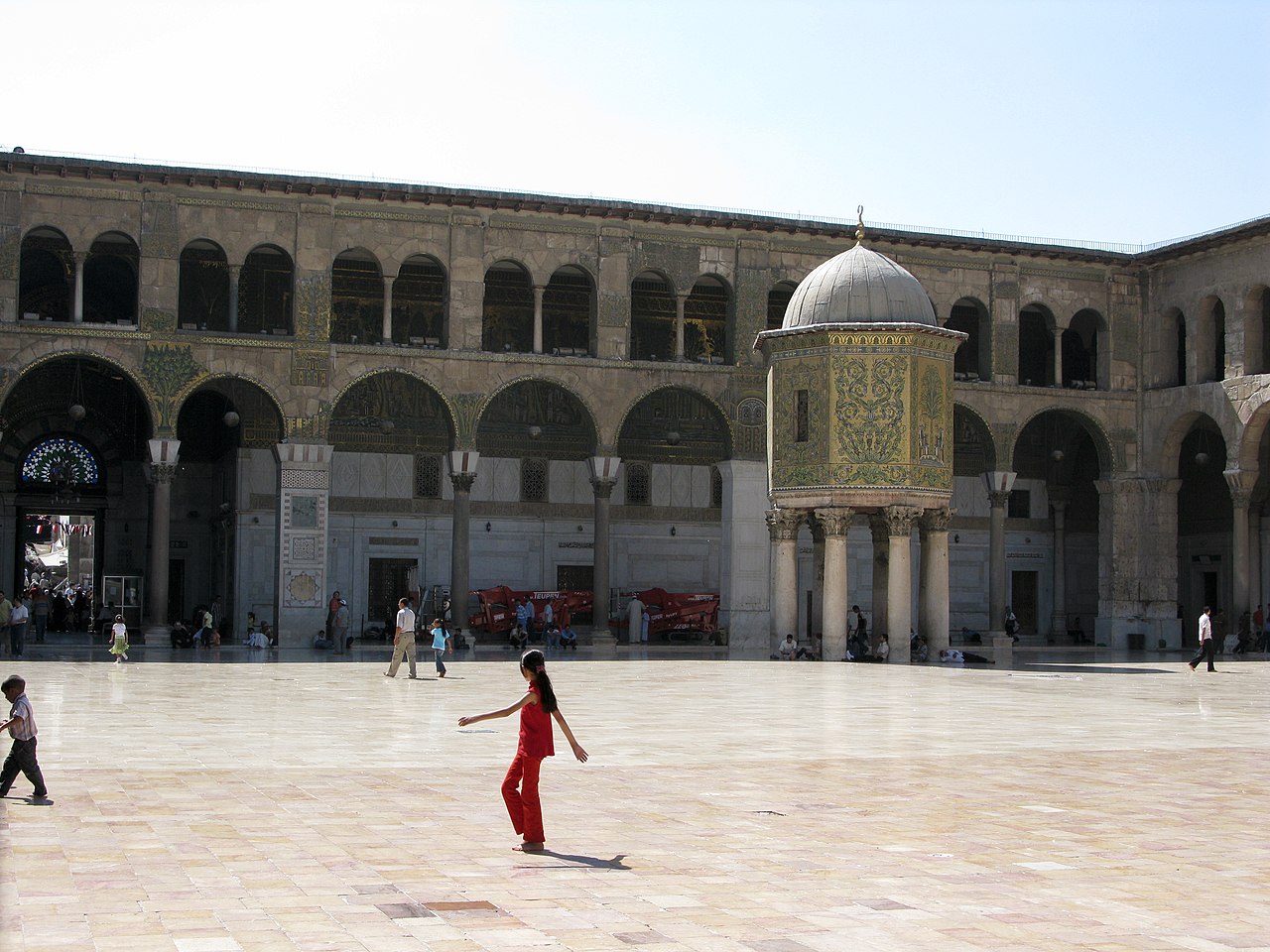
After Khalid ibn al-Walid took Damascus in 634, Muslims prayed in part of the cathedral. In 661 Mu’awiya, the governor of Syria, became caliph and made Damascus the capital of an empire that eventually stretched from Iberia to the Indus. From 685 Caliph Abd al-Malik sent the surplus revenue of every province to the Damascus treasury and made Arabic the language of administration. Then in 706 Caliph al-Walid I took over the rest of the cathedral, compensating the Christians with other properties, and built a congregational mosque that was complete by 715. Its gold mosaics covered some 4,000 square metres, probably the largest such scheme in the world.
The mosque outlasted the dynasty that built it. The Abbasids moved the caliphate to Baghdad after 750 but added the Dome of the Treasury and the Minaret of the Bride; the Mamluks added the Minaret of Qaitbay. Christians and Muslims alike hold that it contains the head of John the Baptist, and shrines inside commemorate Husayn ibn Ali. It is considered the oldest mosque still in use in its original form, and some Muslim writers rank Damascus as the fourth-holiest city in Islam.
Souq al-Hamidiyah, on the Road to Jupiter
Most visitors reach the mosque through the Souq al-Hamidiyah, the largest and most central covered market in Syria. It runs about 600 metres from al-Thawra Street to the mosque plaza, 15 metres wide under a 10-metre-high metal roof, and it ends beside the tall remains of the Roman Temple of Jupiter’s entrance. The line is not a coincidence: the souq follows the axis of the Roman processional route to the temple.
The market itself is Ottoman. It was laid out around 1780 under Sultan Abdul Hamid I and later extended under Abdul Hamid II. A traveller’s handbook of 1898 called it a “new bazaar” and noted confectioners selling ices. Its shops sell clothes, textiles, jewellery and crafts, and Damascus lent its name to one product in particular: the patterned silks traded through the city, a western terminus of the Silk Road, gave English the word “damask”.
The souq also carries scars of the city’s modern politics. During the Great Syrian Revolt against French rule, French forces shelled Damascus on 9 May 1926, and the area between the Hamidiyah and Medhat Pasha markets burned to the ground. That quarter has been called al-Hariqa, “the fire”, ever since.
Straight Street, the Old Decumanus
Just south of the Hamidiyah, the covered Medhat Pasha Souq forms the western half of Straight Street, the Roman decumanus maximus that crosses the Old City for about 1,500 metres to the gate of Bab Sharqi. It was laid out in the Seleucid period, when the city was replanned on a grid. The Acts of the Apostles records that Saul of Tarsus, later Paul, was sent to “the street which is called Straight” after his conversion on the road to Damascus.
The street’s eastern end is the heart of Christian Damascus. The Mariamite Cathedral, traditionally dated to the 2nd century and rebuilt many times, is the seat of the Greek Orthodox Church of Antioch, and the Syriac Orthodox patriarchate is based nearby in Bab Touma. Christians make up roughly 10 to 15 per cent of the city’s population, living mainly in Bab Touma, Qassaa and Ghassani. The mix of communities along this one street is explored further in our guide to religion in Syria.
The Citadel of Damascus, Rebuilt 1203 to 1216
At the north-west corner of the walls stands the Citadel, the fortress that made Damascus defensible in the age of the Crusades. The site was first fortified in 1076 by the Turkman commander Atsiz bin Uvak and finished by the Seljuq ruler Tutush I. Saladin captured it in 1174 and made it his residence; his brother al-Adil then rebuilt it completely between 1203 and 1216 to withstand the newly developed counterweight trebuchet. The result is a curtain wall enclosing an area about 230 by 150 metres, originally protected by 14 massive towers, of which 12 remain.

The fortress tracks every change of ruler. The Mongols under Kitbuqa took Damascus in 1260 and dismantled much of the Citadel; the Mamluks then held it until 1516, when Syria passed to the Ottomans without a fight. From the 17th century it housed Janissary troops. Its last military use came in 1925, when French soldiers shelled the Old City from its walls during the revolt, and it served as a barracks and prison until 1986, when excavation and restoration began.
Azm Palace, the Ottoman Governor’s House of 1749
A short walk south of the Umayyad Mosque, beside the Buzuriyah Souq, the Azm Palace shows what Ottoman Damascus looked like from the inside. It was built in 1749 as the residence of As’ad Pasha al-Azm, governor of Damascus, on the site of a Mamluk palace. About 800 workers took three years to finish it, and a local barber recorded in his diary that the governor seized antique marble and porcelain wherever he heard of it, “with or without the owner’s consent”.
The palace covers about 6,400 square metres, divided into the classic Damascene wings: the haremlek for the family, the selamlek for guests and the khademlek for servants, each arranged around courtyards with fountains, trees and striped stonework. Emperor Wilhelm II of Germany visited in 1898. The Azm family sold it to the French authorities in 1920; it burned in the 1925–26 shelling, was rebuilt in simplified form and then housed the French Institute.

After independence the institute left and the palace returned to the Azm family, from whom the Syrian government bought it in 1951 for 100,000 Syrian pounds and opened the Museum of Arts and Popular Traditions inside. The palace won the Aga Khan Award for Architecture in 1983.
Al-Marjeh Square and the Capital Outside the Walls
Modern Damascus, the capital of ministries and embassies, grew up outside the walls. From the late 19th century an administrative and commercial centre formed west of the Old City around al-Marjeh, “the meadow”, with the city hall on the square and the courts, post office and railway station on higher ground to the south. The commercial and administrative centre then drifted north towards al-Salihiyah, and later 20th-century growth pushed into districts such as Mezzeh in the west.
That modern capital has been claimed repeatedly. Arab Revolt forces under Prince Faisal entered on 3 October 1918, and Faisal was proclaimed king of Syria before French troops crossed the Anti-Lebanon in 1920, defeated a Syrian force at Maysalun and made Damascus the capital of the French Mandate. The French withdrew in 1946, and Damascus remained the capital of independent Syria through the Ba’athist era that began in 1963. On 8 December 2024 opposition forces led by Hayat Tahrir al-Sham entered the city and the Assad government collapsed; Damascus stayed the seat of government for the authorities that followed. Syria’s other great cities, from Aleppo to Homs, are compared in our list of the largest cities in Syria, and the desert caravan city that once traded with Damascus is covered in our guide to Palmyra.
Quick Facts About Damascus
- Country: Syria
- Continent: Asia (Middle East)
- Country population: approximately 26.5 million
- Capital city status: Damascus is the capital of Syria, the seat of national government, and the location of foreign embassies, parliament, and the head of state's official residence.
Frequently Asked Questions
What is the capital of Syria?
The capital of Syria is Damascus. Damascus is the seat of national government, hosts most foreign embassies and consulates, and is typically where the head of state and parliament are located.
What continent is Damascus in?
Damascus, the capital of Syria, is located in Asia, in the Middle East region. As Syria's capital, Damascus serves as the country's primary connection to the broader Asian political, economic, and cultural sphere.
Why is Damascus the capital of Syria?
Damascus was chosen as the capital of Syria for reasons that typically combine geography, history, and politics. Capital city selections often reflect a desire for centrality (being accessible from across the country), historical importance (being a longstanding seat of government or culture), or neutrality (being acceptable to multiple regions or ethnic groups within the country). The specific reasons for Damascus's designation are detailed in the city's history above.
What is Damascus known for?
As the capital of Syria, Damascus is best known for housing the country's central government institutions — parliament, presidential or royal residences, supreme court, and key ministries. It is also typically a major cultural and economic center within Syria, hosting national museums, embassies, and signature monuments. The introduction and history sections above provide detailed coverage of the city's specific notable institutions and landmarks.
Related Pages
- Syria Country Guide — full geography, climate, economy, and culture overview
- Flag of Syria — meaning, history, and design of Syria's national flag