

Tennessee stretches 710 km from the Great Smoky Mountains on its eastern border to the Mississippi River on its western edge, and in that distance it crosses six distinct physiographic regions. This east-to-west geographic transect takes you from ancient Appalachian peaks through broad valleys, across a vast elevated plateau, and down into the fertile lowlands of the Mississippi floodplain.
Introduction
The state's geology spans over a billion years, from the Precambrian metamorphic rocks of the Great Smokies to the relatively young sediments deposited by the Mississippi River. Tennessee's varied topography supports remarkably diverse ecosystems, with the Great Smoky Mountains alone harboring more tree species than all of northern Europe.
Major Geographic Features
Great Smoky Mountains
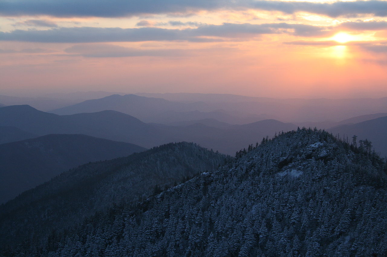
The Great Smoky Mountains along Tennessee's eastern border are among the oldest mountains on Earth, with rocks dating back over 800 million years. Clingmans Dome, at 2,025 meters (6,643 feet), is the highest point in Tennessee and the highest point along the entire Appalachian Trail. The "smoke" that gives the mountains their name is actually a natural hydrocarbon vapor released by the dense vegetation, creating a persistent blue-gray haze.
Cumberland Plateau
The Cumberland Plateau is a broad, flat-topped highland that runs north-south through central-eastern Tennessee, sitting at an elevation of roughly 600 meters above sea level. Its edges are deeply dissected by streams, creating dramatic gorges and waterfalls. The plateau is part of the larger Appalachian Plateau and is underlain by Pennsylvanian-age sandstone and coal-bearing formations.
Fall Creek Falls
Fall Creek Falls drops 78 meters (256 feet) into a deep plunge pool, making it the tallest waterfall east of the Rocky Mountains. Located on the Cumberland Plateau, the falls are surrounded by a rich old-growth hardwood forest. The gorge system around the falls includes three additional significant waterfalls and provides habitat for rare plant species found nowhere else.
Reelfoot Lake
Reelfoot Lake in northwestern Tennessee was formed by the catastrophic New Madrid earthquakes of 1811-1812, some of the most powerful earthquakes in recorded North American history (estimated magnitude 7.5-7.9). The earthquakes caused the Mississippi River to temporarily flow backward, and the resulting land subsidence created this shallow 60 square km lake. It remains the largest natural lake in Tennessee.
Lookout Mountain
Lookout Mountain rises dramatically above the Tennessee Valley near Chattanooga, offering panoramic views across seven states from its summit. The mountain is the southern terminus of the Cumberland Plateau and played a strategic role in the Civil War's "Battle Above the Clouds" in 1863. Ruby Falls, located inside the mountain, is a 44-meter underground waterfall within a limestone cave.
Cumberland Gap
Cumberland Gap is a natural pass through the Cumberland Mountains at the point where Tennessee, Virginia, and Kentucky meet. The gap was formed by an ancient stream that eroded through the mountain ridge. It served as the primary route for westward migration in the late 18th century, with an estimated 200,000-300,000 settlers passing through between 1775 and 1810.
Tennessee River Gorge
The Tennessee River Gorge, often called the "Grand Canyon of Tennessee," stretches 42 km through the Cumberland Plateau near Chattanooga. The gorge walls rise over 300 meters above the river, which cuts through layers of limestone and sandstone. The gorge is home to several rare and endangered plant species that thrive in its unique microclimate.
Key Geographic Facts
- Clingmans Dome at 2,025 m is the highest point in Tennessee
- Tennessee crosses six distinct physiographic regions from east to west
- Fall Creek Falls at 78 m is the tallest waterfall east of the Rocky Mountains
- Reelfoot Lake was formed by the 1811-1812 New Madrid earthquakes
- The Great Smoky Mountains National Park is the most visited national park in the US
Fun Facts
- The "smoke" of the Great Smoky Mountains is actually natural hydrocarbons released by dense vegetation, not water vapor
- The New Madrid earthquakes of 1811-1812 caused the Mississippi River to temporarily flow backward
- The Great Smoky Mountains contain more tree species than all of northern Europe combined
- You can see seven states from the top of Lookout Mountain on a clear day
- Cumberland Gap was so important to westward expansion that it was called the "Gateway to the West"
Final Thoughts
Tennessee offers a remarkable geographic journey from east to west, spanning ancient mountain peaks, broad plateaus, dramatic waterfalls, and earthquake-formed lakes. The state's varied topography supports extraordinary biodiversity and tells a compelling geological story stretching back over a billion years.
Test Your Knowledge!
Think you know your US state geography? Try our interactive quiz!
Play Country Quiz →