

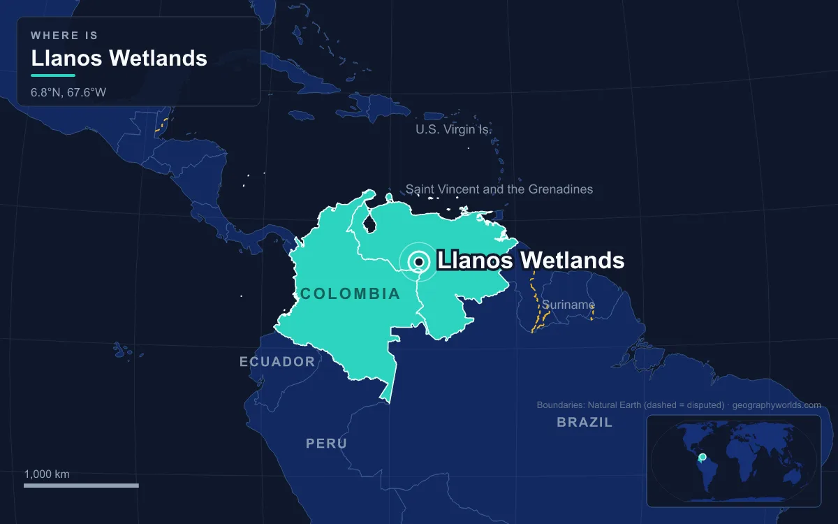
The Llanos is a vast tropical grassland plain east of the Andes in Colombia and Venezuela, covering about 375,800 km² as mapped by the WWF ecoregion and drained by the Orinoco and its tributaries, chiefly the Meta, Apure and Arauca. It is a flat savanna of grass, palm groves and gallery forest that turns into a seasonal wetland every rainy season, from April to November, when water stands up to a metre deep over the low plains. A 2017 assessment found 28 percent of it, about 105,300 km², inside protected areas, including Aguaro-Guariquito National Park (1974) and Cinaruco-Capanaparo National Park (1988) in Venezuela and El Tuparro National Natural Park (1970) in Colombia. The reason it floods so widely lies underground: the Llanos sits in a sinking basin wedged between a 1.7-billion-year-old shield and the rising Andes, and filled with their debris.
The Guiana Shield: A 1.7-Billion-Year-Old Floor
The oldest part of the story forms the plain’s southeastern rim. The Guiana Shield is one of the three cratons of the South American Plate, a Precambrian block about 1.7 billion years old that underlies southern Venezuela, the Guianas and parts of eastern Colombia. Its oldest rocks are the Archean gneisses of the Imataca Complex, whose southern edge is marked by the Guri Fault. Above them, the sandstones and quartzites of the Roraima Group, laid down between about 1.8 and 1.4 billion years ago, now stand up as the tepuis of the Guiana Highlands.
Under the Llanos the same ancient crust continues, but buried. The Colombian part of the plain sits on a Precambrian basement and Paleozoic metasediments, and the Guiana Shield forms the eastern boundary of the Llanos Basin. The basement of the Colombian basin is formed by the westernmost extensions of the shield, and in a few places it breaks the surface: Precambrian remnants stand up as inselbergs such as the Cerros de Mavecure in the far east of Colombia, in the Serranía de la Macarena southwest of the basin and in the tepuis of the Serranía de Chiribiquete to the southeast. Everywhere else the old rock is buried under younger sediment, which is why the plain above it is so flat.
Jurassic Rifts and the Cretaceous Inland Sea
The basin that holds the Llanos started to take shape in the Early Jurassic, when the crust of northwestern South America was stretched and broken into rift basins. Those Mesozoic rifts became the foundation on which the later foreland basin was built.
From the Early Cretaceous until the Eocene, much of what is now Colombia’s Eastern Ranges lay under a long inland sea of northern South America. The rock layers of the Llanos Basin from this time and after now matter commercially: the Gachetá and Los Cuervos formations are source rocks for oil, and the Guadalupe, Mirador and Barco sandstones are reservoirs. Later came the Carbonera Formation, built up in alternating sandy and shaly members; the odd-numbered sandy members hold oil, and the even-numbered shaly ones now act as seals over the fields, along with shales of the Los Cuervos and León formations.
None of this rock is visible on the plain itself, which is covered by much younger river sediment. But it explains why the Llanos is one of the continent’s great oil provinces, and why a grassland famous for cowboys and capybaras is also crossed by pipelines.
Miocene Uplift: How the Andes Made a Sinking Plain
The decisive event came as the Andes rose. The main phase of Andean uplift began about 15 million years ago, driven by the Nazca Plate sliding beneath South America. In Colombia the Eastern Ranges have been rising since Neogene times, while in Venezuela the Cordillera de Mérida, which peaks at Pico Bolívar, 4,978 m, walls the plain to the northwest.
Compression along the Eastern Frontal Fault System, a 921-kilometre fault zone between the mountains and the plain, piled rock into thrust sheets. The weight of the growing mountains pressed the crust down beside them, and the Llanos became a foreland basin: a trough that sinks as the range grows and fills with the debris eroded off it. In Colombia this trough, the Llanos Basin, covers about 96,000 km² of Arauca, Casanare and Meta departments; at the border it grades into the Barinas–Apure Basin on the Venezuelan side. The fault system is still active, and earthquakes in 1827, 1834, 1917, 1967, 1995 and 2008 have been attributed to it.
The uplift also rearranged the continent’s rivers. A 1995 study by Carina Hoorn and colleagues linked Andean tectonics to changing drainage patterns in Miocene northern South America, and the Amazon itself began flowing east to the Atlantic only about 11 to 10 million years ago.

The Meta, the Apure and the Arauca: Rivers That Wander
Into the sinking trough flow rivers loaded with Andean sediment, and they have built the plain’s surface. The Meta rises in the Eastern Ranges, where the Humea, Guatiquía and Guayuriba join, and runs about 1,100 km east-northeast to the Orinoco at Puerto Carreño, draining 103,000 km². Its course follows the line of the Meta Fault, and it splits the Colombian Llanos in two: west of it the plains receive nutrient-rich Andean silt and are wetter, while the high plain or altillanura to the east drains straight to the Orinoco, has a longer dry season and poor soils.
In Venezuela the Apure is the main artery. It forms near Guasdualito from the Sarare and Uribante, most of whose headwaters lie in the Cordillera de Mérida, and flows 1,038 km across the plains past San Fernando de Apure before joining the Orinoco through six braided branches west of Cabruta. Its course across the plains is so sluggish that it is navigable for about 800 km above the Orinoco. To the south, the Apure’s meanders and bayous intermingle with those of the Arauca, which rises above 4,000 m in the Páramo del Almorzadero in Colombia, and between the two rivers lies a wide area flooded every year. Upstream, the Arauca forms 296 km of the Colombia–Venezuela border, and once on the plains it often becomes a braided river, splitting into side channels.
Geologists call the moment a river abandons its channel for a new course an avulsion, a process common where gradients are tiny and sediment is abundant, as on the Llanos. Each flood that tops the banks and each channel that shifts spreads the Andean silt a little further across the plain.
Llano Alto and Llano Bajo: What the Sediment Built
The result is two kinds of savanna, divided by whether they flood. The llano alto, the high plain that stays dry all year, covers roughly two-thirds of the Venezuelan Llanos and much of the Colombian side. Its soils are sandy and poor, and it is covered by tussock grasses 30 to 100 cm high, mostly of the genus Trachypogon, with scattered manteco, chaparro and alcornoque trees growing alone or in woodland clumps called matas.
The llano bajo, the low plain, is the wetland. In the rainy season it floods up to a metre deep, becoming a temporary marsh comparable to the Pantanal of central South America. Its soils are typically richer than those of the high plain. The grass Paspalum fasciculatum dominates, along with the palm Copernicia tectorum. Wetter still are the morichales, seasonally flooded groves of moriche palm, and the vegas, flooded evergreen forests 8 to 20 metres tall along the Orinoco and its tributaries.

Rain decides how much floods. The rainy season runs from April to November, wettest in June and July, and the dry season from December to March. Totals fall from up to 3,000 mm a year in the southwest, near the Andes, to 1,200–1,600 mm in Apure state and 800–1,200 mm in Monagas in the northeast. The mean annual temperature is 27 °C, and the coolest months are only about 2 °C cooler than the hottest.
Capybara Pools and Caiman Water: The Wildlife the Flood Supports
The swing between flood and drought shapes the plain’s animals. The wetlands support around 70 species of water birds, including the scarlet ibis, and a large part of the world range of the sharp-tailed ibis lies here. The capybara, the world’s largest rodent, is common: adults in the Venezuelan Llanos average about 49 kg, and in Venezuela their breeding peaks in April and May, as the rains return.
Reptiles include the spectacled caiman, the green anaconda and the Arrau turtle, which has its own 98.56 km² reserve, the Tortuga Arrau, as well as the critically endangered Orinoco crocodile. The gallery forests hold jaguars, among the largest in the world, with males averaging over 100 kg, alongside pumas, ocelots, tapirs and two species of peccary. Two mammals are found nowhere else: the Llanos long-nosed armadillo and the short-tailed opossum Monodelphis orinoci.

Oil, Cattle and National Parks on the Plain Today
Each layer of the Llanos’ history is now put to use. The layered rocks of the Llanos Basin make it Colombia’s main oil-producing basin, home to four of the country’s biggest fields, including Rubiales, Colombia’s largest, and Caño Limón at the Venezuelan border. On the Venezuelan side, the Orinoco Belt holds extra-heavy crude in oil sands, and Venezuela’s non-conventional deposits, found mainly there, are estimated at about 1,200 billion barrels.
The young river sediments on top have supported cattle since the colonial era, worked by the llaneros, the plainsmen whose culture is often compared with that of the Argentine gauchos. Ranching has changed the land: savannas are burned to clear shrubs, the African grass Melinis minutiflora now covers large areas, and rice fields have replaced some seasonal wetlands. The Guahibo in the west and the Yaruro in the east are the plain’s Indigenous peoples.
Protection follows the same geography. Aguaro-Guariquito, created on 7 March 1974 in southern Guárico state, guards a sample of the central plains; Cinaruco-Capanaparo, also called Santos Luzardo National Park, was decreed in 1988 between the Capanaparo and Cinaruco rivers in Apure; and El Tuparro, created in 1970 in Vichada, is the only protected area of Colombia’s Llanos Orientales in the national parks system, with flooded and non-flooded savannas and the Maipures rapids on the Orinoco. To follow the water downstream to where it meets the Atlantic, read our guide to the Orinoco Delta.