
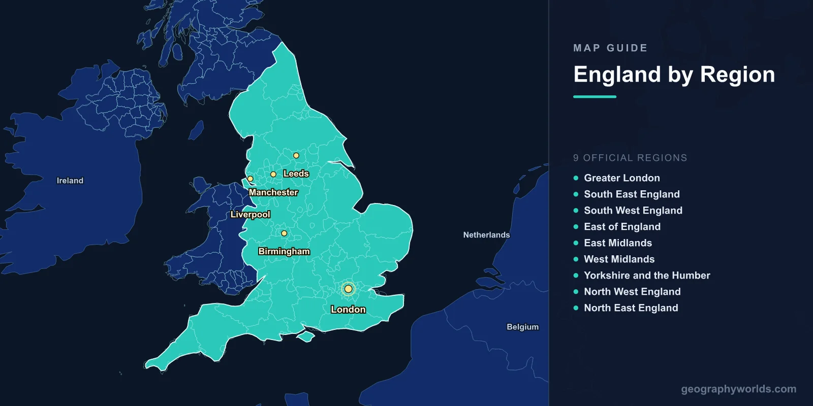
England is the largest and most populous country within the United Kingdom, covering approximately 130,279 square kilometers in the southern and central part of Great Britain. It is divided into 9 official regions, contains 48 ceremonial counties, and is home to major cities including London, Manchester, Birmingham, Liverpool, and Leeds.
Introduction
From the rolling chalk downs of the South to the rugged moorlands of the North, England packs extraordinary geographic diversity into a relatively compact space. Understanding England's map means understanding how its regions, counties, and cities connect to form one of the most historically significant nations on Earth. Whether you are planning a trip or studying British geography, this guide breaks down every major area.

The 9 Official Regions of England
England is organized into 9 official regions, originally created for statistical and administrative purposes. Each has a distinct cultural and economic identity:
- Greater London: The capital region, home to nearly 9 million people, the financial centre of the City of London, Westminster, and iconic landmarks like the Tower of London and Buckingham Palace.
- South East England: Surrounds London and includes Kent (the "Garden of England"), Surrey, Sussex, Hampshire, and the university city of Oxford. It is the most populous region after London.
- South West England: Stretches from Dorset to Cornwall, including the Jurassic Coast, Dartmoor, Exmoor, and the cities of Bristol, Bath, and Exeter.
- East of England: Covers Norfolk, Suffolk, Essex, Cambridgeshire, Bedfordshire, and Hertfordshire. Home to Cambridge University and the flat, fertile Fens.
- East Midlands: Includes Nottinghamshire, Derbyshire, Leicestershire, Lincolnshire, and Northamptonshire. The Peak District National Park sits in its northwest corner.
- West Midlands: Centred on Birmingham, England's second-largest city, with surrounding areas of the Black Country, Coventry, Stoke-on-Trent, and Shropshire.
- Yorkshire and the Humber: Features the Yorkshire Dales, North York Moors, and major cities of Leeds, Sheffield, York, and Hull.
- North West England: Includes Manchester, Liverpool, and the Lake District National Park. A powerhouse of the Industrial Revolution.
- North East England: The smallest region by population, centred on Newcastle upon Tyne, with Hadrian's Wall and the Durham coast.
Major Cities on the Map
- London: Located in the southeast on the River Thames at 51.5°N, 0.1°W. Population ~9 million. Capital of England and the United Kingdom.
- Manchester: In the northwest at 53.5°N, 2.2°W. Population ~550,000 (city), 2.8 million (metro). Historic industrial hub and cultural centre.
- Birmingham: In the West Midlands at 52.5°N, 1.9°W. Population ~1.1 million. England's second city and a major transport hub.
- Liverpool: On the Mersey estuary at 53.4°N, 3.0°W. Famous for its port, music heritage, and two Premier League football clubs.
- Leeds: In West Yorkshire at 53.8°N, 1.5°W. Population ~800,000. A major financial and legal services centre.
Other significant cities include Bristol in the southwest, Newcastle in the northeast, Sheffield and Nottingham in the Midlands, and Cambridge and Oxford as the two great university cities.
Counties of England
England has 48 ceremonial counties, many with origins dating back over a thousand years to Anglo-Saxon times. Some of the most well-known include:
- Yorkshire: The largest historic county, divided into North, South, East, and West Ridings.
- Devon: In the southwest, home to Dartmoor and the English Riviera.
- Kent: The "Garden of England" in the southeast, with the White Cliffs of Dover.
- Cornwall: The far southwest peninsula, with a distinct Celtic heritage and rugged coastline.
- Lancashire: A northwestern county with a proud industrial heritage, separate from its rival Yorkshire.
The county system has evolved significantly over the centuries. Metropolitan counties were created in 1974 for major urban areas, while ceremonial counties preserve the traditional boundaries for Lord Lieutenants and other official purposes.
Physical Geography
- Highest Point: Scafell Pike, 978 m, in the Lake District
- Longest River: River Thames, 346 km
- Largest Lake: Windermere, 14.7 km long
- Coastline: Approximately 3,200 km
England's terrain generally slopes from the mountainous northwest to the flat southeast. The Pennines, often called the "backbone of England," run north to south through the centre of the country. The Lake District in the northwest contains England's highest peaks and most famous lakes. In the south, the chalk downlands of the North and South Downs create the rolling hills of the English countryside.
The country has 10 National Parks: the Lake District, Peak District, Yorkshire Dales, North York Moors, Northumberland, Exmoor, Dartmoor, the South Downs, the New Forest, and the Broads in East Anglia.
Borders & Position
England occupies the southern and central portion of the island of Great Britain. It borders Scotland to the north along the Cheviot Hills and the River Tweed, and Wales to the west along the line of Offa's Dyke. The English Channel separates it from France to the south, while the North Sea lies to the east. The Irish Sea and Bristol Channel bound the northwest and southwest coasts respectively.
At its widest, England stretches approximately 500 km from east to west and 600 km from north to south. The Strait of Dover, at just 34 km, is the narrowest point of the English Channel and the closest approach to continental Europe.
Key Facts
- England has 9 official regions, from Greater London to the North East.
- London, at 51.5°N, is the largest city and capital with nearly 9 million residents.
- There are 48 ceremonial counties, some dating back to Anglo-Saxon times.
- The Pennines run north-south as the "backbone of England."
- England borders Scotland to the north and Wales to the west.
Fun Facts
- No point in England is more than 113 km from the sea.
- The Royal Greenwich Observatory in London defines the Prime Meridian at 0° longitude.
- England has more than 100,000 miles of public footpaths and rights of way.
- The City of London, the historic financial district, is just 1.12 square miles yet generates billions in economic activity daily.
Final Thoughts
The map of England reveals a nation of remarkable geographic variety within a compact area. Its 9 regions each carry distinct landscapes, accents, and cultural traditions. From the granite tors of Cornwall to the Lake District fells, from the flat fenlands of East Anglia to the industrial powerhouses of the Midlands and North, understanding England's geography is key to appreciating its deep and layered history.
Test Your Knowledge!
Think you know where things are on the map? Test your skills!
Play Geography Games →