
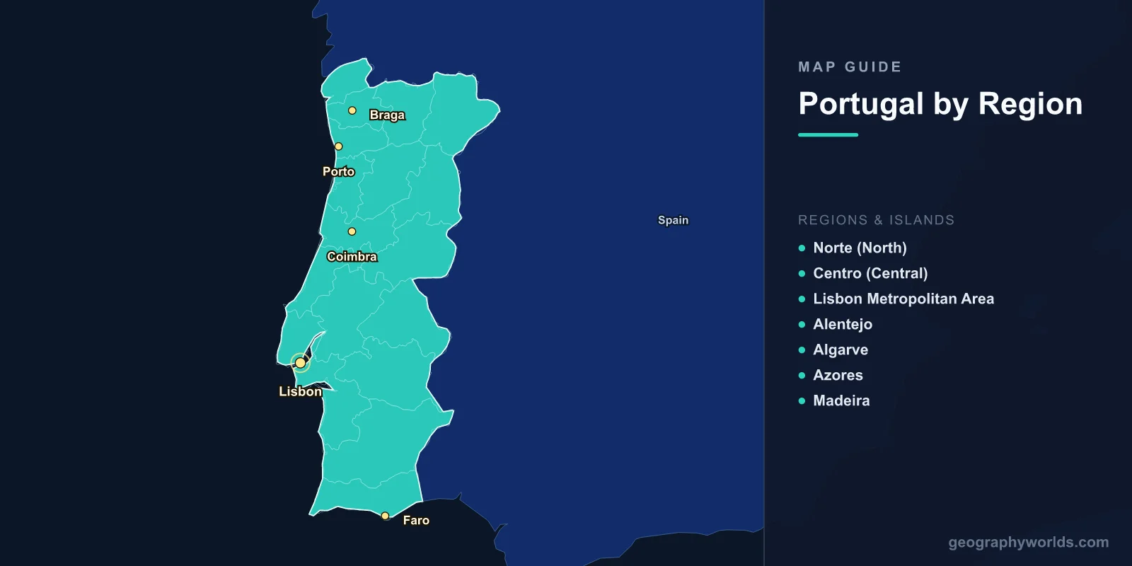
A map of Portugal shows the westernmost country in mainland Europe, stretching 561 km along the Atlantic coast of the Iberian Peninsula. Covering 92,212 km2 (including the Azores and Madeira archipelagos) with a population of 10.3 million, Portugal's map reveals a long, narrow mainland divided by the Tagus River into a mountainous, green north and a flatter, drier south. The country extends far into the Atlantic through its island territories—the Azores (1,500 km west) and Madeira (1,000 km southwest).
Geography of Portugal
Portugal occupies the western edge of the Iberian Peninsula, bordered by Spain to the north and east and the Atlantic Ocean to the west and south. The country's geography transitions dramatically from north to south: the northern half is mountainous and green with abundant rainfall, while the south features rolling plains, Mediterranean-type landscapes, and the dramatic cliff coastline of the Algarve.
The Tagus River (Tejo in Portuguese), the longest river on the Iberian Peninsula at 1,007 km total, enters Portugal from Spain and flows to the sea at Lisbon. It serves as a natural dividing line between the country's two geographic halves. North of the Tagus, granite mountains and deep river valleys dominate; south of it, the landscape flattens into the Alentejo plains and eventually the limestone and sandstone formations of the Algarve coast.
The Serra da Estrela in central Portugal reaches 1,993 m—the highest point on the mainland and the site of Portugal's only ski resort. The mountain contains glacial features including a cirque lake (Lagoa Comprida) that is Portugal's largest natural freshwater lake. On the Azores, Mount Pico reaches 2,351 m—Portugal's absolute highest point and the highest mountain in the mid-Atlantic.
Portugal's mainland coastline of 1,794 km features some of Europe's most impressive beaches and surf breaks. The coast of Nazaré is famous for producing some of the tallest surfed waves in the world, thanks to an underwater canyon that amplifies wave heights. The Algarve's coastline features sea caves, grottos, and sandstone cliffs.

Major Regions
- Norte (North): Mountainous, green, and rainy. Home to Porto (Portugal's second city), the Douro Valley (UNESCO World Heritage wine region), Braga, and Guimarães (birthplace of Portugal). Minho province in the far north is known for vinho verde production.
- Centro (Central): Serra da Estrela mountains, university city of Coimbra (founded 1290), and the Silver Coast (Costa de Prata). Transition zone between the wet north and dry south.
- Lisbon Metropolitan Area: Capital region with 2.9 million people. Built on seven hills along the Tagus estuary. The cultural, political, and economic heart of Portugal. Sintra's palace-dotted mountains and Cascais's coast nearby.
- Alentejo: Portugal's largest region, covering roughly a third of the mainland. Rolling golden plains, cork oak forests (producing over half the world's cork), and sparse population. Medieval hilltop towns like Évora (UNESCO World Heritage Site). Alqueva reservoir is Europe's largest artificial lake by surface area.
- Algarve: Southern coast; Portugal's top tourist destination. Dramatic sandstone cliff formations, sea caves (notably at Ponta da Piedade and Benagil), and over 300 days of sunshine per year. Towns include Faro, Lagos, Albufeira, and Tavira. The Ria Formosa lagoon is a major wetland habitat.
- Azores: Nine volcanic islands in the mid-Atlantic, spanning 600 km. São Miguel is the largest (746 km2). Volcanic calderas, hot springs, tea plantations, and whale watching. Population: 247,000. Subtropical climate.
- Madeira: Subtropical island 1,000 km southwest of Lisbon. Known for its levada (irrigation channel) walking trails through laurel forests (UNESCO World Heritage). Funchal is the capital (105,000). Volcanic terrain rising to 1,862 m at Pico Ruivo.
Major Cities
- Lisbon: 545,000 (city), 2.9 million (metro). Capital at the mouth of the Tagus. One of Europe's oldest cities, predating Rome. The Vasco da Gama Bridge (12.3 km) is the longest in the EU.
- Porto: 240,000 (city), 1.7 million (metro). Portugal's second city on the Douro River. UNESCO-listed historic center. Famous for port wine, produced in Vila Nova de Gaia across the river.
- Braga: 195,000. Portugal's third-largest city and religious capital in the far north. One of the oldest Christian cities in the world.
- Coimbra: 143,000. Home to one of Europe's oldest universities (founded 1290, UNESCO World Heritage Site).
- Faro: 65,000. Gateway to the Algarve. Capital of the southernmost district.
- Funchal: 105,000. Capital of Madeira. Major cruise port in a natural amphitheater-shaped harbor.
Climate
- Northern Portugal: Atlantic maritime; wet and mild. Porto receives about 1,200 mm of rain annually. Temperatures: 5–14°C in winter, 15–25°C in summer.
- Southern Portugal (Alentejo/Algarve): Mediterranean; hot, dry summers (30–40°C in the interior) and mild, wetter winters. The Algarve receives about 500 mm of rain, mostly November–February.
- Lisbon: Transitional Mediterranean; 2,800 hours of sunshine per year. 700 mm of annual rainfall concentrated in winter.
- Azores: Subtropical oceanic; mild year-round (14–22°C). Frequent rainfall and mist, especially in winter. The Azores High pressure system influences weather across the North Atlantic.
- Madeira: Subtropical; warm year-round (16–25°C). North side is wetter; south side (Funchal) is sunnier and drier.
Key Facts About the Map of Portugal
- Cape Roca (Cabo da Roca) is the westernmost point of mainland Europe at 9.5°W.
- Portugal's Exclusive Economic Zone extends 1,727,408 km2 into the Atlantic—the third-largest in the EU.
- The Azores sit where three tectonic plates meet (Eurasian, North American, African) on the Mid-Atlantic Ridge.
- The Alentejo region produces over half the world's cork from its cork oak forests.
- Portugal has 17 UNESCO World Heritage Sites.
- The Douro Valley is the world's oldest demarcated wine region, established in 1756.
- The Vasco da Gama Bridge (12.3 km) in Lisbon is the longest bridge in the European Union.
Final Thoughts
The map of Portugal reveals a compact but geographically diverse nation stretched along Europe's Atlantic frontier. From the granite mountains and green river valleys of the north to the golden plains of the Alentejo and the sun-drenched cliffs of the Algarve, and from there across the ocean to the volcanic Azores and subtropical Madeira, Portugal packs remarkable variety into a relatively small area. Its strategic position at the western edge of Europe made it a launching point for global maritime exploration and continues to define its character as a nation shaped by the Atlantic.
Test Your Geography Knowledge!
Think you know your maps? Try our interactive geography games!
Play Geography Games →