
Melbourne, the capital of Victoria and Australia's second-largest city with a metropolitan population of roughly 5.1 million, is situated at the head of Port Phillip Bay—a large, almost enclosed marine embayment—where the Yarra River meets the sea on the southeastern coast of Australia.
Introduction
The city's geography spans a remarkable variety of landscapes within its metropolitan boundary: basaltic volcanic plains to the west, river flats and gentle hills in the center, and the forested foothills of the Dandenong Ranges to the east. Melbourne is renowned for its changeable weather, encapsulated in the local saying "four seasons in one day," a consequence of its position where cold fronts from the Southern Ocean collide with warm continental air from inland Australia.
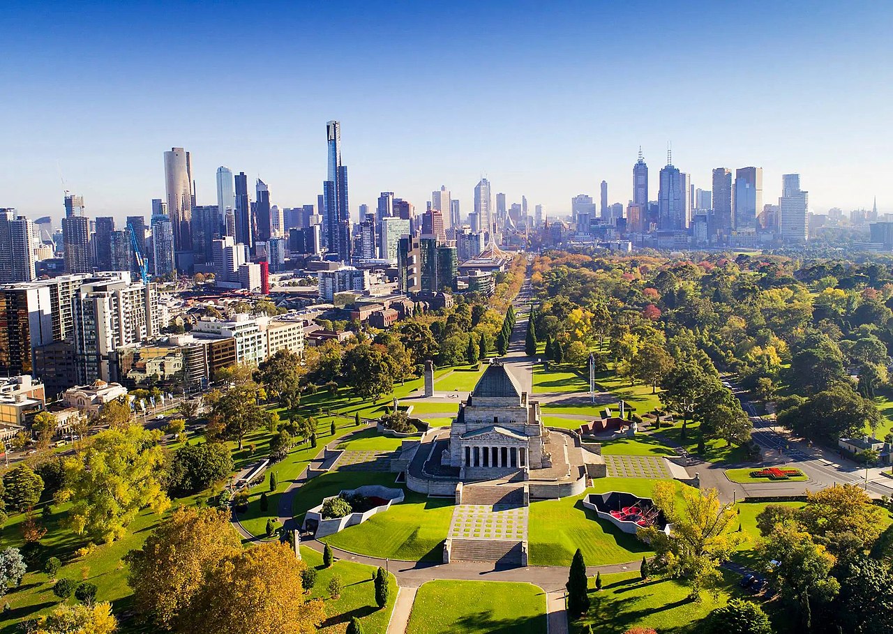
Location & Setting
- Coordinates: 37.8136°S, 144.9631°E
- Elevation Range: 0–633 m (Mount Dandenong)
- Area: 9,993 km² (Greater Melbourne)
- Country: Australia
Melbourne lies at approximately 37.8°S latitude on the coast of Bass Strait, the turbulent waterway separating mainland Australia from Tasmania. The city occupies the northern and eastern shores of Port Phillip Bay, a roughly circular bay covering 1,930 km² but connected to Bass Strait only through the narrow 3.2 km gap of The Rip at Port Phillip Heads—making it almost an inland sea.
The central business district sits on the northern bank of the Yarra River, roughly 5 km upstream from its mouth at Hobsons Bay. The metropolitan area extends over a vast area of nearly 10,000 km², stretching from the You Yangs granite hills in the southwest to the Dandenong Ranges in the east, and from the bay shore northward to the flat plains approaching the Great Dividing Range. This urban sprawl across flat terrain has made Melbourne one of the most horizontally spread cities in the world.
Terrain & Landscape
- Port Phillip Bay: Near-enclosed bay, 1,930 km², max depth 24 m
- Western Plains: Flat basaltic volcanic plains
- Dandenong Ranges: Forested hills to east, peak 633 m
- Yarra Valley: River corridor through central Melbourne
Melbourne's western and northern suburbs sit on the Victorian Volcanic Plain, one of the world's most extensive young volcanic landscapes. These basalt flows, erupted from shield volcanoes and scoria cones between 4.5 million and as recently as 5,000 years ago, create flat to gently undulating terrain with fertile but heavy clay soils. The volcanic heritage is visible in features like the You Yangs, an eroded granite inlier rising 352 m from the plain, and numerous extinct scoria cones.
The eastern suburbs are built on rolling hills of Silurian mudstone and sandstone, rising toward the Dandenong Ranges—a spur of the Great Dividing Range reaching 633 m at Mount Dandenong. These ranges support tall eucalyptus forests, including stands of mountain ash (Eucalyptus regnans), the world's tallest flowering plant. The contrast between the flat, open western plains and the hilly, forested eastern suburbs is one of Melbourne's most distinctive geographic features and has influenced property values and development patterns.
Climate & Weather
- Climate Type: Oceanic/temperate (Köppen Cfb)
- Summer Temps: 15–26°C (December–February)
- Winter Temps: 6–14°C (June–August)
- Annual Rainfall: ~648 mm
Melbourne's climate is oceanic (temperate) with mild summers and cool winters, but it is most famous for its extreme day-to-day variability. The city sits at the boundary between warm, dry continental air from the Australian interior and cool, moist air from the Southern Ocean, and the passage of cold fronts can cause temperature swings of 15–20°C in a single day. A typical summer pattern sees temperatures soar to 35–40°C on a hot northerly wind, then plunge 15°C within an hour as a cold front passes—a phenomenon locals call a "cool change."
Rainfall is moderate and relatively evenly distributed throughout the year, with a slight maximum in late autumn and spring. The western suburbs, on the rain shadow side of the Dandenong Ranges, receive only 450–500 mm, while the ranges themselves receive over 1,200 mm. Despite its reputation for rain, Melbourne actually receives less rainfall than Sydney, Brisbane, or Hobart—what it gets instead is a high number of rainy days (147 per year on average) with generally light totals.
Natural Hazards & Geology
- Bushfire Risk: Extreme; Black Saturday 2009 killed 173 people
- Heat Waves: Temperatures exceeding 45°C possible
- Flood Risk: Moderate; Yarra and Maribyrnong river flooding
- Storm Risk: Severe hailstorms and destructive winds
Bushfire is Melbourne's most devastating natural hazard. The Black Saturday fires of February 7, 2009—Australia's deadliest natural disaster—killed 173 people and destroyed over 2,000 homes in communities on Melbourne's northeastern fringe, driven by temperatures of 46.4°C and erratic winds. The fire risk is greatest in the forested Dandenong Ranges and outer northeastern suburbs where urban development meets dense eucalyptus bushland.
Extreme heat is a growing threat, with climate change increasing the frequency and intensity of heat waves. Melbourne recorded its hottest temperature of 46.4°C during Black Saturday. Flash flooding affects the Yarra and Maribyrnong river systems and low-lying areas across the city. Severe thunderstorms can produce destructive hail and dangerous wind gusts; the November 2016 "thunderstorm asthma" event, triggered by a combination of grass pollen and a storm outflow, caused nine deaths and overwhelmed hospitals.
Rivers & Waterways
- Yarra River: Main river, 242 km, drains 4,000 km²
- Maribyrnong River: Western tributary to Yarra, 57 km
- Werribee River: Western catchment to Port Phillip Bay, 110 km
- Port Phillip Bay: Near-enclosed bay, connected to Bass Strait by The Rip
The Yarra River is Melbourne's principal waterway, rising in the forested Yarra Ranges east of the city and flowing 242 km through the metropolitan area to enter Port Phillip Bay at Hobsons Bay. The upper Yarra catchment provides much of Melbourne's drinking water, stored in a system of reservoirs including the Thomson (1,068 GL), Upper Yarra, and Maroondah dams. Within the city, the Yarra flows past the MCG, Federation Square, and Southbank, and is lined by extensive parkland.
Port Phillip Bay, despite its size (1,930 km²), is remarkably shallow—maximum depth only 24 m, average depth 13 m. The narrow entrance at The Rip creates powerful tidal currents that can exceed 8 knots, making it one of Australia's most dangerous passages. The bay supports important marine ecosystems including the world's largest known population of bottlenose dolphins (over 100 individuals) and significant seagrass beds. The Maribyrnong and Werribee rivers drain the western suburbs and volcanic plains into the bay.
Key Facts
- Port Phillip Bay covers 1,930 km² but connects to Bass Strait through a gap only 3.2 km wide.
- Melbourne's western suburbs sit on volcanic basalt flows as young as 5,000 years.
- Greater Melbourne sprawls across nearly 10,000 km², making it one of the world's most horizontally spread cities.
- The Dandenong Ranges receive over 1,200 mm of rain while western suburbs get only 450 mm.
- The Yarra River catchment supplies much of Melbourne's drinking water from forested mountain reservoirs.
Fun Facts
- Melbourne actually receives less annual rainfall than Sydney, Brisbane, or Hobart despite its rainy reputation.
- Temperature can drop 15°C in under an hour when a "cool change" cold front sweeps through in summer.
- The Victorian Volcanic Plain west of Melbourne is one of the world's most extensive young lava landscapes.
- The Rip at Port Phillip Heads generates tidal currents over 8 knots—strong enough to challenge large ships.
Final Thoughts
Melbourne's geography is a study in contrasts—flat volcanic plains to the west, forested mountain foothills to the east, and the vast enclosed waters of Port Phillip Bay to the south. The city's position at the collision zone between Southern Ocean weather systems and continental air masses creates the famously changeable weather, while its proximity to fire-prone eucalyptus forest makes bushfire an ever-present threat. Understanding Melbourne's diverse physical geography—from ancient volcanic landscapes to modern flood risks—is essential to planning the sustainable growth of Australia's fastest-growing city.
Test Your Knowledge!
Think you know world city geography? Test your knowledge with our interactive games!
Play Geography Games →