

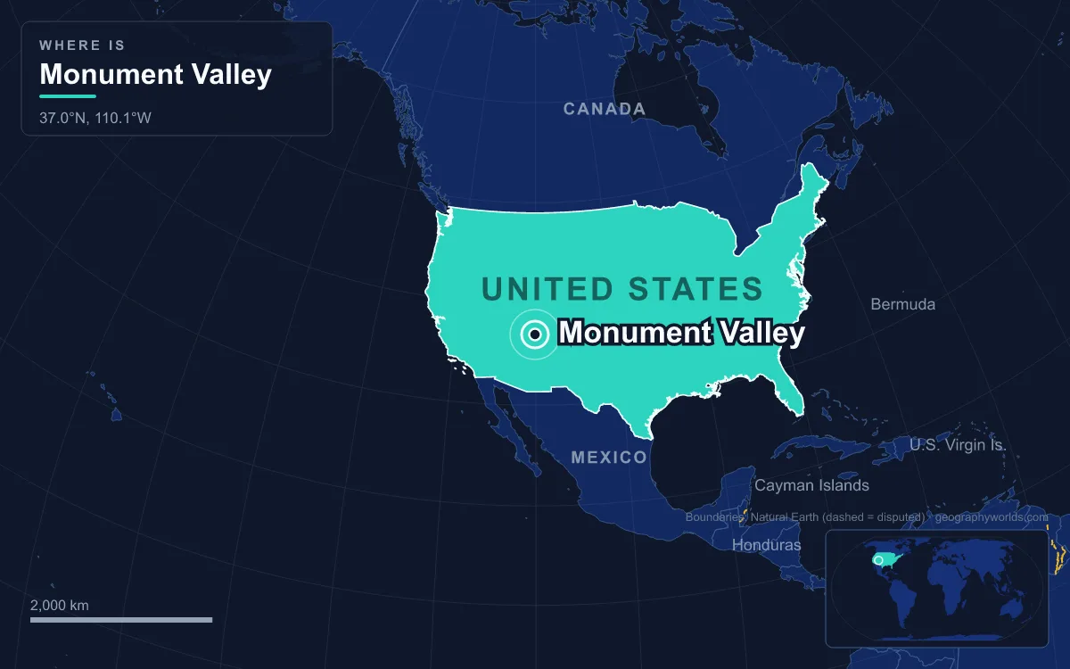
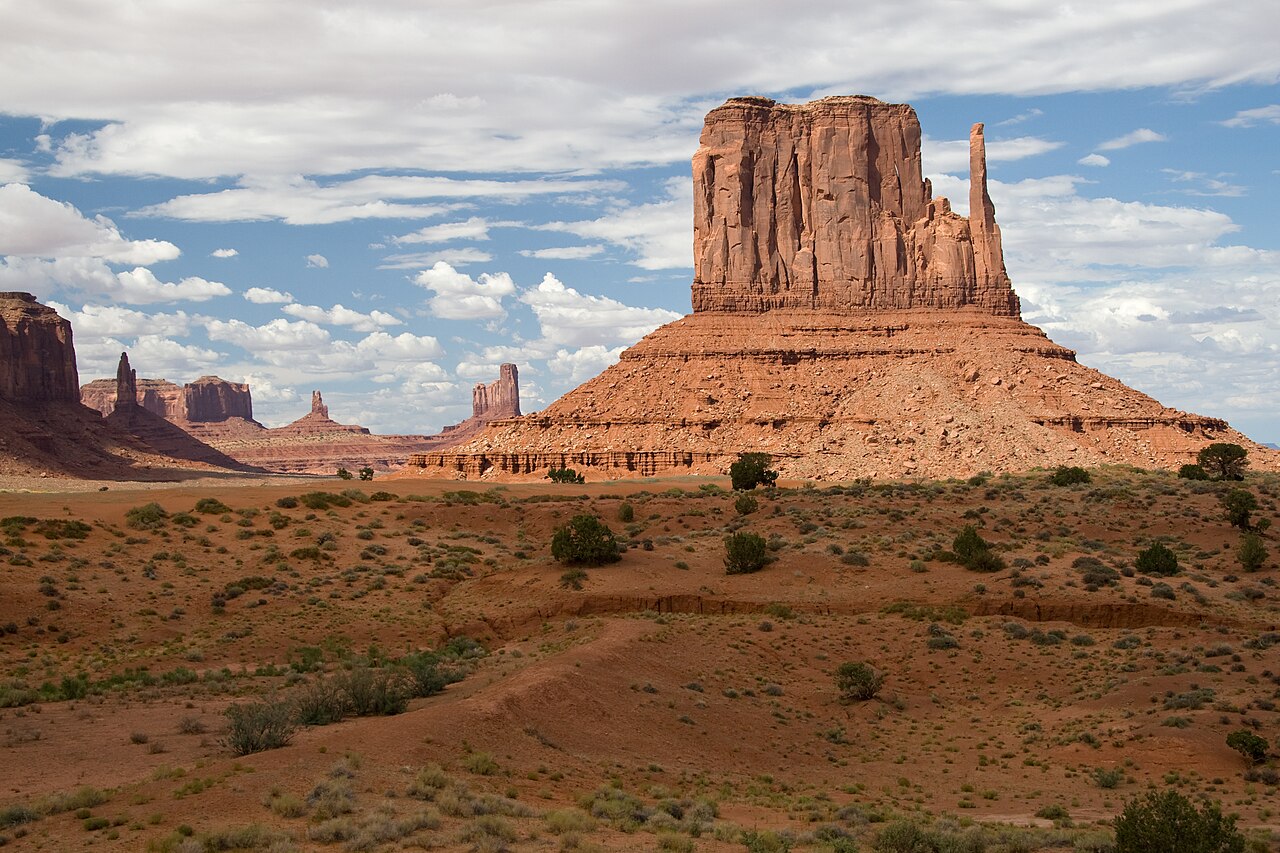
Monument Valley (Navajo: Tsé Biiʼ Ndzisgaii, "valley of the rocks") is a region of the Colorado Plateau on the Arizona–Utah state line, inside the Navajo Nation, where sandstone buttes, the largest reaching 300 m (1,000 ft), rise above a valley floor that lies between 1,500 and 1,800 m (5,000 to 6,000 ft) above sea level. Its geography is a story told in three principal rock layers stacked like a cake: soft red Organ Rock Shale at the base, cliff-forming De Chelly Sandstone in the middle, and on top the Moenkopi Formation capped by Shinarump Conglomerate, all laid down from about 290 million years ago into the Late Triassic. The plateau was then lifted as a single block during the Laramide orogeny, and wind and water stripped away the rock around the hardest remnants, leaving the West and East Mitten Buttes, Merrick Butte and the Totem Pole standing alone.
Reading the valley from the bottom up is the clearest way to understand it, because each layer formed in a different landscape and each now plays a different role in shaping the buttes.
Organ Rock Shale: Mud from the Uncompahgre Uplift, about 290 Million Years Ago
The story begins in the Early Permian, when all of the world's land was joined in the supercontinent Pangaea. To the northeast of today's valley, a range called the Uncompahgre Uplift, part of the Ancestral Rocky Mountains, was rising in what is now western Colorado. Rivers and floods stripped sediment off those mountains and spread it southwest across the lowlands, building the Cutler Group, a stack of red sandstone, siltstone and conglomerate that reached 2,400 m (8,000 ft) thick in places, with its coarsest beds, including granite boulders up to 7.6 m across, near the old mountain front at Gateway, Colorado.
By the time that debris reached the Monument Valley area it had been sorted into fine silt and mud, carried by rivers that spread out and dried up on broad terminal fans in an increasingly arid climate. That deposit is the Organ Rock Formation, or Organ Rock Shale, dated by the layers above and below it to roughly 290 to 272 million years ago. Fossils from it in Arizona, Utah and New Mexico include Dimetrodon, Seymouria and Diadectes, animals that lived long before the first dinosaurs. In Monument Valley the Organ Rock is the dark red-brown siltstone that forms the sloping skirt at the foot of every butte, and the valley floor itself is largely Cutler siltstone or sand weathered from it. Its red colour comes from iron oxide; darker blue-grey streaks on some surfaces come from manganese oxide.
De Chelly Sandstone: A Permian Dune Sea Turned to Cliff
On top of the Organ Rock lies the De Chelly Sandstone, the youngest unit of the Cutler Group and the layer that gives Monument Valley its sheer walls. It was laid down late in the Early Permian, in the Kungurian stage, roughly 280 million years ago, when wind-blown dunes migrated across the region. That origin shows in its massive, cross-bedded structure: the sloping internal lines are the fossilised faces of sand dunes. The same sandstone is exposed at Canyon de Chelly in northeastern Arizona, from which it takes its name.
Well-sorted, cemented dune sand is far tougher than the mudstone beneath it, and that contrast is the engine of the whole landscape. Where the De Chelly survives, it forms near-vertical cliffs; where it has gone, the soft Organ Rock below washes away quickly. In the Mitten Buttes the red cliff that forms each "mitten" is De Chelly Sandstone, and the apron it stands on is Organ Rock Shale.
Moenkopi Mudflats and the Shinarump Caprock of the Triassic
After the Permian came a gap. Erosion removed part of the record, and when deposition resumed in the Early Triassic, around 240 million years ago, the setting was a flat, featureless coastal plain crossed by sluggish rivers. Those rivers and tidal mudflats left the Moenkopi Formation, thin beds of deep red sandstone, mudstone and shale that weather into slopes and benches. On the larger Monument Valley mesas, the Moenkopi forms a crumbly band above the De Chelly cliffs.
Early in the Late Triassic, coarse rivers swept sand and pebbles over the Moenkopi to form the Shinarump Conglomerate, the base of the Chinle sequence. The Shinarump is a hard, well-cemented pebble rock, and it caps only the biggest landforms in the valley. On the perimeter mesas around the valley, the Shinarump still protects the Moenkopi beneath it and the surface above, and the Moenkopi in turn shields the De Chelly cliffs. Hunts Mesa, which forms the valley's southeastern edge, stands at 1,942 m (6,370 ft). Smaller buttes have lost both upper layers and are now held up by the De Chelly alone. Scattered through the Shinarump are deposits of uranium with associated vanadium and copper, which shaped the valley's twentieth-century history.
The Laramide Orogeny Lifts the Colorado Plateau
More rock was piled on top in the Jurassic and Cretaceous, including desert sandstones and, late in the Cretaceous, sediment from a shallow seaway that covered the interior of North America. Then, starting 80 to 70 million years ago, the Laramide orogeny began to push up a broad belt of crust from Montana to Mexico. The Colorado Plateau, probably because its crust was unusually thick, rose largely as a single rigid block rather than being crumpled into mountains. Its layers stayed nearly flat, bending only into gentle folds along ancient faults deep in the basement. One of those broad folds is the Monument Upwarp, on which Monument Valley sits.
Uplift is what made the valley possible. Raising a stack of flat-lying rock high above sea level gave rivers the energy to cut down through it, and over tens of millions of years they removed the Mesozoic layers that once buried the Permian and Triassic rocks now on show.
Agathla Peak and the Navajo Volcanic Field, 25 Million Years Ago
One measure of how much rock has gone comes from volcanoes. Between 26.2 and 24.7 million years ago, more than 80 small volcanoes erupted across Navajo country in what is called the Navajo volcanic field. Most were maar-diatremes, explosive vents where rising magma met groundwater and blasted pipes as much as 1,000 m down into the surrounding rock. Erosion has since removed up to 1,000 m of rock from above them, exposing the roots of those pipes as dark, jagged spires.

Several stand near the southern approach to the valley. Agathla Peak, also called El Capitan (Navajo: Aghaałą́, "much wool"), rises more than 460 m (1,500 ft) above the surrounding land 11 km (7 miles) north of Kayenta, Arizona, and is visible from U.S. Route 163. It is made of volcanic breccia cut by dikes of an unusual potassium-rich rock called minette, dated to about 25 million years ago. Church Rock, 12 km east of Kayenta, is another eroded plug of the same field, and Shiprock in New Mexico is, with Agathla, its most prominent. The Navajo call these vents "black rocks protruding up", and they feature in Navajo creation stories. Because the dikes run in random directions, geologists infer that the plateau was not under strong regional stress when they formed.
Mesa to Butte to Totem Pole: Erosion on the Valley Floor Today
With the overlying rock gone, the valley's present shapes are being carved by the same contrast between hard and soft layers. Water and wind attack the Organ Rock at the base of each cliff; the undermined De Chelly loses its support and breaks away; and the fallen blocks pile up as talus on the slopes. A flat-topped landform wider than it is tall is a mesa, such as Hunts Mesa, Mitchell Mesa and Rain God Mesa. As its edges retreat it becomes a butte, narrower than it is tall, like Merrick Butte, named after the silver miner Jack Merrick, killed in 1880, and the Mittens just to its north. A butte worn down further becomes a spire.
The Totem Pole is the end of that sequence: a slender sandstone spire, the highly eroded remnant of a butte, standing beside a cluster of thicker pillars the Navajo call Yei Bi Chei. It was first climbed on 11 to 13 June 1957 by Bill Feuerer, Jerry Gallwas, Mark Powell and Don Wilson. According to author Ron Hogan, Clint Eastwood and his crew filming The Eiger Sanction (1975) were the last people to climb it, on condition that they cleared old pitons; climbing is now not permitted on Navajo Nation lands.
The climate keeps the process slow but steady. The valley has a high desert climate, with an average of 54 days a year above 32 °C (90 °F), summer highs that rarely pass 38 °C (100 °F), and winter temperatures below −18 °C (0 °F) that are uncommon but possible. Light winter snow usually melts within a day or two.
Uranium, Stagecoach and the Navajo Tribal Park
The geology built the human story too. Between 1945 and 1967, the uranium in the Shinarump Conglomerate drew mining to the southern Monument Upwarp. Long before that, in 1921, Harry Goulding bought 640 acres (260 ha) nearby and in 1928 opened a trading post. During the Great Depression he sent photographs of the buttes to the director John Ford, who shot Stagecoach (1939) there and returned for My Darling Clementine (1946), Fort Apache (1948), She Wore a Yellow Ribbon (1949) and The Searchers (1956). In November 2023 the Navajo Nation bought Goulding's Lodge for $59.5 million.
Today most of the valley's core lies in the Monument Valley Navajo Tribal Park, the Navajo Nation's equivalent of a national park, inside a reservation that covers about 71,000 km² (27,413 sq mi) across Arizona, Utah and New Mexico. Visitors drive a 27 km (17 mile) dirt loop, while Mystery Valley and Hunts Mesa can be reached only with a Navajo guide. The Utah community of Oljato-Monument Valley had 682 residents at the 2020 census. To see how these same layers shape the wider region, read our Colorado Plateau geography guide, compare the valley's shapes with the definitions in what is a butte, or follow the Arizona side further in our guide to landforms in Arizona.