
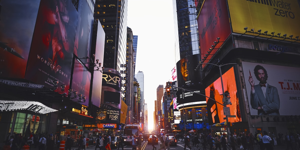
New York City, the most populous city in the United States with over 8.3 million residents, occupies a series of islands and mainland areas at the mouth of the Hudson River where it meets the Atlantic Ocean. The city's five boroughs—Manhattan, Brooklyn, Queens, the Bronx, and Staten Island—span three islands (Manhattan, Staten Island, Long Island), one mainland peninsula (the Bronx), and numerous smaller islands.
Introduction
The city covers 783 km², of which 302 km² is water. New York's geography is defined by its harbor—a deepwater port protected by the Narrows between Brooklyn and Staten Island—and its complex shoreline of over 900 km, the longest of any city in the United States. This watery geography, combined with the solid bedrock of Manhattan, created the conditions for one of the world's great cities.
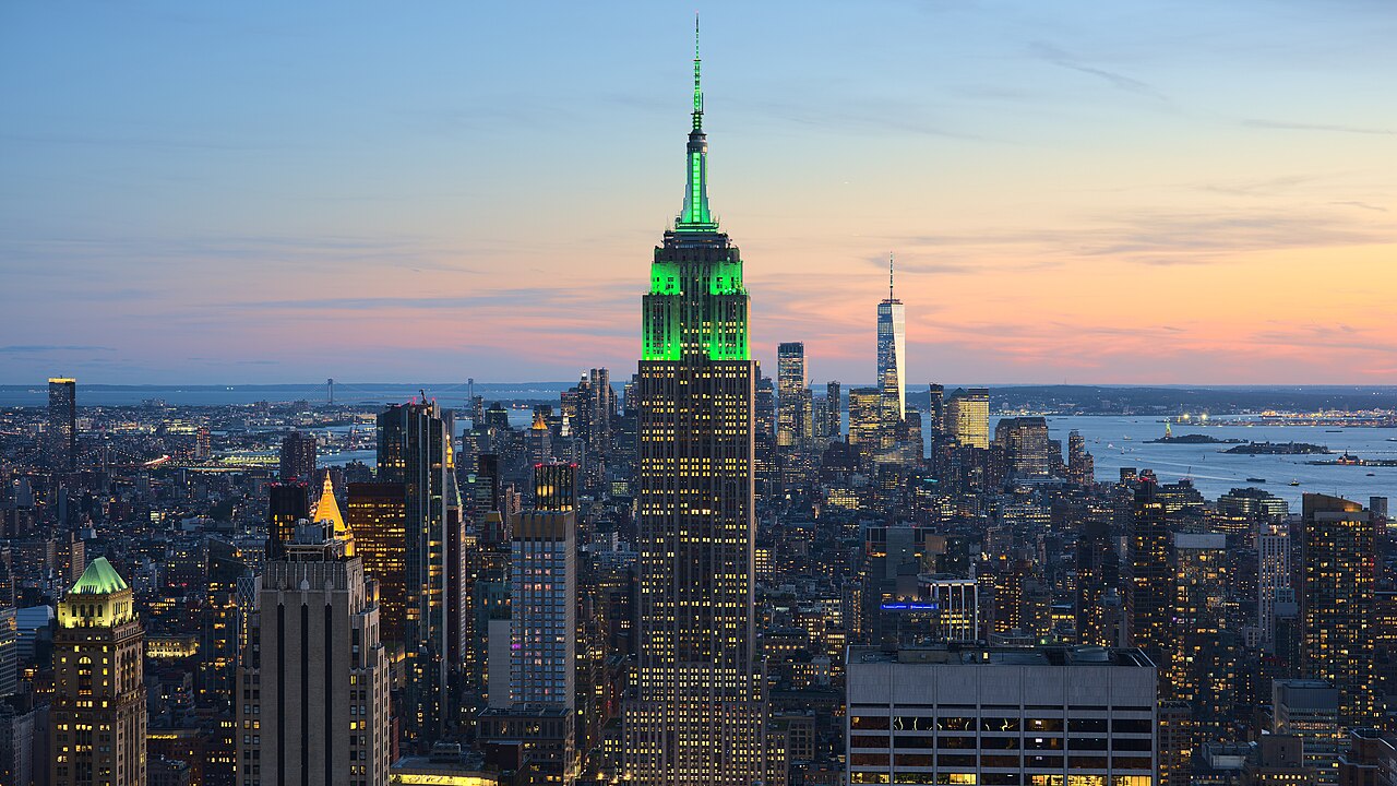
Location & Setting
- Coordinates: 40.7128°N, 74.0060°W
- Elevation Range: 0–125 m (Todt Hill, Staten Island)
- Area: 783 km² (302 km² water)
- Country: United States
New York City sits at the southern tip of New York State where the Hudson River, after flowing 507 km from the Adirondack Mountains, meets the East River (actually a tidal strait) and Upper New York Bay. Manhattan island, the city's dense commercial core, is roughly 21.6 km long and 3.7 km wide at its broadest, flanked by the Hudson River to the west and the East River to the east.
The Upper Bay and Lower Bay, separated by the Narrows—a 1.6-km-wide tidal strait now spanned by the Verrazzano-Narrows Bridge—form one of the world's great natural harbors. This harbor, deep enough for the largest sailing ships and sheltered from Atlantic storms, was the primary reason for New York's rise as America's premier port and gateway for immigration.
Terrain & Geology
- Manhattan Bedrock: Manhattan schist and Fordham gneiss, 450+ million years old
- Highest Point: Todt Hill, Staten Island, 125 m
- Glacial Features: Terminal moraine across Brooklyn, Queens, and Staten Island
- Coastal Type: Drowned river estuary with barrier beaches
Manhattan's famous skyline is made possible by its geology. The island's bedrock—Manhattan schist, a hard metamorphic rock—lies close to the surface in Lower Manhattan and Midtown, providing the solid foundation needed for skyscrapers. Between these two areas, in the Midtown gap (roughly 14th to 30th Streets), the bedrock dips deeper, historically making tall building construction more expensive—though modern engineering has largely overcome this limitation.
The last Ice Age left a dramatic mark on New York's geography. A terminal moraine—a ridge of glacial debris marking the farthest advance of the Laurentide ice sheet roughly 20,000 years ago—runs across Brooklyn, central Queens, and Staten Island. South of this moraine, the landscape is flat sandy outwash plain (visible in southern Brooklyn's Coney Island and the Rockaways). North of it, the terrain is hillier with glacial deposits.
Climate & Weather
- Climate Type: Humid subtropical (Köppen Cfa)
- Average Summer Temp: 22–30°C
- Average Winter Temp: -3–4°C
- Annual Precipitation: ~1,270 mm
New York has a humid subtropical climate with hot, humid summers and cold winters. The city sits at a climatic boundary between the milder mid-Atlantic region and the colder Northeast, meaning winter weather can swing between mild rain and severe blizzards. Summer heat waves, amplified by the urban heat island effect, can push temperatures above 38°C, while winter nor'easters bring heavy snowfall and coastal flooding.
Precipitation is distributed fairly evenly throughout the year, totaling roughly 1,270 mm annually. Tropical storms and hurricanes occasionally affect the city; Hurricane Sandy in 2012 produced a record storm surge of over 4 meters at the Battery in Lower Manhattan, flooding subway tunnels, destroying coastal neighborhoods, and causing 43 deaths in the city. Sea level rise of roughly 30 cm since 1900 has significantly increased the city's flood vulnerability.
Water & Flood Risk
- Hudson River: 507 km, tidal through Manhattan
- East River: Tidal strait, not a true river
- Storm Surge Vulnerability: Low-lying waterfront areas across all five boroughs
- Water Supply: Catskill/Delaware watershed system, 200 km north
New York's 900+ km of coastline makes it extremely vulnerable to coastal flooding and storm surge. Hurricane Sandy in 2012 demonstrated this vulnerability catastrophically, flooding 88 km² of the city and causing $19 billion in damage. Since Sandy, the city has invested billions in coastal resilience, including flood walls, storm surge barriers, and nature-based solutions like restored wetlands and living shorelines.
The city's drinking water comes from a remarkable gravity-fed system of reservoirs in the Catskill Mountains and Delaware River watershed, roughly 200 km north of the city. This system, one of the largest unfiltered surface water supplies in the world, delivers over 3.8 billion liters per day to 9 million people. The pristine watershed is protected by strict land-use regulations rather than filtration, saving billions in treatment costs.
Islands & Coastline
- Manhattan Island: 59 km², the city's commercial core
- Long Island: Brooklyn and Queens occupy its western end
- Staten Island: Largest borough by area, most suburban
- Governors Island: Former military base, now public park
New York is fundamentally an archipelago. Manhattan, the economic heart, is an island connected to the mainland and other boroughs by 21 bridges and 15 tunnels. Brooklyn and Queens occupy the western tip of Long Island, the largest island in the contiguous United States (190 km long). Staten Island, separated from Brooklyn by the Narrows, has a more suburban character with forested parks and salt marshes.
Dozens of smaller islands dot the city's waterways, including Roosevelt Island (in the East River), City Island (a fishing village in Long Island Sound), Governors Island (a former military installation now a public park), and the uninhabited islands of Jamaica Bay. The Jamaica Bay Wildlife Refuge, within the city limits, encompasses 3,700 hectares of salt marsh, open water, and upland habitat—an extraordinary urban wilderness that supports over 330 bird species.
Key Facts
- New York City spans five boroughs across islands and mainland, with over 900 km of coastline.
- Manhattan's skyscrapers are made possible by shallow bedrock of hard schist and gneiss up to 450 million years old.
- A glacial terminal moraine runs across Brooklyn, Queens, and Staten Island, dividing the landscape.
- Hurricane Sandy (2012) flooded 88 km² of the city, causing $19 billion in damage.
- The city's water supply travels 200 km by gravity from Catskill Mountain reservoirs, serving 9 million people.
Fun Facts
- New York has the longest coastline of any city in the United States at over 900 km.
- The East River is not actually a river—it's a tidal strait connecting Long Island Sound to the harbor.
- Jamaica Bay Wildlife Refuge, within NYC limits, supports over 330 bird species.
- Sea level at New York has risen roughly 30 cm since 1900, increasing flood risk dramatically.
Final Thoughts
New York City's geography—its island-and-peninsula layout, deepwater harbor, ancient bedrock, and glacial inheritance—created the conditions for one of the world's most important cities. But the same watery geography that made New York a great port also makes it increasingly vulnerable: with 900 km of coastline and rising seas, the city faces mounting flood risk that Hurricane Sandy previewed in devastating fashion. Understanding New York's physical geography is essential to understanding both its past greatness and its future challenges.
Test Your Knowledge!
Think you know world city geography? Test your knowledge with our interactive games!
Play Geography Games →