
Introduction
North Carolina is a U.S. state covering 139,391 km², with a population of ~10.7 million (9th most populous state). Its capital is Raleigh, and the state features a diverse geographic landscape. Three distinct physiographic regions: the Blue Ridge and Great Smoky Mountains in the west, the rolling Piedmont plateau in the center, and the flat Atlantic Coastal Plain with barrier islands (Outer Banks) in the east Notable geographic features include Great Smoky Mountains, Outer Banks, Blue Ridge Parkway, Cape Hatteras, and Mount Mitchell. The geography of North Carolina has shaped its settlement patterns, economic development, and cultural identity.

Physical Geography
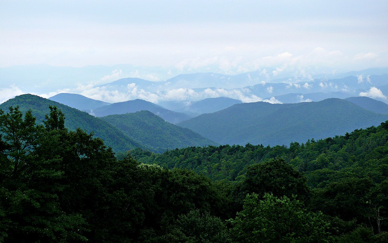
The physical geography of North Carolina encompasses diverse landforms and terrain. Three distinct physiographic regions: the Blue Ridge and Great Smoky Mountains in the west, the rolling Piedmont plateau in the center, and the flat Atlantic Coastal Plain with barrier islands (Outer Banks) in the east The state's mountain systems include Mount Mitchell (2,037 m, highest peak east of the Mississippi River) in the Black Mountains; Clingmans Dome (2,025 m, on TN border); Grandfather Mountain (1,812 m); over 40 peaks above 1,829 m (6,000 ft) in western NC — more than any other eastern state. Major waterways include French Broad River (one of the oldest rivers in the world, flows north), Yadkin-Pee Dee River (435 km), Cape Fear River (only river entirely within NC to reach the Atlantic), Neuse River (443 km), Catawba River, New River (also among oldest rivers in the world). These physical features create distinct geographic regions within the state, each contributing to North Carolina's unique character.
Climate & Weather
North Carolina's climate varies across the state. Humid subtropical in the Piedmont and coast, highland climate in the mountains; coast averages 16°C annually with mild winters, mountains average 10°C with cold winters and heavy snowfall; annual precipitation 1,020 mm in central Piedmont to 2,030 mm in western mountains; hurricane-prone coast These climate patterns directly influence the state's agriculture, outdoor recreation, and daily life for residents across different regions.
Natural Resources & Environment
North Carolina possesses a variety of natural resources and ecosystems. Tobacco (historically leading producer), sweet potatoes (leading US producer), hog farming (2nd in US), poultry, Christmas trees (2nd in US — Fraser fir), lithium (Kings Mountain belt), granite, phosphate The state's ecosystems include Southern Appalachian spruce-fir forests (relict boreal), cove hardwood forests with exceptional biodiversity, Piedmont longleaf pine savannas, Outer Banks maritime forests and dune systems, pocosin wetlands (unique peat-based coastal ecosystems), Great Smoky Mountains old-growth forests (one of the most biodiverse temperate forests in the world) These natural assets support the state's economy and provide habitat for diverse plant and animal communities.
Human Geography
North Carolina has a population of ~10.7 million (9th most populous state), distributed across urban centers and rural communities. Major cities include Charlotte (2.7M metro), Raleigh-Durham (2.1M metro), Greensboro (780K metro), Winston-Salem (680K metro), Asheville (470K metro). The state capital, Raleigh, serves as the center of government. Population distribution reflects the influence of geographic factors on settlement patterns throughout the state's history.
Economy & Industry
North Carolina's economy spans three dramatically different geographic zones. The coastal plain supports tobacco farming (the state's historical economic foundation), sweet potato production (the nation's leader), hog farming (2nd in the US), and commercial fishing along the Outer Banks. The Piedmont Triad and Research Triangle Park in the central region drive technology, pharmaceutical, and biotechnology industries — leveraging the concentration of Duke, UNC-Chapel Hill, and NC State universities. Charlotte has emerged as the second-largest US banking center after New York, driven by its Piedmont location connecting the Southeast. The western mountains support timber, tourism centered on the Blue Ridge Parkway and Great Smoky Mountains, and a growing craft beverage industry, particularly in the Asheville region.
Notable Landmarks
North Carolina's geographic landmarks are among the most varied in the eastern United States. Mount Mitchell at 2,037 meters is the highest peak east of the Mississippi, surrounded by spruce-fir forests that resemble boreal Canada. The Outer Banks — a 320-kilometer chain of narrow barrier islands — include Cape Hatteras, site of the nation's tallest brick lighthouse and the notorious Diamond Shoals that have sunk over 1,000 ships. Jockey's Ridge at Nags Head is the tallest active sand dune on the Atlantic Coast. The Great Smoky Mountains, with their characteristic blue haze, form the most biodiverse temperate forest in North America. Whitewater Falls in Transylvania County drops 126 meters — the highest waterfall east of the Rocky Mountains. The Blue Ridge Parkway winds 755 kilometers through the southern Appalachians.
Geography & Culture
North Carolina's three geographic regions have produced three distinct cultural traditions. The coastal plain and its tobacco and plantation history created a Deep South culture tied to agriculture and Baptist Christianity. The Piedmont's mix of Appalachian migration, textile mill towns, and rapid urbanization produced a complex blend of tradition and ambition visible in the Research Triangle's innovation economy. The western mountains, settled largely by Scots-Irish and German immigrants who bypassed the lowland plantation system, developed an independent highland culture expressed in bluegrass music, craft traditions, and Cherokee heritage. The Great Smoky Mountains remain one of the most visited regions in the country, blending Cherokee cultural tourism with Appalachian storytelling and outdoor recreation traditions.
Key Geographic Facts
- Mount Mitchell at 2,037 m is the highest peak east of the Mississippi River, located in the Black Mountains of western North Carolina
- The Outer Banks barrier islands extend 320 km along the coast and include Cape Hatteras, known as the 'Graveyard of the Atlantic' with over 1,000 shipwrecks
- North Carolina has more than 40 peaks above 1,829 m (6,000 ft), more than any other state east of the Mississippi
- The Great Smoky Mountains are the most visited national park in the US with over 12 million visitors annually
- The French Broad and New Rivers in western NC are among the oldest rivers in the world, predating the Appalachian Mountains themselves
Fun Facts
- The Great Smoky Mountains contain more tree species than all of northern Europe combined — over 100 native tree species
- Cape Hatteras Lighthouse at 64 m is the tallest brick lighthouse in the US and was moved 884 m inland in 1999 to save it from erosion
- Jockey's Ridge at Nags Head is the tallest active sand dune on the Atlantic Coast at about 24-30 m
- Whitewater Falls in Transylvania County drops 126 m, making it the highest waterfall east of the Rocky Mountains