

The Rio Grande (Río Bravo del Norte in Mexico) is the fifth-longest river in North America at approximately 3,051 kilometers, flowing from its source in the San Juan Mountains of Colorado through New Mexico and along the Texas-Mexico border to the Gulf of Mexico. It forms 2,018 kilometers of the international boundary between the United States and Mexico.
Introduction
The Rio Grande is among the most over-exploited rivers in the world. Extensive irrigation and urban water use have reduced it to a fraction of its natural flow, and the river frequently dries up completely in some sections. It is simultaneously a border, a lifeline, a symbol of division, and a shared resource binding two nations together.
Source to Sea
- Length: ~3,051 km
- Source: San Juan Mountains, Colorado (~3,700 m elevation)
- Mouth: Gulf of Mexico, between Brownsville, Texas, and Matamoros, Mexico
The Rio Grande begins as a mountain stream in southwestern Colorado, flowing south through the Rio Grande Rift — a continental rift valley — across New Mexico, past Albuquerque and Las Cruces. At El Paso/Ciudad Juárez, it turns southeast and forms the Texas-Mexico border for over 2,000 kilometers before reaching the Gulf of Mexico.
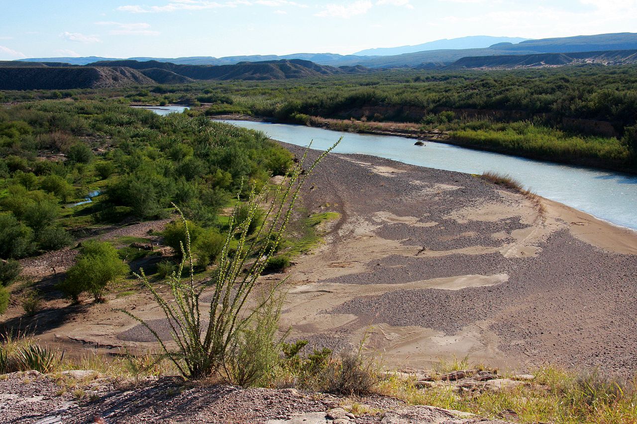
The river's journey through Big Bend National Park in west Texas is one of its most spectacular stretches, with deep canyons carved through limestone mountains. Below the park, the river becomes increasingly dry and shallow as irrigation extractions reduce its flow. In its lower reaches, only water from Mexican tributaries, primarily the Río Conchos, keeps the river flowing.
Geography & Course
- Basin Area: ~472,000 km² (roughly half in each country)
- States/Provinces: Colorado, New Mexico, Texas (US); Chihuahua, Coahuila, Nuevo León, Tamaulipas (Mexico)
- Major Tributaries: Pecos, Devils (US); Río Conchos, Río Salado, Río San Juan (Mexico)
The Rio Grande Basin is shared roughly equally between the United States and Mexico, spanning some of the most arid landscapes in North America. The Chihuahuan Desert, the largest in North America, dominates the basin's midsection. The Río Conchos, entering from Mexico near Presidio/Ojinaga, provides the majority of the Rio Grande's water in its middle section.
The Rio Grande Rift, through which the upper river flows, is an active continental rift where the Earth's crust is slowly pulling apart. This geological feature creates hot springs, volcanic formations, and the distinctive landscape of the Rio Grande valley in New Mexico.
Climate & Hydrology
- Average Discharge: ~95 m³/s at mouth (drastically reduced from natural flow)
- Water Treaties: 1906 Convention and 1944 Water Treaty govern US-Mexico sharing
- Dries Up: River frequently goes dry in sections, especially near El Paso
The Rio Grande has been so thoroughly drained by irrigation and urban use that it is often listed among the world's most endangered rivers. The river frequently dries up completely in the "Forgotten Reach" between El Paso and Presidio, a 300-kilometer stretch that can go without flow for months. Only the contribution of the Mexican Río Conchos revives the river downstream.
The 1906 Convention and 1944 Water Treaty divide Rio Grande water between the United States and Mexico, but both countries struggle to meet their treaty obligations during drought. Mexico has periodically fallen behind on water deliveries from Rio Grande tributaries, causing diplomatic tensions. Climate change projections suggest the basin could receive 20 percent less precipitation by mid-century.
Ecology & Wildlife
- Big Bend: Important refuge for desert and riparian species
- Fish Species: ~90 native species, many threatened
- Endangered: Rio Grande silvery minnow, Big Bend gambusia
The Rio Grande supports remarkable biodiversity in its remaining natural stretches, particularly in Big Bend National Park and the lower Rio Grande Valley. The lower valley is a globally important birding destination, where temperate and tropical species overlap, with over 500 bird species recorded — more than in any other area of comparable size in North America.
The Rio Grande silvery minnow, once abundant throughout the middle Rio Grande, is now one of the most endangered fish in North America, surviving in only a small fraction of its historic range. The Big Bend gambusia, a small fish found only in a single spring near the Rio Grande, is one of the rarest fish species in the world with a population of fewer than 500 individuals.
Human Geography & History
- Population in Basin: ~13 million people
- Border Cities: El Paso/Ciudad Juárez, Laredo/Nuevo Laredo, Brownsville/Matamoros
- Cultural Significance: Central to US-Mexico relations, immigration, and trade
The Rio Grande is one of the most culturally complex rivers in the world, defining the border between two nations with very different economies and political systems. Twin cities straddling the border — El Paso/Ciudad Juárez, Laredo/Nuevo Laredo, McAllen/Reynosa, Brownsville/Matamoros — form interconnected metropolitan areas where millions of people cross the river daily for work, shopping, and family visits.
The river has been a contested boundary since the Treaty of Guadalupe Hidalgo ended the Mexican-American War in 1848. Immigration, drug trafficking, trade, and water sharing all converge at the Rio Grande, making it one of the most politically charged rivers on Earth. Despite these tensions, the shared river also fosters cooperation, with joint environmental initiatives and cultural exchanges flourishing in border communities.
Key Facts
- The Rio Grande is approximately 3,051 km long, forming 2,018 km of the US-Mexico border.
- The river frequently dries up completely in sections due to over-extraction.
- Only about 95 m³/s reaches the Gulf of Mexico — a fraction of its natural flow.
- The lower Rio Grande Valley hosts over 500 bird species, more than almost anywhere in North America.
- The Río Conchos from Mexico provides the majority of the Rio Grande's water in its middle section.
Fun Facts
- The Rio Grande has different names in each country: Rio Grande in the US, Río Bravo del Norte in Mexico.
- The river has changed course many times, leading to the creation of the Chamizal National Memorial, which commemorates the peaceful resolution of a border dispute.
- Big Bend National Park on the Rio Grande is one of the least-visited national parks in the US lower 48 states.
- The lower Rio Grande Valley is where temperate and tropical ecosystems meet, creating extraordinary biodiversity.
Final Thoughts
The Rio Grande is a river caught between two nations and a drying climate. Its waters, once abundant enough to sustain diverse ecosystems and communities on both sides of the border, are now fought over by farms, cities, and countries. The Rio Grande's crisis is a preview of what many rivers worldwide will face as climate change and growing populations compete for shrinking water supplies.
Test Your Knowledge!
Think you know the world's rivers? Test your knowledge!
Play Geography Games →