
The Rio Grande is one of the longest rivers in North America, flowing approximately 3,051 kilometers from its source in the San Juan Mountains of Colorado through New Mexico and along the entire length of the Texas-Mexico border to the Gulf of Mexico. In Mexico, the river is known as the Río Bravo del Norte.
Introduction
The Rio Grande is far more than a physical boundary. It is a cultural corridor where Native American, Spanish, Mexican, and Anglo-American histories intersect. It irrigates millions of acres of farmland, provides drinking water to millions of people on both sides of the border, and is at the center of one of the most complex water allocation disputes in the Western Hemisphere.
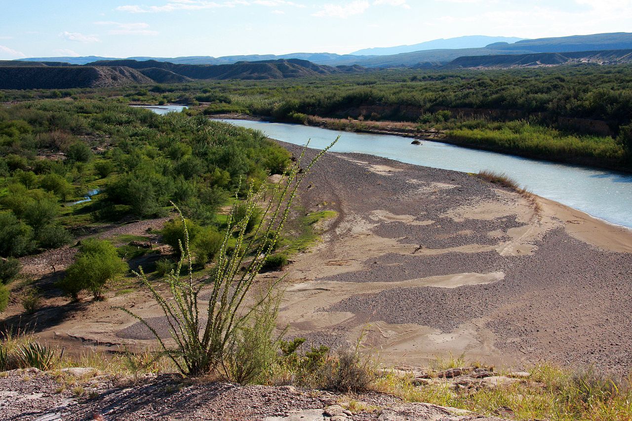
Geography & Course
- Length: 3,051 km (1,896 mi)
- Basin Area: 924,000 km²
- Source Elevation: 3,700 m (San Juan Mountains, Colorado)
The Rio Grande rises in the San Juan Mountains of southwestern Colorado at an elevation of about 3,700 meters. It flows south through the Rio Grande Rift — a continental rift valley that stretches from central Colorado to northern Mexico — passing through Albuquerque and Las Cruces before reaching El Paso-Ciudad Juárez, where it becomes the international border.
Below El Paso, the river flows through increasingly arid terrain. Big Bend National Park in Texas showcases the river's most dramatic landscape, where it has carved deep canyons through limestone mountains. The lower Rio Grande passes through the agricultural Rio Grande Valley before reaching the Gulf of Mexico at Brownsville-Matamoros.
Water Allocation
- US-Mexico Treaty: 1944 (water sharing agreement)
- Rio Grande Compact: 1939 (CO, NM, TX allocation)
- Water Stress: River often fails to reach the Gulf
The Rio Grande is one of the most over-allocated rivers in the world. Water is divided between three US states (Colorado, New Mexico, Texas) under the Rio Grande Compact of 1939, and between the United States and Mexico under the 1944 Water Treaty. Despite these agreements, disputes over water allocation are constant and growing more intense.
The river is so heavily used for irrigation and municipal water supply that in many years it runs dry before reaching the Gulf of Mexico. The stretch between El Paso and Presidio, known as the "Forgotten River," often goes completely dry, with the channel reduced to cracked mud and invasive saltcedar thickets.
Big Bend Region
- Santa Elena Canyon: 457 m deep
- Boquillas Canyon: 366 m deep
- Chihuahuan Desert: Largest in North America
Big Bend National Park, where the Rio Grande makes a sweeping 90-degree turn (the "big bend"), contains some of the most dramatic river scenery in North America. Santa Elena Canyon, with walls rising 457 meters above the river, is a geological masterpiece carved through ancient Cretaceous limestone.
The Big Bend region sits within the Chihuahuan Desert, the largest desert in North America. Despite the aridity, the Rio Grande corridor supports a surprising diversity of life, including over 450 bird species (more than any other national park), mountain lions, black bears, and the unique Big Bend bluebonnet found nowhere else on Earth.
Cultural Significance
- Pueblo Peoples: Lived along the Rio Grande for 2,000+ years
- Spanish Colonization: Camino Real de Tierra Adentro (1598)
- US-Mexico Border: Since 1848 (Treaty of Guadalupe Hidalgo)
Pueblo peoples have lived along the Rio Grande in present-day New Mexico for over 2,000 years, building sophisticated agricultural communities sustained by the river's waters. The Spanish arrived in 1598, establishing the Camino Real de Tierra Adentro trade route along the Rio Grande that connected Mexico City to the northern frontier.
The Rio Grande became the US-Mexico border in 1848 following the Mexican-American War. Today, twin cities like El Paso-Ciudad Juárez, Laredo-Nuevo Laredo, and Brownsville-Matamoros straddle the river, creating a unique binational culture and economy. The border region is one of the fastest-growing population corridors in North America.
Modern Challenges
- Population Growth: ~10 million people depend on the river
- Agricultural Demand: 60-80% of water used for irrigation
- Climate Change: Reduced snowpack and increasing drought
The Rio Grande faces a water crisis driven by population growth, agricultural demand, and climate change. Approximately 10 million people on both sides of the border depend on the river for drinking water, while agriculture consumes 60-80% of the total allocation. Albuquerque, El Paso, and Ciudad Juárez are among the most water-stressed cities in North America.
Climate change is reducing the Rocky Mountain snowpack that feeds the Rio Grande, while higher temperatures increase evaporation. Scientific projections suggest that the river's flow could decline by 25-50% by the end of the century, posing existential questions for the communities, farms, and ecosystems that depend on it.
Key Facts
- The Rio Grande is approximately 3,051 km long, one of the longest rivers in North America.
- The river forms the entire Texas-Mexico border (1,954 km).
- Water allocation is governed by both interstate (1939) and international (1944) treaties.
- The river often runs dry before reaching the Gulf of Mexico due to over-allocation.
- Big Bend National Park has more bird species than any other US national park.
Fun Facts
- In 2001, the Rio Grande's mouth silted closed, physically disconnecting the river from the Gulf of Mexico for the first time in recorded history.
- The Rio Grande was one of the first rivers to be featured in a US postal stamp series on American waterways.
- The river's name means "Great River" in Spanish, while its Mexican name "Río Bravo" means "Fierce River."
- Bats emerging from caves along the Rio Grande in Big Bend form columns visible on weather radar.
Final Thoughts
The Rio Grande is a river defined by scarcity in a land of abundance. Its waters sustain millions of people, irrigate vast farmlands, and nourish a unique borderland culture, yet the river itself is being consumed faster than nature can replenish it. The Rio Grande's future is one of the great water challenges of the 21st century.
Test Your Knowledge!
Think you know your rivers? Try our interactive quiz!
Play Geography Games →