
The Rio Grande is one of the longest rivers in North America, flowing 1,896 miles from its source in the San Juan Mountains of southwestern Colorado through New Mexico and along the Texas-Mexico border to the Gulf of Mexico. Known as the Rio Bravo del Norte in Mexico, it forms 1,254 miles of the international boundary between the United States and Mexico.
Introduction
The Rio Grande is a river in crisis. Overallocation, drought, and climate change have reduced its flow so severely that it frequently dries up entirely in certain stretches. A river that once supported vast wetlands at its delta now rarely delivers water to the Gulf of Mexico, making it one of the most water-stressed rivers in the world.
Geography & Dimensions
- Length: 1,896 miles (3,051 km)
- Drainage Basin: 182,200 sq miles (US + Mexico)
- US-Mexico Border: 1,254 miles
- Source: San Juan Mountains, Colorado (12,000 ft elevation)
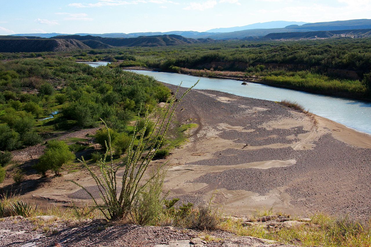
The Rio Grande descends from over 12,000 feet in the Rocky Mountains of Colorado, flowing south through the Rio Grande Rift — a geological feature where the Earth's crust is pulling apart — creating the broad valley that gives New Mexico its characteristic landscape. Below El Paso, the river enters the Chihuahuan Desert and flows through Big Bend, one of the most remote and dramatic river canyons in North America.
Big Bend, where the river curves around the Chisos Mountains, features canyons with walls rising up to 1,500 feet. Below Big Bend, the river receives its last major tributary, the Rio Conchos from Mexico, which now provides more water than the Rio Grande itself. The lower river flows through the subtropical Rio Grande Valley of Texas before reaching the Gulf of Mexico.
Water Rights & Allocation
- Rio Grande Compact: 1938, allocates water among CO, NM, TX
- International Treaties: 1906 and 1944 treaties with Mexico
- Irrigation: Over 2 million acres in US and Mexico
- Depletion: River frequently runs dry in multiple reaches
The Rio Grande is governed by a complex web of interstate compacts and international treaties. The Rio Grande Compact of 1938 divides water among Colorado, New Mexico, and Texas. International treaties of 1906 and 1944 allocate water between the US and Mexico. Together, these agreements allocate more water than the river reliably produces, creating chronic shortages.
Irrigation is the dominant use, consuming over 80 percent of the river's water. The Elephant Butte Reservoir in New Mexico, completed in 1916, stores water for irrigation in southern New Mexico and the El Paso-Juarez metropolitan area. The lower Rio Grande Valley of Texas irrigates citrus, vegetables, and sugarcane. In drought years, farmers face devastating water cuts.
Ecology & Wildlife
- Rio Grande Silvery Minnow: Critically endangered, once abundant
- Big Bend: Mountain lions, black bears, javelinas
- Wetland Loss: Over 95% of riparian habitat lost
- Bird Migration: Key flyway for millions of migrating birds
The Rio Grande silvery minnow, once one of the most abundant fish in the river, is now critically endangered, surviving only in a 174-mile stretch of the middle Rio Grande in New Mexico. Dams, diversions, and channelization have eliminated 95 percent of its historic habitat. Captive breeding programs and managed water releases are keeping the species from extinction.
The lower Rio Grande Valley is one of the most important birding destinations in North America. Located at the convergence of the Central and Mississippi flyways, the valley hosts over 500 bird species — more than almost any other location in the United States. Rare species including the green jay, altamira oriole, and aplomado falcon attract birders from around the world.
Border & Human Geography
- Border Cities: El Paso-Juarez, Laredo-Nuevo Laredo, McAllen-Reynosa
- Population: Over 12 million people in border region
- Immigration: River is iconic symbol of US-Mexico border
- Colonias: Unincorporated settlements lacking basic infrastructure
The Rio Grande border region is home to over 12 million people living in twin cities on either side of the river. El Paso-Juarez, with a combined metropolitan population of over 2.7 million, is the largest binational urban area on the border. The economic and cultural connections between US and Mexican border communities are deep, with hundreds of thousands of legal crossings occurring daily.
The Rio Grande has become an iconic symbol of immigration and border politics. Along its lower reaches, the river is shallow enough in many places to wade across. Despite the political symbolism, the border communities share water, economies, families, and culture across the river, and cooperation between the two countries on water management remains essential.
Challenges & Future
- Climate Change: 20–30% flow reduction projected by 2100
- Groundwater Depletion: Aquifers along the river being drawn down
- Restoration: Efforts to restore flows and riparian habitat
Climate change projections suggest the Rio Grande's flow could decline by 20 to 30 percent by the end of the century due to reduced snowpack, increased evaporation, and longer droughts. The river is already so overallocated that even modest reductions in supply create crises for cities, farms, and ecosystems that depend on it.
Groundwater pumping along the Rio Grande is depleting aquifers that once sustained the river during dry periods. In many areas, the water table has dropped by over 100 feet. Restoration efforts, including managed environmental flows, invasive salt cedar removal, and native riparian planting, are attempting to rebuild some of the river's lost ecological function, but the fundamental challenge of too many users and not enough water remains unsolved.
Key Facts
- The Rio Grande is 1,896 miles long, forming 1,254 miles of the US-Mexico border.
- It is governed by interstate compacts and international treaties that allocate more water than the river reliably produces.
- The river frequently runs dry in stretches of New Mexico and Texas.
- The Rio Grande silvery minnow, once abundant, is now critically endangered.
- The lower Rio Grande Valley supports over 500 bird species.
Fun Facts
- The Rio Grande is called Rio Bravo del Norte ("Wild River of the North") in Mexico — a name that better captures its historic character.
- Big Bend National Park is so remote that it has some of the darkest night skies in the continental United States.
- The river was once so full that steamboats operated on it as far upstream as Albuquerque in the 1880s.
- The Rio Grande's delta on the Gulf of Mexico has largely dried up — what was once a vast wetland is now mostly farmland and dry ground.
Final Thoughts
The Rio Grande is a river that embodies the water crisis of the American Southwest. Once a powerful river that sustained civilizations and ecosystems across 1,896 miles, it has been reduced by overuse, drought, and climate change to a shadow of its former self. Its future — and the future of millions who depend on it — hinges on hard choices about water allocation in an increasingly arid landscape.
Test Your Knowledge!
Think you know America's rivers? Try our interactive quiz!
Play Geography Games →