
San Diego, the eighth-largest city in the United States with approximately 1.4 million residents, occupies 964 square kilometers of Southern California coastline stretching from the Pacific Ocean to the foothills of the Laguna Mountains. The city sits at the southwestern corner of the contiguous United States, with the Mexican city of Tijuana (population 1.9 million) directly across the international border — together they form one of the busiest land border crossings in the world, with over 70,000 northbound crossings daily.
Introduction
San Diego's geography is defined by three elements: its 112 kilometers of coastline, its system of deep canyons that carve the coastal mesas into a series of isolated plateaus, and its consistently mild Mediterranean climate. San Diego Bay, a 56 square kilometer natural harbor protected by the Coronado peninsula, attracted the first European visitors in 1542 and has been central to the city's development as a major naval base and port.
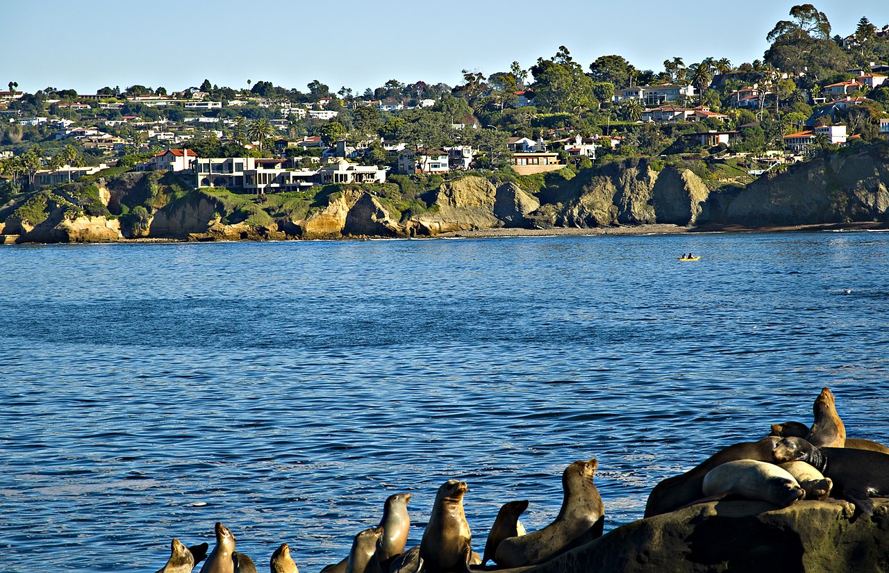
Physical Geography & Terrain
- City Area: 964 km²
- Elevation Range: 0–485 m (Cowles Mountain)
- Coastline: ~112 km
- Terrain: Coastal mesas dissected by deep canyons
- Founding Year: 1769 (Spanish mission)
San Diego's landscape consists of a series of flat-topped mesas (marine terraces) carved by steep-sided canyons that run east-to-west toward the ocean. These canyons — including Mission Valley, Rose Canyon, Chollas Creek, and Tecolote Canyon — were cut by streams draining the mountains to the east during wetter glacial periods. The mesa-and-canyon topography gives San Diego a distinctive character, with neighborhoods isolated on separate plateaus and connected by bridges and canyon-edge roads.
The Cuyamaca and Laguna mountains rise to over 1,800 meters within 60 kilometers of the coast, creating a dramatic transition from Mediterranean scrubland to pine-forested peaks. Cowles Mountain, the highest point within San Diego city limits at 485 meters, offers views spanning from the Pacific coast to the deserts of Imperial County. The San Diego River, the city's primary waterway, flows 84 kilometers from the mountains through Mission Valley to the ocean.
San Diego Bay & Coastline
- San Diego Bay: 56 km²
- Point Loma: Protects bay from Pacific swells
- Coronado: Sandy isthmus/peninsula forming bay's western edge
- Tidal Range: ~1.5 m
San Diego Bay is one of the finest natural harbors on the Pacific coast, protected from ocean swells by Point Loma, a narrow peninsula that rises 128 meters above sea level. The bay's calm, deep waters have made it the primary home port of the US Navy's Pacific Fleet, with Naval Base San Diego being the largest naval complex on the West Coast. Coronado, connected to the mainland by the 3.4 kilometer Coronado Bridge and a narrow sandy isthmus (the Silver Strand), forms the bay's western shore.
The coastline north of the bay features a succession of distinct beach communities — Ocean Beach, Mission Beach, Pacific Beach, La Jolla, and Del Mar — each with its own character. La Jolla, perched on sandstone cliffs above rocky coves, is home to the Scripps Institution of Oceanography, one of the world's leading marine research centers. The La Jolla Submarine Canyon, extending offshore, plunges to depths exceeding 300 meters and creates upwelling that supports rich marine life.
Climate & Weather
- Climate Type: Semi-arid Mediterranean (BSh/Csa)
- Average High (August): 26°C
- Average Low (January): 9°C
- Annual Precipitation: 262 mm
- Sunny Days: ~266 per year
San Diego has the mildest and most consistent climate of any major US city. Average temperatures vary by only 8 degrees Celsius between the coolest and warmest months, and extremes are rare — the all-time high at the downtown station is just 44 degrees Celsius, and frost is virtually unknown along the coast. The city averages 266 sunny days per year, and the marine layer of low clouds that often covers the coast in May and June (locally called "May Gray" and "June Gloom") is the closest thing to unpleasant weather.
Rainfall is scarce, averaging just 262 millimeters annually, concentrated almost entirely in the November-to-March wet season. Some years bring less than 100 millimeters, making water supply a critical issue. San Diego imports roughly 85 percent of its water from the Colorado River and Northern California via aqueducts. The Claude "Bud" Lewis Carlsbad Desalination Plant, the largest in the Western Hemisphere, has operated since 2015, providing about 10 percent of the county's water supply.
Neighborhoods & Urban Geography
- Population: ~1.4 million (city), ~3.3 million (metro)
- Population Density: 1,671/km²
- Key Neighborhoods: Downtown, La Jolla, North Park, Hillcrest, Pacific Beach
- Border Crossing: San Ysidro: busiest land crossing in Western Hemisphere
San Diego's canyon-dissected terrain has created a city of distinct neighborhoods separated by undeveloped green canyons. Balboa Park, a 4.9 square kilometer urban park in the center of the city, contains 17 museums, several performing arts venues, and the San Diego Zoo. The park was set aside as public land in 1868 and is the cultural heart of the city.
The San Ysidro border crossing at the US-Mexico border handles over 70,000 northbound crossings per day, making it the busiest land border crossing in the Western Hemisphere. The cross-border relationship between San Diego and Tijuana is one of the most economically integrated in the world, with billions in trade and hundreds of thousands of daily commuters. The border region has a combined population of over 5 million people.
Economic Geography
- Metro GDP: $272 billion (2023)
- Key Industries: Military/defense, biotech, tourism, tech
- Military: Largest concentration of military in the US
- Tourism: ~35 million visitors annually
San Diego is the most military-concentrated city in the United States. Naval Base San Diego, Marine Corps Air Station Miramar, Marine Corps Base Camp Pendleton (north of the city), and numerous other installations collectively employ over 100,000 active-duty military personnel. Defense spending is the single largest economic driver in the region.
The biotech and life sciences sector is the second major pillar, anchored by the UC San Diego campus, the Salk Institute, and the Sanford Burnham Prebys Medical Discovery Institute in the Torrey Pines area. Over 1,200 biotech and pharmaceutical companies operate in the region. Tourism brings approximately 35 million visitors annually, drawn by the climate, beaches, Balboa Park, SeaWorld, and the San Diego Zoo.
Key Facts
- San Diego covers 964 km² with 112 km of coastline at the US-Mexico border.
- The city's terrain consists of flat mesas carved by deep canyons running toward the ocean.
- San Diego averages 266 sunny days per year and only 262 mm of annual rainfall.
- San Ysidro is the busiest land border crossing in the Western Hemisphere.
- San Diego has the largest concentration of military personnel of any US city.
Fun Facts
- The name "San Diego" was given by the Spanish explorer Sebastián Vizcaíno in 1602, honoring San Diego de Alcalá.
- La Jolla's submarine canyon is deep enough that California gray whales migrate through it within sight of shore.
- San Diego's dry climate preserves historic buildings unusually well — some adobe structures from the 1820s are still standing.
- The Carlsbad Desalination Plant produces 190,000 m³ of drinking water per day from Pacific Ocean seawater.
Final Thoughts
San Diego's geography — a canyon-carved coastline, a superb natural harbor, an international border, and the mildest climate of any US city — has shaped a community that is simultaneously a military stronghold, a biotech hub, a tourist destination, and a binational metropolis. Its limited rainfall and imported water supply are the geographic constraints that will most influence its future, even as its spectacular setting continues to attract residents and visitors from around the world.
Test Your Knowledge!
Think you know American cities? Try our interactive geography quiz!
Play Geography Games →