
Introduction
The subarctic climate, classified as Dfc, Dwc, and Dfd in the Köppen system, is defined by very long, bitterly cold winters lasting six to eight months and brief, cool summers. Average temperatures remain below freezing for more than half the year, and winter lows can plunge below -50°C in the most extreme locations. Despite these harsh conditions, the subarctic zone covers an enormous area of the Northern Hemisphere.
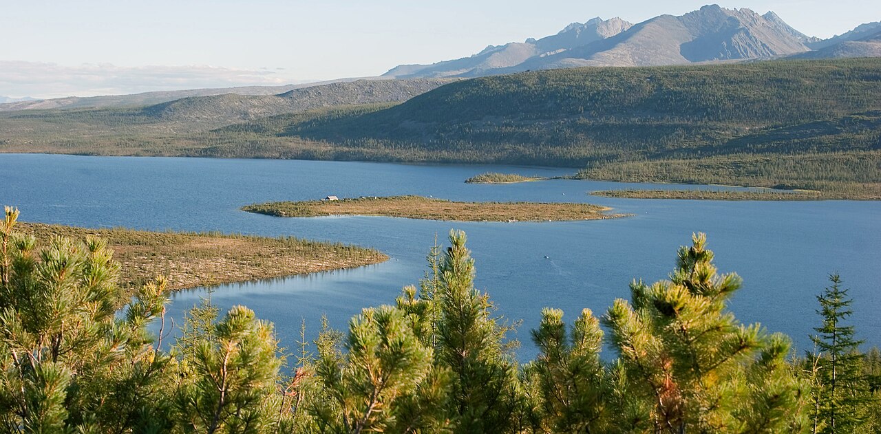
Subarctic climates dominate interior Alaska, most of Canada between 50°N and the treeline, Scandinavia, and the vast expanse of Siberia. This zone coincides with the boreal forest, or taiga, the largest terrestrial biome on Earth. The combination of extreme cold, permafrost, and short growing seasons creates a landscape of remarkable resilience and stark beauty.

Temperature Patterns
- Winter Average: -20 to -40°C (coldest months)
- Summer Average: 10-18°C (warmest month)
- Extreme Low: -67.8°C (Oymyakon, Russia)
- Frost-Free Period: 50-120 days
Subarctic temperatures are defined by extreme cold that persists for the majority of the year. The warmest month averages between 10°C and 18°C, which is enough to support tree growth and distinguishes subarctic from tundra climates. However, winter temperatures routinely drop below -30°C, and the coldest subarctic locations experience temperatures below -60°C.
Oymyakon and Verkhoyansk in Siberia are the coldest permanently inhabited places on Earth, with recorded lows near -68°C. The extreme cold results from the combination of high latitude, continentality, and temperature inversions that trap cold air in valley bottoms. Despite these brutal winters, summers can occasionally reach 30°C or above, giving subarctic regions surprisingly large annual temperature ranges.
Precipitation & Snow
- Annual Precipitation: 200-600 mm
- Snow Cover: 6-8 months continuously
- Snow Depth: Generally moderate (30-100 cm)
- Summer Rain: Brief convective showers
Subarctic regions receive relatively little precipitation because cold air holds very little moisture. Most subarctic areas receive between 200 and 600 millimeters annually, comparable to many semi-arid regions. However, because cold temperatures drastically reduce evaporation, the landscape remains waterlogged and boggy during the brief summer thaw.
Snow covers the ground continuously for six to eight months, though accumulation is generally moderate because the dry, cold air produces light, powdery snowfall. When summer arrives, the snow melts rapidly, feeding countless rivers, lakes, and wetlands. The subarctic zone contains a disproportionate share of the world's freshwater, locked in lakes, rivers, and seasonally frozen ground.
Boreal Forest (Taiga)
- Area: ~17 million km² (largest land biome)
- Dominant Trees: Spruce, pine, larch, birch, fir
- Tree Density: Decreases toward treeline
- Carbon Storage: Stores 30-40% of terrestrial carbon
The boreal forest, or taiga, is the dominant vegetation of subarctic climates and the largest continuous forest on Earth. It stretches in an almost unbroken belt across North America and Eurasia, covering roughly 17 million square kilometers. Coniferous trees dominate because their needle-like leaves and conical shapes shed snow efficiently and resist freezing.
The taiga stores an estimated 30-40% of all terrestrial carbon, much of it locked in the soil and peat beneath the forest floor. This makes the boreal zone one of the most critical ecosystems for global climate regulation. As permafrost thaws and fires increase under climate change, this carbon reservoir is at risk of releasing vast quantities of greenhouse gases.
Permafrost & Hydrology
- Permafrost: Continuous or discontinuous beneath surface
- Active Layer: 0.5-3 m thaws annually
- Thermokarst: Ground subsidence from thawing permafrost
- Lakes: Millions of small lakes dot the landscape
Permafrost — permanently frozen ground — underlies much of the subarctic zone. In the coldest regions, permafrost extends hundreds of meters deep and has been frozen for thousands of years. Only a thin surface layer, called the active layer, thaws during summer, creating a waterlogged landscape of bogs, marshes, and innumerable small lakes.
Climate change is causing widespread permafrost thaw across the subarctic. As ice-rich ground thaws, it collapses and subsides, creating a pitted landscape called thermokarst. This process damages roads, buildings, and pipelines, and releases methane and carbon dioxide stored in the frozen soil. Scientists estimate that subarctic permafrost contains roughly twice as much carbon as the entire atmosphere.
Human Habitation
- Population Density: Very low (less than 1 person/km² in most areas)
- Indigenous Peoples: Inuit, Cree, Evenki, Sami, Yakut
- Economy: Mining, forestry, oil and gas, reindeer herding
- Challenges: Extreme cold, isolation, permafrost damage
Despite the harsh conditions, subarctic regions have been home to indigenous peoples for thousands of years. The Sami of Scandinavia, the Cree and Inuit of Canada, the Evenki of Siberia, and the Yakut of northeastern Russia have developed remarkable adaptations to extreme cold, including specialized clothing, housing, and food preservation techniques.
Modern subarctic economies are dominated by resource extraction: forestry in the boreal belt, mining of minerals and precious metals, and oil and gas production in Alaska, Canada, and Siberia. Climate change is a double-edged sword for these communities, potentially opening new shipping routes and agricultural land while simultaneously undermining permafrost-dependent infrastructure and traditional ways of life.
Key Facts
- The subarctic zone coincides with the taiga, the largest terrestrial biome at ~17 million km².
- Oymyakon, Russia recorded -67.8°C, the lowest temperature in any permanently inhabited place.
- Subarctic permafrost contains roughly twice as much carbon as the entire atmosphere.
- Despite low precipitation (200-600 mm), the subarctic landscape is waterlogged because cold limits evaporation.
- The frost-free period in subarctic zones ranges from just 50 to 120 days.
Fun Facts
- In Yakutsk, Siberia, eyelashes freeze together outdoors and cars must be kept running continuously in winter to prevent engines from seizing.
- The boreal forest produces 25% of the world's commercial timber and paper products.
- Subarctic lakes are so numerous in Canada that the country contains more lake surface area than all other countries combined.
- Larch trees in the Siberian taiga are the only conifers that shed their needles in winter, turning the forest golden in autumn.
Final Thoughts
The subarctic climate creates one of Earth's most extreme inhabited environments, where temperatures plunge below -60°C and winter dominates more than half the year. Yet the boreal forest it supports is the planet's largest land biome and a critical carbon reservoir. As climate change accelerates permafrost thaw and alters fire regimes, the future of the subarctic zone has profound implications for the entire global climate system.
