
Introduction
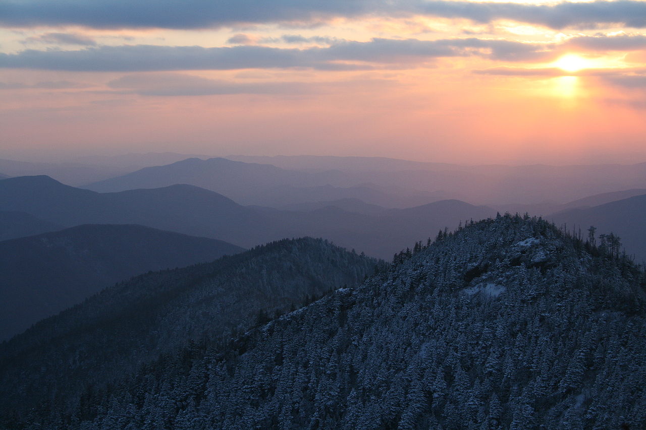
Tennessee is a U.S. state covering 109,153 km², with a population of ~7.1 million (15th most populous state). Its capital is Nashville, and the state features a diverse geographic landscape. Long narrow east-west state with the Great Smoky Mountains and Ridge-and-Valley Appalachians in the east, Cumberland Plateau in the center, Highland Rim surrounding the Nashville Basin, and the flat Mississippi River bottomlands and Gulf Coastal Plain in the west Notable geographic features include Great Smoky Mountains, Cumberland Plateau, Nashville Basin, Reelfoot Lake, and Mississippi River bluffs. The geography of Tennessee has shaped its settlement patterns, economic development, and cultural identity.

Physical Geography
The physical geography of Tennessee encompasses diverse landforms and terrain. Long narrow east-west state with the Great Smoky Mountains and Ridge-and-Valley Appalachians in the east, Cumberland Plateau in the center, Highland Rim surrounding the Nashville Basin, and the flat Mississippi River bottomlands and Gulf Coastal Plain in the west The state's mountain systems include Clingmans Dome (2,025 m, highest in Tennessee) on the NC border in the Great Smoky Mountains; Mount LeConte (2,010 m); Roan Mountain (1,916 m); Cumberland Mountains; Chilhowee Mountain; Great Smoky Mountains have 16 peaks above 1,829 m. Major waterways include Tennessee River (1,049 km total, the largest tributary of the Ohio River, loops through the state twice), Cumberland River (1,106 km), Mississippi River (forms entire western border), Duck River (one of the most biologically diverse rivers in North America), Hiwassee River, Clinch River. These physical features create distinct geographic regions within the state, each contributing to Tennessee's unique character.
Climate & Weather
Tennessee's climate varies across the state. Humid subtropical throughout; warm summers (32°C average highs) and mild winters (4-7°C in January); annual precipitation 1,220-1,520 mm in the east, 1,270 mm in Nashville, 1,370 mm in Memphis; elevation creates cooler temperatures in the mountains; occasional tornadoes; rare ice storms These climate patterns directly influence the state's agriculture, outdoor recreation, and daily life for residents across different regions.
Natural Resources & Environment
Tennessee possesses a variety of natural resources and ecosystems. Zinc (historically a top producer), marble (Tennessee pink marble used in many government buildings), coal (Cumberland Plateau), timber, agriculture (cotton in the west, tobacco, cattle), TVA hydroelectric system (29 dams), freshwater mussels The state's ecosystems include Great Smoky Mountains temperate forest (most biodiverse in North America), Cumberland Plateau sandstone gorges with unique plant communities, cedar glades (globally rare limestone grasslands endemic to the Nashville Basin), Mississippi River bottomland hardwoods, Reelfoot Lake cypress swamp, Appalachian bog complexes These natural assets support the state's economy and provide habitat for diverse plant and animal communities.
Human Geography
Tennessee has a population of ~7.1 million (15th most populous state), distributed across urban centers and rural communities. Major cities include Nashville (2.0M metro), Memphis (1.3M metro), Knoxville (900K metro), Chattanooga (580K metro), Clarksville (310K metro). The state capital, Nashville, serves as the center of government. Population distribution reflects the influence of geographic factors on settlement patterns throughout the state's history.
Economy & Industry
Tennessee's economy is deeply shaped by its central geographic position and diverse terrain. Nashville has emerged as a major healthcare hub — it's home to more healthcare companies per capita than any other US city, including HCA Healthcare. The music industry anchors Nashville's economy, drawing on the city's cultural geography. Memphis leverages its Mississippi River location as a logistics hub; FedEx was founded there in part because of the city's geographic centrality. The Tennessee Valley Authority's 29-dam hydroelectric system, built across the Highland Rim and Appalachian terrain, provides low-cost energy that attracted manufacturing. Tourism centered on Great Smoky Mountains National Park (the most visited in the US) generates over $1 billion annually. Agricultural output includes tobacco, cotton, soybeans, and cattle from the diverse physiographic zones.
Notable Landmarks
Great Smoky Mountains National Park straddles the Tennessee-North Carolina border and is the most visited national park in the United States, with over 12 million annual visitors. Clingmans Dome (2,025 m) offers panoramic views from the highest point on the Appalachian Trail. Reelfoot Lake in the northwest corner is a rare shallow cypress swamp created by the 1811-12 New Madrid earthquakes, where the Mississippi River briefly reversed course. Fall Creek Falls State Park on the Cumberland Plateau features a 78 m free-fall waterfall — the tallest east of the Mississippi. The Ocoee River Gorge hosted the 1996 Olympic whitewater events. The Tennessee River's impoundments created massive TVA reservoirs including Cherokee, Douglas, and Watts Bar lakes that today serve as recreation destinations.
Geography & Culture
Tennessee's three distinct geographic regions — mountains, central basin, and western lowlands — shaped three different cultural identities. East Tennessee's isolated Appalachian valleys produced a fiercely independent, predominantly Scots-Irish culture that largely opposed the Confederacy during the Civil War. Middle Tennessee's Nashville Basin, with fertile limestone soils, developed a plantation culture that later gave rise to country music — a genre rooted in Appalachian fiddle traditions carried westward through mountain gaps. West Tennessee's flat Mississippi bottomlands share the Delta culture of neighboring Mississippi and Arkansas, with deep blues and gospel roots tied to the cotton economy. Tennessee's geographic position as a gateway between the Appalachians and the Deep South made it a crucible of American musical heritage.
Key Geographic Facts
- Tennessee has more documented caves than any other US state, with over 10,000 known caves in its limestone and dolomite bedrock
- The Duck River in central Tennessee is one of the most biologically diverse rivers in North America, with over 50 freshwater mussel species and 150 fish species
- Clingmans Dome at 2,025 m is the highest point on the Appalachian Trail and the highest point in Tennessee
- Reelfoot Lake in the northwest was created by the massive New Madrid earthquakes of 1811-1812, which temporarily reversed the flow of the Mississippi River
- Fall Creek Falls at 78 m is the tallest free-fall waterfall east of the Mississippi River, located on the Cumberland Plateau
Fun Facts
- Tennessee borders eight states — the most of any US state (tied with Missouri): Kentucky, Virginia, North Carolina, Georgia, Alabama, Mississippi, Arkansas, and Missouri
- The Nashville Basin's cedar glades are found almost nowhere else on Earth and contain several plant species that are globally endemic
- The Tennessee River loops into Alabama and then back into Tennessee, meaning the river crosses the state border four times
- Great Smoky Mountains National Park straddles the TN-NC border and contains more tree species (over 100) than all of northern Europe