

The Tyrrhenian Sea is a section of the Mediterranean Sea lying off the western coast of the Italian Peninsula, bounded by the islands of Corsica and Sardinia to the west and Sicily to the south. Covering approximately 275,000 square kilometers, it is the deepest part of the western Mediterranean, reaching 3,785 meters at its deepest point in the Vavilov Plain. The sea takes its name from the Tyrrhenians, the ancient Greek name for the Etruscans.
Introduction
The Tyrrhenian Sea is one of the most geologically active sections of the Mediterranean, home to active volcanoes including Stromboli and Vesuvius, and the volcanic Aeolian Islands. Its shores include some of the most famous coastlines in the world — the Amalfi Coast, the Costa Smeralda of Sardinia, and the rugged shores of Corsica. For millennia, the sea has been a crossroads of Mediterranean civilizations, from Phoenician traders to Roman galley fleets to modern cruise ships.
Geography & Dimensions
- Area: Approximately 275,000 km²
- Maximum Depth: 3,785 m (Vavilov Plain)
- Major Islands: Sardinia, Corsica (France), Sicily, Elba, Aeolian Islands
- Bordering Nations: Italy (primary), France (Corsica)
The Tyrrhenian Sea is roughly triangular, enclosed by the Italian coast from Liguria to Calabria on the east, Sardinia and Corsica to the west, and Sicily to the south. The Strait of Messina (as narrow as 3.1 km) separates it from the Ionian Sea to the southeast. Several narrow passages between Sardinia, Corsica, and the Italian mainland connect it to the Ligurian Sea to the north.
The sea floor is geologically young and complex, featuring deep abyssal plains, underwater volcanoes (seamounts), and areas of active tectonic stretching. The Vavilov and Marsili basins contain oceanic crust — rare in the Mediterranean — created by back-arc spreading behind the Calabrian subduction zone. The Marsili seamount, Europe's largest underwater volcano at over 3,000 meters tall, rises from the central basin.
Volcanoes & Geology
- Active Volcanoes: Stromboli, Vulcano, Vesuvius (near the coast)
- Aeolian Islands: UNESCO World Heritage volcanic archipelago
- Marsili Seamount: Europe's largest submarine volcano
- Tectonic Setting: Back-arc basin behind Calabrian subduction zone
The Tyrrhenian Sea is one of the most volcanically active regions in Europe. Stromboli, in the Aeolian Islands, has been erupting almost continuously for over 2,000 years — earning it the nickname "Lighthouse of the Mediterranean." Vulcano, the island that gave all volcanoes their name, still produces fumaroles and occasional eruptions. Mount Vesuvius on the Bay of Naples, while technically on the coast rather than in the sea, is intimately associated with the Tyrrhenian.
The Marsili seamount, rising from the Tyrrhenian's central basin, is a massive submarine volcano approximately 70 km long and 30 km wide. Scientists have raised concerns about its potential for flank collapse, which could generate a tsunami affecting the densely populated Italian coastline. The Aeolian Islands, designated a UNESCO World Heritage Site for their outstanding volcanic features, attract volcanologists and tourists alike.
Coastal Treasures
- Amalfi Coast: UNESCO World Heritage Site south of Naples
- Costa Smeralda: Sardinia's exclusive resort coastline
- Island of Capri: Iconic island in the Bay of Naples
- Cultural Heritage: Thousands of years of Mediterranean civilization
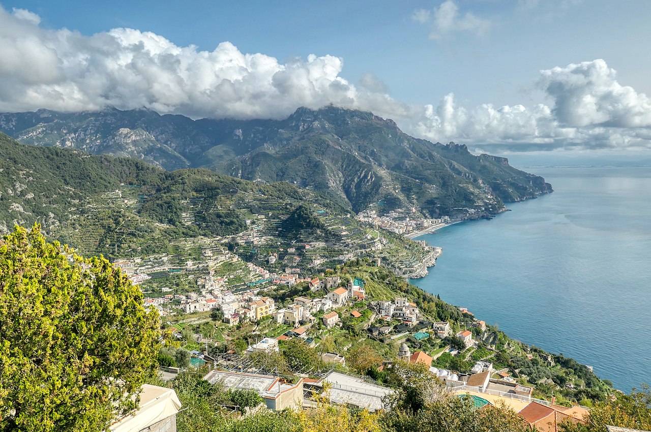
The Tyrrhenian Sea's coastlines are among the most celebrated in the world. The Amalfi Coast, a UNESCO World Heritage Site, features dramatic cliffs plunging into turquoise waters, with picturesque villages like Positano, Amalfi, and Ravello clinging to the mountainside. The island of Capri, with its famous Blue Grotto and luxury tourism, has been a playground for the wealthy since Roman Emperor Tiberius built his villa there.
Sardinia's Costa Smeralda (Emerald Coast) in the northeastern part of the island is renowned for its stunning beaches, crystal-clear waters, and exclusive resorts. Corsica's western coast offers dramatic granite cliffs and secluded coves. Elba, where Napoleon was first exiled, lies in the northern Tyrrhenian. These coastlines collectively support a tourism industry worth tens of billions of euros annually.
Marine Life
- Cetaceans: Sperm whales, fin whales, striped dolphins
- Protected Areas: Pelagos Sanctuary for Mediterranean Marine Mammals
- Posidonia: Extensive seagrass meadows around Sardinia and Corsica
- Threats: Overfishing, pollution, invasive species
The Tyrrhenian Sea supports significant marine biodiversity by Mediterranean standards. The Pelagos Sanctuary, established jointly by Italy, France, and Monaco, protects 87,500 km² of the northwestern Tyrrhenian and Ligurian seas — the world's first international marine sanctuary for marine mammals. The area hosts regular populations of fin whales, sperm whales, Cuvier's beaked whales, and several dolphin species.
Posidonia oceanica seagrass meadows around Sardinia and Corsica are among the best-preserved in the Mediterranean and are critically important as carbon sinks, nursery habitats, and water quality regulators. The Tyrrhenian's deeper waters support diverse fish communities including bluefin tuna, swordfish, and various shark species, though most are severely depleted by overfishing. The Mediterranean monk seal, one of the world's rarest marine mammals, has occasionally been sighted in remote areas of the Tyrrhenian.
Maritime History
- Ancient Routes: Phoenician, Greek, Etruscan, and Roman trade routes
- Naval Battles: Battle of the Tyrrhenian Sea (Alalia, 535 BC)
- WWII: Allied amphibious landings at Salerno and Anzio
- Modern Shipping: Major cruise and ferry routes
The Tyrrhenian Sea has been a thoroughfare of Mediterranean civilization for over 3,000 years. The Etruscans, who gave the sea its name, were accomplished seafarers who dominated its waters before the rise of Rome. Phoenicians and Greeks established trading colonies around its shores, and the Romans turned it into a Roman lake — their primary route for transporting grain from Sicily and Sardinia to feed the capital.
During World War II, the Tyrrhenian was the scene of major Allied amphibious operations, including the landings at Salerno (September 1943) and Anzio (January 1944) during the Italian Campaign. Today, the sea is one of the busiest ferry and cruise ship corridors in the Mediterranean, connecting the Italian mainland to Sardinia, Sicily, Corsica, and the smaller islands.
Key Facts
- The Tyrrhenian Sea reaches 3,785 meters at its deepest point — the deepest in the western Mediterranean.
- Stromboli volcano has been erupting almost continuously for over 2,000 years.
- The Marsili seamount is Europe's largest underwater volcano, and a potential tsunami risk.
- The Pelagos Sanctuary protects 87,500 km² for Mediterranean marine mammals.
- The Amalfi Coast on the Tyrrhenian Sea is one of the most famous coastlines in the world.
Fun Facts
- The island of Vulcano in the Tyrrhenian Sea gave the word "volcano" to every language in the world.
- Stromboli's eruptions have been so regular for millennia that ancient sailors used the glow as a navigational beacon — the "Lighthouse of the Mediterranean."
- The Blue Grotto on Capri was the personal swimming pool of Roman Emperor Tiberius, who had it decorated with marble statues.
- The Tyrrhenian Sea contains oceanic crust — actual new sea floor — making it one of the few parts of the Mediterranean that is technically a young ocean basin.
Final Thoughts
The Tyrrhenian Sea is where natural beauty, geological drama, and human civilization have been intertwined for millennia. From the fire of Stromboli to the elegance of the Amalfi Coast, from ancient Etruscan seafarers to modern cruise ships, the sea remains one of the Mediterranean's most captivating and consequential bodies of water. Its volcanic geology reminds us that this beauty rests on restless foundations — the same forces that created the Tyrrhenian's stunning landscape continue to reshape it today.
Test Your Knowledge!
Think you know the world's oceans and seas? Try our interactive geography quiz!
Play Geography Games →