
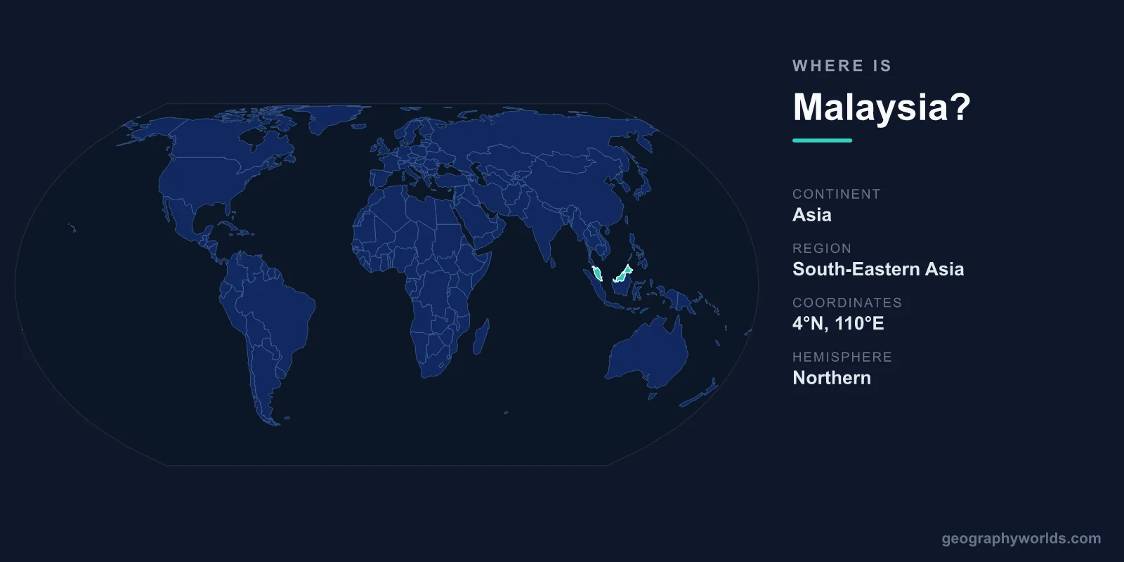
Malaysia is located in Southeast Asia, split into two land masses separated by the South China Sea: Peninsular Malaysia, which hangs off the southern tip of mainland Asia just below Thailand, and East Malaysia (Malaysian Borneo), which occupies the northern third of the island of Borneo. The country covers roughly 330,803 km², its capital is Kuala Lumpur, and it sits just north of the Equator in the Northern and Eastern Hemispheres.
Where Exactly Is Malaysia on the Map?
Malaysia lies between approximately 1 and 7 degrees north of the Equator and between 100 and 119 degrees east longitude. That equatorial position gives the whole country a hot, humid tropical climate year-round, with no true winter or summer and consistent daylight hours. If you trace the world map across Southeast Asia, Malaysia sits south of Thailand and Vietnam, north of Singapore and most of Indonesia, and west of the Philippines.
The two halves of the country are separated by roughly 600 to 700 km of the South China Sea. Peninsular Malaysia, also called West Malaysia, shares the long, narrow Malay Peninsula with Thailand to the north and Singapore to the south. East Malaysia is made up of the states of Sabah and Sarawak on Borneo, the third-largest island on Earth.
The Two Regions of Malaysia
Understanding Malaysia means understanding its divided geography. The two regions feel quite different despite forming one nation.
- Peninsular Malaysia (West Malaysia): Home to most of the population and the capital, Kuala Lumpur. This region also contains the federal administrative center of Putrajaya, the historic port of Melaka, and the island of Penang. A central mountain spine, the Titiwangsa Range, runs down its length with coastal plains on either side.
- East Malaysia (Malaysian Borneo): Made up of Sabah and Sarawak, this region is far less densely populated and dominated by tropical rainforest, winding river systems, and Mount Kinabalu, the country's highest peak at around 4,095 metres.
Which Countries Border Malaysia?
Malaysia's split geography means it has neighbours touching both of its land masses. It shares land borders with three countries:
- Thailand – borders Peninsular Malaysia to the north, across a frontier that spans the width of the peninsula.
- Indonesia – shares a long interior border on the island of Borneo with the Indonesian region of Kalimantan.
- Brunei – a small, oil-rich sultanate almost entirely surrounded by the Malaysian state of Sarawak.
Malaysia also lies extremely close to Singapore, separated only by the narrow Johor Strait and linked by a causeway and a bridge that form one of the busiest border crossings in the world. It faces the Philippines across the Sulu and Celebes Seas and sits near Vietnam across the South China Sea. These connections have made Malaysia a crossroads of trade for centuries, with the Strait of Malacca on its western coast remaining one of the most important shipping lanes on the planet.
Landscape, Coastline, and Climate
Because Malaysia straddles a peninsula and a large island, it has an extensive coastline facing both the South China Sea and the Strait of Malacca. Inland, dense equatorial rainforest covers much of the country, particularly in Borneo, where some of the oldest tropical forests on Earth shelter orangutans, proboscis monkeys, hornbills, and the giant rafflesia flower.
The terrain ranges from coastal lowlands and mangroves to rugged interior highlands. Cooler hill stations such as the Cameron Highlands sit at elevation in the peninsula, while Mount Kinabalu towers over Sabah. The capital, Kuala Lumpur, is famous for the soaring Petronas Twin Towers, once the tallest buildings in the world. To learn more about the country's regions, culture, and travel highlights, see our malaysia country guide.
Quick Facts About Malaysia's Location
- Continent: Asia (Southeast Asia)
- Capital: Kuala Lumpur (administrative center: Putrajaya)
- Total area: roughly 330,803 km², comparable in size to Germany or Japan
- Hemispheres: Northern and Eastern
- Major water bodies: South China Sea and the Strait of Malacca
- Population: approximately 34 million
Frequently Asked Questions
What continent is Malaysia in?
Malaysia is in Asia, specifically the Southeast Asia region. It lies just north of the Equator and is a member of ASEAN alongside neighbours such as Thailand, Indonesia, and Singapore.
Why is Malaysia split into two parts?
Malaysia is divided into Peninsular Malaysia and East Malaysia (Sabah and Sarawak on Borneo) because the modern federation, formed in 1963, brought together the former British territories of Malaya, Sabah, and Sarawak. The South China Sea separates the two regions by several hundred kilometres.
Is Malaysia near Singapore?
Yes. Singapore lies directly south of Peninsular Malaysia, separated only by the narrow Johor Strait. The two are connected by a road-and-rail causeway and a second bridge, making it one of the busiest land crossings in the world.
Where is Kuala Lumpur located?
Kuala Lumpur, Malaysia's capital and largest city, sits in the west-central part of Peninsular Malaysia, near the Strait of Malacca coast. It is the political, financial, and cultural heart of the country.
