
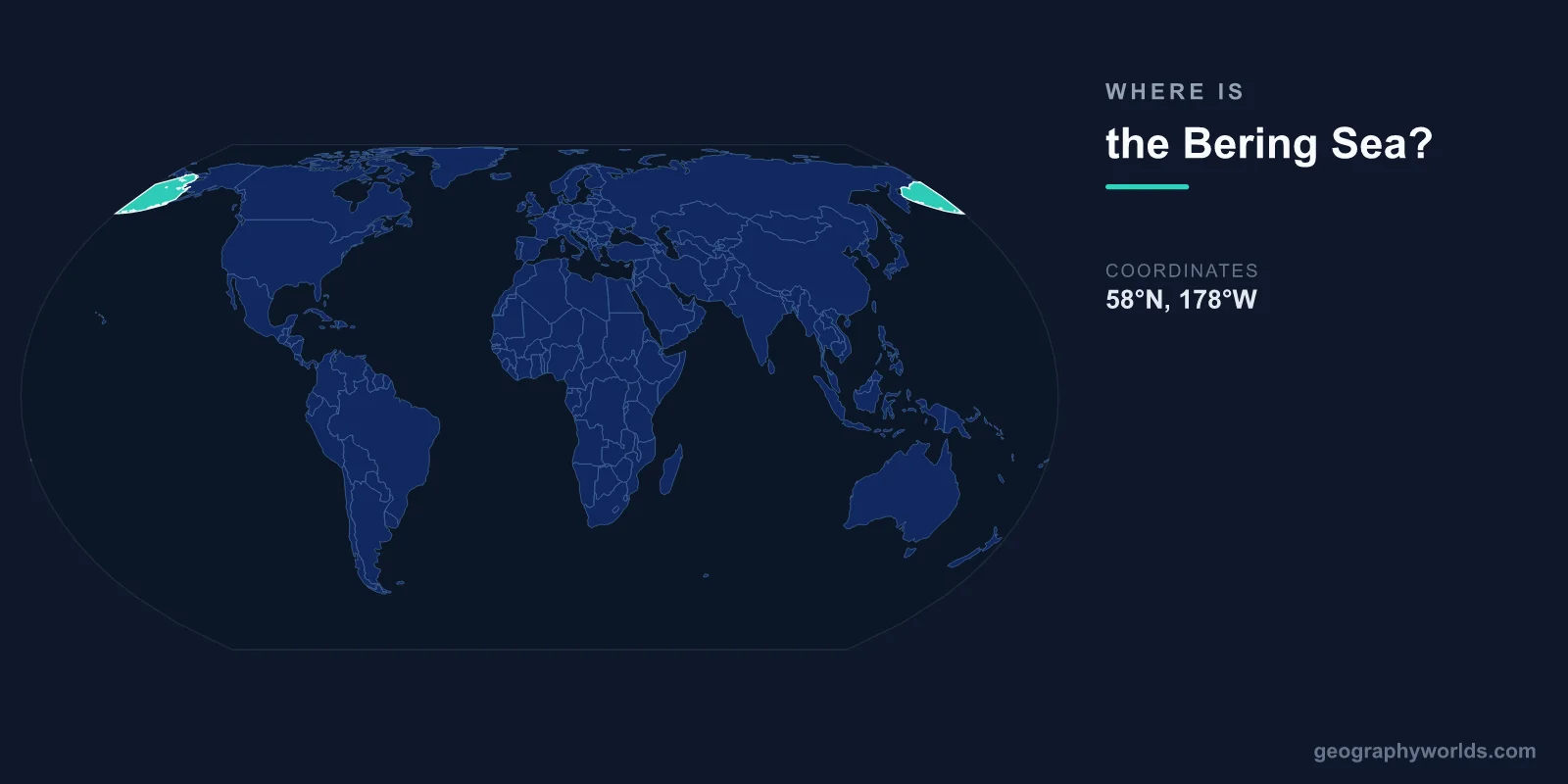
The Bering Sea is located in the northernmost part of the Pacific Ocean, centered at approximately 58°N latitude and 175°W longitude. It separates the continents of North America and Asia, bounded by Alaska to the east, the Russian Kamchatka Peninsula and Siberian coast to the west, and the Aleutian Islands arc to the south.
Introduction
Covering approximately 2,292,000 square kilometers, the Bering Sea connects to the Arctic Ocean through the narrow Bering Strait, only 82 kilometers wide at its narrowest point. This strait is where Asia and North America come closest together, and where the International Date Line passes between the Russian and American Diomede Islands.

Exact Location & Coordinates
- Center Coordinates: 58°N, 175°W
- Region: North Pacific, between Alaska and Russia
- Connected To: Arctic Ocean via Bering Strait, Pacific via Aleutian chain
On a world map, the Bering Sea is found at the top of the Pacific Ocean, in the gap between the easternmost tip of Russia and the westernmost extension of Alaska. The Aleutian Islands chain curves southwestward from Alaska, forming the sea's southern boundary and separating it from the open Pacific.
The easiest way to locate the Bering Sea on a map is to find Alaska, then look west across the water toward Russia. The sea occupies the space between these two landmasses, narrowing to the north where the Bering Strait connects it to the Arctic Ocean.
Surrounding Countries & Borders
- United States (Alaska): Eastern shore
- Russia (Siberia, Kamchatka): Western shore
- Aleutian Islands: Southern arc boundary
Only two nations border the Bering Sea: the United States (Alaska) and Russia. Alaska's western coast, including the Seward Peninsula and the Yukon-Kuskokwim Delta, forms the eastern boundary. Russia's Chukotka Peninsula, Kamchatka Peninsula, and the Commander Islands define the western limits.
The Aleutian Islands, a volcanic archipelago stretching 1,900 kilometers from Alaska toward Kamchatka, create a natural barrier between the Bering Sea and the Pacific Ocean. Passes between the islands allow water exchange, with the major routes being Unimak Pass and Amchitka Pass.
Geographic Context
- Bering Strait Width: ~82 km at narrowest
- Diomede Islands: Only 3.8 km apart (US and Russian)
- Land Bridge: Exposed during Ice Ages as Beringia
The Bering Strait is one of the most geographically significant narrow waterways on Earth. At its narrowest, only 82 kilometers separate Cape Dezhnev in Russia from Cape Prince of Wales in Alaska. The two Diomede Islands in the strait are just 3.8 kilometers apart — Big Diomede belongs to Russia and Little Diomede to the United States.
During the Ice Ages, lower sea levels exposed a vast land bridge called Beringia that connected Asia and North America. This bridge, up to 1,600 kilometers wide, allowed humans to migrate from Asia to the Americas roughly 15,000 to 20,000 years ago. The shallow northern Bering Sea floor is essentially the submerged remnant of this ancient land bridge.
Physical Characteristics
- Area: 2,292,000 km²
- Maximum Depth: 4,151 m (Bowers Basin)
- Average Depth: 1,547 m
- Sea Ice: Seasonal coverage up to 75% in winter
The Bering Sea has a striking division between its shallow northern shelf and deep southern basin. The northern continental shelf, covering roughly half the sea's area, averages only about 50 meters deep — this is the drowned Beringia land bridge. The deep Aleutian Basin in the south plunges to over 4,000 meters.
Sea ice is a defining feature, covering up to 75 percent of the sea's surface during winter and retreating almost completely during summer. This seasonal ice cycle drives one of the most productive marine ecosystems on Earth. The combination of cold, nutrient-rich waters and seasonal mixing creates enormous plankton blooms.
Why It Matters
- Fisheries: Among the world's most productive (pollock, crab, salmon)
- Migration Route: Ancestral human migration from Asia to Americas
- Climate: Critical indicator of Arctic climate change
The Bering Sea supports some of the richest fisheries in the world. Alaska pollock, caught primarily in the Bering Sea, is the single largest fishery in the United States by volume. King crab, snow crab, salmon, and halibut fisheries are also enormously valuable, supporting a multi-billion-dollar industry.
The Bering Sea is also a critical bellwether for climate change. Arctic sea ice extent in the Bering Sea has declined dramatically in recent years, with record-low ice coverage observed multiple times since 2018. This reduction affects marine ecosystems, indigenous communities that depend on sea ice for hunting, and global climate patterns.
Key Facts
- The Bering Sea is centered at approximately 58°N, 175°W between Alaska and Russia.
- It covers about 2,292,000 km² in the northernmost Pacific Ocean.
- The Bering Strait, only 82 km wide, connects it to the Arctic Ocean.
- The ancient land bridge of Beringia once connected Asia and North America across its shallow northern floor.
- Maximum depth reaches 4,151 m in the Bowers Basin.
Fun Facts
- The Diomede Islands in the Bering Strait are only 3.8 km apart but 21 hours apart in time zones.
- During the Ice Ages, a land bridge up to 1,600 km wide connected Asia and North America across the Bering Sea.
- Alaska pollock from the Bering Sea is the most heavily fished species in the United States.
- The Bering Sea is named after Vitus Bering, a Danish explorer in Russian service who crossed it in 1728.
Final Thoughts
The Bering Sea occupies the northern Pacific between Alaska and Russia, centered at approximately 58°N, 175°W. Its narrow strait connecting to the Arctic Ocean was once a land bridge that enabled human migration to the Americas, and today its waters support some of the world's most productive fisheries. As Arctic ice continues to decline, the Bering Sea remains one of the most dynamic and consequential features on the world map.
Test Your Knowledge!
Think you know where things are on the map? Test your skills!
Play Geography Games →