
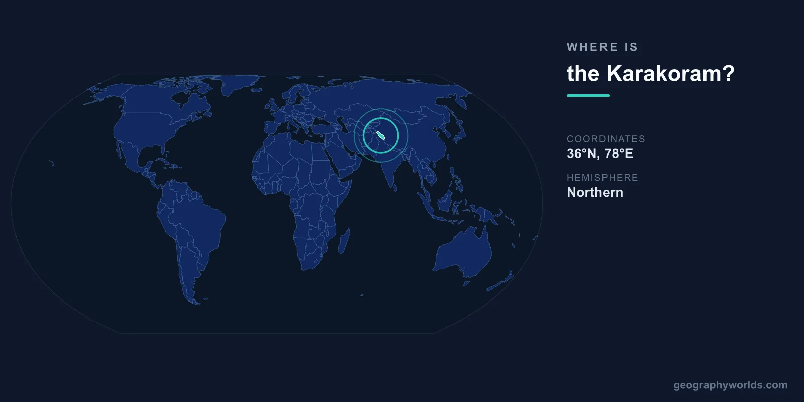
The Karakoram range is located in Central and South Asia, centered at approximately 36°N latitude and 76°E longitude. It extends roughly 500 kilometers across the borders of Pakistan, China (Xinjiang), and India (Ladakh), forming one of the highest and most heavily glaciated mountain regions on Earth outside the polar regions.
Introduction
The Karakoram contains K2 (8,611 meters), the world's second-highest peak and widely considered the most difficult and dangerous of the 8,000-meter mountains to climb. Four of the world's 14 peaks above 8,000 meters are in the Karakoram: K2, Gasherbrum I, Broad Peak, and Gasherbrum II.
Exact Location & Coordinates
- Center Coordinates: 36°N, 76°E
- Region: Central/South Asia (Pakistan, China, India)
- Extent: ~500 km
- K2: 35°52'N, 76°30'E, 8,611 m
On a world map, the Karakoram sits at the junction where Pakistan, China, and India meet. It lies northwest of the Himalayas, separated by the Indus River valley. Find Pakistan's northern tip on a map — the Karakoram occupies the mountainous border zone where Pakistan's Gilgit-Baltistan region meets China's Xinjiang and India's Ladakh.
The Karakoram Highway, one of the world's highest paved international roads, crosses the range between Pakistan and China via the Khunjerab Pass at 4,693 meters. This road follows part of the ancient Silk Road and provides one of the few land connections between South Asia and China.
Surrounding Countries & Borders
- Pakistan: Southern and western Karakoram (Gilgit-Baltistan)
- China: Northern Karakoram (Xinjiang)
- India: Southeastern edge (Ladakh, Siachen Glacier area)
Pakistan contains the most accessible and most visited parts of the Karakoram, including K2 Base Camp, the Baltoro Glacier, and the town of Skardu, which serves as the main gateway for mountaineering expeditions. The Hunza Valley on the Karakoram's western edge is one of Pakistan's most scenic and culturally distinct regions.
China's portion of the Karakoram is largely uninhabited high plateau. India's claim to the southeastern Karakoram includes the disputed Siachen Glacier area, which has been the site of the world's highest-altitude military conflict between India and Pakistan since 1984.
Geographic Context
- Part Of: Greater Himalayan system
- Separated From Himalayas: By the Indus River valley
- Key Glaciers: Siachen (76 km), Baltoro (62 km), Biafo (67 km)
The Karakoram is part of the greater Himalayan orogenic system but is geologically distinct from the Himalayas proper. While the Himalayas were formed by the Indian plate pushing under the Eurasian plate, the Karakoram involves more complex interactions between multiple tectonic blocks. The Karakoram Fault, one of the longest strike-slip faults in Asia, runs along the range.
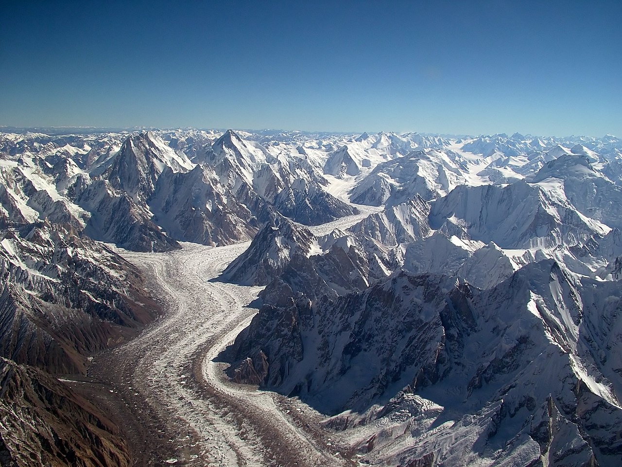
The Karakoram contains the largest concentration of glaciers outside the polar regions. The Siachen Glacier (76 km) is the longest glacier in the Karakoram and the second-longest non-polar glacier in the world. The Baltoro Glacier (62 km) leads to the base of K2 and is one of the most dramatic glacier approaches in mountaineering.
Physical Characteristics
- Highest Peak: K2, 8,611 m (world's 2nd highest)
- 8,000m Peaks: 4 (K2, Gasherbrum I, Broad Peak, Gasherbrum II)
- 7,000m Peaks: Over 60
- Major Glaciers: Some of the longest non-polar glaciers on Earth
The Karakoram has a higher average elevation than the Himalayas, with a greater concentration of high peaks in a compact area. Besides the four 8,000-meter peaks, there are over 60 peaks above 7,000 meters. The Karakoram's peaks are known for their steepness and technical difficulty, making them among the most challenging in the world for climbers.
K2 is called "The Savage Mountain" for good reason — it has a fatality rate of roughly 1 in 4 climbers who attempt the summit, far higher than Everest. The mountain was not successfully climbed in winter until 2021, when a Nepalese team reached the summit in January. Its pyramidal shape and extreme weather make it perhaps the ultimate mountaineering challenge.
Why It Matters
- Mountaineering: Home to K2, the ultimate mountaineering challenge
- Water Source: Glaciers supply the Indus River system
- Geopolitics: Disputed territory between Pakistan, India, and China
The Karakoram's glaciers are the primary water source for the Indus River, which flows through Pakistan and sustains over 200 million people with irrigation water. The glaciers of the Karakoram are anomalous in that some have been growing or remaining stable in recent decades, unlike most of the world's glaciers — a phenomenon known as the "Karakoram anomaly."
Geopolitically, the Karakoram is one of the most contested mountain regions in the world. The Siachen Glacier has been occupied by Indian and Pakistani military forces since 1984 in the world's highest-altitude conflict. The China-India border in the eastern Karakoram (Aksai Chin) is also disputed. The Karakoram Highway represents a major Chinese infrastructure investment connecting to Pakistan.
Key Facts
- The Karakoram is centered at approximately 36°N, 76°E across Pakistan, China, and India.
- K2 at 8,611 m is the world's second-highest peak and most dangerous 8,000-meter mountain.
- The range contains 4 of the world's 14 peaks above 8,000 meters.
- It holds the largest concentration of glaciers outside the polar regions.
- The Siachen Glacier (76 km) is the second-longest non-polar glacier on Earth.
Fun Facts
- K2 was not climbed in winter until 2021 — the last 8,000-meter peak to be summited in winter.
- K2's fatality rate of roughly 1 in 4 climbers makes it far deadlier than Everest.
- The "Karakoram anomaly" refers to some glaciers here actually growing while most global glaciers shrink.
- The Karakoram Highway, at up to 4,693 m, is one of the highest paved international roads in the world.
Final Thoughts
The Karakoram range lies at the junction of Pakistan, China, and India at approximately 36°N, 76°E, containing K2 and three other 8,000-meter giants in a compact region of extreme altitude and glaciation. Its combination of the world's most challenging mountains, the longest non-polar glaciers, and active geopolitical disputes makes it one of the most dramatic and consequential features on the world map.
Test Your Knowledge!
Think you know where things are on the map? Test your skills!
Play Geography Games →