

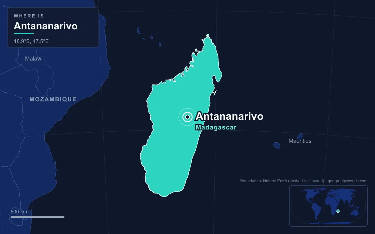
Antananarivo, whose name means "City of the Thousand", is the capital and largest city of Madagascar. It sits on a Y-shaped rocky ridge in the Central Highlands, about 1,280 metres above sea level, 160 kilometres from the east coast and 330 kilometres from the west. The 2018 census counted about 1.27 million people inside the city limits and nearly 2.3 million in the wider urban area, close to a tenth of the country's population. Most people call it Tana. It has been the island's largest city since at least the late 18th century, and its people explain its shape better than any landmark does. Royal decrees told nobles, commoners and slaves which hills they could live on. Later came missionaries and craftsmen, then French planners, then Indian and Chinese merchants, and now a steady flow of rural migrants.
The Vazimba, King Andrianjaka and the Thousand Soldiers of Analamanga
Before it was a capital, the hilltop was a village called Analamanga, "Blue Forest", held by the Vazimba. Popular belief holds them to be the island's first inhabitants, descended from seafarers from maritime South-East Asia, although how and when Madagascar was first settled is still debated. In the highland forest they cleared land by slash-and-burn to grow bananas, tubers and ginger, and lived in villages ruled by chiefs and later kings. The Merina arrived in the highlands around the 15th century, and Andrianjaka himself had come from the south-east coast.
Around 1610, or 1625 in some accounts, the Merina king Andrianjaka drove the Vazimba off Analamanga. According to oral history he took and held the hill with a garrison of 1,000 soldiers. He built a rova, a fortified royal compound, on the summit. Over the next two centuries it grew into the palace complex whose largest building, Manjakamiadana, still dominates the skyline. King Andriamasinavalona (1675–1710) later renamed the city Antananarivo in honour of those soldiers. He also laid out the Andohalo square outside the town gate, where every later sovereign made public speeches.
Early Merina kings also shaped the land below the ridge. Using fanampoana, compulsory unpaid labour, they built irrigated paddies and dikes to feed the growing city. The largest of these, the Betsimitatatra rice plain west of the ridge, is still farmed. When Andriamasinavalona died in 1710 his kingdom broke into four warring parts. Antananarivo became capital of only the southern quarter until King Andrianampoinimerina of Ambohimanga took it in 1793. He moved the capital back in 1794 and made Ambohimanga, about 24 kilometres to the north-east, the kingdom's spiritual capital. He also started a market at Analakely in the valley and made Friday, Zoma, the market day. The valley is still the city's commercial centre.

Andriana, Hova and Andevo: How the Merina Castes Drew the Map
Merina society was divided into andriana (nobles, themselves split into ranked sub-castes), hova (free commoners) and andevo (slaves). Andriamasinavalona gave each group its own territory, both inside the city and in the surrounding countryside. Members of a sub-caste had to live in their assigned area and could not stay long in areas reserved for others. There were also fady, or taboos: non-nobles could not build wooden houses, and pigs were banned inside the city limits.
La haute ville: nobles closest to the palace
The highest-ranking nobles lived nearest the Rova, and elevation still follows that old hierarchy. The upper town, or haute ville, is mainly residential and remains a prestigious address for many of the city's wealthiest and most influential Malagasy families. It contains most of the city's pre-colonial heritage. That includes the royal palace, the Andafiavaratra Palace built in 1873 for Prime Minister Rainilaiarivony, the old Andohalo square and 19th-century houses of Merina nobles.
La ville moyenne and la ville basse: commoners and the descendants of slaves
Under the Kingdom of Madagascar, hova families settled on the lower slopes around the noble districts. That middle town, the ville moyenne, now includes Antaninarenina, Isoraka and Ankadifotsy. The lower classes, including people descended from the andevo, lived on the flood-prone flats beside the rice fields to the west. They still do. Isotry, Anosy and the planned district known as "67 Hectares" are among the city's densest and poorest neighbourhoods. About 40 percent of lower-town households with electricity get it by illegally tapping power lines. Those areas also face the worst fires, floods and landslides in the cyclone season. The monarchy fell in 1897, but those old divisions still show on the city map.
Missionaries, Craftsmen and Merchants After 1820
By 1810, when Radama I became king, Antananarivo had over 80,000 people and was the biggest and richest city on the island. Radama let in the first Europeans to settle there. They were artisan missionaries of the London Missionary Society, who arrived in 1820 and opened the city's first public schools. One of them, James Cameron, introduced brick-making and created Lake Anosy to supply water power for workshops. Radama's campaigns brought about two-thirds of the island under Merina rule, and British diplomats recognised him as "ruler of Madagascar".
Jean Laborde and the trano gasy
Under Queen Ranavalona I, a shipwrecked Frenchman named Jean Laborde became the monarchy's chief engineer. He built the tomb of Prime Minister Rainiharo and Manjakamiadana, the great palace of 1839–1841. At the highland village of Mantasoa, he organised some 20,000 forced labourers to build an industrial complex producing everything from cannon to soap. Stone had long been reserved for tombs, but after a series of fires Queen Ranavalona II allowed stone and brick buildings in 1867. The missionaries' first brick house, built in 1869, set a new style. The trano gasy, or "Malagasy house", is a two-storey brick building with a columned wooden veranda. It soon replaced most of the aristocracy's wooden homes and is still the typical highland house.
The newcomers also changed who could read and heal. Prime Minister Rainilaiarivony, who governed alongside three queens from 1864 to 1894, brought back compulsory schooling in 1881. That led to new schools, teacher-training colleges staffed by missionaries, and the country's first pharmacy, medical college and modern hospital, all in the capital.

Christianity spread quickly among the highland elite. Stone churches went up across Imerina, including four memorial churches on sites where early Malagasy Christians had been martyred under Ranavalona I. The city and its suburbs now have more than 5,000 church buildings, among them Anglican and Catholic cathedrals, a story told more fully in our guide to religion in Madagascar.
French planners, Indian traders and Chinese newcomers
French troops reached the city in September 1895 after marching inland from Mahajanga. A cannon shell tore through a building at the Rova, causing heavy casualties, and the queen surrendered. France abolished the Merina monarchy in 1897. The colonial government renamed the city Tananarive and moved the governor's residence to Antaninarenina. It cut tunnels through the hills and drained rice fields to build the lower town. The Avenue de l'Indépendance was laid out to run to Soarano station, from which lines ran to Toamasina and Fianarantsoa. By 1950 the city had about 175,000 people.
Merchant communities settled in the new commercial districts. West of Soarano, Tsaralalana is the only district laid out on a grid, and it is the centre of the city's South Asian community. Malagasy call these families Karana. Most are Khoja Muslims whose ancestors came from the Indian subcontinent through the north-western port of Mahajanga, many of them in the 1880s. Chinese migration began on the coast in the 1860s. The long-settled "Sinoa zanatany" families mostly live in the east, but newer migrants who speak mainly Mandarin are concentrated in the capital. In 2011 Madagascar's Chinese community was estimated at 70,000 to 100,000, the third-largest overseas Chinese population in Africa.
Rural Migrants and the Pull of the Tanindrazana
Since independence in 1960, most of the city's growth has come from the countryside. The population reached 1.4 million by the late 1990s. Today it is larger than the other five former provincial capitals combined. All eighteen officially recognised Malagasy ethnic groups live in the city, but the Merina are still the majority. They make up about a quarter of the national population and are the island's largest ethnic group. Their dialect is the basis of standard Malagasy, one of the country's two official languages alongside French.
Most newcomers keep close ties to their tanindrazana, the ancestral village where the family tomb stands. Many older residents go back there when they retire. Merina and Betsileo families in the city still hold famadihana, a reburial ceremony. Typically five to seven years after a death, the remains of the relative are taken from the tomb, wrapped in fresh silk shrouds and returned, with music, dancing and a feast. Families often cut back on other spending for years to pay for it.
City life is hard for many of these migrants. In 2007 only about two-thirds of homes had electricity, fewer than a quarter had running water, and 60 percent of households used shared public latrines. The average household spends just under half its budget on food. Meat consumption has fallen sharply since the 1970s, and the urban poor eat it only once or twice a year, on holidays. Even so, the capital keeps growing, and the greater urban area is expected to reach 6 million people by 2030. To see how Tana compares with the island's other cities, from Toamasina on the east coast to Mahajanga in the north-west, read our guide to the largest cities in Madagascar, or widen the view with the Madagascar country guide.
Quick Facts About Antananarivo
- Country: Madagascar
- Continent: Africa (East Africa)
- Country population: approximately 33.5 million
- Capital city status: Antananarivo is the capital of Madagascar, the seat of national government, and the location of foreign embassies, parliament, and the head of state's official residence.
Frequently Asked Questions
What is the capital of Madagascar?
The capital of Madagascar is Antananarivo. Antananarivo is the seat of national government, hosts most foreign embassies and consulates, and is typically where the head of state and parliament are located.
What continent is Antananarivo in?
Antananarivo, the capital of Madagascar, is located in Africa, in the East Africa region. As Madagascar's capital, Antananarivo serves as the country's primary connection to the broader African political, economic, and cultural sphere.
Why is Antananarivo the capital of Madagascar?
Antananarivo was chosen as the capital of Madagascar for reasons that typically combine geography, history, and politics. Capital city selections often reflect a desire for centrality (being accessible from across the country), historical importance (being a longstanding seat of government or culture), or neutrality (being acceptable to multiple regions or ethnic groups within the country). The specific reasons for Antananarivo's designation are detailed in the city's history above.
What is Antananarivo known for?
As the capital of Madagascar, Antananarivo is best known for housing the country's central government institutions — parliament, presidential or royal residences, supreme court, and key ministries. It is also typically a major cultural and economic center within Madagascar, hosting national museums, embassies, and signature monuments. The introduction and history sections above provide detailed coverage of the city's specific notable institutions and landmarks.
Related Pages
- Madagascar Country Guide — full geography, climate, economy, and culture overview
- Flag of Madagascar — meaning, history, and design of Madagascar's national flag