
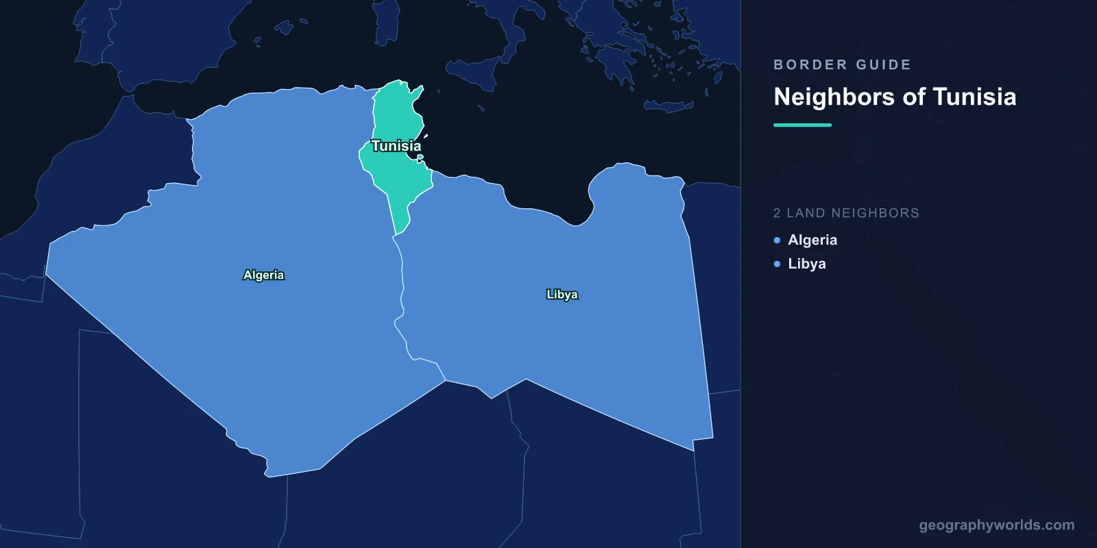
Tunisia shares land borders with just two countries: Algeria to the west and south-west, and Libya to the south-east. The Algerian frontier runs about 1,000 kilometres, the Libyan one about 460, and the Mediterranean accounts for the remaining 1,150 kilometres of the country's perimeter. Tunisia is the smallest state in North Africa, wedged between two neighbours many times its size, and the management of those two lines has been its central security problem since 2011.
The Smallest Country Between Two Large Ones
Algeria is roughly fourteen times Tunisia's area and Libya about eleven times. Tunisia's response to being the small one has generally been diplomatic rather than military: it has avoided taking sides in its neighbours' conflicts, stayed out of the Western Sahara dispute as far as possible, and maintained relations with rival Libyan factions simultaneously.
That posture has limits when the instability arrives anyway. The collapse of the Libyan state in 2011 sent weapons, fighters and more than a million people across the eastern border, and the Algerian civil war of the 1990s pushed armed groups into the western mountains.
Jebel Chaambi, and the Mountain Border
The Algerian border in the centre-west runs through the Tebessa mountains, and Jebel Chaambi, Tunisia's highest peak at about 1,540 metres, sits directly on it. From 2012 the massif became a base for a jihadist group affiliated first with al-Qaeda in the Islamic Maghreb and later partly with Islamic State.
Ambushes there killed Tunisian soldiers and national guardsmen repeatedly, including an attack in 2013 in which soldiers' bodies were mutilated, which shocked the country. The area was declared a closed military zone, the national park was shut, and the army conducted extended operations in terrain that favours the defender.
Cooperation with Algeria on this frontier has been close and largely unpublicised. Algeria has decades of counter-insurgency experience from its own civil war and has treated its eastern border as a buffer, which has given the two states a shared interest that survives other disagreements.
The Berm
After two mass-casualty attacks in 2015 — at the Bardo National Museum in Tunis and on a beach at Sousse, which together killed dozens of foreign tourists and gutted the tourism industry — Tunisia began constructing a physical barrier along the Libyan border.
The structure runs roughly 200 kilometres inland from the coast: a sand berm and a water-filled trench, backed by watchtowers, electronic sensors and patrol roads, funded in part by the United States and Germany. It does not cover the full length of the frontier, because further south the terrain is open desert where a berm would be futile.
Its effectiveness is debated. A large assault on the border town of Ben Guerdane in March 2016, in which Islamic State fighters attempted to seize the town outright and were defeated by the army with local help, took place after construction began. What is less debatable is what the barrier did to the border economy.
Ben Guerdane, and an Economy Built on Crossing
The south-east of Tunisia is poor, dry and short of formal employment, and for decades its economy has rested on trade across the Libyan line. Subsidised Libyan fuel, cheap electronics, foodstuffs and consumer goods moved west, and Tunisian produce and manufactured items moved east.
This is smuggling in the legal sense and ordinary commerce in the practical one. Estimates have put the share of the regional economy dependent on it at well over half, and the trade supports fuel sellers by the roadside across southern Tunisia, whose jerrycans of Libyan petrol are a standard feature of the landscape.
Closing or restricting the frontier therefore produces immediate hardship and protest. The Ras Jedir crossing has been shut repeatedly, by Tunisian decision, by Libyan militia action and during the pandemic, and each closure has triggered demonstrations. Tunis has generally had to reopen.
The Crossing Where a Million People Arrived
In early 2011, as the Libyan uprising turned into war, the Ras Jedir crossing received one of the fastest mass movements of people anywhere in that decade. Migrant workers from Egypt, Bangladesh, sub-Saharan Africa and elsewhere, employed in Libya, fled west in enormous numbers.
Tunisia, weeks into its own revolution and with no functioning government to speak of, absorbed them. The Choucha camp was set up near the border, and local residents in one of the country's poorest regions housed, fed and transported arrivals on their own initiative — a response that drew international recognition at the time and is still a point of considerable national pride.
Djerba, and the Corner Where the Border Meets the Sea
The island of Djerba sits just up the coast from the Libyan frontier, connected to the mainland by a Roman-era causeway. It holds the El Ghriba synagogue, among the oldest in Africa, and a Jewish community with a documented presence going back many centuries — one of the last such communities in the Arab world.
Djerba is also the heartland of Tunisian Ibadi Islam, the same branch that predominates in Oman, brought by Berber communities in the early Islamic centuries. That makes this small corner of the country, a short drive from the berm, one of the most religiously distinctive places in North Africa.
The Algerian Border and the Desert South
South of the mountains the Algerian boundary runs out into the Sahara, meeting the Libyan line at a tripoint in the far south-east near Borj El Khadra. These desert sections were fixed by French colonial administration, since both Tunisia and Algeria were under French control, and they have never been seriously disputed.
The Chott el Djerid, a vast salt pan, lies near the border in the south-west, and the oasis towns of Tozeur and Nefta sit on its edge. Cross-border movement here is light, and the principal concern is the same as elsewhere in the Sahara: trafficking routes that use emptiness as cover.
A Border Dispute That Became a Bombing
Tunisia and Algeria did have one serious territorial disagreement, over the Garet el Hamel and Borj Le Boeuf area in the south, which was resolved by agreement in 1970 and demarcated in the 1990s.
Relations with Libya were more violent. In 1980, an armed group trained and equipped in Libya seized the town of Gafsa in an attempt to trigger an uprising against Habib Bourguiba. The attack failed, French support helped defeat it, and the episode poisoned relations for years. Libya expelled tens of thousands of Tunisian workers in 1985 and the two countries came close to open conflict.
Within a few years the position had reversed entirely, and by the 2000s hundreds of thousands of Tunisians were working in Libya again. The border's history is a series of these swings.
Carthage, and an Older Frontier
Tunisia's borders sit on top of one of the oldest frontier lines in the Mediterranean. Carthage, founded on the bay where Tunis now stands, controlled the trade of the western Mediterranean until Rome destroyed it in 146 BC, and the Roman province of Africa that replaced it was the empire's granary.
The Fossatum Africae, a system of ditches, walls and forts, ran across what is now southern Tunisia and eastern Algeria to regulate movement between the settled north and the desert. It was not a wall to keep people out so much as a customs and control line for transhumant herders — which is broadly what the berm on the Libyan border does today, nineteen centuries later.
The Phosphate Basin, and Where the Revolution Started
Tunisia's interior, along the corridor running toward the Algerian border, holds the phosphate deposits of the Gafsa basin, mined since the 1890s and for a long period among the largest sources of phosphate rock in the world.
The mining towns — Gafsa, Redeyef, Metlaoui — have been the country's most consistent sites of protest. A mining-basin uprising in 2008 over recruitment and corruption was suppressed, and the same grievances surfaced again in 2010.
The revolution that began in December 2010 started in Sidi Bouzid, in the same interior belt, when a street vendor set himself alight after his goods were confiscated. It spread through the interior towns before reaching Tunis, and the geography is not incidental: coastal Tunisia had tourism, manufacturing and European investment, while the border-facing interior had phosphate, unemployment and the informal cross-frontier trade that the state periodically criminalised.
Phosphate output collapsed after 2011 amid repeated strikes and sit-ins at production sites, and has only partially recovered. The interior's sense that it was governed as a periphery has not been resolved, and it remains the most important political fact about the half of the country that faces the borders.
Migration, and a Coast That Is Now a Frontier
Tunisia's most consequential border today may be the maritime one. Departures from the coast near Sfax toward Lampedusa, roughly 130 kilometres away, rose sharply through the 2020s, carrying Tunisians and, increasingly, sub-Saharan Africans who had entered overland.
The European Union signed a memorandum with Tunisia in 2023 providing funding for border management in exchange for interdiction, on the model applied earlier in Libya and Niger. Human rights organisations have documented expulsions of migrants into the desert on the Libyan and Algerian frontiers.
The result is that a country with only two land neighbours finds both of its land borders, and its sea border, functioning as instruments of somebody else's migration policy. Tunisia in the round is our Tunisia country guide, and the desert its southern frontiers run into is described in the geography of the Sahara.
