
Introduction
Egypt 🇪🇬 and Ethiopia 🇪🇹 sit on opposite ends of the Nile, one at the river's mouth in the deserts of North Africa, the other near its source in the highlands of East Africa. They are bound together by that single river and divided by almost everything else. This comparison lines them up on area, population, capitals, climate, and the landmarks that make each instantly recognizable.
Whether you are revising for a geography test, planning a trip, or simply wondering how two of Africa's most populous nations measure up, the figures below give you the essentials at a glance.
Size & Geography
| Feature | Egypt 🇪🇬 | Ethiopia 🇪🇹 |
|---|---|---|
| Area | 1,002,450 km² | 1,104,300 km² |
| Continent | Africa | Africa |
| Region | North Africa | East Africa |
| Land Borders | Libya, Sudan, Israel, Palestine | Eritrea, Djibouti, Somalia, Kenya, South Sudan, Sudan |
| Landscape | vast desert with the fertile Nile Valley | Ethiopian Highlands, Great Rift Valley, Danakil Depression |
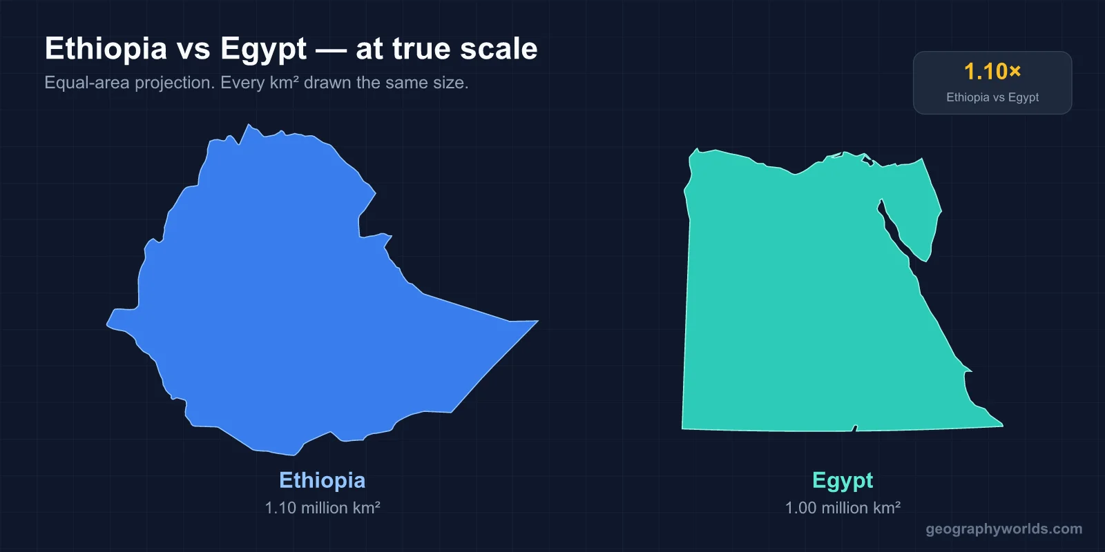
In raw area the two are close, with Ethiopia's 1,104,300 km² edging out Egypt's 1,002,450 km², making it roughly 1.1 times larger. The contrast lies in the terrain rather than the size. Egypt is overwhelmingly desert, with life concentrated along the thin, fertile ribbon of the Nile Valley. Ethiopia is dominated by the Ethiopian Highlands, cut by the Great Rift Valley and dropping to the searing Danakil Depression, one of the lowest and hottest places on Earth. Their borders reflect their positions too: Egypt touches just four neighbors at the continent's northeast corner, while landlocked Ethiopia is hemmed in by six.
Population & Demographics
| Metric | Egypt 🇪🇬 | Ethiopia 🇪🇹 |
|---|---|---|
| Population | 120.1 million | 138.9 million |
| Population Density | 119.8 per km² | 125.8 per km² |
Ethiopia is the more populous of the two, with 138.9 million people to Egypt's 120.1 million, about 1.2 times as many. Their average densities are almost identical on paper, 125.8 per km² for Ethiopia and 119.8 for Egypt, a gap of only about 6.0 people per km². That tidy figure hides a stark reality in Egypt's case, since nearly all of its population is squeezed into the Nile Valley and Delta while the surrounding desert sits empty, making the lived density along the river far higher than the national average suggests.
Capital Cities
Cairo is the capital of Egypt and Addis Ababa the capital of Ethiopia. Both lie within Africa, Cairo in the north and Addis Ababa in the east, but their characters differ sharply. Cairo spreads across the Nile in the desert lowlands, while Addis Ababa is one of the highest capital cities in the world, perched in the Ethiopian Highlands.
Language, Currency & Culture
| Aspect | Egypt 🇪🇬 | Ethiopia 🇪🇹 |
|---|---|---|
| Languages | Arabic (official), Egyptian Arabic widely spoken | Amharic (official), Oromo, Tigrinya, Somali |
| Currency | Egyptian Pound (EGP) | Ethiopian Birr (ETB) |
Egypt is an Arabic-speaking country, with Arabic as the official language and Egyptian Arabic the everyday dialect. Ethiopia's linguistic map is more layered: Amharic is official, but Oromo, Tigrinya, and Somali are all widely spoken across its regions. Amharic is written in the distinctive Ge'ez script, unrelated to the Arabic alphabet. Each country keeps its own currency, the Egyptian Pound (EGP) and the Ethiopian Birr (ETB).
Climate & Natural Features
| Aspect | Egypt 🇪🇬 | Ethiopia 🇪🇹 |
|---|---|---|
| Climate | desert; hot, dry summers and mild winters | tropical monsoon with wide variations by altitude |
| Key Features | Nile River, Sahara Desert, Suez Canal, Sinai Peninsula | Blue Nile source, Simien Mountains, Danakil Depression |
| Economy | tourism, Suez Canal revenues, oil, agriculture | agriculture (coffee origin), textiles, livestock |
Egypt's climate is straightforwardly desert, hot, dry summers and mild winters, and its landmarks read like a checklist of the ancient and the strategic: the Nile River, the Sahara Desert, the Suez Canal, and the Sinai Peninsula. Ethiopia's tropical monsoon climate varies dramatically with altitude, so a single country can hold cool highland plateaus and the scorching Danakil. Its standout features include the source of the Blue Nile and the rugged Simien Mountains. The Nile connection underlines the contrast neatly: the Blue Nile rises in Ethiopia and supplies much of the water that ultimately sustains Egypt downstream. Economically, Egypt draws on tourism, Suez Canal revenues, oil, and agriculture, while Ethiopia rests on agriculture, including coffee, which traces its origin to the country, plus textiles and livestock.
What Makes Each Country Unique
Egypt is known the world over for the Pyramids of Giza, its ancient pharaonic civilization, and the Nile River. The Great Pyramid of Giza held the title of tallest man-made structure on Earth for more than 3,800 years.
Ethiopia is celebrated as the birthplace of coffee, home of the ancient Aksumite civilization, and site of the rock-hewn churches of Lalibela. It also keeps its own calendar, running roughly 7 years behind the Gregorian system and divided into 13 months.
Key Differences at a Glance
- Area: Egypt (1,002,450 km²) vs Ethiopia (1,104,300 km²) — Ethiopia is 1.1x larger
- Population: Egypt (120.1 million) vs Ethiopia (138.9 million) — Ethiopia is 1.2x more populous
- Capitals: Cairo vs Addis Ababa
- Currency: Egyptian Pound (EGP) vs Ethiopian Birr (ETB)
- Continents: Africa vs Africa
- Density: Ethiopia is more densely populated (difference of ~6.0 people per km²)
- Languages: Arabic (official) vs Amharic (official)
Verdict
Egypt and Ethiopia are nearly twins in size, with Ethiopia just 1.1 times larger and 1.2 times more populous, yet they feel like products of two different worlds, one a desert nation organized around a single river, the other a highland country of mountains and rift valleys. The near-matching density figures only sharpen the difference, since Egypt's people cluster along the Nile while Ethiopia's spread across its plateaus.
Egypt is defined by its desert climate and monuments like the Nile and the Pyramids, while Ethiopia stands out for its altitude-driven monsoon climate and features such as the source of the Blue Nile. Their economies reflect this divide, Egypt leaning on tourism and the Suez Canal, Ethiopia on the agriculture that gave the world coffee.
Set side by side, the two show how geography, water, and altitude shape national character. For a student, a traveler, or a curious reader, comparing them is a reminder that countries of similar size can lead profoundly different lives.
Test Your Knowledge!
Think you know your countries? Try our interactive geography quiz!
Play Geography Games →