

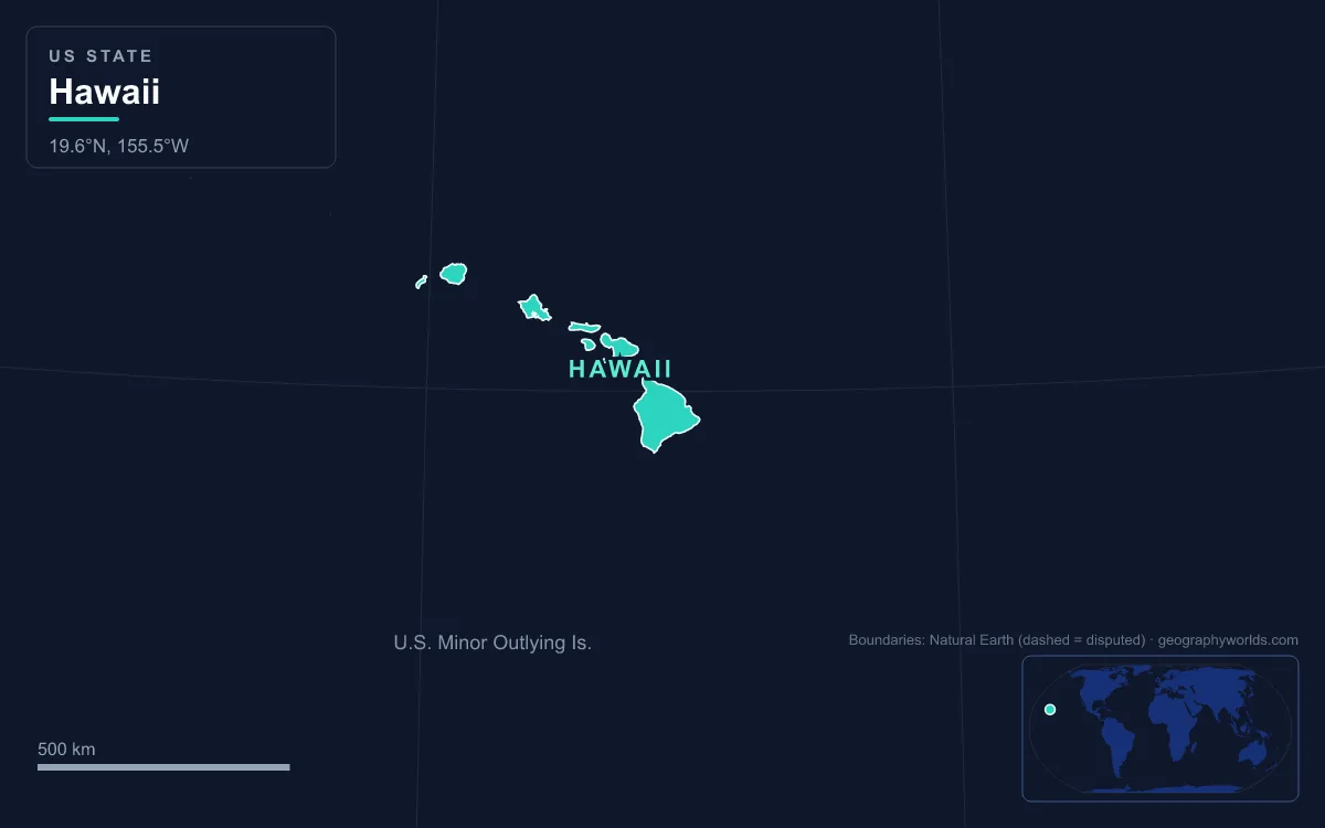
Hawaii is a chain of 137 volcanic islands stretching about 2,400 km (1,500 miles) across the North Pacific, the only US state made entirely of islands. Eight are the main islands, from Niʻihau and Kauaʻi in the northwest to Oʻahu, Molokaʻi, Lānaʻi, Kahoʻolawe, Maui and the island of Hawaiʻi in the southeast; the rest are small islets and the mostly uninhabited Northwestern Hawaiian Islands. The island of Hawaiʻi alone covers 10,430 km² (4,028 sq mi), about 63 percent of the land in the archipelago. Every island was built by the Hawaiʻi hotspot, a plume of magma that, on the prevailing view, has stayed largely fixed while the Pacific Plate carries each new volcano northwest, so the islands get older, lower and more eroded the farther they lie from the Big Island. The highest point is Mauna Kea at 4,207 m (13,803 ft); the lowest is sea level along about 1,210 km (750 miles) of coastline. Six landforms, one per island or volcano, tell the whole story.
Mauna Kea, the Summit That Begins on the Seafloor
Mauna Kea, "White Mountain", is a dormant shield volcano on the island of Hawaiʻi and the highest point in the state. Its summit stands 4,207 m (13,803 ft) above sea level, about 38 m (125 ft) higher than its neighbour Mauna Loa. Because the island slopes deep into the ocean, its dry prominence, measured from the seafloor, is about 9,330 m (30,610 ft), second in the world only to Everest and more than Everest's height above sea level. Measured from base to peak, some authorities call it the tallest mountain on Earth.
The volcano is about a million years old and has passed the main shield-building stage. Its later lavas were thicker and stickier, so they built cinder cones and a steeper, rougher summit than the smooth domes nearby. Glaciers capped the summit during the ice ages, and the last eruption came about 4,600 years ago. Ancient Hawaiians quarried the dense basalt that formed where lava met glacial ice on its flanks to make stone tools, and under old law only high-ranking chiefs could go to the sacred summit.
Today the summit holds the Maunakea Observatories, a cluster of large telescopes inside an "Astronomy Precinct" established in 1967. Dark, dry, thin air makes it one of the best observing sites on Earth; its role in Native Hawaiian religion makes every new telescope there fiercely contested.
Mauna Loa, the Largest Active Volcano on Earth
Next door rises Mauna Loa, the "Long Mountain", with a summit at 4,169 m (13,678 ft). By mass and volume it is the largest active volcano on Earth, holding an estimated 75,000 km³ (18,000 cubic miles) of rock. Its flanks continue about 5,000 m (16,400 ft) below the sea, so from base to top it rises about 9,170 m (30,085 ft).
Mauna Loa has probably been erupting for at least 700,000 years and broke the surface about 400,000 years ago. Its lava is low in silica and very fluid, so eruptions pour out rather than explode, and the flows travel far. Lava in 1926 and 1950 destroyed villages, and part of Hilo, the island's largest community, is built on flows from the late 19th century. After a 38-year pause the volcano erupted again from 27 November to 13 December 2022. The Hawaiian Volcano Observatory has watched it since 1912, and the Mauna Loa Observatory near the summit samples the atmosphere. In 500,000 to a million years, plate motion will carry it off the hotspot and it will go extinct.
Kīlauea and the Pit Crater of Halemaʻumaʻu
On Mauna Loa's southeastern flank lies Kīlauea, whose name means "spewing" or "much spreading". It is between 210,000 and 280,000 years old and only reached sea level about 100,000 years ago, yet it has been the most active of the island's five volcanoes since people arrived. Lavas younger than 1,000 years cover 90 percent of its surface. Its summit caldera contains Halemaʻumaʻu, the pit crater that Hawaiian tradition holds is the home of Pele, goddess of fire and volcanoes, and two rift zones run from it, one 125 km (78 miles) to the east and one 35 km (22 miles) to the west.

Kīlauea erupted almost without pause from vents at Puʻu ʻŌʻō on the east rift between January 1983 and April 2018, burying the towns of Kalapana and Kaimū in 1990. In May 2018 activity moved downslope to the lower Puna district: 24 fissures opened in and around Leilani Estates, 716 homes were destroyed, lava filled Kapoho Bay and boiled away Green Lake, until then the largest natural freshwater lake in Hawaii. At the same time the summit lava lake drained and Halemaʻumaʻu collapsed in a series of explosions. The latest eruption began inside the crater in December 2024 and has continued in episodes of lava fountaining. About 35 km (22 miles) off the southeast coast, the Kamaʻehuakanaloa Seamount, its top about 975 m (3,200 ft) below the surface, is the next Hawaiian volcano in the making.
Haleakalā, the House of the Sun on Maui
Northwest across the ʻAlenuihāhā Channel, Maui is two volcanoes joined by a low isthmus. Haleakalā, the East Maui Volcano, forms more than 75 percent of the island; the eroded West Maui Mountains form the rest. Haleakalā's highest point is Puʻu ʻUlaʻula (Red Hill) at 3,055 m (10,023 ft), and in its prime the volcano may have stood about 3,700 m (12,000 ft) high.
Its famous "crater" is not a volcanic crater at all. Rain, wind and possibly ice carved two great valleys into the mountain's flanks until their heads met at the summit, leaving a depression about 18 km (11.25 miles) long, 5 km (3.2 miles) wide and nearly 800 m (2,600 ft) deep. Later eruptions scattered cinder cones across its floor, and the volcano has erupted about ten times in the last 1,000 years, making it Maui's only active volcano. Its name means "house of the sun", from the legend in which the demigod Māui snared the sun here to slow its passage and lengthen the day. Today the summit and crater lie within Haleakalā National Park, whose boundaries were expanded in 2005.
Waimea Canyon and the Rains of Mount Waiʻaleʻale
At the other end of the main chain, Kauaʻi is the oldest of the large islands, with lava flows dated to about 5 million years ago. Its central shield has been worn down to Kawaikini, 1,598 m (5,243 ft), and its neighbour Mount Waiʻaleʻale, 1,569 m (5,148 ft). Waiʻaleʻale is among the rainiest places on Earth, averaging more than 9,500 mm (373 inches) a year since 1912 and recording 17,300 mm (683 inches) in 1982. Moist trade winds hit its cliffs and are forced upward, and the summit sits just below the trade-wind inversion at about 1,800 m (6,000 ft), which caps how high the clouds can rise.
That rain feeds the Waimea River, which has cut Waimea Canyon on the island's western side, about 16 km (10 miles) long and up to 910 m (3,000 ft) deep, sometimes called the Grand Canyon of the Pacific. The canyon follows a huge fault. Roughly 4 million years ago, while Kauaʻi was still erupting, part of the island collapsed; thick lavas pooled in the hole and now form the canyon's flat-layered east wall, while thin, west-tilted flows form the west wall. Weathering has turned the black basalt bright red, and the canyon's name, Waimea, means "reddish water", a reference to its eroding red soil.

The Nuʻuanu Pali and the Broken Koʻolau Volcano
Oʻahu, home to Honolulu and just under a million people, is made of two old volcanoes: the Waiʻanae Range in the west, topped by Kaʻala at 1,227 m (4,026 ft), and the Koʻolau Range in the east. The Koʻolau is not a true range but the western half of a single shield volcano that first erupted on the seafloor more than 2.5 million years ago and fell dormant about 1.7 million years ago. In prehistoric times its entire eastern half slid into the Pacific in one catastrophic landslide; the debris lies scattered up to 160 km (100 miles) across the ocean floor northeast of the island, and Kāneʻohe Bay marks the remains of its summit caldera. Its highest peak, Puʻu Kōnāhuanui, reaches only 945 m (3,100 ft), from a summit that may once have passed 3,000 m.
What the landslide left is the pali, a windward wall of fluted cliffs. At Nuʻuanu Pali, at the head of Nuʻuanu Valley above Honolulu, a low notch in that wall has always been the main route between the city and the windward towns of Kailua and Kāneʻohe. In May 1795 it was the scene of the Battle of Nuʻuanu, in which Kamehameha I's army drove Oʻahu's defenders toward the cliff edge and took the island. The Pali Highway now runs through tunnels bored in 1958, and the lookout above them is known for the strong trade winds that funnel through the gap.

Beyond Kauaʻi and Niʻihau the chain keeps going. The Northwestern Hawaiian Islands, a string of small islets and atolls from Nīhoa to Kure Atoll with just 8 km² (3.1 sq mi) of land between them, are the worn-down stumps of once-great volcanoes. The whole Hawaiian–Emperor seamount chain, more than 80 volcanoes, stretches about 6,200 km (3,900 miles) from Kamaʻehuakanaloa to near the Aleutian Trench, with a sharp bend that records a shift in plate motion some 47 to 50 million years ago. Read in order, from Kīlauea's fresh lava to Kaʻala's eroded ridge, the islands show that whole life cycle in one state. The island-by-island breakdown is in our guide to the Hawaiian Islands, and the two most active volcanoes have their own pages on Kīlauea and Mauna Loa.