

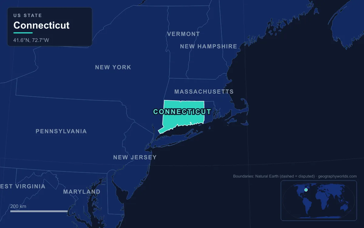
Connecticut is a small New England state of 14,356 km² (5,543 sq mi) built from three strips of land running north to south, with a coast along Long Island Sound. In the northwest are the Western Highlands, the Litchfield Hills and the Taconic peaks around Salisbury, where the state’s highest point, 725 m (2,379 ft), lies on the southern slope of Mount Frissell and its highest summit, Bear Mountain, reaches 706 m (2,316 ft). Down the middle runs the Central Valley, a rift basin of red sandstone framed by basalt ridges of the Metacomet Ridge such as Talcott Mountain and the Hanging Hills. In the east are the rolling, wooded Eastern Highlands. The Connecticut River, New England’s longest at 653 km (406 mi), flows through the valley and then the eastern hills to reach sea level at the Sound between Old Saybrook and Old Lyme. Following that river downstream from the Massachusetts line is the clearest way to see how the pieces fit together.
Enfield Rapids to Hartford: Where the Tide Stops in the Central Valley
The river enters Connecticut between Suffield and Enfield and almost immediately drops over the Enfield Rapids, once called Enfield Falls, the first obstacle to boats coming up from the sea. The Dutch explorer Adriaen Block sailed up as far as these rapids in 1614, the first European to chart the river, and called it the Fresh River. In 1829 the Enfield Falls Canal was opened to get around the shallows, and its locks gave the town of Windsor Locks its name. The rapids are also where the tide gives out: the Sound’s tides push up the river as far as Windsor Locks, about 93 km (58 mi) from the mouth.
Below the rapids the river runs across the floor of the Central Valley, the Connecticut part of the Hartford Basin. Around 220 to 190 million years ago, as North America began to separate from Africa and the Atlantic opened, the crust here stretched and dropped along a great fault on the valley’s eastern side. Rivers filled the sinking basin with red sandstone, siltstone and shale, and lava flows poured across it at intervals. Those sediments, part of the Newark Supergroup, are still tilted gently eastward. The valley’s soft rock and later lake silts give Connecticut most of its best farmland.
At Windsor the river picks up its longest tributary, the Farmington River, and following that tributary upstream is the quickest way to the state’s high ground.
Detour up the Farmington to the Litchfield Hills and Mount Frissell
The Farmington is 75 km long in its main stem and 129 km measured from the source of its West Branch at Hayden Pond in Otis, Massachusetts, making it the longest tributary of the Connecticut. It behaves oddly. Its upper reaches flow south out of the hills, but at Farmington the river turns north and runs through the valley until, at a sharp bend by Tariffville at the northern end of Talcott Mountain, it breaks east through the Metacomet Ridge in the only gorge that interrupts the ridge in Connecticut. Its East Branch rises in Hartland and is held back by the Saville Dam to form the Barkhamsted Reservoir.
Upstream lie the Western Highlands: old, hard metamorphic rock worn into rounded hills, the Litchfield Hills of horse farms and village greens, reaching into the Taconic Mountains in the northwest corner. There, in the town of Salisbury, Bear Mountain rises to 706 m, the highest summit wholly inside Connecticut, with a stone monument on top and the Appalachian Trail crossing it. The state’s true high point is about 2 km away, on the Massachusetts border along the Mount Frissell Trail at 725 m, where the US Geological Survey placed it in the 1940s; Frissell’s 748 m summit is in Massachusetts. This corner also shares the state’s cold record: Falls Village, in the Litchfield County town of Canaan, recorded −36 °C (−32 °F) on 16 February 1943, a state record shared with Coventry in the Eastern Highlands.
Talcott Mountain, Rocky Hill and the Metacomet Traprock
Back on the main river, Hartford, the state capital and the only state capital on the Connecticut, sits on the west bank on an ancient floodplain that stretches south to Middletown. Look west from the city and a steep dark ridge fills the horizon. This is Talcott Mountain, 10 km (6 mi) west of Hartford, part of a 21 km ridge that runs through Farmington, West Hartford, Avon, Bloomfield and Simsbury. Its cliffs rise up to 213 m above the surrounding land, and its 290 m (950 ft) high point carries the Heublein Tower.
Talcott is one segment of the Metacomet Ridge, a narrow, steep fault-block ridge that runs about 160 km (100 mi) from Branford on Long Island Sound, through the Connecticut valley, to northern Franklin County in Massachusetts. It is built of basalt, known locally as traprock, from the lava flows that spread across the rift basin, layered with sedimentary rock and tilted by faulting. Because the basalt resists erosion while the sandstone around it does not, the lava sheets now stand up as ridges with cliffs on their western faces. The ridge is only 370 m high at its highest and averages 221 m, yet it rises abruptly from the valley floor, and more than 1.5 million people live within 16 km of it.

Farther south the same ridge forms the Hanging Hills of Meriden, a horseshoe of traprock whose West Peak, at 312 m (1,024 ft), overlooks the Quinnipiac valley 274 m below; the stone Castle Craig stands on East Peak, built in 1900.
Downstream from Hartford, past Wethersfield, the river reaches Rocky Hill, where two moments in the valley’s history meet. In 1966 a bulldozer operator digging foundations for a state building uncovered dinosaur trackways in sandstone from the start of the Jurassic, about 200 million years ago. The site became Dinosaur State Park in 1968; its 32 hectares protect one of the largest dinosaur track sites in North America, animals that walked the muddy shores of lakes in the rift basin.
The second moment is much younger. About 15,000 years ago, as the Laurentide Ice Sheet melted back, a moraine at Rocky Hill dammed the valley and meltwater backed up behind it into Lake Hitchcock, a long, narrow lake that eventually stretched about 320 km (200 mi) north to St. Johnsbury, Vermont. It lasted roughly 3,000 years and laid down layered silt and clay, called varves, that later settlers dug for bricks. The rift valley itself continues south from Rocky Hill to New Haven, but the moraine turned the river aside, which is why the Connecticut does not reach the sea at New Haven.
The Big Bend at Middletown: Through the Eastern Highlands
About 24 km (15 mi) south of Hartford, at Middletown, the river narrows and swings sharply southeast. This is the Big Bend, where the Mattabesset people had their principal village. Here the Connecticut leaves the soft sandstone of the Central Valley and cuts through the older, harder rock of the Eastern Highlands, the belt of rolling, forested upland that covers eastern Connecticut to the Rhode Island line. From here to the coast the river passes through thinly populated, hilly, wooded country, with the valley walls closing in.
At East Haddam the river runs below Gillette Castle, which sits high above the east bank; it was built by the actor William Gillette, famous for playing Sherlock Holmes, who lived there from 1919 until his death in 1937; the grounds are now a state park that straddles East Haddam and Lyme. Just south, Selden Island is a roadless island about 2.4 km long, separated from the east bank by Selden Creek. It rises to 70 m, is fringed by tidal marsh, and has been a state park since land purchases began in 1917. Excavations there in the 1980s found a Middle Woodland village dated to about 1000 CE.

Old Saybrook, Old Lyme and the Sandbars of Long Island Sound
Below Essex the river widens again and crosses flat coastal marshland to enter the Sound between Old Saybrook on the west bank and Old Lyme on the east. It carries a heavy load of silt from as far north as Quebec, especially during spring snowmelt, and that silt builds large, shifting sandbars at the mouth. As a result the Connecticut is the only major river in the northeastern United States without a port at its mouth, and the region’s big river cities, Hartford and Springfield, grew far upstream. The same undisturbed estuary earned international recognition: its tidal wetlands are listed under the Ramsar Convention, and The Nature Conservancy named its tidelands one of the Western Hemisphere’s “40 Last Great Places”. The river supplies about 70 per cent of the fresh water entering the Sound, discharging an average of 520 m³ a second.
Long Island Sound is not open ocean but a tidal estuary, 180 km (110 mi) long from the East River in New York City to Block Island Sound, up to 34 km wide and 20 to 70 m deep. Long Island itself, across the water, is a glacial moraine left at the ice sheet’s greatest extent. Sheltered by it, the Connecticut shore faces relatively small storm waves, although the 1938 New England hurricane, Hurricane Carol in 1954 and Hurricane Sandy in 2012 all caused damage in the state. Many coastal towns have land less than 6 m (20 ft) above sea level, and east of New Haven the shore is mostly coastal marsh and beach. West of the river mouth, the Metacomet Ridge reaches the Sound at Branford, closing the loop that began at Talcott Mountain.
The river journey crosses every part of Connecticut’s landscape except the far corners, and the full course of the river from Quebec is traced in our Connecticut River geography guide. The traprock ridges end in the parks of New Haven, where the old rift valley meets the Sound, and the state’s place among its neighbours is set out in the New England region guide.