

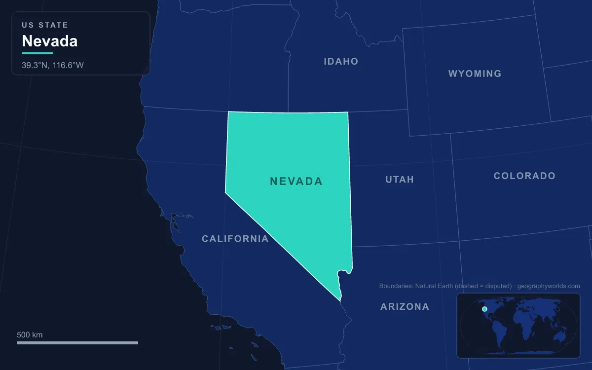
Nevada’s landforms are dominated by the Basin and Range Province: dozens of narrow north–south mountain ranges separated by flat desert valleys, most of which drain to no ocean. The north lies in the Great Basin, the south in the Mojave Desert, and the only real exceptions are the Colorado River on the Arizona border and a few Snake River tributaries in the far north. The highest point is Boundary Peak in the White Mountains at 4,007 m (13,147 ft); the lowest is the Colorado River south of Laughlin at 147 m (481 ft). Nevada covers 286,382 km² (110,577 sq mi), the seventh-largest state, and that relief has decided almost everything about where its 3.1 million people (2020 census) live: along one east–west river, beside a few Sierra-fed lakes, and in one spring-watered valley in the south.
Basin and Range: why Nevada’s people cluster in a few valleys
Nevada has 172 summits with at least 610 m (2,000 ft) of topographic prominence. The ranges run north to south in parallel rows, and between them the valley floors seldom drop below about 910 m (3,000 ft); some in central Nevada sit above 1,800 m (6,000 ft). The ranges catch snow and support forests high above the desert, creating "sky islands" with their own endemic species, while the basins between them are sagebrush flats and dry lake beds. Latitude and height split the state into two deserts. The Great Basin in the north is a cold desert with hot summers and hard winters; San Jacinto in the northeast holds the state’s record low, given as −47 °C (−52 °F) in 1972 by some sources and −46 °C (−50 °F) in 1937 by others. The southern third, home to the Las Vegas area, belongs to the Mojave Desert, where summer days are far hotter.
The highest points show how the state’s edges and interior differ. Boundary Peak stands less than 1 km from the California line and, with only 77 m (253 ft) of prominence, is usually treated as a sub-peak of Montgomery Peak across the border. Wheeler Peak in the Snake Range, at 3,982 m (13,065 ft), is the tallest mountain wholly inside Nevada, with a glacial cirque, moraines and an active rock glacier; Great Basin National Park now protects it. Neither range could support a city. Water, not height, decided where people went, and in a state where almost every river ends in a sink or a lake, the few reliable streams became the only corridors worth following. For the wider desert these ranges sit in, see our Great Basin Desert guide.
The Humboldt River corridor: trail, railroad and Interstate 80
The Humboldt River is the one river that crosses northern Nevada. It rises in the Jarbidge, Independence and Ruby mountains of Elko County and runs west for about 362 km (225 mi) in a straight line, and perhaps 610 km (380 mi) counting its meanders, before vanishing into the Humboldt Sink in Churchill County. Its basin, about 43,600 km² (16,840 sq mi), is the largest sub-basin of the Great Basin, and it is the only major river system contained entirely within Nevada.
Peter Skene Ogden of the Hudson’s Bay Company reached it near present-day Winnemucca on 9 November 1828, and John C. Frémont later named it after Alexander von Humboldt. Because it offered a natural east–west route across the Great Basin, the California Trail followed it, then the transcontinental railroad, and now Interstate 80 tracks it from source to mouth. The towns strung along it, including Elko, Carlin, Winnemucca and Lovelock, are railroad and highway towns first. When the University of Nevada opened in 1874, it opened in Elko.
The same valley sits on one of the world’s richest gold belts. The Carlin Trend, about 8 km wide and 64 km long, runs north-northwest through the town of Carlin, where hot springs deposited gold in limy sediments along an ancient fault zone. By 2008 its mines had yielded more than 70 million ounces, worth around $85 billion at 2010 prices, which makes it one of the world’s richest gold mining districts.
Mount Davidson and the Comstock Lode, 1859–1864
The first permanent non-Native settlement in the region grew up at the western edge of the basins, where the Carson River leaves the Sierra Nevada. Mormon settlers set up a trading post called Mormon Station in the Carson Valley in 1851 to supply travellers on the Carson Route of the California Trail; it became Genoa, the first settlement in what would become Nevada Territory.
What turned that fringe into a state was geology on the east slope of Mount Davidson, in the Virginia Range. There, a fault fissure had filled with mineral-bearing quartz between diorite and andesite, and in 1859 news of the Comstock Lode, the first major silver discovery in the United States, set off a rush from California. Virginia City and Gold Hill grew on the mountainside, and the mines drove new techniques such as square-set timbering. Nevada Territory was created in 1861, and statehood followed on 31 October 1864, even though the population was far short of the usual 60,000; it grew from 6,857 in 1860 to 42,941 in 1870. Carson City, in the valley below, became the capital. The Comstock mines declined after 1874.

Truckee water: Lake Tahoe, Reno and the Derby Dam
The Sierra Nevada, which gives the state its name, sends three rivers east into Nevada: the Truckee, Carson and Walker. Each ends inside the Great Basin, in Pyramid Lake, the Carson Sink and Walker Lake respectively. The Truckee begins as the outflow of Lake Tahoe, which lies across the California border at 1,897 m (6,225 ft) and is 501 m (1,645 ft) deep, the second-deepest lake in the United States after Crater Lake. The mountains around it are covered in our Sierra Nevada range guide.
Where the Truckee crosses a fertile valley called the Truckee Meadows, pioneers settled in the 1850s to farm and trade with travellers on the California Trail. The Central Pacific Railroad built a depot at Lake’s Crossing, and the town of Reno was officially founded there on 9 May 1868. Downstream, the river ends in Pyramid Lake, about 43 km (27 mi) long, the largest remnant of Lake Lahontan, an Ice Age lake that once covered much of western Nevada. The lake lies entirely within the Pyramid Lake Paiute Tribe Reservation. People have lived beside these terminal lakes for a very long time: petroglyphs near the shore of nearby Winnemucca Lake, dated to between 10,500 and 14,800 years ago, are the oldest known petroglyphs in North America.
In 1903–1905 the new US Reclamation Service built its first project here: Derby Dam, about 32 km (20 mi) east of Reno, which diverts Truckee water through the Truckee Canal to Lahontan Reservoir on the Carson River. The water turned the Lahontan Valley around Fallon, itself an old lakebed, into irrigated farmland; the Truckee–Carson Irrigation District still runs about 610 km (380 mi) of canals. The cost fell on the terminal lakes. Winnemucca Lake, also cut off by a highway embankment, has been dry since the late 1930s. Pyramid Lake had dropped about 24 m (80 ft) by the mid-1970s, and its native Lahontan cutthroat trout had died out there by 1939; the fish is now restocked.
Colorado River borders and the Las Vegas Valley
Nevada’s map was drawn partly around landforms. The diagonal boundary with California, just over 640 km (400 mi) long, begins in Lake Tahoe and runs to the Colorado River. The state was enlarged twice after admission: in 1866 it gained a strip of Utah Territory to the east, and on 18 January 1867 it absorbed the part of Arizona Territory’s Pah-Ute County west of the Colorado River, essentially everything south of the 37th parallel. Officials expected a gold rush there. Instead, that transfer handed Nevada the Las Vegas Valley.
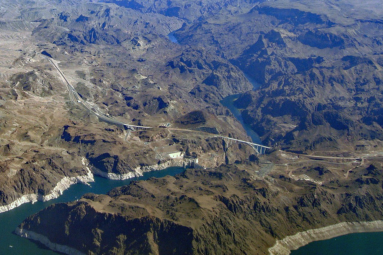
The valley is a basin of about 1,600 km² (600 sq mi) ringed by mountains, with the Spring Mountains, named for their many springs, along its western side. In the 19th century artesian springs there fed green meadows, which is why travellers on the Old Spanish Trail named it Las Vegas, "the meadows"; Mormon farmers settled in 1854. The Colorado River then supplied what the springs could not. Hoover Dam, built in Black Canyon between 1931 and 1936 and dedicated by Franklin D. Roosevelt on 30 September 1935, brought its own town, Boulder City, built to house the workers. The dam impounds Lake Mead, the largest reservoir in the United States by capacity, 24 miles (39 km) east of Las Vegas. Our Hoover Dam guide covers its construction.
Growth followed the water. Clark County had 8,532 people in 1930 and 1,375,765 in 2000; the Las Vegas Valley reached about 2.42 million in 2024, and nearly three-quarters of all Nevadans now live in Clark County. The emptier basins to the north found other uses. From 1951 the Nevada Test Site, about 105 km (65 mi) northwest of Las Vegas in Nye County, hosted about 928 nuclear tests on its 3,500 km² of desert flats and mesas until testing stopped in 1992. At the southern tip, the Colorado leaves Nevada below Laughlin at the state’s lowest point; Laughlin also holds the state heat record of 52 °C (125 °F), set on 29 June 1994. From Boundary Peak to that riverbank, Nevada’s people have followed the few places where its ranges let water through.