

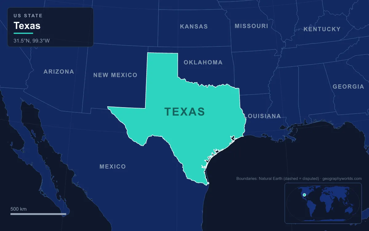
Texas’s main landforms step down from west to east: the Basin and Range mountains of the Trans-Pecos, where Guadalupe Peak reaches the state’s highest point at 2,667 m (8,751 ft); the high tableland of the Llano Estacado, edged by the Caprock Escarpment and cut by Palo Duro Canyon; the limestone Edwards Plateau and its Hill Country, which ends at the Balcones Escarpment; the rolling North Central Plains; and the broad Gulf Coastal Plain, which reaches sea level, the state’s lowest point, along 591 km (367 mi) of Gulf of Mexico shoreline fronted by barrier islands such as Padre Island. The Texas Almanac groups these into four physical regions (Basin and Range, Great Plains, Interior Lowlands and Gulf Coastal Plains) across an area of about 695,600 km² (268,600 sq mi), second only to Alaska. The simplest way to see how they fit together is to start at the top and walk downhill.
Guadalupe Peak and El Capitan: a Permian reef at 2,667 m
The roof of Texas is in Culberson County, about 140 km (90 mi) east of El Paso, where the Guadalupe Mountains run south out of New Mexico and end abruptly in a pale cliff. Guadalupe Peak rises more than 910 m (3,000 ft) above the floor of the Chihuahuan Desert; a stainless-steel pyramid put on the summit by American Airlines in 1958 marks the top. Just south of it, the sheer prow of El Capitan, 2,464 m (8,085 ft), towers over U.S. 62/180 and has been a landmark for travellers at least since Butterfield Overland Mail stagecoaches began using the road below it in 1858.
What makes these mountains unusual is what they are made of. The Guadalupes are an exposed piece of the Capitan Reef, a barrier reef roughly 560 km (350 mi) long built by calcareous sponges, algae and lime mud around the Delaware Sea, an inland sea that covered parts of southern New Mexico and Trans-Pecos Texas in the Permian period. The range lends its name to the Guadalupian series of the Permian, dated at about 272 to 260 million years ago. As the sea’s outlet silted up, the basin evaporated into thick layers of gypsum, anhydrite and salt. Much later, in the late Cretaceous and afterwards, tectonic uplift raised the reef and erosion stripped the softer rock around it, leaving the fossil reef standing as a mountain wall. Gypsum sand dunes lie on the park’s western side near Dell City. The whole of Guadalupe Mountains National Park covers 349.5 km² (86,367 acres).
The Davis and Chisos Mountains, sky islands of the Trans-Pecos
West of the Pecos River lies the only part of Texas regarded as mountainous, the Basin and Range country of the Trans-Pecos, with seven named peaks above 2,400 m (8,000 ft). Most ranges here are built not of reef limestone but of volcanic rock from the Trans-Pecos Volcanic Field. The Davis Mountains near Fort Davis are an irregular jumble of isolated peaks and ridges about 50 km (31 mi) across, formed in eruptions around 35 million years ago. Their high point, Mount Livermore, reaches about 2,554 m (8,378 ft), some 1,000 m above the town of Fort Davis at 1,500 m (4,900 ft). Like other ranges in the region, the Davis Mountains are a sky island: cooler, wetter slopes carry montane grassland and woodlands of alligator juniper, oak and pinyon pine above a desert floor.
Farther south, inside the great bend of the Rio Grande, the Chisos Mountains are the southernmost mountain range in the mainland United States and the only one lying entirely within a national park. Created by volcanic activity 35 to 44 million years ago, they cover about 104 km² (40 sq mi) of Big Bend National Park. Their summit, Emory Peak, reaches about 2,385 m (7,825 ft); sources differ by a few feet. The road into the Chisos Basin crosses Panther Pass at 1,731 m (5,679 ft), and from the mountains the land keeps dropping all the way to the river, where the park’s lowest ground lies at about 550 m (1,800 ft).
Santa Elena, Mariscal and Boquillas canyons on the Rio Grande
The Rio Grande, 3,051 km (1,896 mi) long, forms the border between Texas and Mexico for more than 1,600 km (1,000 mi), and Big Bend National Park administers about 190 km (118 mi) of it. Along that stretch the river has cut three deep canyons with nearly vertical walls through three limestone uplifts: Santa Elena at the western end, Mariscal at the southern tip of the bend, and Boquillas in the east. Under the Treaty of Guadalupe Hidalgo, the park’s territory reaches only to the centre of the deepest channel as the river flowed in 1848, so the far wall of each canyon is in Mexico. Across the water, Mexico protects its own side as the Cañón de Santa Elena and Maderas del Carmen reserves.

The rocks in those walls are Cretaceous formations with names taken from the canyons themselves: the Santa Elena Limestone and the Boquillas Formation, laid down in the Cretaceous as the Gulf of Mexico opened. Rocks of this period preserve dinosaur bones, fossil forests and sea fossils across the park, which is the largest protected area of Chihuahuan Desert in the United States, covering 3,242 km² (801,163 acres).
The Llano Estacado and the Caprock Escarpment
North and east of the Pecos, the land rises again onto one of the largest mesas in North America. The Llano Estacado, shared with eastern New Mexico, climbs from about 900 m (3,000 ft) in the southeast to over 1,500 m (5,000 ft) in the northwest, tilting at a steady 2 m per km (about 10 ft per mile). Its flat surface holds the world’s largest concentration of playa lakes, nearly 22,000 shallow basins that fill after rain, spread across the Southern High Plains of Texas and eastern New Mexico. Lubbock, Amarillo, Midland and Odessa all stand on this plateau. Francisco Vázquez de Coronado crossed this “sea of grass” in 1541.
The plateau ends in the Caprock Escarpment, which runs about 320 km (200 mi) south-southwest from near the Oklahoma border through Briscoe, Floyd, Motley, Crosby, Dickens, Garza and Borden counties. A hard layer of caliche, a calcium carbonate crust, protects the top, and in places the escarpment stands about 300 m (1,000 ft) above the plains to the east. The Spanish name probably refers to this edge: “estacado” can mean stockaded or palisaded, which is how the caprock looks from below.
Streams eating back into the escarpment have carved its biggest canyon. Palo Duro Canyon, southeast of Amarillo, was cut by the Prairie Dog Town Fork of the Red River. It runs roughly 72 km (45 mi), averages 9.7 km (6 mi) wide but reaches 32 km (20 mi) in places, and is about 240 m (800 ft) deep, with bands of red, orange and white rock that have earned it the nickname “Grand Canyon of Texas”. Members of Coronado’s expedition visited it in 1541, and a U.S. Army team under Randolph B. Marcy mapped it in 1852.

The Edwards Plateau, Enchanted Rock and the Balcones Escarpment
South of the High Plains the ground drops onto the Edwards Plateau, a limestone upland roughly outlined by San Angelo, Austin, San Antonio and Del Rio and bounded by the Pecos River on the west. Its elevations run from about 30 m to 900 m (100 to 3,000 ft), its soils are thin, and caves are numerous. Rain sinks quickly into the rock and feeds the Edwards Aquifer. Its southeastern part is known as the Texas Hill Country.
On the northern side of the plateau, erosion has opened a window into much older rock. The Llano Uplift is a low dome about 140 km (90 mi) across, mostly in Llano, Mason, San Saba, Gillespie and Blanco counties, where Precambrian granite and schist are exposed in a basin rimmed by flat-topped hills of Cretaceous limestone. Its best-known dome is Enchanted Rock, 27 km (17 mi) north of Fredericksburg: a pink granite dome covering about 260 ha (640 acres) and rising about 130 m (425 ft) above its surroundings to 556 m (1,825 ft). The Town Mountain Granite it is made of formed about 1.08 billion years ago, and the dome is the largest pink granite monadnock in the United States.
The plateau ends in the east at the Balcones Escarpment, the surface trace of the Balcones Fault Zone, which curves from near Del Rio to the Dallas area roughly along Interstate 35. The faults have been inactive for nearly 15 million years, but the cliffs and slopes they left mark a sharp line: Hill Country to the west, flat coastal plain to the east. Many springs rise along the fault zone, among them San Pedro, Comal, San Marcos and Barton Springs.
The Gulf Coastal Plain, from the Big Thicket to Padre Island
Below the escarpment lies the Gulf Coastal Plains, a nearly level surface that stretches from the Balcones Fault and the Eastern Cross Timbers down to the Gulf, taking in cities from Paris to San Antonio and Del Rio. Annual rainfall ranges from about 510 to 1,470 mm (20 to 58 in). Inland, the Blackland Prairie’s dark expansive clays, the Houston Black series, cover about 6,000 km² between north of Dallas and San Antonio. In the southeast, the Piney Woods thicken into the Big Thicket, historically the densest forest in Texas and a national preserve since 1974.
At the coast, the land finally meets the sea. Much of the state’s 591 km (367 mi) Gulf shoreline is lined with barrier islands that enclose estuaries such as Corpus Christi Bay and Aransas Bay. The largest is Padre Island, the longest barrier island in the world at about 182 km (113 mi), yet only about 3 km (1.8 mi) wide, running from Corpus Christi to South Padre Island with the Laguna Madre behind it. Since 1964 it has been split in two by the dredged Port Mansfield Channel, and its central section is protected as Padre Island National Seashore. At the southern tip, just below Brownsville, the Rio Grande reaches the Gulf, 1,289 km (801 mi) in a straight line from the far corner of the Panhandle.
From the fossil reef of the Guadalupes to the sand of Padre Island, the whole descent covers 2,667 m of relief within one state. The rivers that carry water down that staircase are covered in our guide to the rivers in Texas; for a closer look at the limestone country west of Austin, see the Texas Hill Country geography guide, and for the border river itself, follow the Rio Grande from Colorado to the Gulf.