

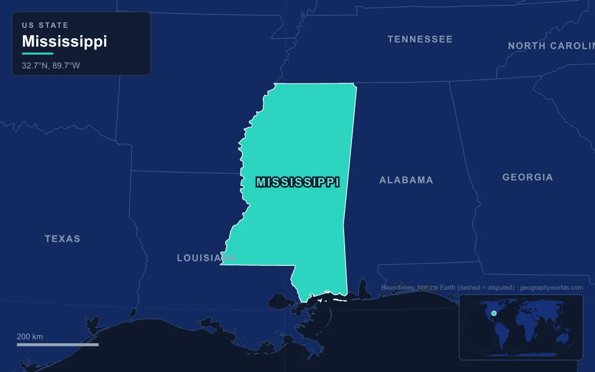
The main rivers in Mississippi are the Mississippi itself, which forms most of the state's western boundary, and the Yazoo, Big Black, Pearl, Pascagoula and Tombigbee, with the Tennessee River touching the far northeastern corner. The longest of the rivers that rise in the state is the Pearl, with a meander length of 715 km (444 miles) from Neshoba County to the Gulf of Mexico. The Big Black runs 530 km (330 miles) and the Yazoo 303 km (188 miles). The Pascagoula is the only large river flowing from the United States into the Gulf that remains nearly free of dams. Mississippi is a low state: its highest point, Woodall Mountain, is only 246 m (806 ft), and its lowest is sea level on the Gulf coast. That low relief is the result of about 300 million years of mountain-building, subsidence, marine flooding and river deposition, and the rivers make most sense when they are read in that order.
Tishomingo's Carboniferous rock and the Tennessee River corner
The oldest ground in Mississippi is in Tishomingo County, the state's northeastern corner. Here, and nowhere else in the state, cliffs and boulders of Carboniferous sandstone and limestone break the surface. They mark the southwestern tip of the Southern Appalachian Plateau, and Woodall Mountain, south of Iuka, rises from these Appalachian foothills to the state's high point.
These rocks date from the Carboniferous, when the continents were coming together into Pangaea. About 300 million years ago, as the plate carrying North America collided with those carrying Africa and South America, one continuous mountain chain was thrust up. It ran from the modern Appalachians around to the Ouachita Mountains of Arkansas and Oklahoma, and Mississippi's northeastern corner sits on its worn-down southwestern edge.
The rivers here do not drain to the Gulf directly. Bear Creek cuts a sandstone canyon through Tishomingo State Park, on the Natchez Trace Parkway, and then flows about 130 km (80 miles) into the Tennessee River. The Tennessee brushes the state along Pickwick Lake, a Tennessee Valley Authority reservoir that is one of the few lakes in the country shared by three states. This corner of the state drains north to the Ohio rather than south to the Gulf.
The Cretaceous sea: the Mississippi Embayment and the Tombigbee's Black Belt
Everything to the south and west of Tishomingo is younger, and much of it sits in a great hollow in that old mountain chain. The leading explanation, put forward by Van Arsdale and Cox in 2007, is that as Pangaea began to break apart about 200 million years ago, North America passed over the Bermuda hotspot. Rising magma arched the crust up by perhaps 2 to 3 km, and the uplift quickly eroded away. When the continent moved on and the crust cooled, it sank to a depth of about 2.6 km, forming a trough that the Gulf of Mexico flooded. That trough is the Mississippi Embayment, a break in the once-continuous Appalachian–Ouachita chain, and it is why the Mississippi River valley cuts through the line of old mountains.
During the Cretaceous, roughly 145 to 66 million years ago, shallow seas covered much of the southeastern United States. Plankton skeletons settled on their floors as thick beds of chalk, and one old shoreline left a crescent of this chalk, the Black Belt, about 480 km (300 miles) long and up to 40 km (25 miles) wide, across central Alabama and northeastern Mississippi. Weathered into dark, fertile soil, it became prime upland cotton country in the 1820s and 1830s.
The Tombigbee River drains this belt. It rises near the Pharr Mounds in Itawamba County and flows through Aberdeen Lake and Columbus Lake and on into Alabama, joining the Alabama River to form the Mobile River, about 325 km (200 miles) in all. It marked the eastern limit of Choctaw lands until the removals of the 1830s. In December 1984 the Army Corps of Engineers completed the Tennessee–Tombigbee Waterway after 12 years of work at a cost of nearly $2 billion. The 377 km (234 mile) channel, with ten locks and dams and a 53 m (175 ft) deep cut through the divide, finally linked this Gulf-bound river with the Tennessee.
Filling the embayment: the Big Black, Pearl and Pascagoula
As sea level fell after the Cretaceous, the Mississippi and smaller rivers pushed their courses south into the embayment and slowly filled it with sediment. The result is the east Gulf Coastal Plain, which covers most of the state: low hills such as the North Central Hills and the Pine Hills of the south, the higher Pontotoc Ridge and Fall Line Hills in the northeast, and a mean elevation of only about 91 m (300 ft). Three rivers cross this plain independently of the Mississippi.
The Big Black River rises near Eupora in Webster County and runs southwest for 530 km (330 miles) to join the Mississippi about 40 km (25 miles) below Vicksburg. Its basin, 8,800 km² (3,400 square miles), is hilly and lies between 14 and 198 m above sea level. The river and most of its tributaries carry heavy loads of silt washed from farmland.
The Pearl is a blackwater river that forms in Neshoba County where Nanih Waiya and Tallahaga creeks meet. It flows past Jackson, the state capital, and its lower course forms part of the Mississippi–Louisiana border. Northeast of Jackson it has been dammed to make the Ross Barnett Reservoir, begun in 1960. The 130 km² (33,000 acre) lake is the state's largest source of drinking water. Downstream the Pearl's floodplain holds large tracts of bottomland hardwood and cypress swamp, habitat for sturgeon and black bears.

Farther east, the Leaf and Chickasawhay rivers meet in George County to form the Pascagoula, which runs about 130 km (80 miles) through swampy bottomland to Mississippi Sound. Its basin is large, about 23,000 km² (8,800 square miles), and at low water the tide is felt more than 64 km (40 miles) upstream. It is the only river carrying more than 10 km³ of water a year into the Gulf from the United States that is still nearly unaltered by dams. That status has made it the focus of repeated campaigns against proposed dams.
Ice-age loess and the Yazoo–Mississippi Delta
The youngest large landforms in the state date from the Pleistocene ice ages, even though no glacier ever reached Mississippi. Each spring and summer, meltwater from the ice sheets far to the north poured down the Mississippi valley and laid down broad sheets of silt. In autumn and winter the flow dropped, the silt dried out, and wind lifted it and dropped it on the high ground to the east as loess.
Near Vicksburg the loess comes in three layers. The Crowley's Ridge Loess dates from the late Illinoian stage, the Sicily Island Loess from the early Wisconsin, and the Peoria Loess, in which today's soil has formed, from the late Wisconsin. Old buried soils separate the layers. This silt caps the steep bluffs along the east side of the valley at Vicksburg and Natchez. Vicksburg's position atop a high bluff above the river made it all but impregnable to direct assault, and it held out until it surrendered on 4 July 1863 after a 47-day siege.

West of the bluffs lies the Delta, the Mississippi's alluvial plain. It is 320 km (200 miles) long and 140 km (87 miles) across at its widest, covering about 17,806 km² (6,875 square miles) between the Mississippi and Yazoo rivers. Its flat floodplain holds some of the most fertile soil in the world, and before the Civil War it was developed as one of the richest cotton-growing areas in the nation. The Yazoo is formed at Greenwood, where the 370 km (230 mile) Tallahatchie meets the Yalobusha. It runs parallel to the Mississippi along the eastern edge of the floodplain, because the bigger river's natural levees block it from joining until just north of Vicksburg. Hydrologists now call any river trapped like this a "yazoo stream", and river scientists think the Yazoo's channel may once have carried the lower Ohio River. The Mississippi Delta guide follows the region's history in more detail.
From the 1876 Vicksburg cutoff to Hurricane Camille: rivers still at work
The shaping has not stopped. In 1876 a flood cut through the neck of De Soto Point and moved the Mississippi away from Vicksburg, leaving the city on an oxbow lake. Vicksburg was not a river port again until the Army Corps of Engineers finished the Yazoo Diversion Canal in 1903, sending the Yazoo along the old channel.
The Great Mississippi Flood of 1927 covered about 70,000 km² (27,000 square miles) to depths of up to 9 m (30 ft) and killed around 500 people. Most of the 630,000 people directly affected lived in Arkansas, Mississippi and Louisiana, above all in the Delta. The federal response was the world's longest system of levees and floodways. The Flood Control Act of 1936 then authorized Sardis Dam on the Tallahatchie, the first of the flood-control projects on the Yazoo's headwaters. Its reservoir, Sardis Lake, covers 398.7 km² (98,520 acres) and is the largest lake in the state.
At the coast, the sea is still rearranging the youngest land in Mississippi. The barrier islands of Petit Bois, Horn, Ship and Cat shelter the shallow Mississippi Sound. In 1969 Hurricane Camille cut Ship Island in two, and in 2019 the Army Corps of Engineers finished the first stage of a project to rejoin the halves. For the great river that bounds the state, see our complete guide to the Mississippi River, and for the rest of the state's landscape, our overview of Mississippi's geography.