

Minnesota has 11,842 lakes of 10 acres (4 hectares) or more, so its "Land of 10,000 Lakes" slogan is an undercount; counting every basin over 2.5 acres would give 21,871. Together they have about 72,300 km (44,926 miles) of shoreline, more than California's lake and ocean shores combined. The largest and deepest body of water in the state is its share of Lake Superior, 3,896 km² (1,504 sq mi) and 393 m (1,290 ft) deep. The largest lake entirely inside Minnesota is Red Lake, 1,150 km² (444 sq mi), followed by Mille Lacs and Leech Lake. Nearly all of them are gifts of the last ice age: the Wisconsin glaciation covered all but the far southeast of the state and retreated about 12,000 years ago, leaving scoured bedrock, dammed-up meltwater and blocks of stranded ice that melted into kettle lakes. Only four of the state's 87 counties, Mower, Olmsted, Pipestone and Rock, lack a natural lake. Those waters decided where Minnesotans traded, farmed, drew borders and built cities.
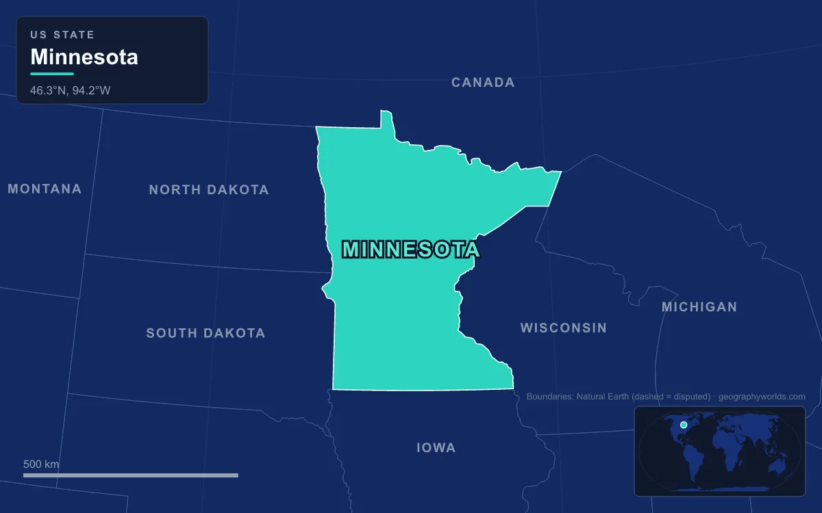
Lake Superior's North Shore: Grand Portage, Duluth and the Iron Ore Trade
Minnesota's Lake Superior coast runs northeast from Duluth to the Canadian border along the North Shore, where basalt lava flows from the Midcontinent Rift, which split the continent about 1.1 billion years ago, form cliffs and headlands such as Shovel Point and Palisade Head, the highest cliff in Minnesota. Split Rock Lighthouse stands on a 41 m (133 ft) sheer cliff of diabase. The state's highest point, Eagle Mountain at 701 m (2,301 ft), rises only 21 km (13 miles) from its lowest, the Superior shoreline at 183 m (602 ft). Rivers tumbling down that steep slope to the lake shaped the first commerce here.
At the far northeast tip, the Pigeon River tumbles over falls and rapids in its last 32 km (20 miles) to the lake. Voyageurs of the fur trade carried their canoes and packs around them on the Grand Portage, a footpath 13.7 km (8.5 miles) long, and the post at its lake end became one of the British Empire's four main fur-trading centres in North America, alongside Fort Niagara, Detroit and Michilimackinac. About 80 km (50 miles) up the route, the Height of Land Portage crosses the divide between the Great Lakes and Hudson Bay drainages, so this one trail tied Atlantic ports to the fur country of the northwest.
At the other end of the shore, Duluth grew where the lake ends. It sits at the westernmost point of the Great Lakes, 3,700 km (2,300 miles) from the Atlantic by the Great Lakes Waterway and St. Lawrence Seaway, and its port is the farthest inland port that ocean-going ships can reach. What made it large was iron. The Mesabi Range to the northwest, called Misaabe-wajiw, "giant mountain", by the Ojibwe, has been mined since 1892 and is the chief iron ore district in the United States; today it produces taconite pellets. The port still ships iron ore, coal, grain, limestone and wind turbine parts. Duluth had 86,697 people in 2020, and Minnesota Point, a 10 km (6 mile) sandbar across its harbour, is the longest freshwater baymouth bar in the world.
Lake of the Woods and the Northwest Angle: A Border Drawn From a Faulty Map
Minnesota's northern border is mostly water, and the lakes along it produced one of the strangest lines on the map of the contiguous United States. When Benjamin Franklin and the British negotiated the 1783 Treaty of Paris, they worked from John Mitchell's map, which showed Lake of the Woods as a rough oval and did not mark the source of the Mississippi, then thought to lie somewhere to the northwest. The treaty sent the border "through the Lake of the Woods to the northwesternmost point thereof, and from thence on a due west course to the river Mississippi".
The Mississippi actually rises almost due south of the lake, so the line could never reach it. Survey teams went out in 1822 and 1824 without settling the question; in 1825 the astronomer Johann Ludwig Tiarks fixed the northwesternmost point at the edge of a pond on Angle Inlet, and the Webster–Ashburton Treaty of 1842 confirmed it. The Anglo-American Convention of 1818 had already replaced the impossible westward line with one running due north or south from that point to the 49th parallel, and the line due south cut off a piece of the United States on the far side of the lake. That piece is the Northwest Angle, the only part of the lower 48 states north of the 49th parallel. It had 149 residents in 2020, it can be reached by land only through Manitoba, and 70 percent of its land is held in trust for the Red Lake Band of Chippewa.

Lake of the Woods itself is more than 110 km (70 miles) long and wide, with over 14,500 islands and about 105,000 km (65,000 miles) of shoreline shared with Ontario and Manitoba. It is fed by the Rainy River and drains north through the Winnipeg River into Lake Winnipeg, part of the Hudson Bay drainage. It is the sixth-largest freshwater lake lying at least partly in the United States, after the five Great Lakes. East of it, the border follows the old voyageur canoe route through a maze of lakes on the Canadian Shield. Voyageurs National Park, created in 1975 around the Kabetogama Peninsula near International Falls, and the Boundary Waters Canoe Area Wilderness protect that route. The Boundary Waters, whose present rules were set by the Boundary Waters Canoe Area Wilderness Act of 1978, covers about 4,400 km² (1.09 million acres) along 240 km (150 miles) of the border, contains more than 1,100 lakes and is the most visited wilderness in the United States.
Red Lake, Leech Lake and Mille Lacs: Ojibwe Homelands on the Bed of Glacial Lake Agassiz
About 13,000 years ago meltwater trapped against the retreating ice sheet formed Lake Agassiz, which at its greatest may have covered 440,000 km² (170,000 sq mi) of what are now Manitoba, Ontario, Minnesota, North Dakota and Saskatchewan, more than all of today's Great Lakes combined. When it drained, it left Lake Winnipeg, Lake of the Woods and Red Lake behind as remnants. Its outflow, the Glacial River Warren, carved the broad valley the small Minnesota River now occupies, and its lake bed, one of the flattest expanses of land in the world, became the fertile farmland of the Red River valley on the North Dakota border, where the Red River flows north toward Hudson Bay.
Red Lake is the biggest remnant within the state, 1,150 km² (444 sq mi), split by a peninsula into Upper and Lower Red Lake and no more than 10 m (33 ft) deep. Lower Red Lake lies wholly inside the Red Lake Indian Reservation, and the western half of Upper Red Lake falls within its boundary. The reservation is unusual: the Red Lake Band of Chippewa claims it by conquest and aboriginal title rather than by assignment from Washington, and it is the only fully "closed" reservation in the country, where all land is held in common and none is privately owned. Ojibwe has been its official language since 2011.

Leech Lake, the third largest at 417 km² (161 sq mi), lies mainly within the Leech Lake Indian Reservation and entirely within Chippewa National Forest; its Ojibwe name means "lake abundant with bloodsuckers". It is far deeper than Red Lake, reaching 48 m (156 ft), and a dam controls its sole outlet, the Leech Lake River, which flows east to the Mississippi. Mille Lacs, the second largest at 536 km² (207 sq mi), sits about 120 km (75 miles) north of the Twin Cities. Its French name means "thousand lakes"; the Ojibwe call it Misi-zaaga'igan, "grand lake", and a reservation on its shore was established for the Mille Lacs Band in 1855. Farther northwest, in Clearwater County, Lake Itasca, only 4.7 km² (1,200 acres), is where the Mississippi River begins its 3,766 km (2,340 mile) run to the Gulf of Mexico. Henry Schoolcraft coined its name from the Latin veritas caput, "true head".
Kettle Lakes in the City: Bde Maka Ska, the Chain of Lakes and Lake Minnetonka
The same retreating ice that left the great northern lakes also dropped blocks of ice into old buried river valleys under what is now Minneapolis. When they melted, 10,000 to 12,000 years ago, they left kettle lakes, and the city grew around them. The largest is Bde Maka Ska, formerly Lake Calhoun, 1.72 km² (424 acres) and 27 m (90 ft) deep, the deepest lake in Minneapolis. It anchors the Chain of Lakes, which the city's park board wrapped in shoreline parks and linked into the Grand Rounds, a loop of about 80 km (50 miles) of parkways and paths, much of it built in the 1930s.
That parkland was engineered. Before settlement the lakes were ringed by bogs and marshes; between 1911 and 1924 Bde Maka Ska was dredged and its wetlands filled to make firm, public shoreline. Farm runoff and storm sewers later loaded the lakes with phosphorus; a clean-up began in 1990. Its Dakota name, meaning "Lake White Earth" or "White Bank", replaced that of John C. Calhoun, the Secretary of War whose surveyors named it in 1817. The park board took up the question in 2011, and in January 2018 the state made Bde Maka Ska the official name, a reminder that Native peoples lived around these lakes long before the city did.
West of the city, Lake Minnetonka shows the kettle pattern at a larger scale. It is a knot of interconnected kettles, channels and marsh covering 5,879 hectares (14,528 acres), with 18 islands, 125 miles (201 km) of shoreline and 14 towns around it. People have lived here for about 10,000 years; in the 1880s surveyors mapped 524 burial mounds and earthworks along its shore. The Dakota harvested wild rice and made maple sugar on its banks until they were forcibly removed after the Dakota War of 1862. European American settlement began in the 1850s, and streetcars, trains and steamboats later made it a nationally known vacation destination.
Few states are defined by their water as thoroughly as this one: an ore port on an inland sea, a border set by a lake no one had surveyed, reservations on the beds of glacial lakes and a city built around its kettles. For the wider picture of the state's terrain, see our guide to Minnesota geography. The biggest of its waters is covered in depth in the geography of Lake Superior, and the river that leaves Lake Itasca is followed all the way to the Gulf in our complete guide to the Mississippi.